Captain John Smith Chesapeake National Historic Trail
Designation: National Historic Trail
Location: Virginia, Maryland, Delaware, District of Columbia, Pennsylvania, New York
📘 Park Overview
People first arrived in the Chesapeake Bay during the last ice age. As glaciers melted, diverse societies learned to thrive in a world of water. When Englishman Captain John Smith explored the Bay in 1608, he documented hundreds of American Indian communities. Today, sites on his map are archeological treasures and sacred sites for tribal citizens. Come join us on the shores of the Chesapeake Bay!
🌤 Weather Information
During the summer season, visitors should dress in light, comfortable, moisture-wicking clothing, and use sunscreen. High temperatures and humidity create a higher risk of heat cramps, heat exhaustion and heatstroke. We strongly recommended you carry a bottle of water with you and wear a life jacket at all times. During the winter, be aware that submersion in freezing cold water can be deadly. If you are going out, bring safety gear such as a wetsuit and practice techniques to avoid tipping over.
🚗 Directions
The water trail is 3,000 miles long and there are countless places to explore it. The trail's headquarters and main visitor center is at Colonial National Historical Park - Historic Jamestowne. For an internet map search or GPS, use the following: Historic Jamestowne Visitor Center, 1368 Colonial Parkway, Jamestown, Virginia 23081.
Images
Many people visit Blackwater National Wildlife Refuge to spot birds, like this heron, that rely the natural resources of the landscape.
Credit: NPS Photo / Middleton Evans
At Jamestown Settlement, trail visitors can view yihakan, the houses seen pictured here, which are constructed from saplings and reed mats.
Credit: Jamestown Settlement
Some scenes - like this one of cypress trees in the Chickahominy River - look similar to what Captain John Smith would have seen 400 years ago.
Credit: Bill Portlock
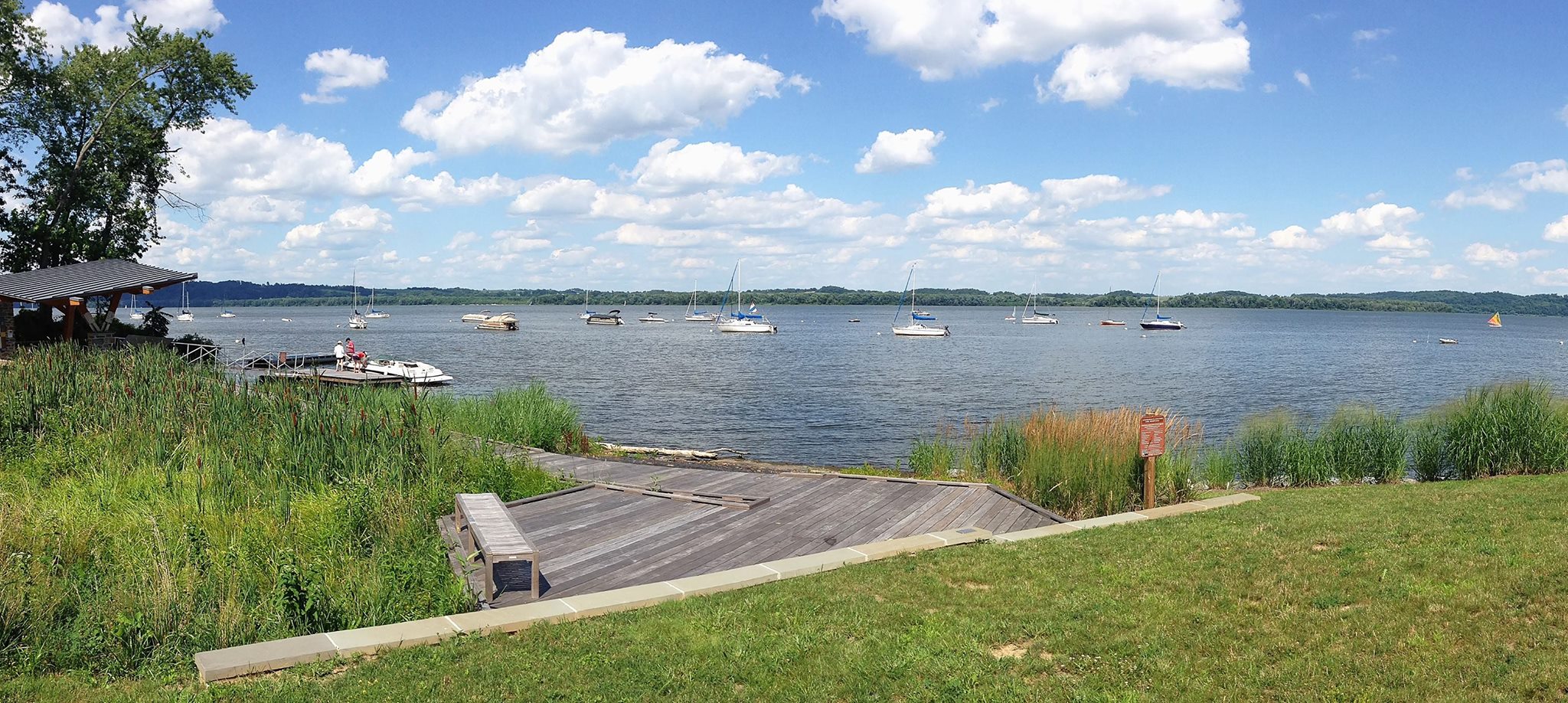
The upper reaches of the Patuxent River at Jug Bay give visitors a view of the Chesapeake region that feels similar to a time before European settlement.
Credit: NPS Photo / Middleton Evans
Visitors can use the dock at Zimmerman Center for Heritage to launch canoes and kayaks onto the beautiful Susquehanna River in south central Pennsylvania.
Credit: Susquehanna Gateway Heritage Area
Many people visit Blackwater National Wildlife Refuge to spot birds, like this heron, that rely the natural resources of the landscape.
Credit: NPS Photo / Middleton Evans
At Jamestown Settlement, trail visitors can view yihakan, the houses seen pictured here, which are constructed from saplings and reed mats.
Credit: Jamestown Settlement
Some scenes - like this one of cypress trees in the Chickahominy River - look similar to what Captain John Smith would have seen 400 years ago.
Credit: Bill Portlock
The upper reaches of the Patuxent River at Jug Bay give visitors a view of the Chesapeake region that feels similar to a time before European settlement.
Credit: NPS Photo / Middleton Evans
Visitors can use the dock at Zimmerman Center for Heritage to launch canoes and kayaks onto the beautiful Susquehanna River in south central Pennsylvania.
Credit: Susquehanna Gateway Heritage Area
Activities
Topics
Operating Hours
Entrance Fees
No entrance fees listed.
Entrance Passes
No entrance passes listed.
3-Day Weather Forecast
Sunday, Apr 26

Patchy rain nearby
High: 52.8°F | Low: 46.2°F
Humidity: 82%
Wind: 18.8 mph
Rain Chance: 78%
UV Index: 3.5
Sunrise: 06:14 AM
Sunset: 07:54 PM
Moon: Waxing Gibbous (70%)
Visibility: 4 mi
Dew Point: 45.2°F
Cloud Cover: 78%
Pressure: N/A mb
Air Quality (PM2.5): N/A
Ozone: N/A
EPA Index: N/A
Monday, Apr 27

Sunny
High: 61°F | Low: 44.8°F
Humidity: 69%
Wind: 12.1 mph
Rain Chance: 0%
UV Index: 7.2
Sunrise: 06:13 AM
Sunset: 07:55 PM
Moon: Waxing Gibbous (79%)
Visibility: 6 mi
Dew Point: 46.1°F
Cloud Cover: 0%
Pressure: N/A mb
Air Quality (PM2.5): N/A
Ozone: N/A
EPA Index: N/A
Tuesday, Apr 28

Partly Cloudy
High: 58.3°F | Low: 47.3°F
Humidity: 68%
Wind: 12.1 mph
Rain Chance: 0%
UV Index: 6.1
Sunrise: 06:11 AM
Sunset: 07:56 PM
Moon: Waxing Gibbous (87%)
Visibility: 6 mi
Dew Point: 46°F
Cloud Cover: 0%
Pressure: N/A mb
Air Quality (PM2.5): N/A
Ozone: N/A
EPA Index: N/A
Visitor Center & Contacts
📍 Physical Address:
1368 Colonial Parkway
Jamestown, VA 23081
🏤 Mailing Address:
P.O. Box 210
Yorktown, VA 23690
📞 Voice Phone: (757) 856-1220
✉️ Email: cajo_info@nps.gov