Christiansted National Historic Site
Designation: National Historic Site
Location: U.S. Virgin Islands
📘 Park Overview
Christiansted National Historic Site was established in 1952 as the first unit of the National Park Service in the Virgin Islands of the United States. Covering over seven acres the park tells the stories about Danish economy and ways of life, and the interactions of people in Europe, Africa, West Indies, and North America during the Danish era of occupation of the Virgin Islands (1734-1917).
🌤 Weather Information
Welcome to the tropics! Temperatures do not vary much by season. Highs are usually in the upper 80s and lows are typically in the mid-70s. Pop-up showers and storms are common and usually pass quickly. Atlantic hurricane season runs June 1 - November 30, however tropical systems can occur at any time. St. Croix lies in an active tectonic zone. Earthquakes can and do occur. If you feel shaking and hear sires, follow the tsunami evacuation signs to higher ground.
🚗 Directions
To Christiansted National Historic Site from Henry E. Rohlsen Airport: Drive east on Route 64 to Melvin Edwards Highway (Route 66). Turn right and continue for 4.8 miles (7.2 kilometers). Continue straight onto Old Centerline Road (Queen Mary Highway), and continue straight onto the Christiansted Bypass 3.7 miles (5.9 km). Turn left onto Hospital Street. The parking lot for Christiansted National Historic Site will be on your right.
Images
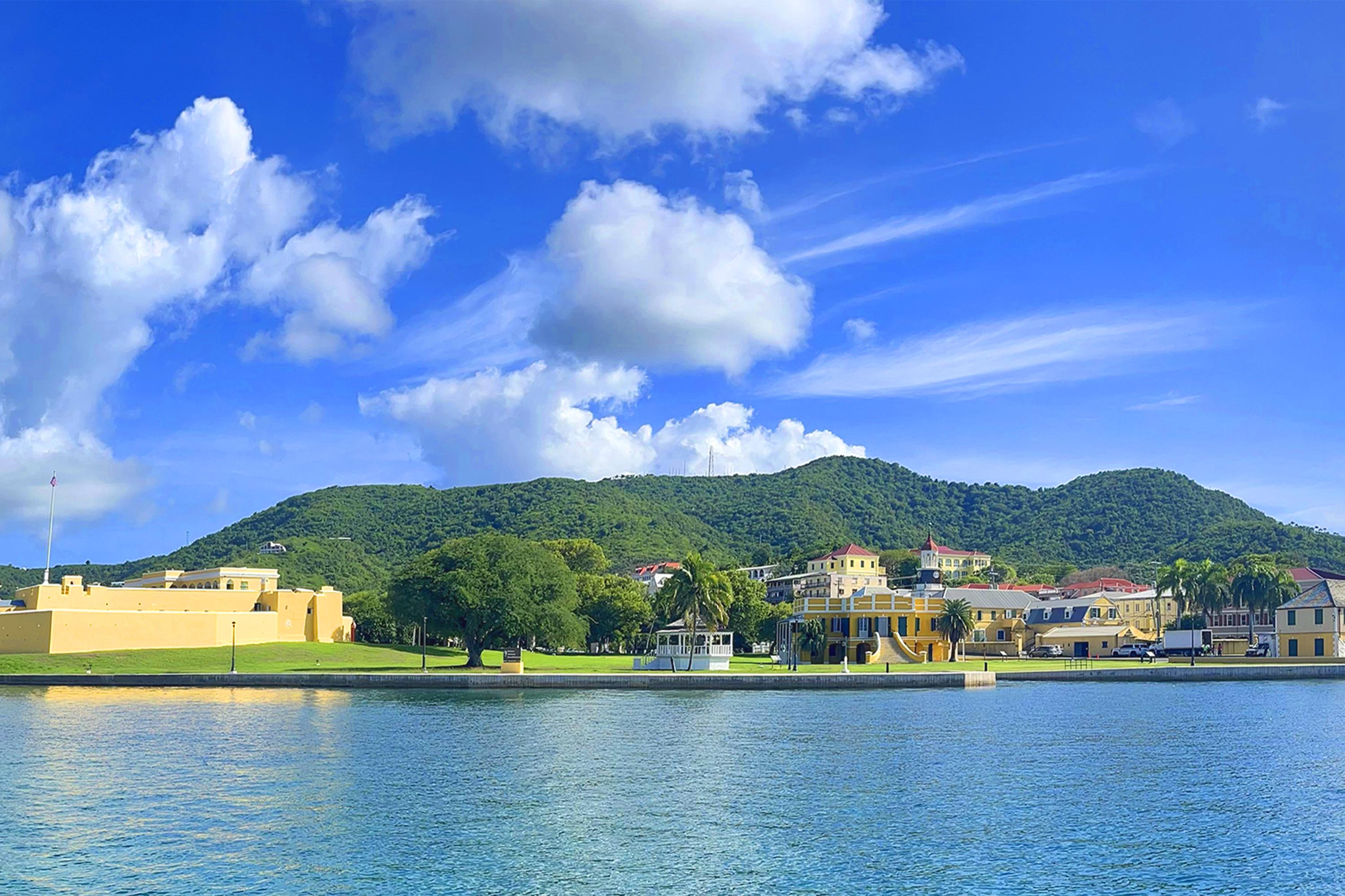
Fort Christiansvaern, the Danish Customs House, Scale House, Danish West Inda and Guinea Co Warehouse and Steeple Building make up Christiansted NHS
Credit: NPS Photo: Diaz
A customs house has stood on this spot since the 1730s. The current building was finished in the 1842.
Credit: NPS
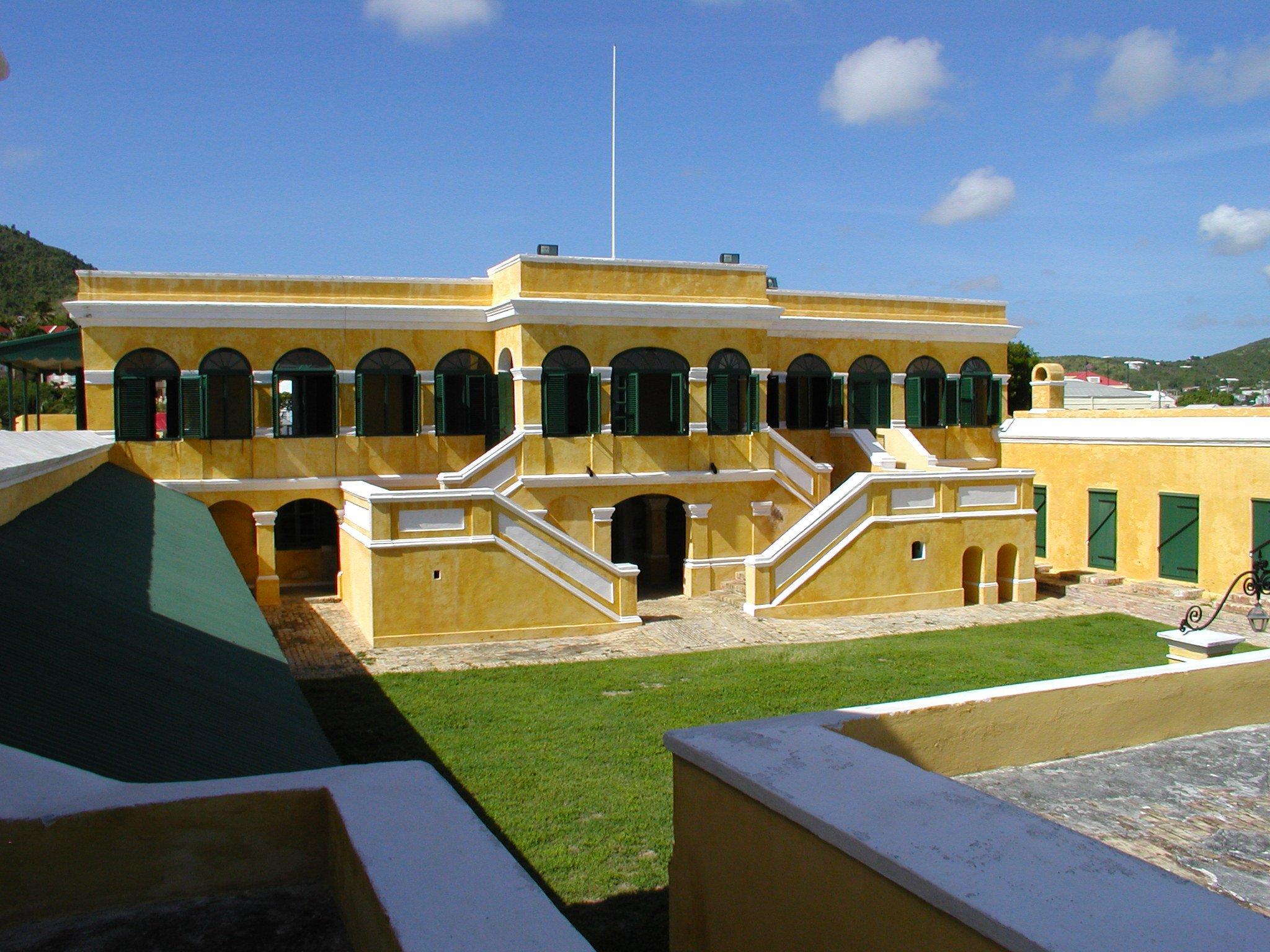
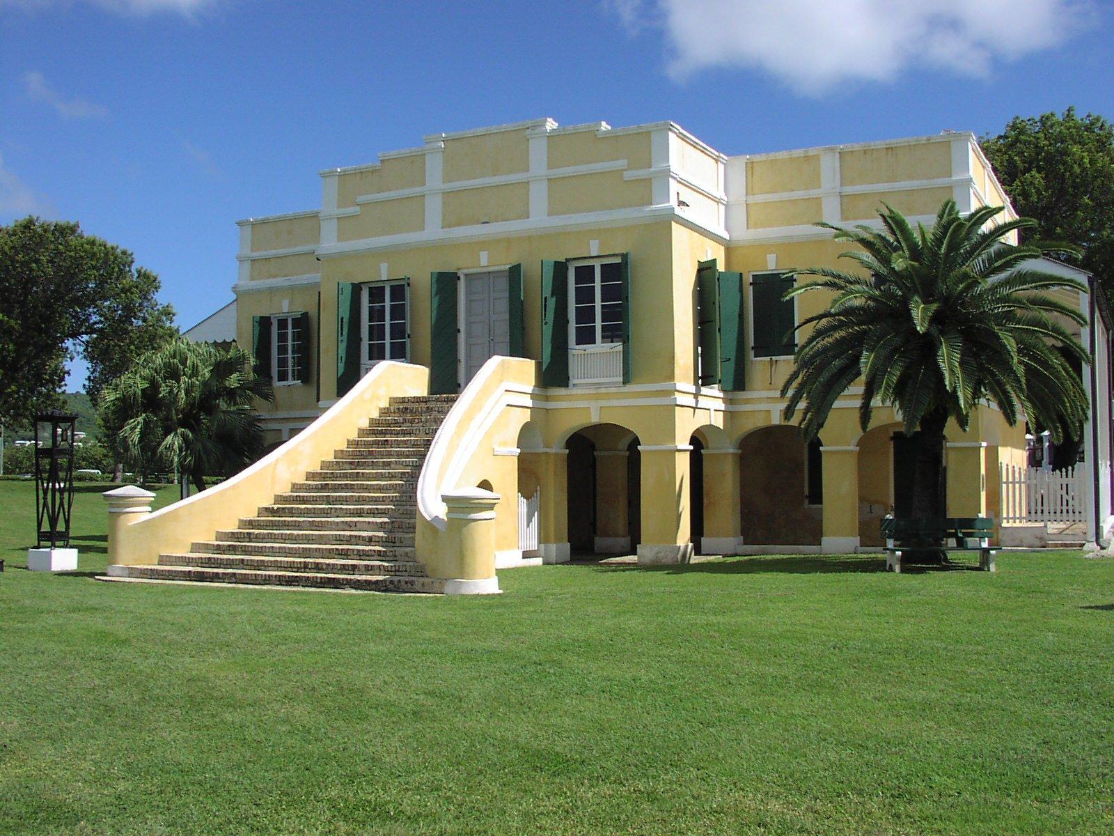
Fort Christiansvaern served as the residence for the Danish colony's Governor, then for the fort's Commandant and his family.
Credit: NPS
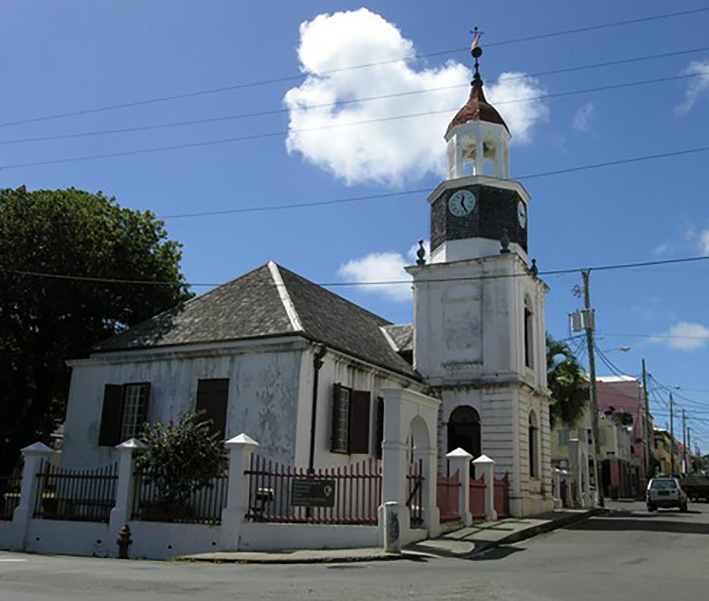
First known as the Church of Our Lord of Zebaoth, the church was completed in 1751, and consecrated in 1753. The steeple tower was built 1793-1796.
Credit: NPS
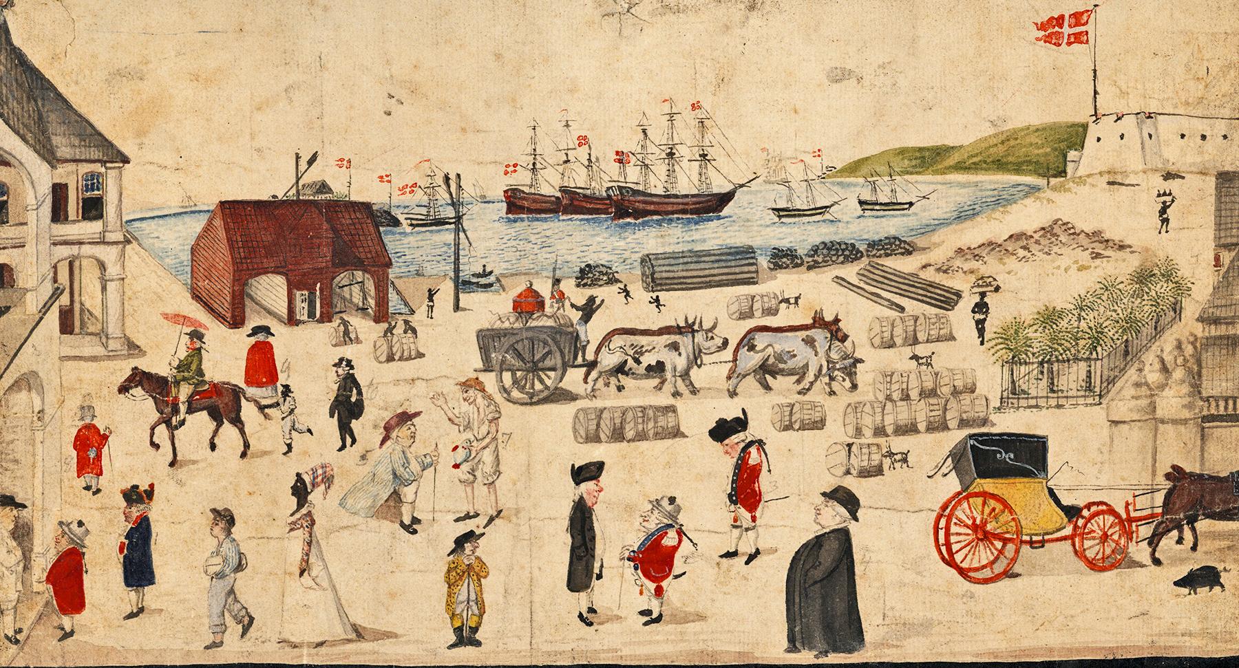
The Christiansted wharf was a cosmopolitan port throughout the 18th and 19th centuries.
Credit: Danish Maritime Museum
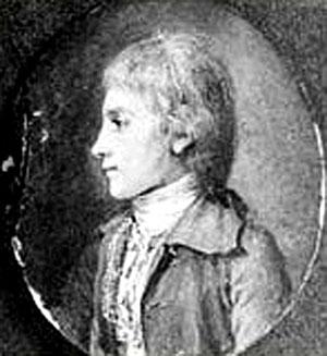
Alexander Hamilton spent his youth on St. Croix, from 1765 until 1772. This drawing was made shortly after he left the island.
Credit: Library of Congress
Activities
Topics
Operating Hours
Entrance Fees
Entrance Passes
No entrance passes listed.
3-Day Weather Forecast
Saturday, Jun 20

Patchy rain nearby
High: 85.1°F | Low: 80°F
Humidity: 71%
Wind: 21.5 mph
Rain Chance: 39%
UV Index: 10.4
Sunrise: 05:44 AM
Sunset: 06:56 PM
Moon: First Quarter (38%)
Visibility: 6 mi
Dew Point: 75.9°F
Cloud Cover: 39%
Pressure: N/A mb
Air Quality (PM2.5): N/A
Ozone: N/A
EPA Index: N/A
Sunday, Jun 21
Patchy rain nearby
High: 84.8°F | Low: 79.1°F
Humidity: 74%
Wind: 21 mph
Rain Chance: 43%
UV Index: 11.2
Sunrise: 05:44 AM
Sunset: 06:56 PM
Moon: First Quarter (48%)
Visibility: 6 mi
Dew Point: 76.6°F
Cloud Cover: 43%
Pressure: N/A mb
Air Quality (PM2.5): N/A
Ozone: N/A
EPA Index: N/A
Monday, Jun 22
Patchy rain nearby
High: 85.1°F | Low: 79.9°F
Humidity: 70%
Wind: 22.4 mph
Rain Chance: 17%
UV Index: 11.2
Sunrise: 05:45 AM
Sunset: 06:56 PM
Moon: First Quarter (59%)
Visibility: 6 mi
Dew Point: 75.9°F
Cloud Cover: 17%
Pressure: N/A mb
Air Quality (PM2.5): N/A
Ozone: N/A
EPA Index: N/A
Park Alerts
Visitor Center & Contacts
📍 Physical Address:
2100 Church St. #100
Christiansted, VI 00820
🏤 Mailing Address:
2100 Church St. #100
Christiansted, VI 00820
📞 Voice Phone: (340) 773.1460
📞 Fax Phone: (340) 719.1791
✉️ Email: CHRI_Webmail@nps.gov