Curecanti National Recreation Area
Designation: National Recreation Area
Location: Colorado
📘 Park Overview
Three reservoirs and surrounding lands make up this recreation area in western Colorado. It is a landscape of tradeoffs; natural and human made features exist together. Geologic wonders are abundant from the sagebrush shrublands to forests. Visitors can experience the park year-round on both land and water.
🌤 Weather Information
During spring and fall, temperatures range from 44°F to 70°F (7°C to 34°C) with overnight lows from the teens to about freezing (-9°C to 2°C). In summer, temperatures are usually in the 70°F to 80°F (21°C to 27°C). Nights are usually 40°F to 50°F (4°C to 10°C). The wind often picks up at 12 pm and continues through the afternoon. Thunderstorms are common. In winter, temperatures usually reach 20°F to 30°F (-7°C to -1°C) and lows often dip below zero (-18°C).
🚗 Directions
Curecanti is located between the Colorado towns of Gunnison (to the east), Montrose (to the west), and Lake City (to the south). The West Elk Mountain Wilderness area borders Curecanti to the north. U.S. Highway 50 runs the length of Curecanti east to west.
Images
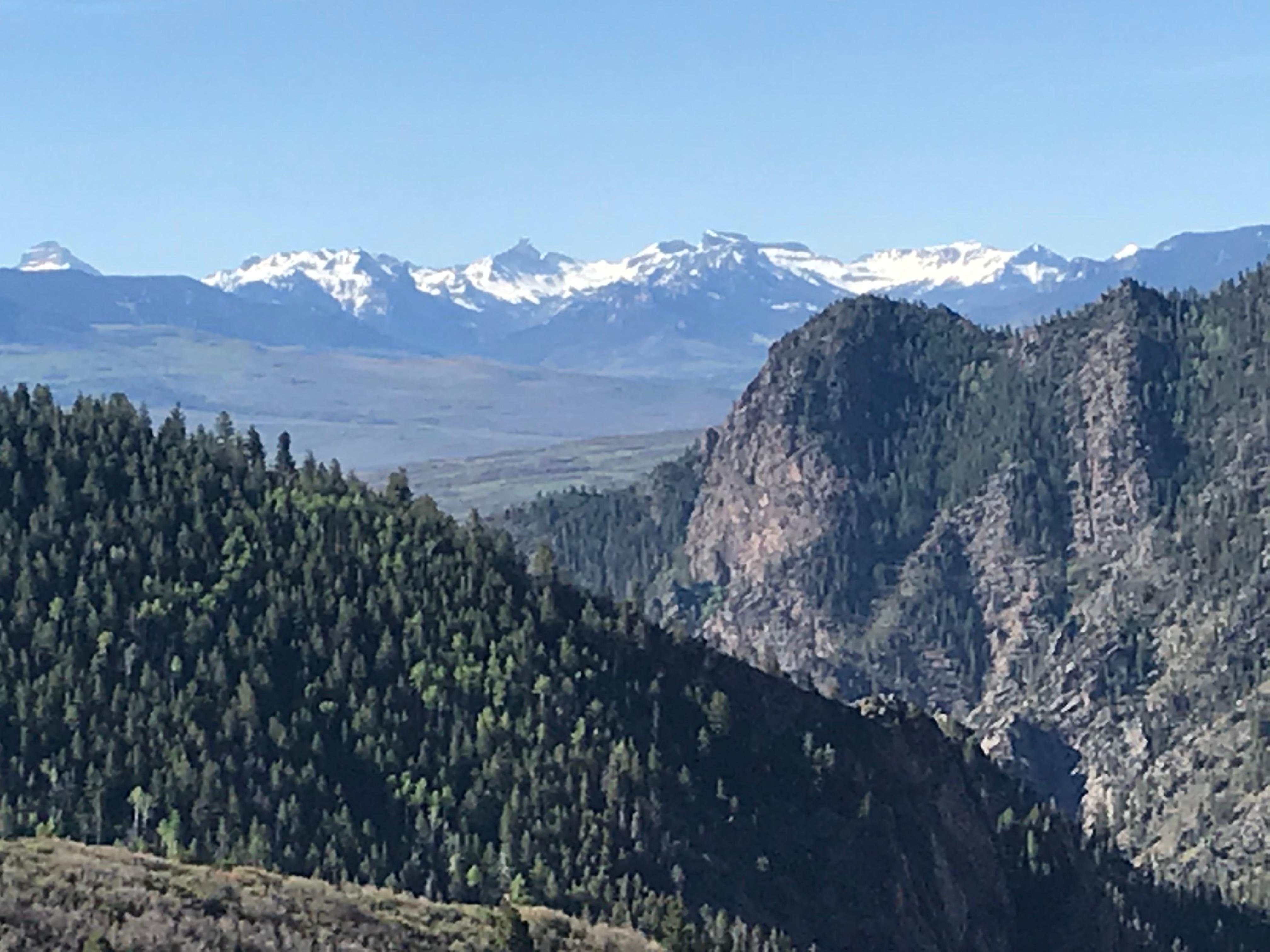
The snow-capped San Juan Mountain Range looms in the distance as viewed from the Crystal Trail
Credit: NPS image by Matt Johnson
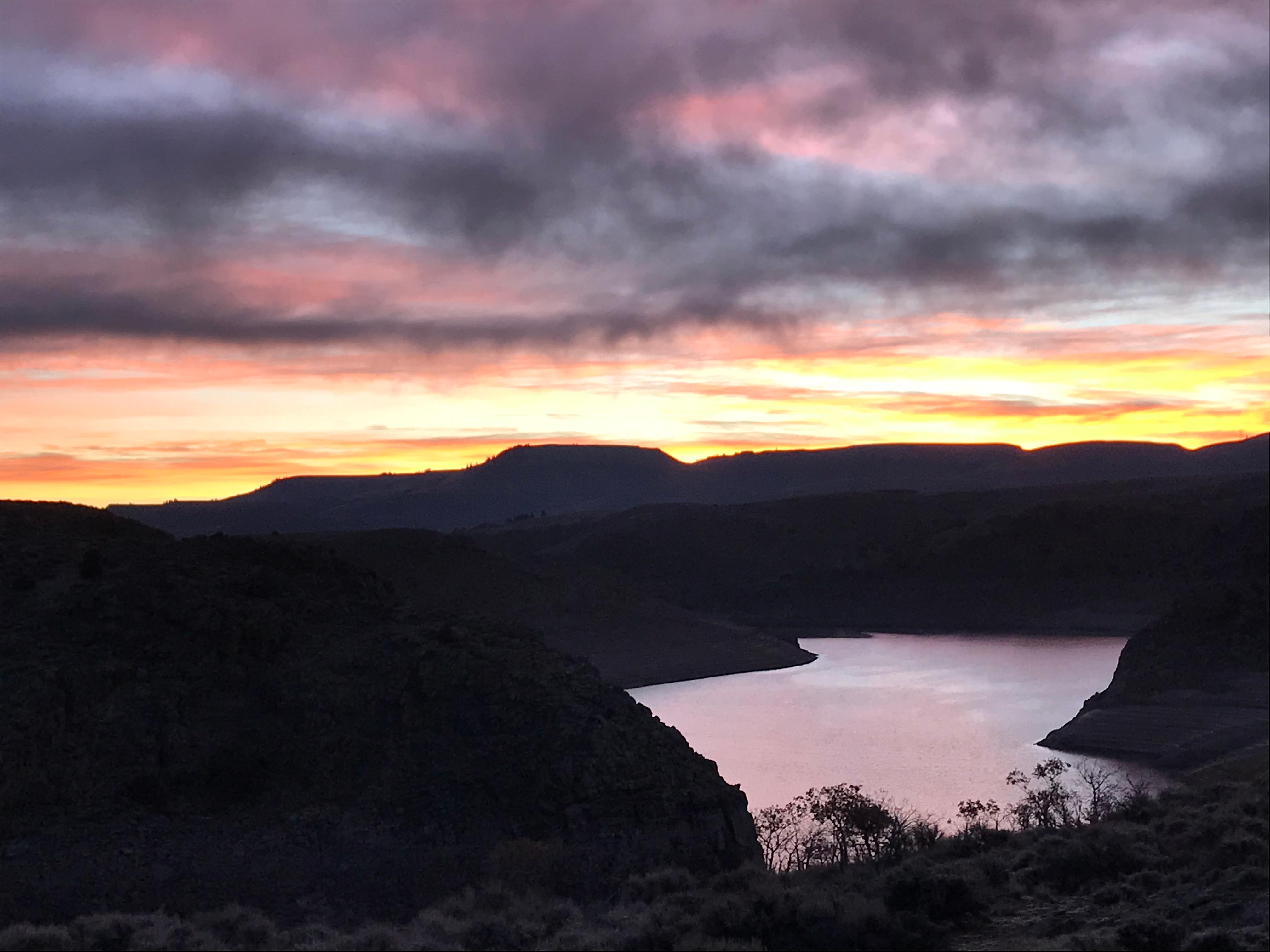
Blue Mesa reflects the color of the sky in the dawn twilight.
Credit: NPS image by Matt Johnson
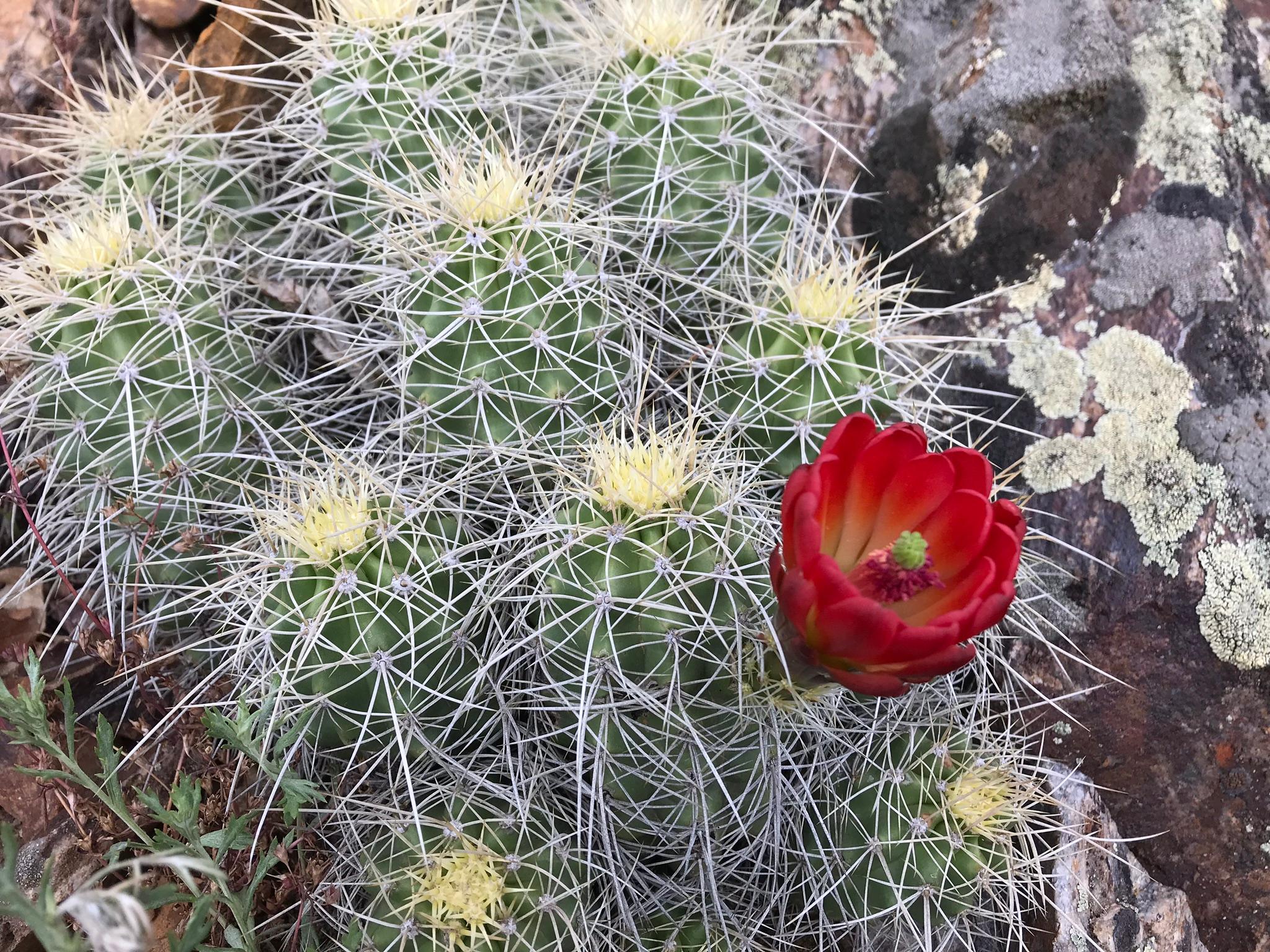
Hedgehog Cactus flower blooming along the Crystal Trail
Credit: NPS image by Matt Johnson
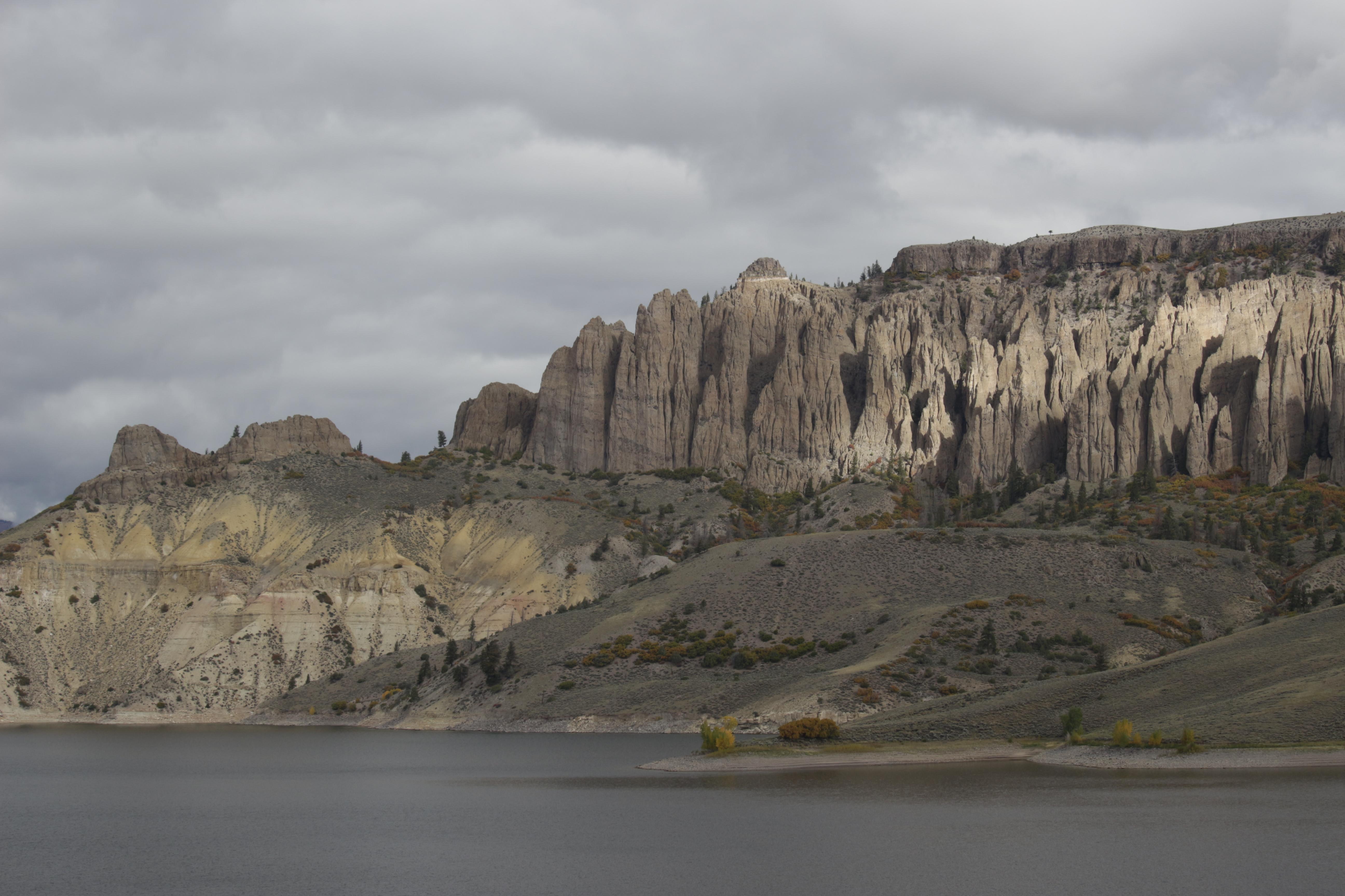
Dillon Pinnacles next to Blue Mesa Reservoir
Credit: NPS Photo
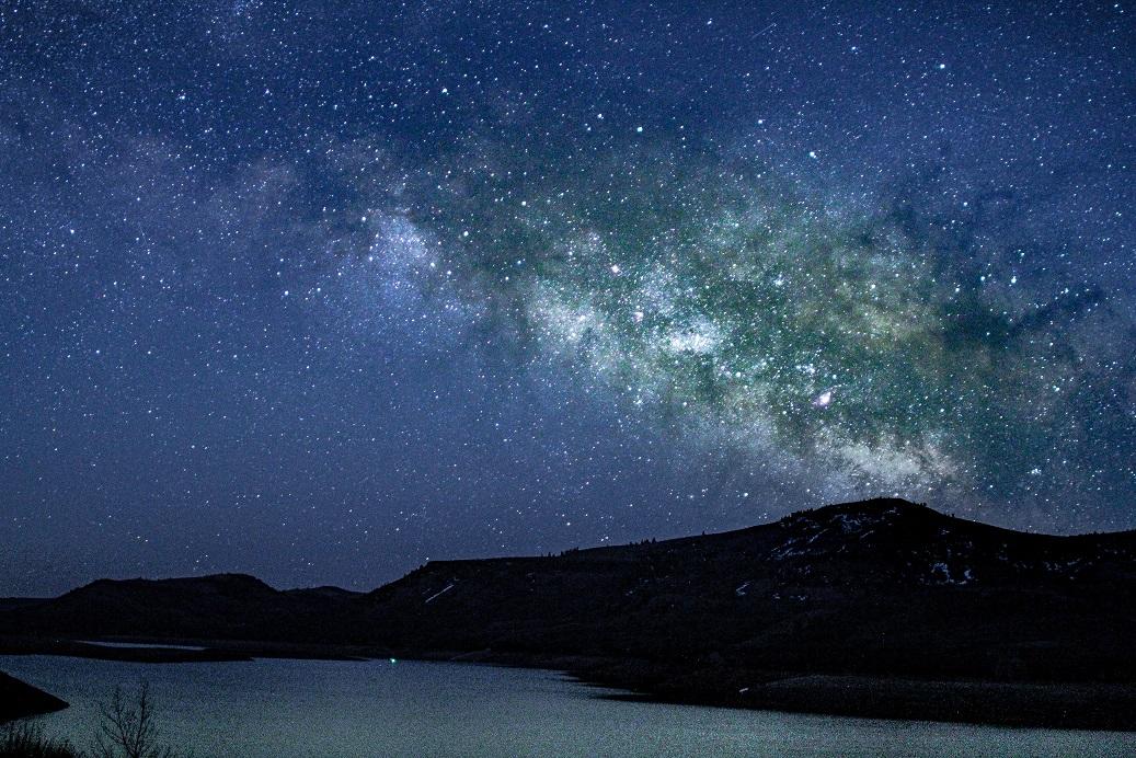
An arm of the Milky Way galaxy glows over Blue Mesa.
Credit: NPS image by Leo Pareti
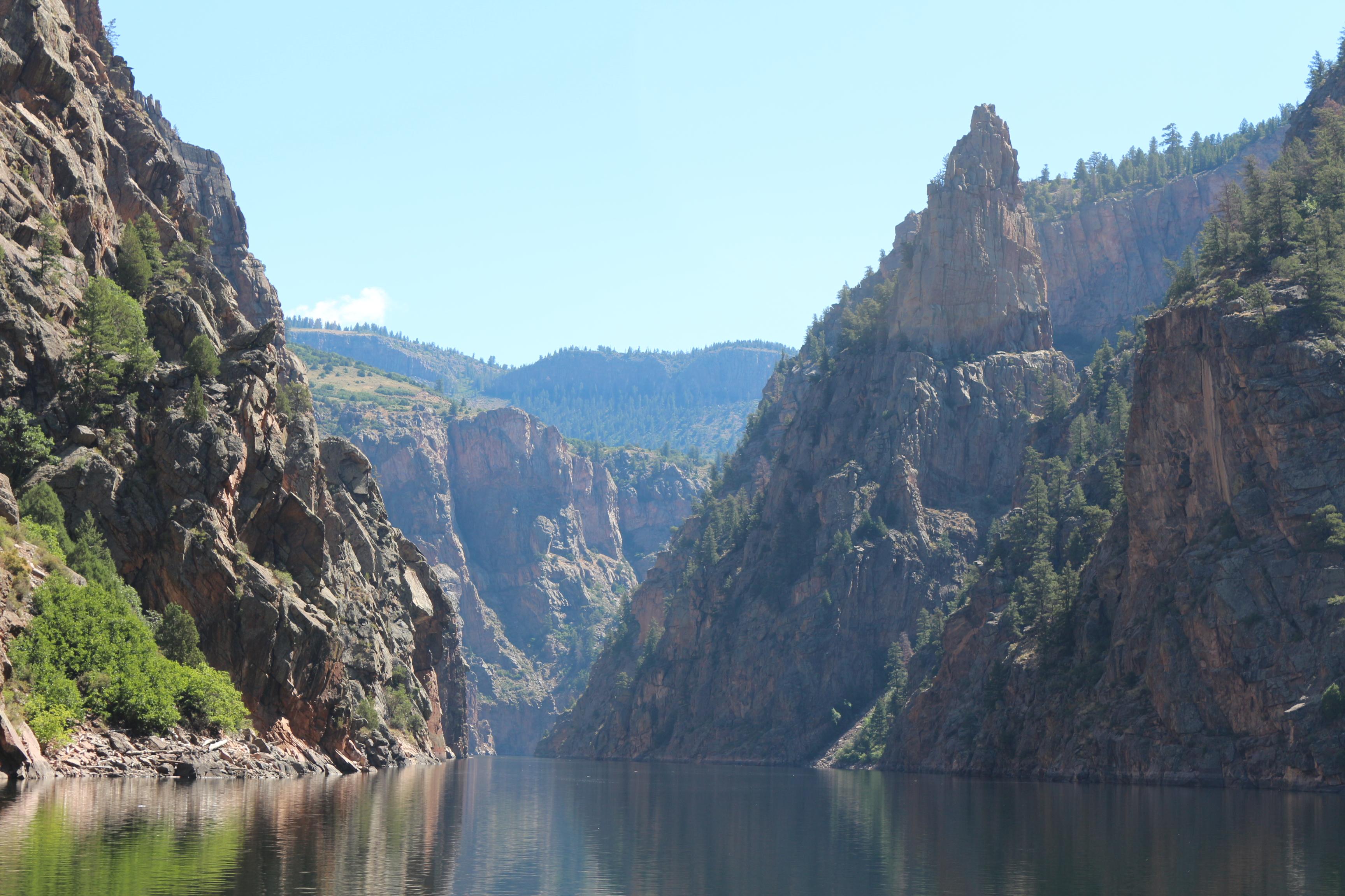
Morrow Point Reservoir
Credit: NPS Photo
Activities
Topics
Operating Hours
Entrance Fees
No entrance fees listed.
Entrance Passes
No entrance passes listed.
3-Day Weather Forecast
Friday, Feb 20

Moderate or heavy snow showers
High: 22.8°F | Low: 14.2°F
Humidity: 79%
Wind: 21 mph
Rain Chance: 74%
UV Index: 0.5
Sunrise: 06:54 AM
Sunset: 05:54 PM
Moon: Waxing Crescent (7%)
Visibility: 3 mi
Dew Point: 14.3°F
Cloud Cover: 74%
Pressure: N/A mb
Air Quality (PM2.5): N/A
Ozone: N/A
EPA Index: N/A
Saturday, Feb 21

Moderate snow
High: 32.4°F | Low: 1.6°F
Humidity: 63%
Wind: 6.7 mph
Rain Chance: 73%
UV Index: 1
Sunrise: 06:52 AM
Sunset: 05:55 PM
Moon: Waxing Crescent (14%)
Visibility: 5 mi
Dew Point: 9.5°F
Cloud Cover: 73%
Pressure: N/A mb
Air Quality (PM2.5): N/A
Ozone: N/A
EPA Index: N/A
Sunday, Feb 22

Sunny
High: 41.4°F | Low: 4.3°F
Humidity: 55%
Wind: 7.2 mph
Rain Chance: 0%
UV Index: 1.1
Sunrise: 06:51 AM
Sunset: 05:56 PM
Moon: Waxing Crescent (23%)
Visibility: 6 mi
Dew Point: 12.7°F
Cloud Cover: 0%
Pressure: N/A mb
Air Quality (PM2.5): N/A
Ozone: N/A
EPA Index: N/A
Weather Alerts (5)
Avalanche Warning issued February 16 at 5:21PM MST by NWS Denver CO
Effective: Feb 16, 2026 7:21pm
Expires: Feb 20, 2026 7:30pm
AVWBOU
THE FOLLOWING MESSAGE IS TRANSMITTED AT THE REQUEST OF THE
COLORADO AVALANCHE INFORMATION CENTER.
AVALANCHE WARNING IN EFFECT FROM TUESDAY MORNING THROUGH FRIDAY
*WHAT Heavy snow and strong winds will result in HIGH (4 of 5)
avalanche danger
*WHERE The West Elk Mountains including the Ruby and Ragged Ranges
*WHEN Expect very dangerous avalanche conditions to begin Tuesday
and last through Friday
*IMPACTS Large and dangerous avalanches will be easy to trigger.
Large avalanches will run naturally.
*PRECAUTION/PREPAREDNESS ACTIONS Travel in backcountry avalanche
terrain is not recommended from Tuesday through Friday.
Avoid travel on and under slopes with a slope angle steeper than
about 30 degrees. You can find more detailed information at
colorado.gov/avalanche
Avalanche Warning issued February 19 at 8:28AM MST by NWS Denver CO
Effective: Feb 19, 2026 10:28am
Expires: Feb 20, 2026 6:30pm
AVWBOU
THE FOLLOWING MESSAGE IS TRANSMITTED AT THE REQUEST OF THE
COLORADO AVALANCHE INFORMATION CENTER.
...AVALANCHE WARNING IN EFFECT FROM TUESDAY EVENING THROUGH FRIDAY...
*WHAT... Heavy snow and strong winds will result in HIGH (4 of 5)
avalanche danger
*WHERE... The Grand Mesa, Sawatch, West Elk, Elk Mountains, San Juan
Mountains
*WHEN... Expect very dangerous avalanche conditions to begin on
Tuesday evening and last through Friday
*IMPACTS... Large and dangerous avalanches will be easy to trigger.
Large avalanches will run naturally.
*PRECAUTION/PREPAREDNESS ACTIONS... Travel in backcountry avalanche
terrain is not recommended from Tuesday evening through Friday.
Avoid travel on and under slopes with a slope angle steeper than
about 30 degrees. You can find more detailed information at
colorado.gov/avalanche
Pritchett
Winter Weather Advisory issued February 19 at 10:43PM MST until February 20 at 11:00PM MST by NWS Grand Junction CO
Effective: Feb 20, 2026 12:43am
Expires: Feb 20, 2026 2:00pm
* WHAT...Snow expected. Total snow accumulations between 6 and 10
inches. Winds gusting as high as 40 mph.
* WHERE...Grand and Battlement Mesas and West Elk and Sawatch
Mountains.
* WHEN...From 2 AM to 11 PM MST Friday.
* IMPACTS...Travel could be very difficult. The hazardous conditions
could impact the Friday morning and evening commutes.
Avalanche Advisory issued February 19 at 5:31PM MST by NWS Denver CO
Effective: Feb 19, 2026 7:31pm
Expires: Feb 22, 2026 7:45pm
SABCO
THE FOLLOWING MESSAGE IS TRANSMITTED AT THE REQUEST OF THE
COLORADO AVALANCHE INFORMATION CENTER.
A SPECIAL AVALANCHE ADVISORY IN EFFECT FROM THURSDAY EVENING
THROUGH SUNDAY
*WHATit is very easy for people to trigger large and deadly
avalanches through the weekend.
*WHEREthe Elkheads, Park Range, Flat Tops, Front Range, Gore Range,
10-Mile Range, Grand Mesa, Sawatch, West Elk, Elk Mountains, San
Juan Mountains.
*WHENDangerous avalanche conditions exist through Sunday.
*IMPACTSLarge and dangerous avalanches will be easy to trigger.
*PRECAUTION/PREPAREDNESS ACTIONS Travel in backcountry avalanche
terrain requires careful planning and cautious route-finding to
stay safe. Many slopes that were safe earlier this winter are now
dangerous. Avoid travel on and under slopes with a slope angle
steeper than about 30 degrees. You can find more detailed
information at colorado.gov/avalanche
Pritchett
Winter Weather Advisory issued February 20 at 11:09AM MST until February 20 at 11:00PM MST by NWS Grand Junction CO
Effective: Feb 20, 2026 1:09pm
Expires: Feb 21, 2026 1:00am
* WHAT...Snow expected. Total snow accumulations between 6 and 10
inches. Winds gusting as high as 40 mph.
* WHERE...Grand and Battlement Mesas and West Elk and Sawatch
Mountains.
* WHEN...Until 11 PM MST this evening.
* IMPACTS...Travel could be very difficult. The hazardous conditions
could impact the Friday morning and evening commutes.
Park Alerts
Visitor Center & Contacts
📍 Physical Address:
102 Elk Creek
Gunnison, CO 81230
🏤 Mailing Address:
102 Elk Creek
Gunnison, CO 81230
📞 Voice Phone: 9706412337
📞 Fax Phone: 9706413127
✉️ Email: cure_info@nps.gov