El Morro National Monument
Designation: National Monument
Location: New Mexico
📘 Park Overview
Imagine the refreshment of finding water after days of dusty travel. A reliable waterhole hidden at the base of a sandstone bluff made El Morro (the headland) a popular campsite for hundreds of years. Here, ancestral Puebloans, Spanish, and American travelers carved over 2,000 signatures, dates, messages, and petroglyphs. Make El Morro National Monument a stopping point on your travels.
🌤 Weather Information
At an elevation of 7,219 feet (2200 meters) winters can be cold and snowy. Summers are warm with afternoon thunder showers from mid-July through mid-September. Trails can close unexpectedly due to severe weather. Average snowfall: 40 inches per year. Average precipitation (snowmelt and rain): 16 inches per year. Warmest month: July, with average highs of 84 degrees and lows of 52 degrees. Coldest months: December and January, with average lows of 14-15 degrees, and average highs of 44-45 degrees.
🚗 Directions
From Albuquerque, NM, or from the east: take Interstate 40 west to Grants. At exit 81, go south on Highway 53 for 42 miles to El Morro National Monument. From Flagstaff, AZ, or from the west: take Interstate 40 east to Gallup. At exit 20, go south on Highway 602 for about 31 miles. Turn east (left) onto Highway 53. El Morro is 25 more miles.
Images
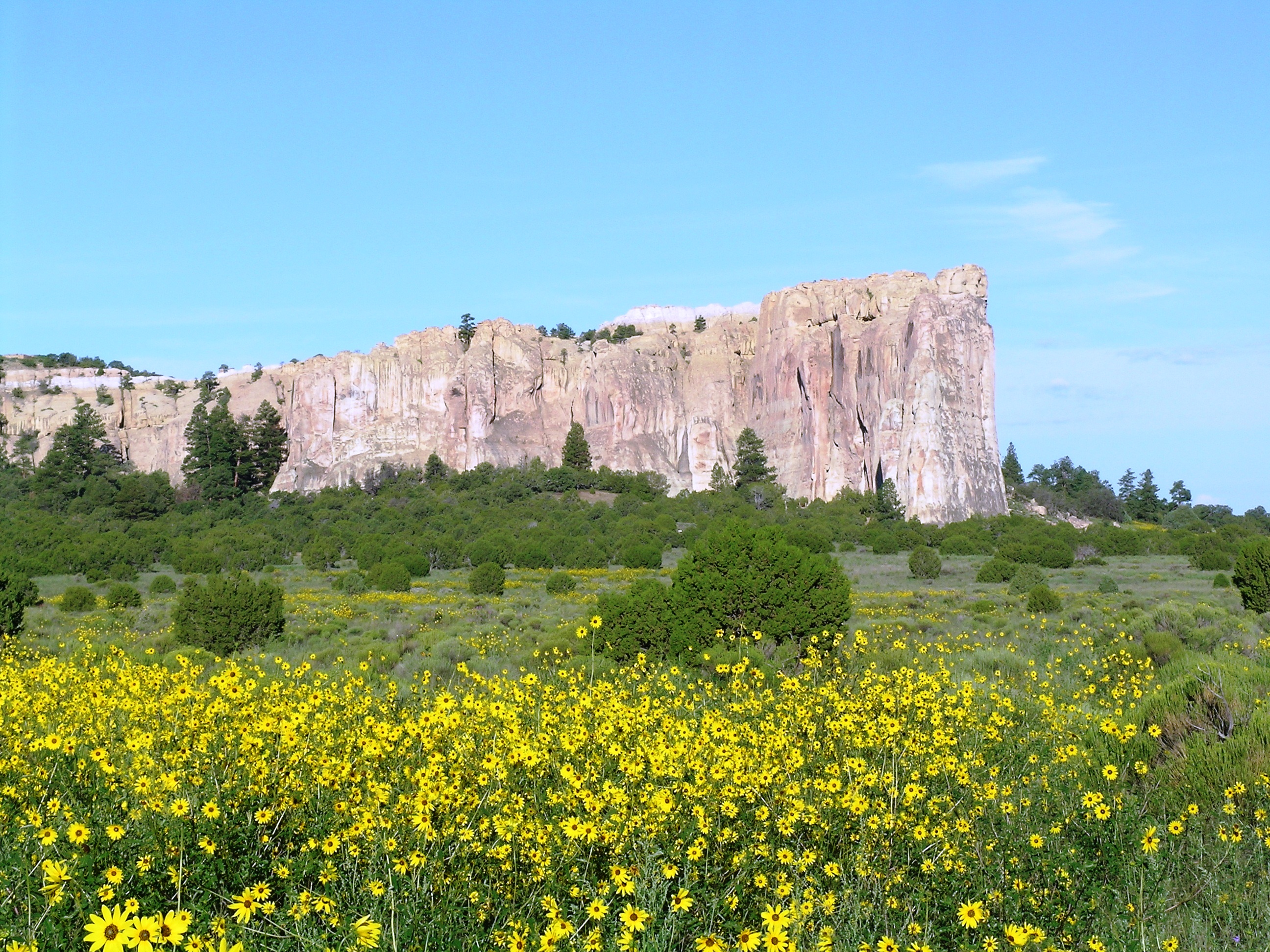
El Morro with Sunflowers
Credit: NPS Photo
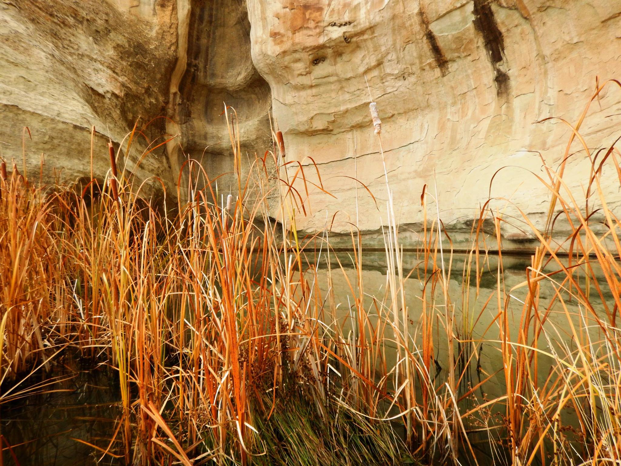
A drinking hole for visitors for hundreds of years, the pool at El Morro has significant cultural and historical value.
Credit: NPS Photo
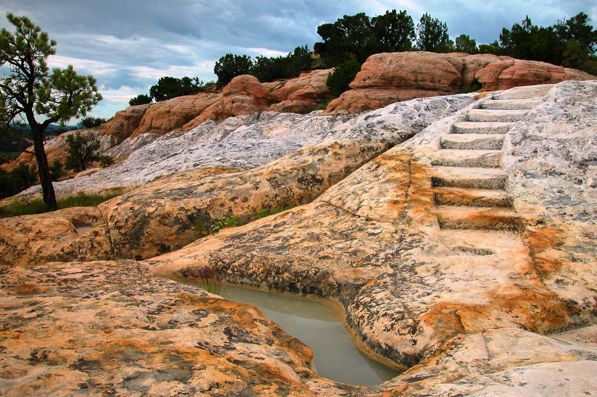
Constructed by the CCC, the historic headland trail at El Morro offers visitors great views and the archaeological site of Atsinna.
Credit: NPS Photo
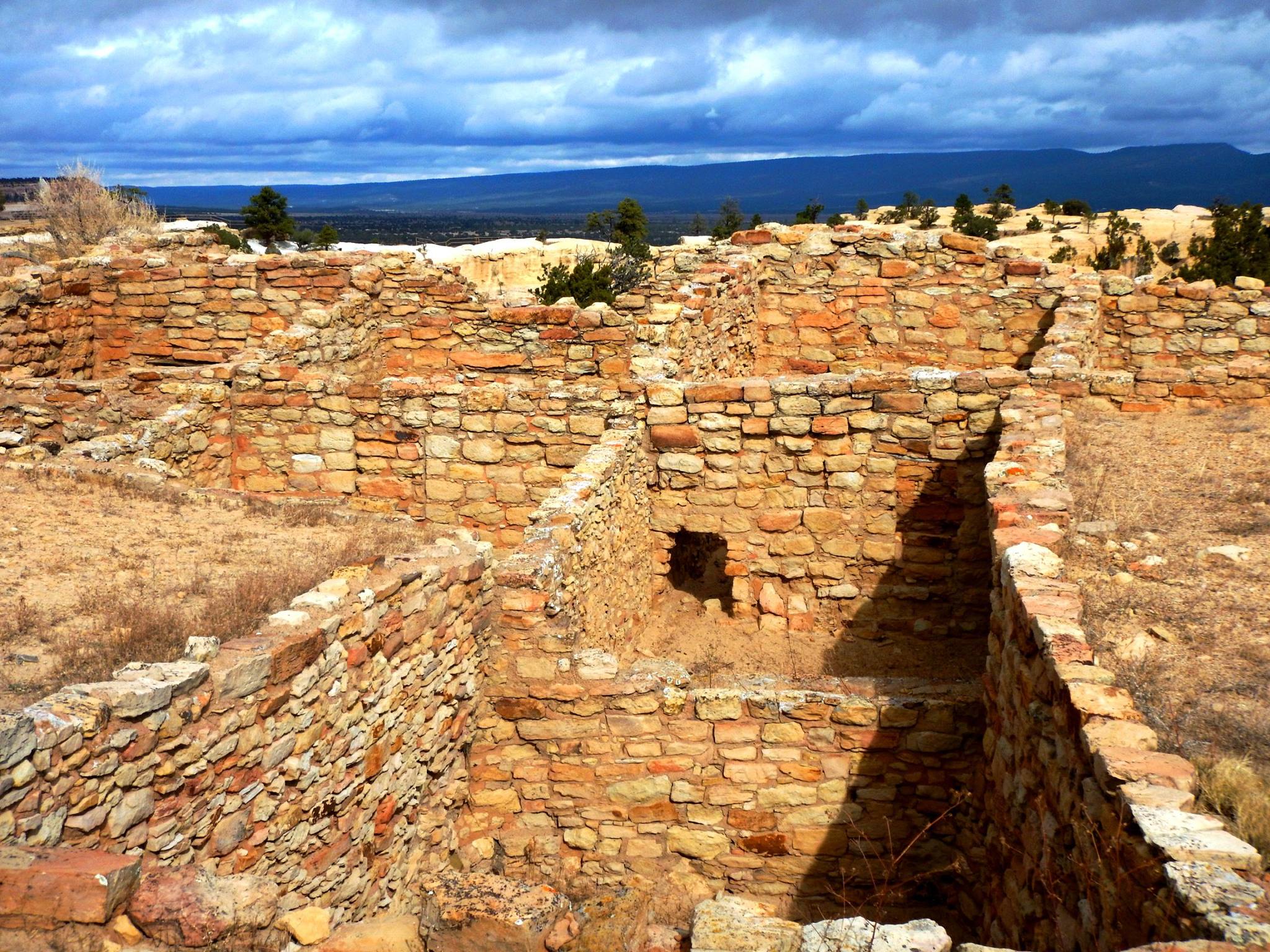
Atsinna Pueblo sits atop the headland at El Morro
Credit: NPS Photo
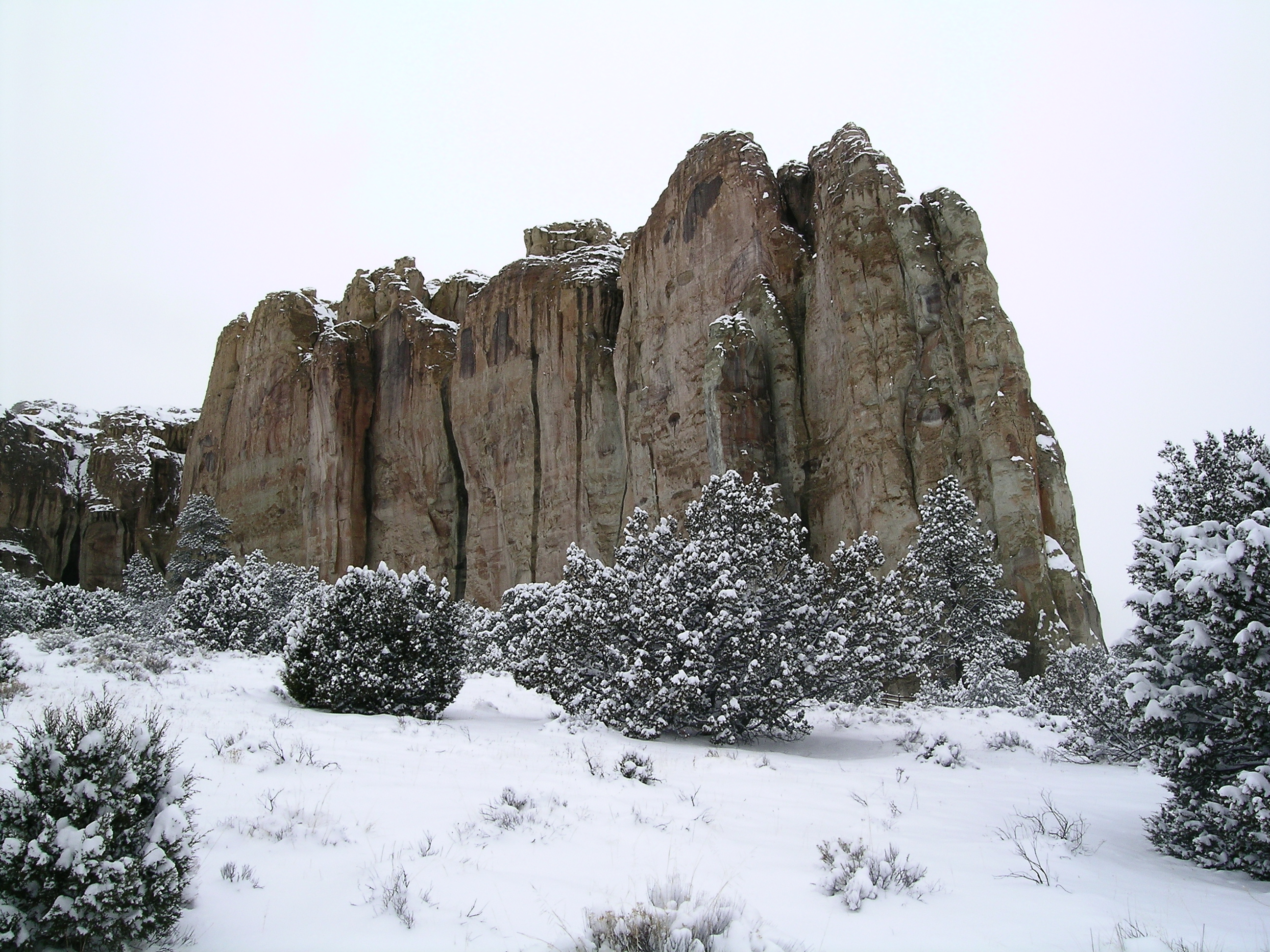
El Morro blanketed with snow
Credit: NPS Photo
Activities
Topics
Operating Hours
Entrance Fees
No entrance fees listed.
Entrance Passes
No entrance passes listed.
3-Day Weather Forecast
Tuesday, Jun 2

Patchy rain nearby
High: 81.5°F | Low: 51.8°F
Humidity: 21%
Wind: 22.1 mph
Rain Chance: 73%
UV Index: 10.9
Sunrise: 06:00 AM
Sunset: 08:22 PM
Moon: Waning Gibbous (90%)
Visibility: 6 mi
Dew Point: 50.4°F
Cloud Cover: 73%
Pressure: N/A mb
Air Quality (PM2.5): N/A
Ozone: N/A
EPA Index: N/A
Wednesday, Jun 3

Moderate rain
High: 75.7°F | Low: 54.2°F
Humidity: 46%
Wind: 19.9 mph
Rain Chance: 73%
UV Index: 10.9
Sunrise: 05:59 AM
Sunset: 08:23 PM
Moon: Waning Gibbous (83%)
Visibility: 6 mi
Dew Point: 50.7°F
Cloud Cover: 73%
Pressure: N/A mb
Air Quality (PM2.5): N/A
Ozone: N/A
EPA Index: N/A
Thursday, Jun 4

Sunny
High: 82.4°F | Low: 51.6°F
Humidity: 28%
Wind: 17.4 mph
Rain Chance: 0%
UV Index: 11.2
Sunrise: 05:59 AM
Sunset: 08:23 PM
Moon: Waning Gibbous (74%)
Visibility: 6 mi
Dew Point: 53.4°F
Cloud Cover: 0%
Pressure: N/A mb
Air Quality (PM2.5): N/A
Ozone: N/A
EPA Index: N/A
Park Alerts
Park Events
Stories Carved in Stone
Discover the many layers of history caputured in stone carvings along the Inscription Loop Trail. Join a ranger for this easy, half-mile guided walk.
Date: May 22, 2026 12:00am to May 22, 2026 12:00am
Paid Event
Pueblo Hike
Join a ranger-guided hike to Atsinna Pueblo to learn about Ancestral Puebloan history, Zuni cultural connections, and the unique geology of the Zuni Sandstone. Wear sturdy footwear, bring water, and wear sun protection for this monderately strenuous, one-mile hike.
Date: May 23, 2026 12:00am to May 23, 2026 12:00am
Paid Event
Stories Carved in Stone
Discover the many layers of history caputured in stone carvings along the Inscription Loop Trail. Join a ranger for this easy, half-mile guided walk.
Date: May 24, 2026 12:00am to May 24, 2026 12:00am
Paid Event
Guided Hike
Join a ranger guided hike to Atsinna Pueblo to learn about Ancestral Puebloan history, Zuni cultural connections, and the unique geology of the Zuni Sandstone.
(Moderately Strenuous, one-mile hike)
Location: Meet at the Visitor Center
Date: May 30, 2026 12:00am to May 30, 2026 12:00am
Paid Event
Pueblo Hike
Join a ranger-guided hike to Atsinna Pueblo to learn about Ancestral Puebloan history, Zuni cultural connections, and the unique geology of the Zuni Sandstone.
(Moderately Strenuous, one-mile hike)
Date: May 31, 2026 12:00am to May 31, 2026 12:00am
Paid Event
Visitor Center & Contacts
📍 Physical Address:
Mile Marker 44.6 Hwy 53
Ramah, NM 87321
🏤 Mailing Address:
HC 61 Box 43
Ramah, NM 87321
📞 Voice Phone: 5057834226
📞 Fax Phone: 5057834689
✉️ Email: wendy_gordge@nps.gov