Fort Larned National Historic Site
Designation: National Historic Site
Location: Kansas
📘 Park Overview
Discover a complete and authentic army post from the 1860s -1870s! This well-preserved fort on the Santa Fe Trail shares a tumultuous history of the Indian Wars era. The sandstone constructed buildings sheltered troops who were known as the Guardians of the Santa Fe Trail.
🌤 Weather Information
Central Kansas has a four-season climate. Winter tends to be cold and dry, with average daytime highs below 40F (4C). Foehn winds blowing across the Great Plains from the Southwest periodically raise temperatures above 80F (27C). Unsettled warmer air, higher winds, and severe weather arrive in the spring and often last through early July. Late summer days hover above 90F (32C) and readings over 100F (38C) are not uncommon. Fall is variable but generally milder with showers changing to snow and ice later.
🚗 Directions
Fort Larned National Historic Site is located on KS Hwy 156, six miles west of Larned, Kansas.
Images
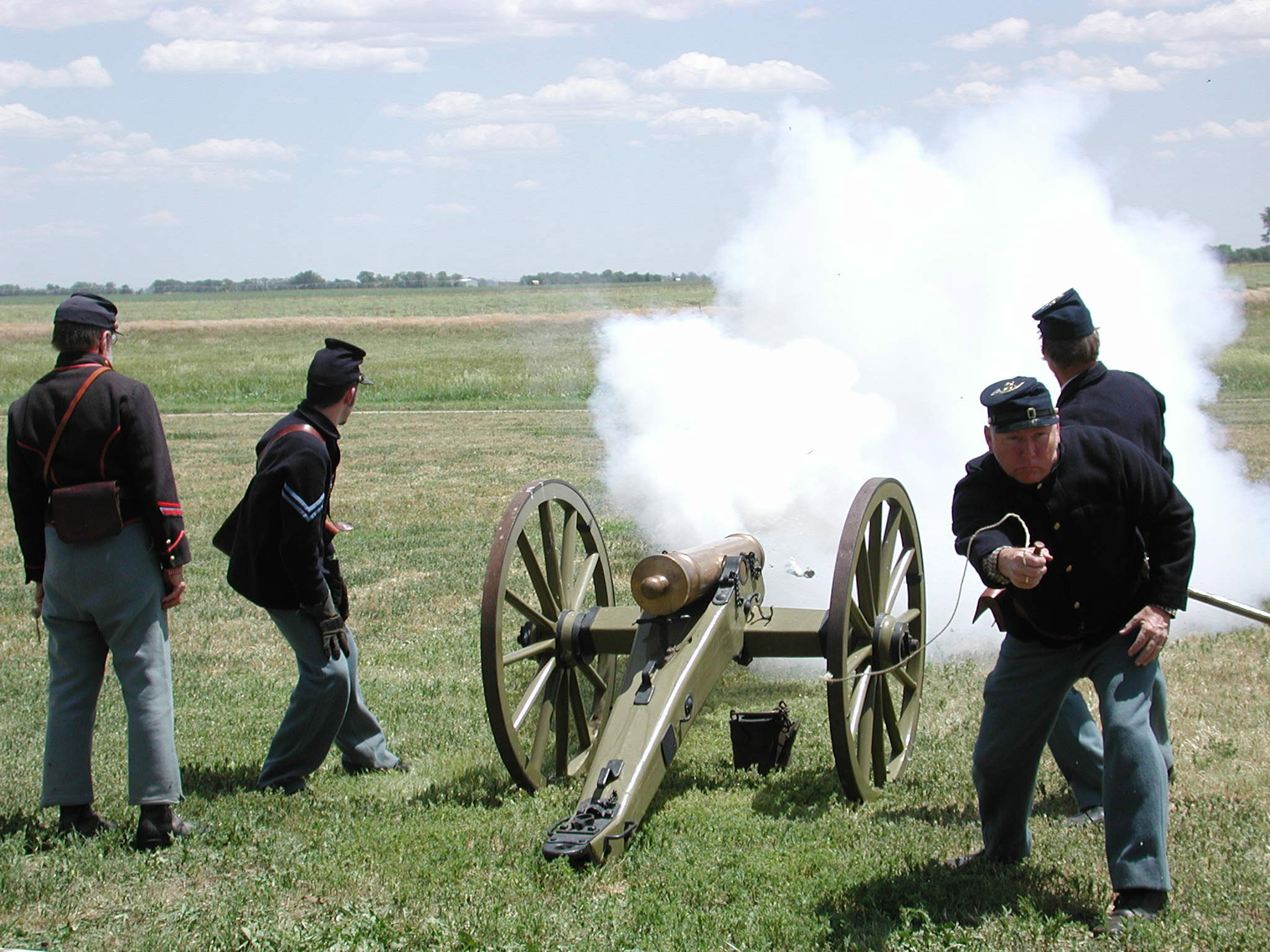
Volunteers demonstrating the use of a mountain howitzer during one of Fort Larned's living history weekends.
Credit: NPS Photo
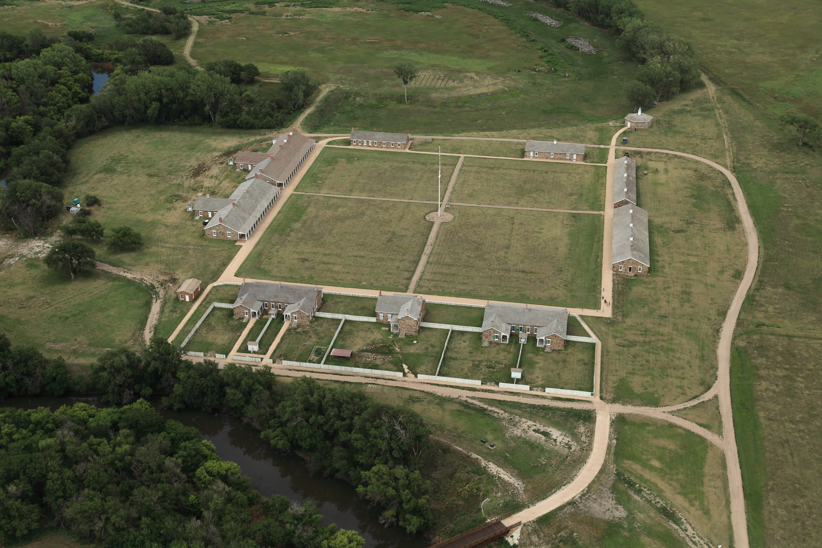
The historic sandstone buildings at Fort Larned date to 1868
Credit: NPS Photo

The blacksmith demonstration is one of the most popular living history demonstrations.
Credit: NPS Photo
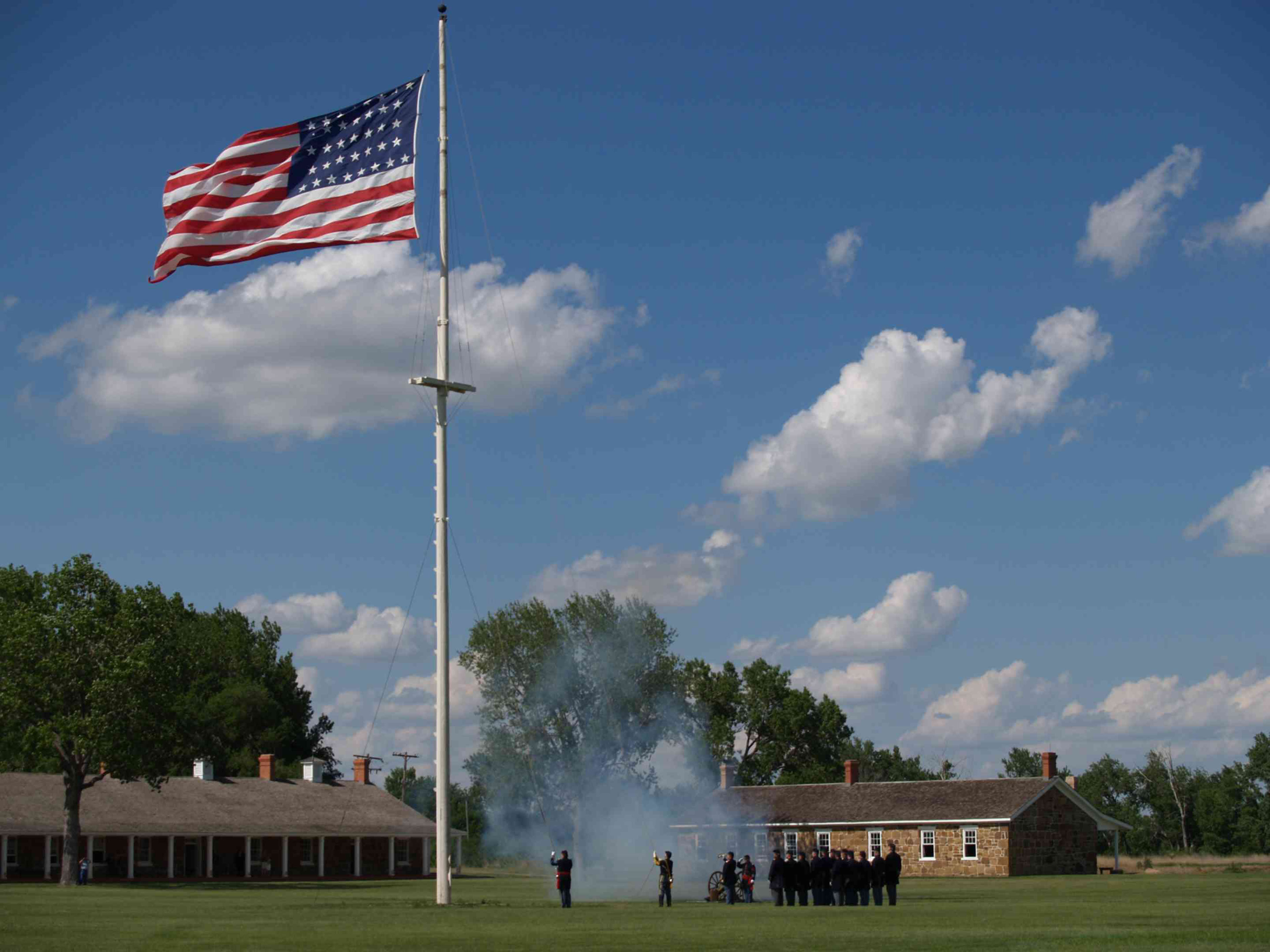
Volunteers help recreate the U.S. Army flag lowering ceremony known as Retreat.
Credit: NPS Photo
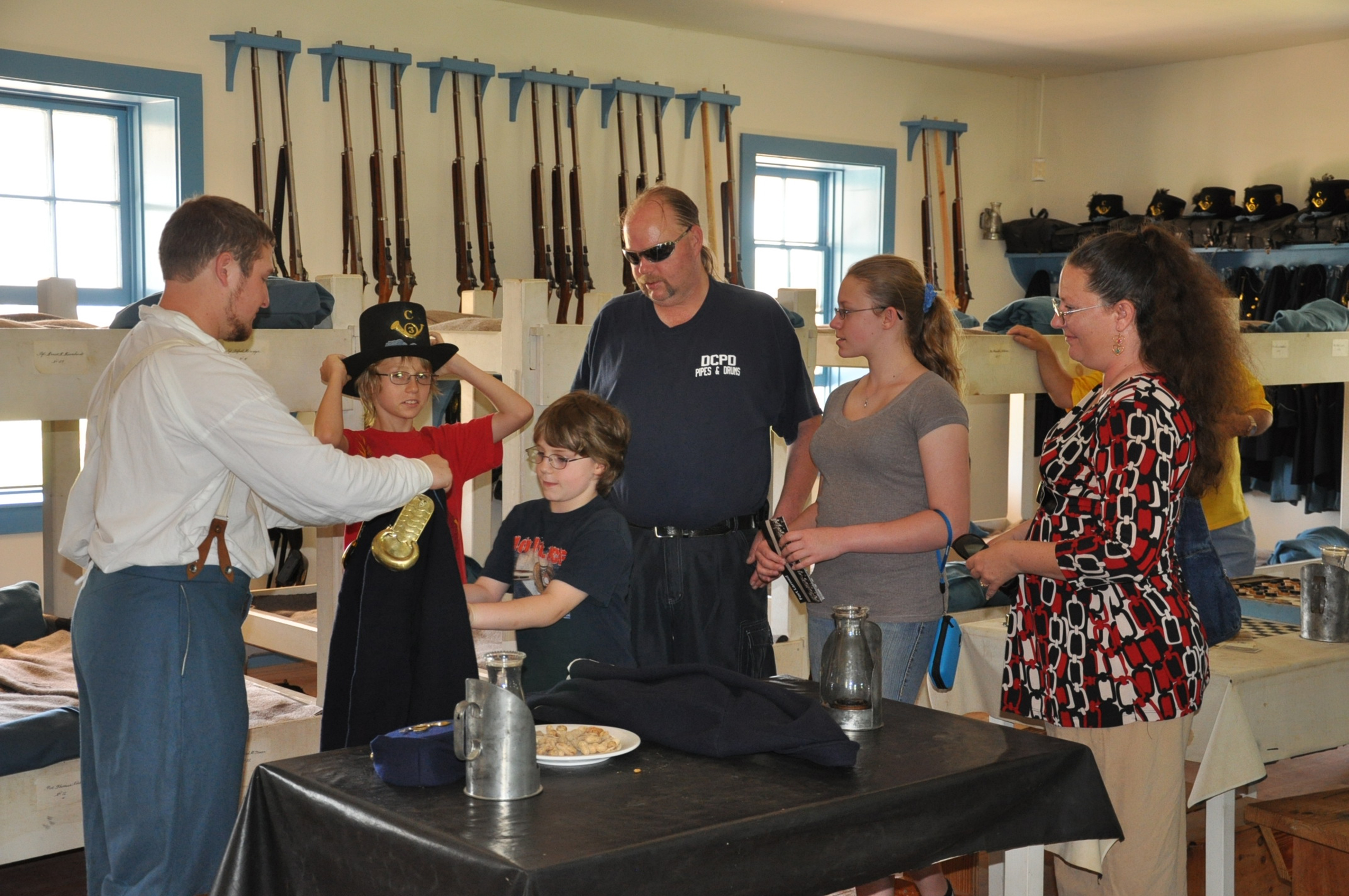
A volunteer shows visitors how soldiers lived during the 1860s at Fort Larned.
Credit: NPS Photo
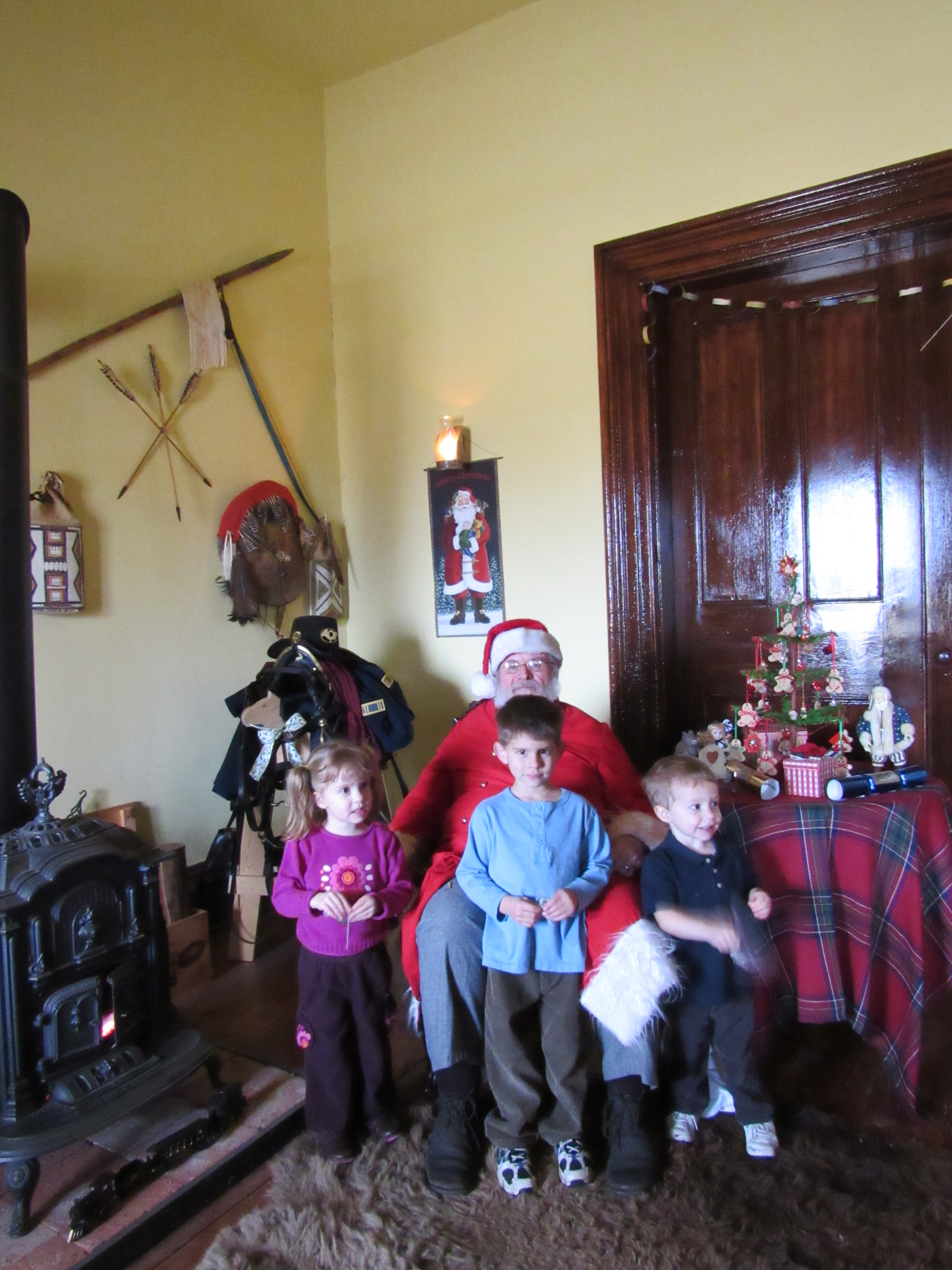
Young visitors get their picture taken with Santa during the fort's Christmas Past event.
Credit: NPS Photo
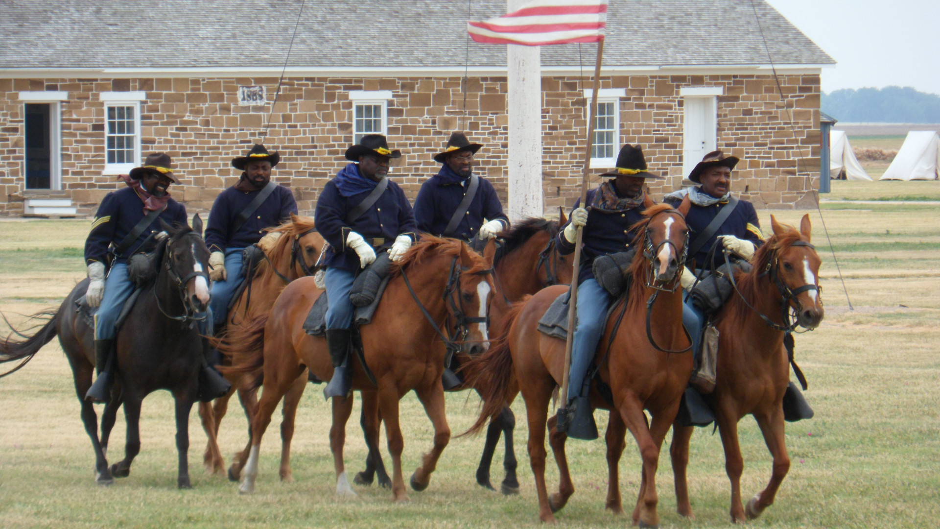
Buffalo Soldier re-enactors help bring Fort Larned's history to life.
Credit: NPS Photo
Activities
Topics
Operating Hours
Entrance Fees
No entrance fees listed.
Entrance Passes
No entrance passes listed.
3-Day Weather Forecast
Thursday, Jun 25

Heavy rain
High: 74.3°F | Low: 65.5°F
Humidity: 92%
Wind: 19.2 mph
Rain Chance: 85%
UV Index: 3.5
Sunrise: 06:15 AM
Sunset: 09:03 PM
Moon: Waxing Gibbous (87%)
Visibility: 5 mi
Dew Point: 67.6°F
Cloud Cover: 85%
Pressure: N/A mb
Air Quality (PM2.5): N/A
Ozone: N/A
EPA Index: N/A
Friday, Jun 26

Moderate rain
High: 82.6°F | Low: 63.8°F
Humidity: 79%
Wind: 12.5 mph
Rain Chance: 78%
UV Index: 9
Sunrise: 06:15 AM
Sunset: 09:04 PM
Moon: Waxing Gibbous (93%)
Visibility: 5 mi
Dew Point: 67.7°F
Cloud Cover: 78%
Pressure: N/A mb
Air Quality (PM2.5): N/A
Ozone: N/A
EPA Index: N/A
Saturday, Jun 27

Patchy rain nearby
High: 99.8°F | Low: 69.2°F
Humidity: 62%
Wind: 23 mph
Rain Chance: 17%
UV Index: 11
Sunrise: 06:15 AM
Sunset: 09:04 PM
Moon: Full Moon (97%)
Visibility: 4 mi
Dew Point: 75.6°F
Cloud Cover: 17%
Pressure: N/A mb
Air Quality (PM2.5): N/A
Ozone: N/A
EPA Index: N/A
Weather Alerts (5)
Flash Flood Warning issued June 25 at 9:38AM CDT until June 25 at 12:45PM CDT by NWS Dodge City KS
Effective: Jun 25, 2026 10:38am
Expires: Jun 25, 2026 1:45pm
FFWDDC
The National Weather Service in Dodge City has issued a
* Flash Flood Warning for...
Northern Edwards County in south central Kansas...
Western Pawnee County in south central Kansas...
Northeastern Hodgeman County in southwestern Kansas...
* Until 1245 PM CDT.
* At 938 AM CDT, Doppler radar indicated thunderstorms producing
heavy rain across the warned area. Between 1 and 2 inches of rain
have fallen. Additional rainfall amounts of 0.5 to 1 inch are
possible in the warned area. Flash flooding is ongoing or expected
to begin shortly.
HAZARD...Flash flooding caused by thunderstorms.
SOURCE...Radar.
IMPACT...Flash flooding of small creeks and streams, urban
areas, highways, streets and underpasses as well as
other poor drainage and low-lying areas.
* Some locations that will experience flash flooding include...
Burdett, Garfield, Rozel, Sanford and Frizell.
Flash Flood Warning issued June 25 at 10:34AM CDT until June 25 at 1:45PM CDT by NWS Dodge City KS
Effective: Jun 25, 2026 11:34am
Expires: Jun 25, 2026 2:45pm
FFWDDC
The National Weather Service in Dodge City has issued a
* Flash Flood Warning for...
Edwards County in south central Kansas...
Northwestern Kiowa County in south central Kansas...
* Until 145 PM CDT.
* At 1034 AM CDT, Doppler radar indicated thunderstorms producing
heavy rain across the warned area. Between 1 and 2 inches of rain
have fallen. Additional rainfall amounts of 0.5 to 1 inch are
possible in the warned area. Flash flooding is ongoing or expected
to begin shortly.
HAZARD...Flash flooding caused by thunderstorms.
SOURCE...Radar.
IMPACT...Flash flooding of small creeks and streams, urban
areas, highways, streets and underpasses as well as
other poor drainage and low-lying areas.
* Some locations that will experience flash flooding include...
Kinsley, Lewis, Offerle, Belpre, Centerview, Fellsburg and
Trousdale.
Flash Flood Warning issued June 25 at 8:26AM CDT until June 25 at 11:30AM CDT by NWS Dodge City KS
Effective: Jun 25, 2026 9:26am
Expires: Jun 25, 2026 12:30pm
FFWDDC
The National Weather Service in Dodge City has issued a
* Flash Flood Warning for...
Hodgeman County in southwestern Kansas...
Southern Ness County in west central Kansas...
* Until 1130 AM CDT.
* At 826 AM CDT, Doppler radar indicated thunderstorms producing
heavy rain across the warned area. Between 1 and 2 inches of rain
have fallen. Additional rainfall amounts of 0.5 to 1 inch are
possible in the warned area. Flash flooding is ongoing or expected
to begin shortly.
HAZARD...Flash flooding caused by thunderstorms.
SOURCE...Radar.
IMPACT...Flash flooding of small creeks and streams, urban
areas, highways, streets and underpasses as well as
other poor drainage and low-lying areas.
* Some locations that will experience flash flooding include...
Gray, Jetmore, Hanston and Beeler.
Flash Flood Warning issued June 25 at 11:10AM CDT until June 25 at 2:15PM CDT by NWS Dodge City KS
Effective: Jun 25, 2026 12:10pm
Expires: Jun 25, 2026 3:15pm
FFWDDC
The National Weather Service in Dodge City has issued a
* Flash Flood Warning for...
Pratt County in south central Kansas...
* Until 215 PM CDT.
* At 1110 AM CDT, emergency management reported thunderstorms
producing heavy rain across the warned area. Between 1 and 2
inches of rain have fallen. Additional rainfall amounts of 0.1 to
0.5 inches are possible in the warned area. Flash flooding is
ongoing or expected to begin shortly.
HAZARD...Flash flooding caused by thunderstorms.
SOURCE...Emergency management reported water over several roads
in Pratt.
IMPACT...Flash flooding of small creeks and streams, urban
areas, highways, streets and underpasses as well as
other poor drainage and low-lying areas.
* Some locations that will experience flash flooding include...
Pratt, Iuka, Preston, Sawyer, Cullison, Isabel, Coats, Byers,
Cairo and Hopewell.
Flood Watch issued June 24 at 8:02PM CDT until June 26 at 7:00AM CDT by NWS Wichita KS
Effective: Jun 24, 2026 9:02pm
Expires: Jun 25, 2026 6:00pm
* WHAT...Flooding caused by excessive rainfall continues to be
possible.
* WHERE...Portions of central, east central, south central, and
southeast Kansas, including the following counties, in central
Kansas, Barton, Ellsworth, Lincoln, Marion, McPherson, Rice,
Russell and Saline. In east central Kansas, Chase. In south
central Kansas, Butler, Cowley, Harper, Harvey, Kingman, Reno,
Sedgwick and Sumner. In southeast Kansas, Allen, Chautauqua, Elk,
Greenwood, Labette, Montgomery, Neosho, Wilson and Woodson.
* WHEN...From 1 AM CDT Thursday through Friday morning.
* IMPACTS...Excessive runoff may result in flooding of rivers,
creeks, streams, and other low-lying and flood-prone locations.
Creeks and streams may rise out of their banks. Flooding may occur
in poor drainage and urban areas.
* ADDITIONAL DETAILS...
- Several rounds of thunderstorms producing heavy rainfall are
expected from late tonight through early Friday morning.
While not everyone will see flooding from rainfall, it
appears likely that several locations will receive enough
rainfall to cause flooding concerns.
Park Alerts
Park Events
Memorial Day Weekend at Fort Larned
Program schedule:
10:00AM – Strike the Iron: Blacksmithing Demonstration
11:00AM – Steadfast Springfields: Small Arms Firing Demonstration (with bonus Artillery Firing Demonstration)
1:00PM – Drill and Discipline: The First Sergeants’ view of the Barracks
2:00PM – Manmade Thunder: Artillery Firing Demonstration
3:00PM – Curing Boredom: Children’s Toys of the 19th Century
4:30PM – Retreat Ceremony (lowering of the flag)
NOTE: Programs and program times are subject to change. To ensure the program you want to check out is still happening, give us a ring at 620-285-6911.
Date: May 23, 2026 12:00am to May 23, 2026 12:00am
Paid Event
Memorial Day Weekend at Fort Larned
Program schedule:
10:00AM – Strike the Iron: Blacksmithing Demonstration
11:00AM – Steadfast Springfields: Small Arms Firing Demonstration (with bonus Artillery Firing Demonstration)
1:00PM – Salvation or Solitude: A tour of the Blockhouse tunnel
2:00PM – Manmade Thunder: Artillery Firing Demonstration
3:00PM – Layers and Layers: Victorian Fashion on the Frontier
4:30PM – Retreat Ceremony (lowering of the flag)
NOTE: Programs and program times are subject to change. To ensure the program you want to check out is still happening, give us a ring at 620-285-6911.
Date: May 24, 2026 12:00am to May 24, 2026 12:00am
Paid Event
Memorial Day Weekend at Fort Larned
Program schedule:
10:00AM – Strike the Iron: Blacksmithing Demonstration
11:00AM – Steadfast Springfields: Small Arms Firing Demonstration
12:00 Noon – Saluting of the Flag (including a cannon salute)
1:00PM – Death in Dark Blue: A Memorial for the Fallen
2:00PM – Manmade Thunder: Artillery Firing Demonstration
3:00PM – Arming the Frontier: The Ordnance Sergeant’s role at Fort Larned
4:30PM – Retreat Ceremony (lowering of the flag)
NOTE: Programs and program times are subject to change. To ensure the program you want to check out is still happening, give us a ring at 620-285-6911.
Date: May 25, 2026 12:00am to May 25, 2026 12:00am
Paid Event
Independence Day weekend at Fort Larned NHS
10AM – Strike the Iron: Blacksmithing demonstration
11AM – Steadfast Springfields: Rifle firing demonstration
1PM – From Flint to Brass: Comparing the loading and firing process from Revolutionary War muskets to Fort Larned rifles
2PM – Manmade Thunder: Artillery firing demonstration
3PM – Elmer Newacheck: From WWI veteran to Pawnee County history buff
4:30PM – Pomp and Circumstance: Flag retreat ceremony
NOTE: Progams are subject to change and cancelation
Date: Jul 4, 2026 12:00am to Jul 4, 2026 12:00am
Paid Event
Independence Day weekend at Fort Larned NHS
10AM – Strike the Iron: Blacksmithing demonstration
11AM – Steadfast Springfields: Rifle firing demonstration
1PM – TBD
2PM – Manmade Thunder: Artillery firing demonstration
3PM – Vietnam and the Beehive: A Park Ranger and veteran’s perspective
4:30PM – Pomp and Circumstance: Flag retreat ceremony
NOTE: Progams are subject to change and cancelation
Date: Jul 5, 2026 12:00am to Jul 5, 2026 12:00am
Paid Event
Labor Day Weekend at Fort Larned NHS
Program times and topics coming soon!
Date: Sep 5, 2026 12:00am to Sep 7, 2026 12:00am
Paid Event
Reservations open for Candlelight Tour
Details on how to register coming soon.
Date: Sep 28, 2026 12:00am to Sep 28, 2026 12:00am
Paid Event
Candlelight Tour at Fort Larned NHS
Reservations required, more information coming soon.
Date: Oct 10, 2026 12:00am to Oct 10, 2026 12:00am
Paid Event
Christmas Past at Fort Larned
More details coming soon.
Date: Dec 12, 2026 12:00am to Dec 12, 2026 12:00am
Paid Event
Visitor Center & Contacts
📍 Physical Address:
1767 KS Hwy 156
Larned, KS 67550
🏤 Mailing Address:
1767 KS Hwy 156
Larned, KS 67550
📞 Voice Phone: 620-285-6911
📞 Fax Phone: 620-285-3571
✉️ Email: fols_internet@nps.gov