📘 Park Overview
A showcase of melting glaciers, alpine meadows, carved valleys, and spectacular lakes. With over 700 miles of trails, Glacier is a paradise for adventurous visitors seeking a landscape steeped in human culture. Relive the days of old through historic chalets, lodges, and the famous Going-to-the-Sun Road.
🌤 Weather Information
Glacier's weather is highly variable and can be extreme. Expect warm, sunny summer days but be ready for any type of conditions. In the winter, temperatures can fall well below freezing and typically the park receives considerable amounts of snow. Glacier's geography, straddling the Continental Divide, sets the stage for clashes of two very different climates. Warm, wet Pacific air moves in from the west, and cold, dry Arctic air flows from the northeast. They meet at the Divide.
🚗 Directions
Glacier National Park is located in the northwest corner of Montana along the spine of the Rocky Mountains. By car you can access Glacier via Highway 2, which runs along the southern boundary of the park. You can reach the east side of the park via Highway 89. The nearest airports are in Kalispell and Great Falls, Montana.
Images
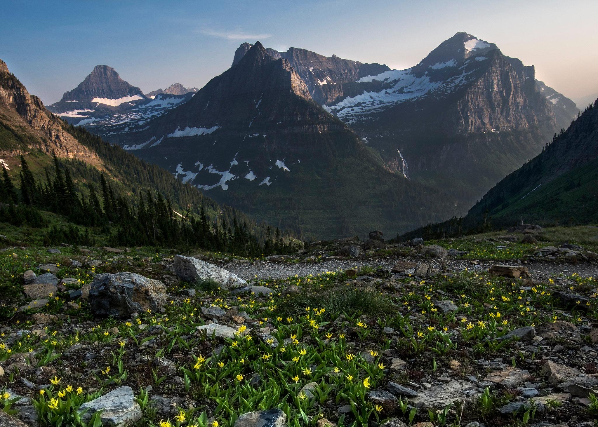
Glacier lilies dot the landscape off the Highline Trail.
Credit: NPS Photo

Glacier National Park is sculpted by water.
Credit: NPS Photo
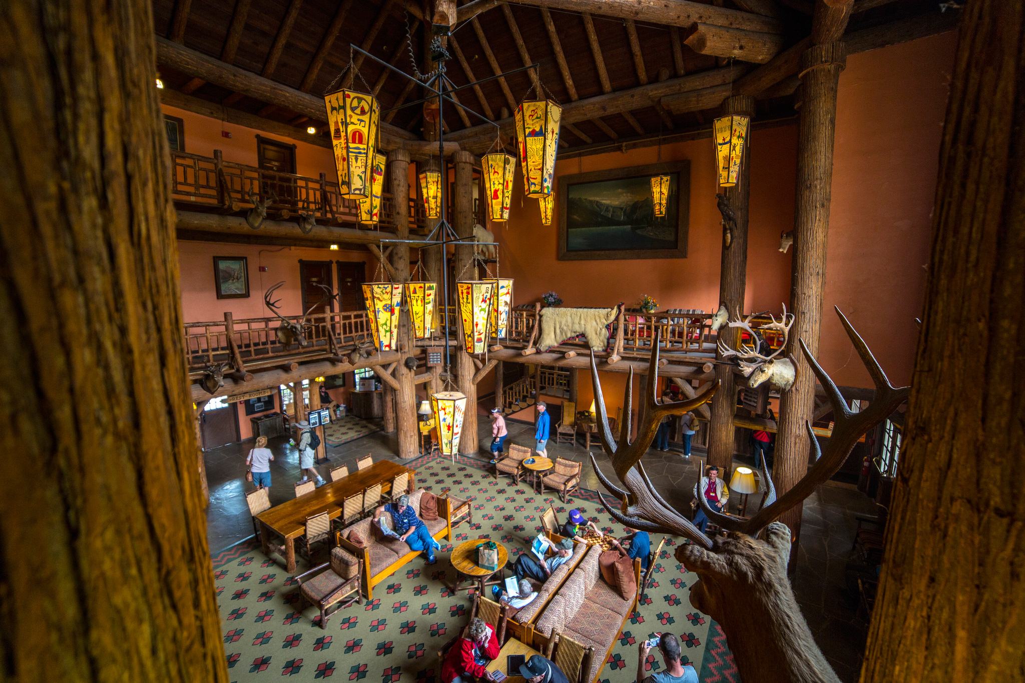
Lobby of the historic Lake McDonald Lodge
Credit: NPS Photo / Jacob W. Frank
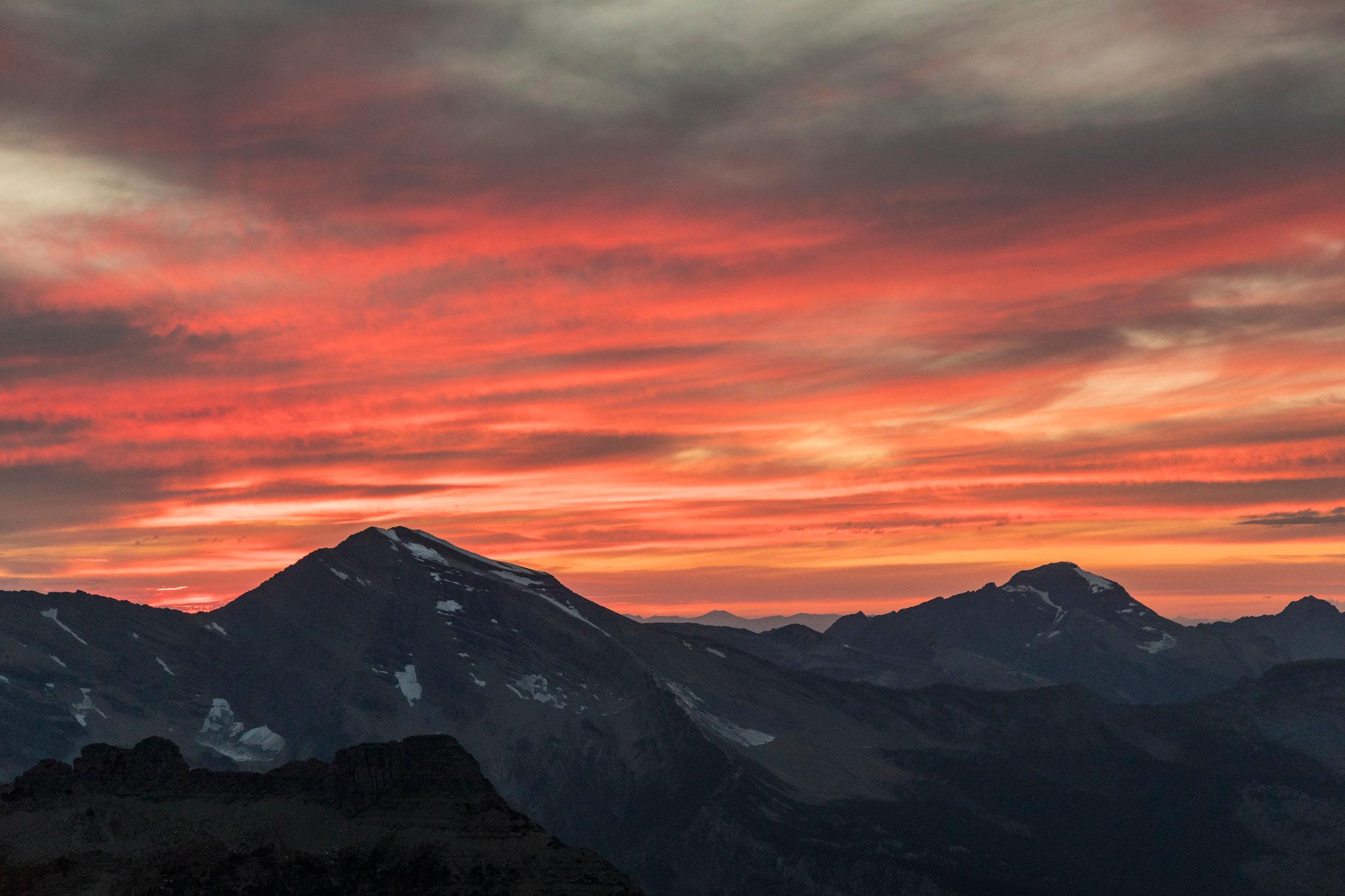
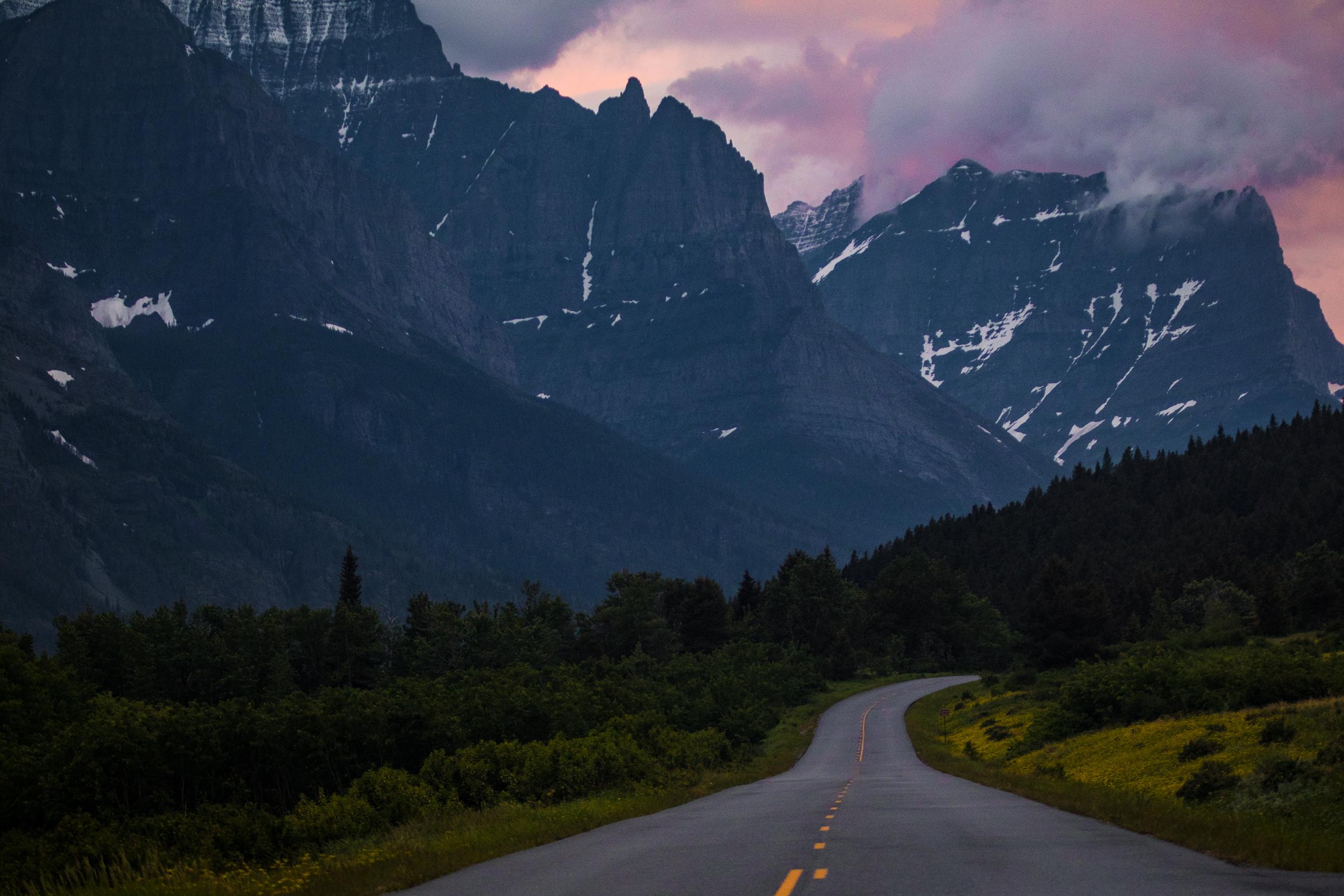
Majestic Heavens Peak is easily viewed from the Going-to-the-Sun Road.
Credit: NPS Photo
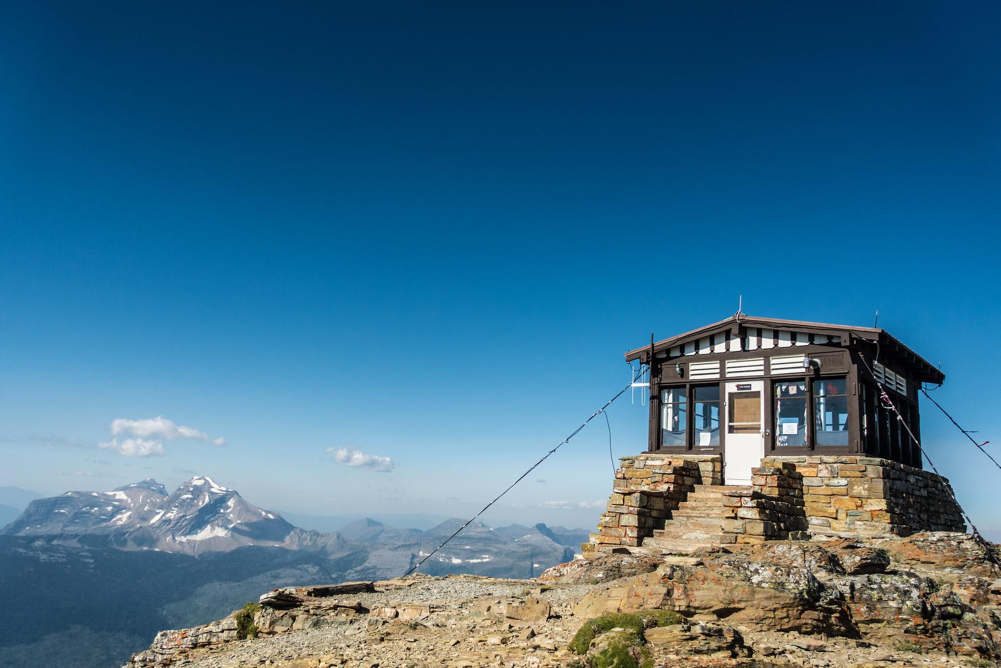
The historic Swiftcurrent Lookout was built in a Swiss chalet architectural style.
Credit: NPS Photo
Going-to-the-Sun Road in the St. Mary Valley
Credit: NPS Photo
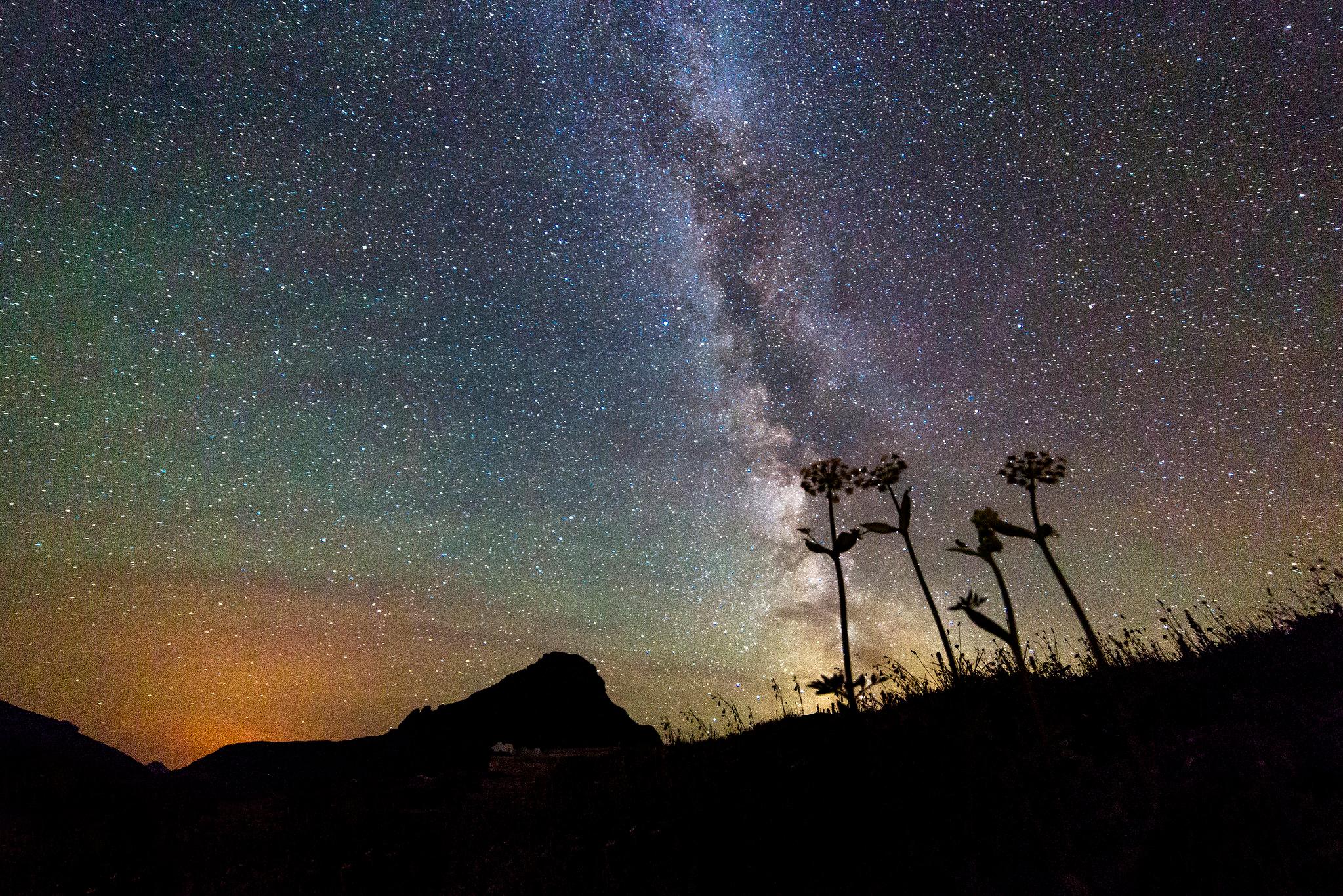
Glacier's dark sky is important to wildlife and people.
Credit: NPS Photo
Activities
Topics
Operating Hours
Entrance Fees
Entrance Passes
3-Day Weather Forecast
Tuesday, Apr 21

Patchy rain nearby
High: 76.6°F | Low: 45.7°F
Humidity: 38%
Wind: 5.4 mph
Rain Chance: 80%
UV Index: 6.3
Sunrise: 06:33 AM
Sunset: 08:36 PM
Moon: Waxing Crescent (17%)
Visibility: 6 mi
Dew Point: 47.6°F
Cloud Cover: 80%
Pressure: N/A mb
Air Quality (PM2.5): N/A
Ozone: N/A
EPA Index: N/A
Wednesday, Apr 22

Moderate rain
High: 63.7°F | Low: 38.3°F
Humidity: 74%
Wind: 7.4 mph
Rain Chance: 84%
UV Index: 5.1
Sunrise: 06:31 AM
Sunset: 08:38 PM
Moon: Waxing Crescent (27%)
Visibility: 5 mi
Dew Point: 42.5°F
Cloud Cover: 84%
Pressure: N/A mb
Air Quality (PM2.5): N/A
Ozone: N/A
EPA Index: N/A
Thursday, Apr 23
Patchy rain nearby
High: 40.7°F | Low: 20.8°F
Humidity: 72%
Wind: 8.9 mph
Rain Chance: 88%
UV Index: 3.9
Sunrise: 06:29 AM
Sunset: 08:39 PM
Moon: Waxing Crescent (38%)
Visibility: 5 mi
Dew Point: 28.5°F
Cloud Cover: 88%
Pressure: N/A mb
Air Quality (PM2.5): N/A
Ozone: N/A
EPA Index: N/A
Park Alerts
Park Events
Winter Snowshoe Walk
Explore Glacier National Park on a two-hour ranger-led snowshoe walk and take an intimate look at the park in winter. Search for signs of wildlife, discover the plants and animals of the park, and enjoy the solitude of winter during this unique experience.
Not recommended for children under age 6.
Participants should be prepared for a variety of winter conditions by wearing appropriate winter clothing, dressing in layers, and bringing water and snacks. You may use your own snowshoes or rent snowshoes for $2 at the Apgar Visitor Center beginning 1 hour prior to the program. Rental snowshoe availability is limited and only available for those participating in ranger-led snowshoe hikes. Snowshoe rentals are also available in neighboring communities.
Program is offered conditions-permitting. Walks will be canceled if West Glacier temperatures are forecasted below 10° F. Walks may proceed without snowshoes if there is not sufficient snow cover.
As of mid-February 2026, snow cover has not been sufficient for snowshoe use and recent walks have proceeded without snowshoes. Please check the Apgar Visitor Center Plaza webcam for snow cover conditions.
Location: Meet at the Apgar Visitor Center.
Date: Jan 10, 2026 12:00am to Mar 15, 2026 12:00am
Paid Event
CANCELLED - Astronomy at Medicine Spring Library
Join us for an evening of Blackfeet star stories and night sky viewing hosted by Medicine Spring Library.
Glacier's Native America Speaks and Astronomy Programs are made possible by donations to the Glacier National Park Conservancy.
This event takes place at the Medicine Spring Library in the neighboring community of Browning, MT.
Location: Medicine Spring Library 504 SE Boundary St, Browning, MT 59417
Date: Feb 25, 2026 12:00am to Feb 25, 2026 12:00am
Paid Event
Astronomy at Medicine Spring Library
Join us for an evening of Blackfeet star stories and night sky viewing hosted by Medicine Spring Library.
Glacier's Native America Speaks and Astronomy Programs are made possible by donations to the Glacier National Park Conservancy.
This event takes place at the Medicine Spring Library in the neighboring community of Browning, MT.
Location: Medicine Spring Library 504 SE Boundary St, Browning, MT 59417
Date: Mar 2, 2026 12:00am to Mar 2, 2026 12:00am
Paid Event
Creekside Stroll
Enjoy a casual stroll through diverse habitats along beautiful lower McDonald Creek. Easy 2-mile (3.2 km) walk. Program is offered conditions-permitting. Spring conditions can be variable and may change quickly.
Location: Meet at the Apgar Visitor Center.
Date: Mar 21, 2026 12:00am to Apr 12, 2026 12:00am
Paid Event
Visitor Center & Contacts
📍 Physical Address:
64 Grinnell Drive
Glacier National Park Headquarters
West Glacier, MT 59936
🏤 Mailing Address:
PO Box 128
West Glacier, MT 59936
📞 Voice Phone: 406-888-7800
📞 Fax Phone: 406-888-7808
📞 TTY Phone: 406-888-7806
✉️ Email: glac_questions@nps.gov