← Back to Search

Grant-Kohrs Ranch National Historic Site

Designation: National Historic Site

Location: Montana

Visit Official Park Website

📘 Park Overview

Wide open spaces, the hard-working cowboy, his spirited cow pony, and vast herds of cattle are among the strongest symbols of the American West. Once the headquarters of a 10 million acre cattle empire, Grant-Kohrs Ranch National Historic Site preserves these symbols and commemorates the role of cattlemen in American history.

🌤 Weather Information

Spring: Temperatures can fluctuate greatly. Sub-freezing temperatures in the morning can give way to mild days. Snow in early spring, rain in late season. Summer: Temperatures can average 70-80 F, but can reach highs of 100 F. Rain rare. Dry and hot. Fall: Temperatures can fluctuate greatly. Sub-freezing mornings can give way to mild days. Rain in early fall likely. Winter: Temperature can fall to -30 F, with highs of 10-20 F. Snow is possible. Cold weather gear is highly recommended.

🚗 Directions

Arriving from the east: Take Interstate 90, exit 187. Drive through town, approximately 2.5 miles. Turn left onto Grant Circle and enter the park. Arriving from the west: Take Interstate 90, exit 184. Turn right. Drive approximately 3/4 of a mile. Turn right on to Grant Circle and enter the park.

Images

A front view of the ranch house.

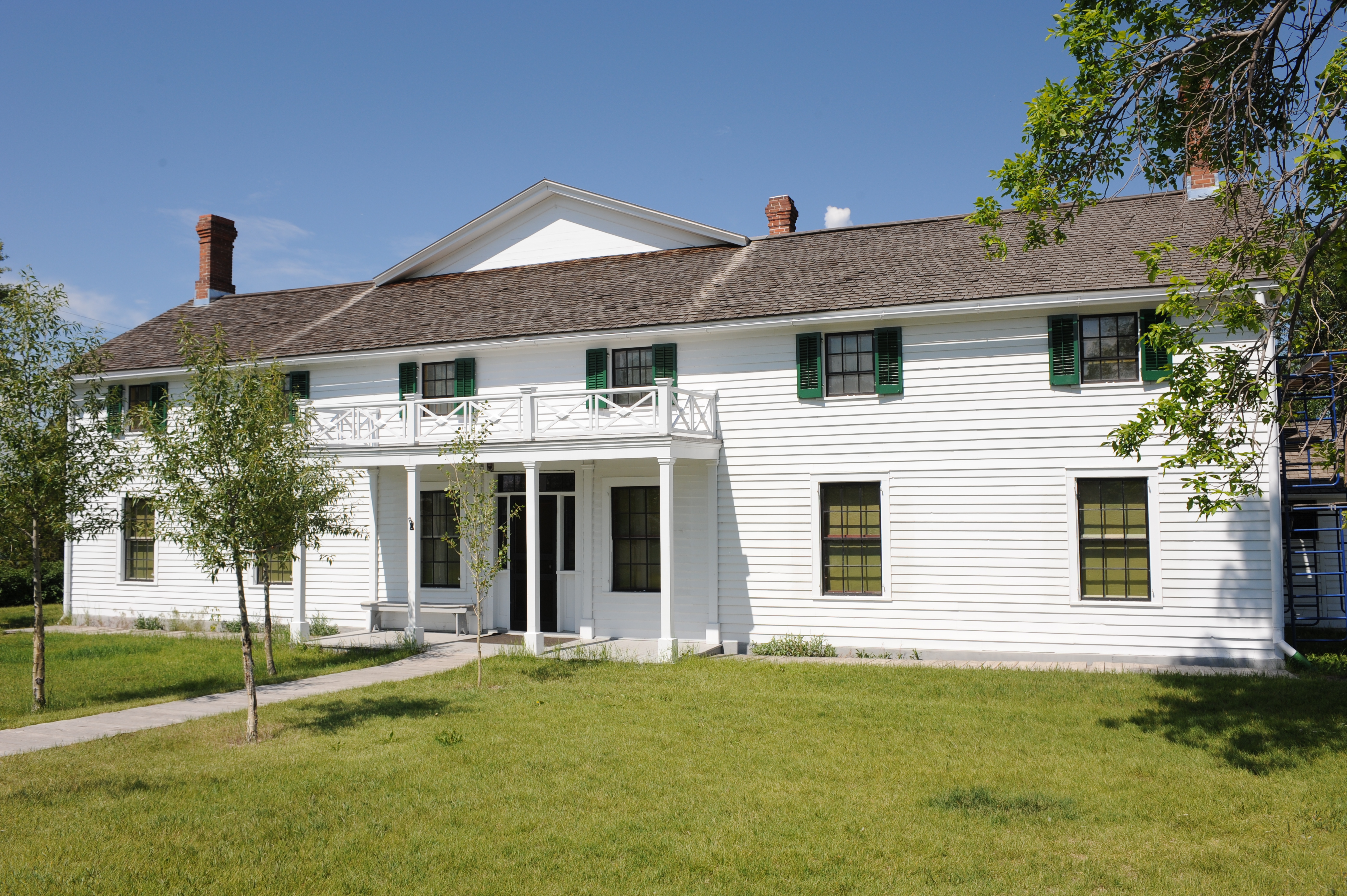
The front portion of the ranch house was originally built by Canadian fur trader Johnny Grant in 1862.

Credit: NPS Photo

A view of the rear of the ranch house.

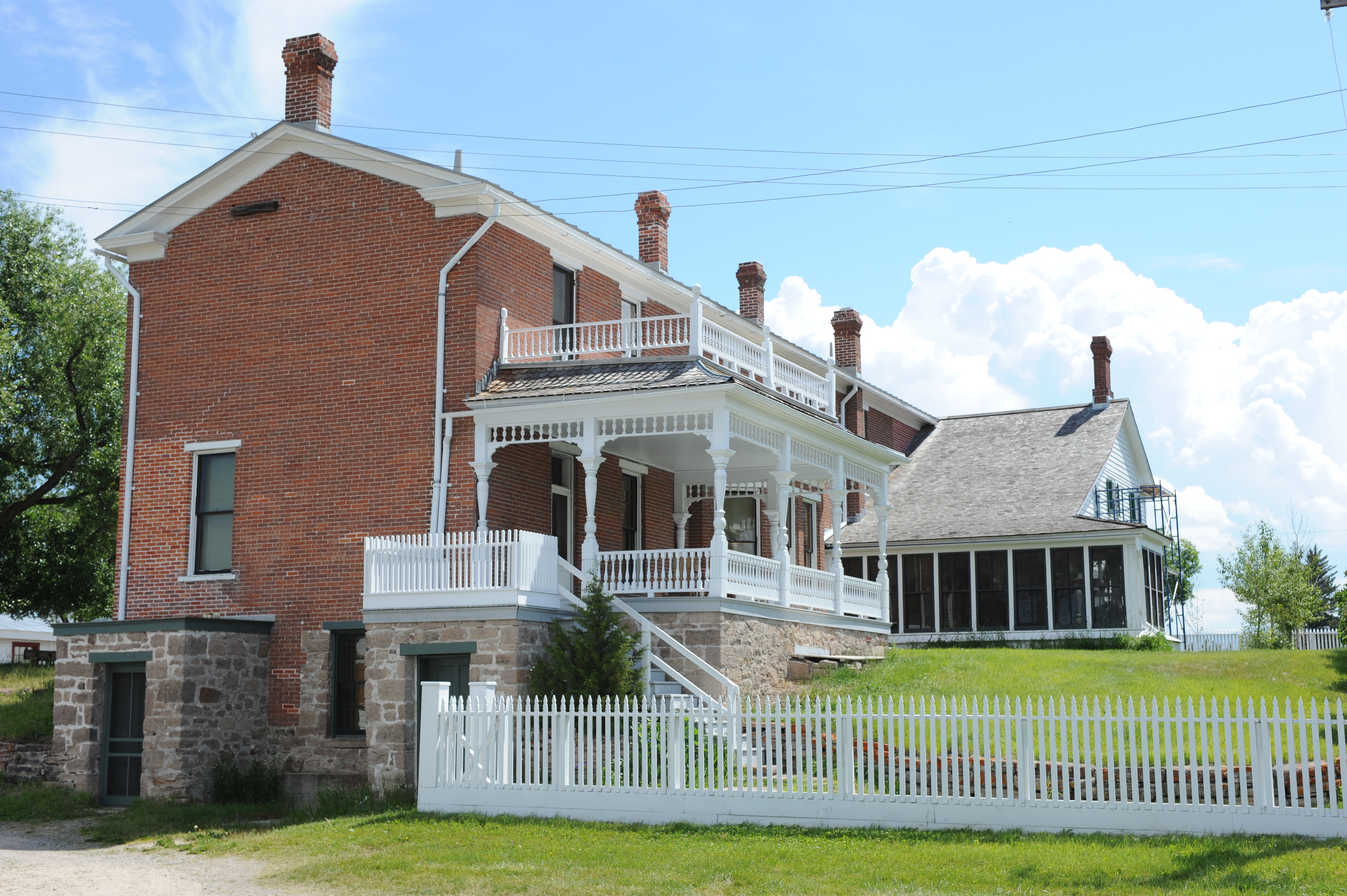
The rear portion of the ranch house was an addition put on by Conrad Kohrs in 1891.

Credit: NPS Photo

Deer Lodge Mountain rises up over the pastures of Grant-Kohrs Ranch National Historic Site.

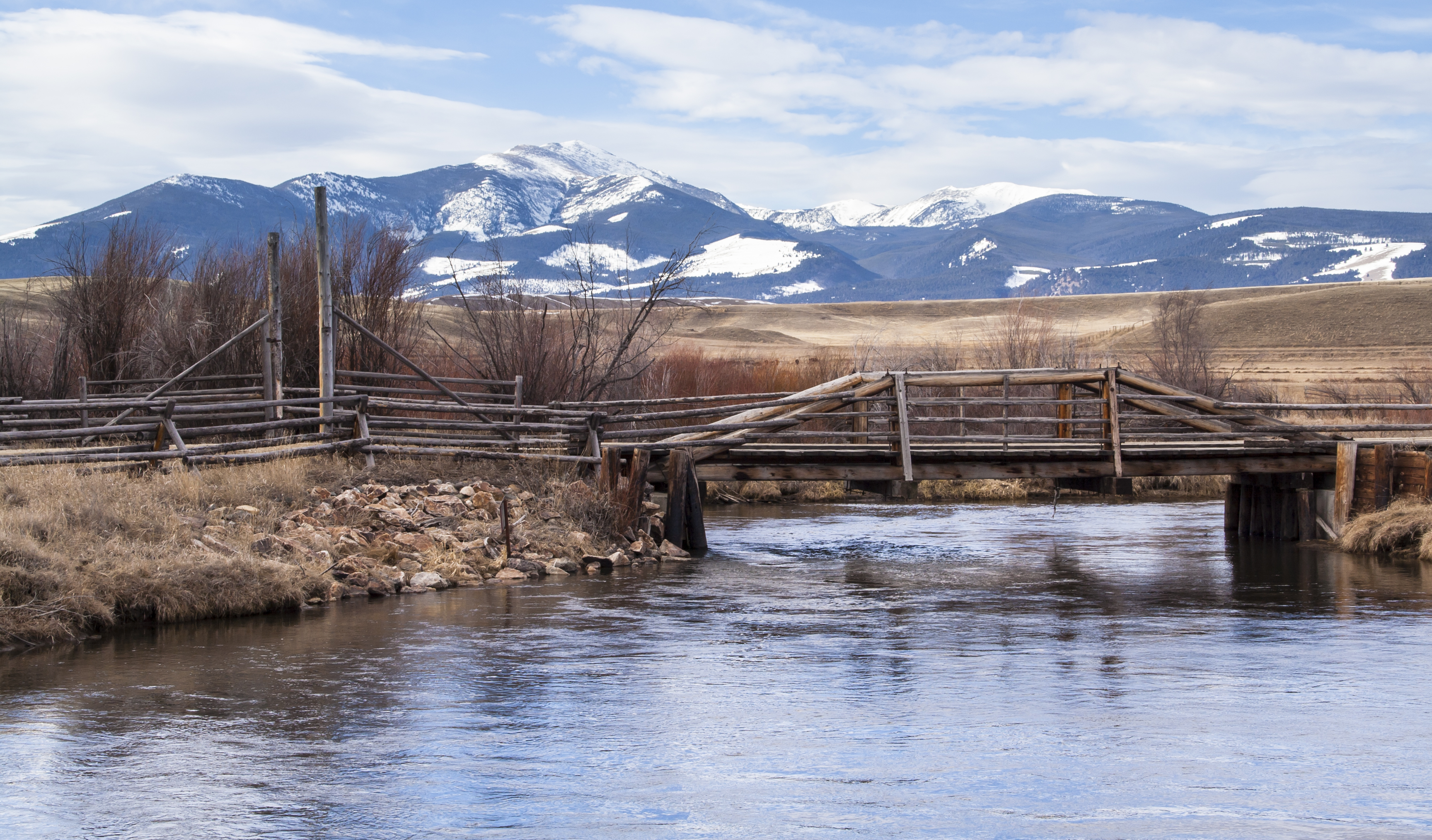
Deer Lodge Mountain, and the rest of the Flint Creek Range, directly influence the weather in the valley below.

Credit: NPS Photo / Austin Bousquet

Fenced green pasture in front, 3 ranch buildings across center, blue sky with large white clouds.

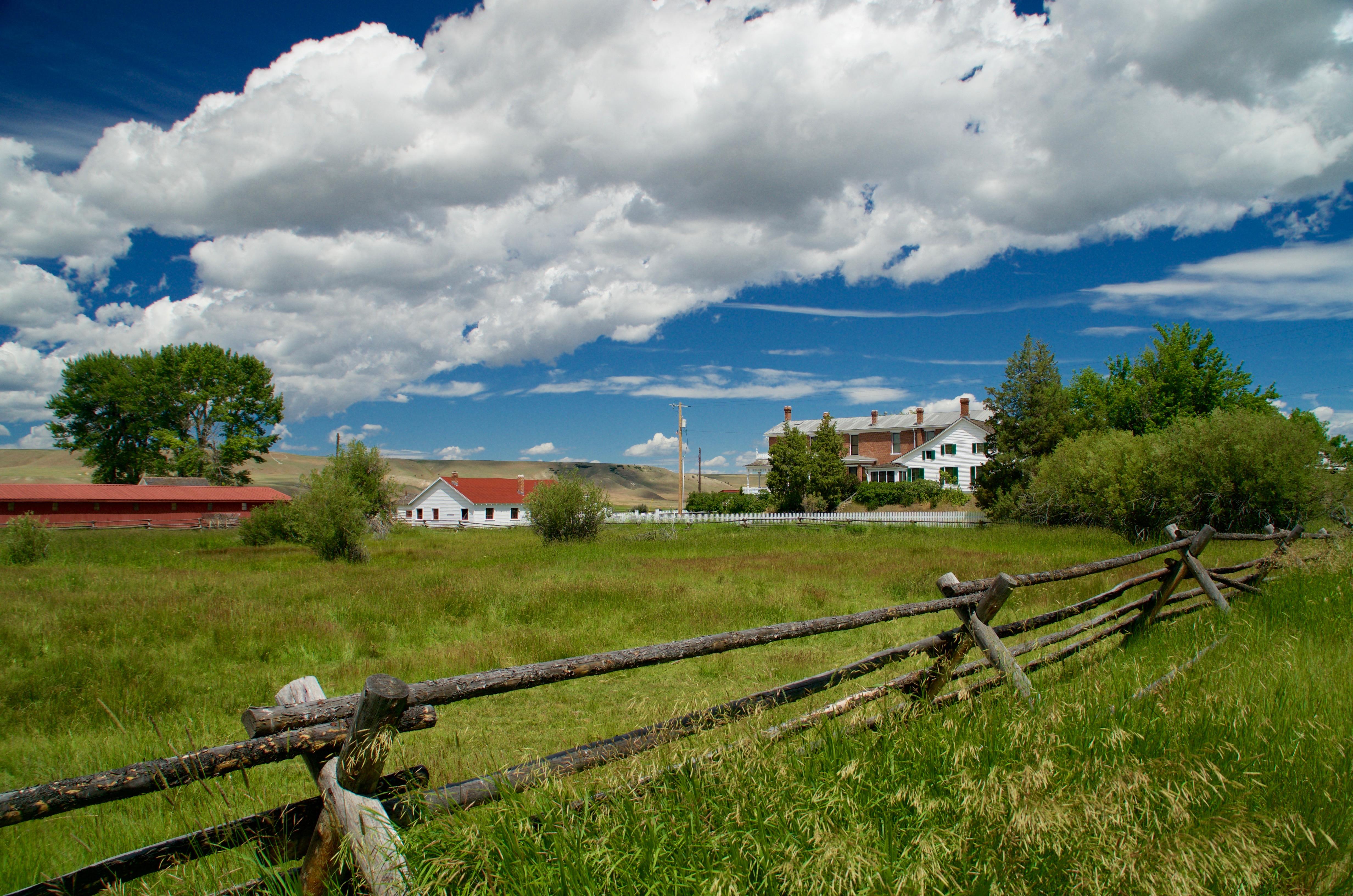
Many people are surprised by the first glimpse of the historic ranch buildings.

Credit: NPS Photo/ Richard Headley

Herd of cattle moving from back right to front left in front of historic buildings

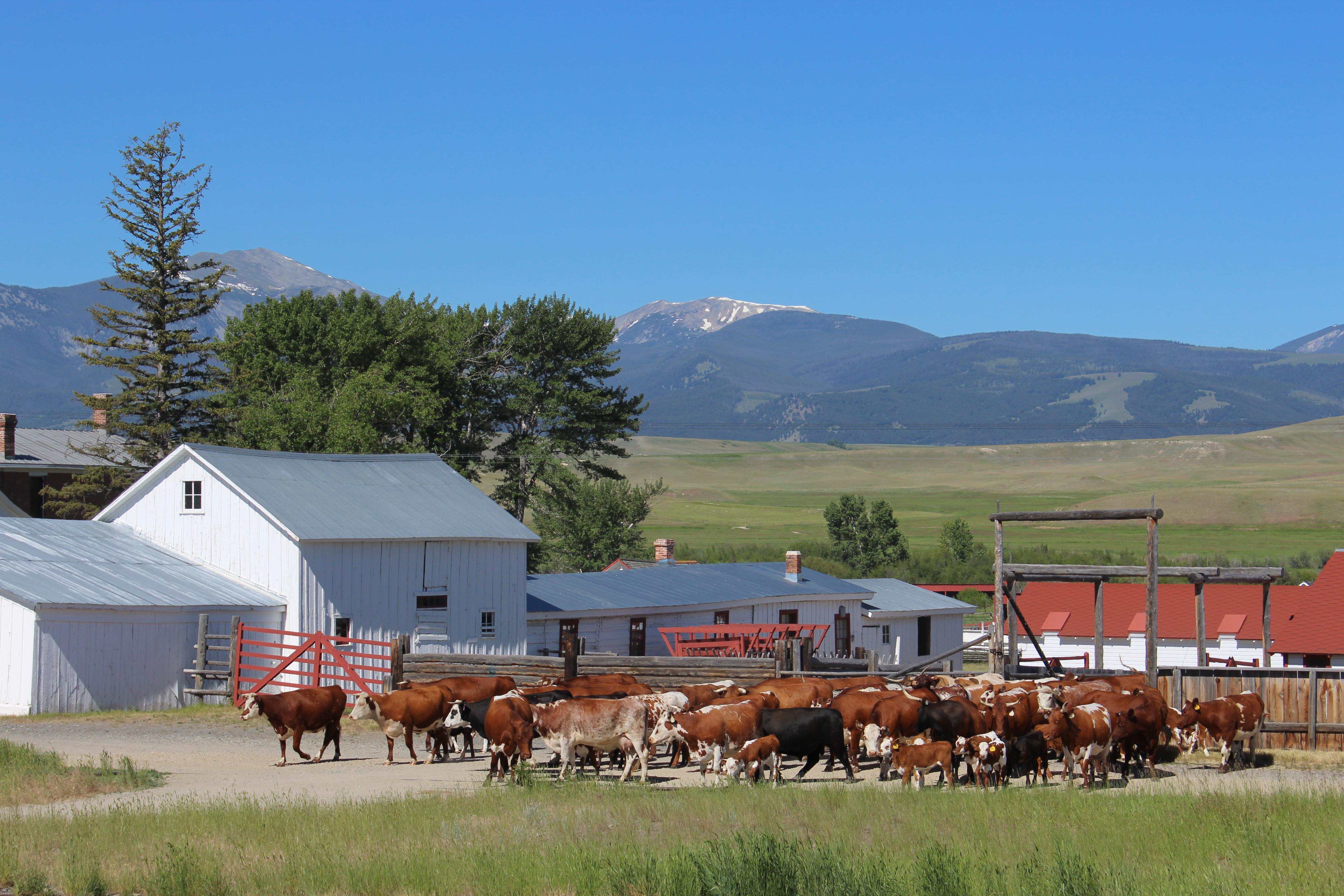
The ranch cattle herd contains Hereford, Shorthorn and Texas Longhorn, which were popular breeds during the Open Range Cattle Era

Credit: NPS Photo

Historic buildings surround fenced pasture, cattle being moved by cowboy on horseback toward viewer.

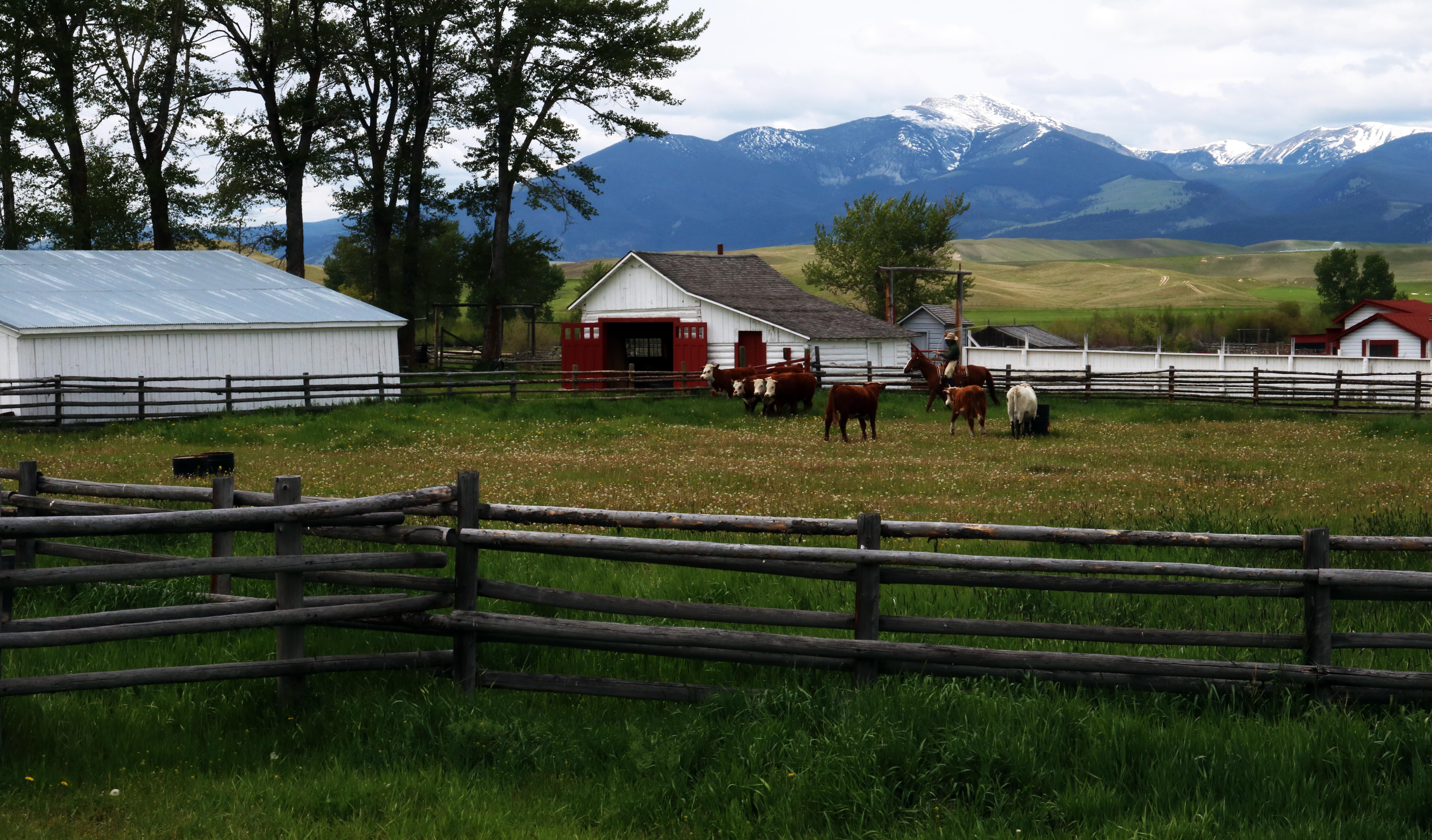
The American Cowboy developed during the Open Range Era and became a cultural icon.

Credit: NPS Photo/ Lori Jensen

Activities

Topics

Operating Hours

Sunday
9:00AM - 4:30PM
Monday
9:00AM - 4:30PM
Tuesday
9:00AM - 4:30PM
Wednesday
9:00AM - 4:30PM
Thursday
9:00AM - 4:30PM
Friday
9:00AM - 4:30PM
Saturday
9:00AM - 4:30PM

Entrance Fees

No entrance fees listed.

Entrance Passes

No entrance passes listed.

3-Day Weather Forecast

Thursday, Apr 23

Patchy rain nearby

Patchy rain nearby

High: 42.8°F | Low: 21.8°F

Humidity: 72%

Wind: 15.4 mph

Rain Chance: 87%

UV Index: 3.8

Sunrise: 06:29 AM

Sunset: 08:29 PM

Moon: Waxing Crescent (38%)

Visibility: 4 mi

Dew Point: 30.7°F

Cloud Cover: 87%

Pressure: N/A mb

Air Quality (PM2.5): N/A

Ozone: N/A

EPA Index: N/A

Friday, Apr 24

Light snow showers

Light snow showers

High: 33.1°F | Low: 15.7°F

Humidity: 74%

Wind: 16.3 mph

Rain Chance: 66%

UV Index: 6.4

Sunrise: 06:28 AM

Sunset: 08:31 PM

Moon: First Quarter (49%)

Visibility: 5 mi

Dew Point: 21.7°F

Cloud Cover: 66%

Pressure: N/A mb

Air Quality (PM2.5): N/A

Ozone: N/A

EPA Index: N/A

Saturday, Apr 25

Patchy moderate snow

Patchy moderate snow

High: 37.5°F | Low: 12.4°F

Humidity: 69%

Wind: 11.4 mph

Rain Chance: 84%

UV Index: 5.5

Sunrise: 06:26 AM

Sunset: 08:32 PM

Moon: Waxing Gibbous (60%)

Visibility: 5 mi

Dew Point: 19.5°F

Cloud Cover: 84%

Pressure: N/A mb

Air Quality (PM2.5): N/A

Ozone: N/A

EPA Index: N/A

Weather Alerts (5)

⚠️ Winter Weather Advisory (Moderate)

Winter Weather Advisory issued April 21 at 1:50PM MDT until April 24 at 12:00PM MDT by NWS Missoula MT

Effective: Apr 21, 2026 3:50pm
Expires: Apr 24, 2026 2:00pm

* WHAT...Snow expected. There is a likelihood of moderate to
isolated major winter weather impacts. Total snow accumulations of
2 and 5 inches in the valleys, 5 to 10 inches at pass level, and
over 12 inches in the high terrain. Winds gusting as high as 35
mph.

* WHERE...Georgetown Lake, Butte, Highway 12 Garrison to Elliston,
MacDonald Pass, and Homestake Pass.

* WHEN...From 6 PM Wednesday to noon MDT Friday.

* IMPACTS...For MODERATE winter weather impacts, expect disruptions
to normal activities. Hazardous traveling conditions. Use extra
caution while driving. Closures and disruptions to infrastructure
may occur. For MAJOR winter weather impacts, expect considerable
disruptions to normal activities. Dangerous or impossible
traveling conditions. Avoid travel in the impacted areas if
possible. Widespread closures and disruptions to infrastructure
may occur. The hazardous conditions could impact the Thursday
morning and evening commutes, especially over higher passes.

* ADDITIONAL DETAILS...The most impactful snow accumulations are
most likely to occur Thursday evening through Friday morning.

⚠️ Winter Weather Advisory (Moderate)

Winter Weather Advisory issued April 21 at 1:50PM MDT until April 24 at 12:00PM MDT by NWS Missoula MT

Effective: Apr 21, 2026 3:50pm
Expires: Apr 24, 2026 2:00pm

* WHAT...Snow expected. There is a likelihood of moderate to
isolated major winter weather impacts. Total snow accumulations of
2 and 4 inches in the valleys and 6 to 12 inches in the mountains.

* WHERE...Highway 200 Bonner to Greenough, I-90 East Missoula to
Bearmouth, and Highway 83 Seeley Lake to Condon.

* WHEN...From 6 PM Wednesday to noon MDT Friday.

* IMPACTS...For MODERATE winter weather impacts, expect disruptions
to normal activities. Hazardous traveling conditions. Use extra
caution while driving. Closures and disruptions to infrastructure
may occur. For MAJOR winter weather impacts, expect considerable
disruptions to normal activities. Dangerous or impossible
traveling conditions. Avoid travel in the impacted areas if
possible. Widespread closures and disruptions to infrastructure
may occur. The hazardous conditions could impact the Thursday
morning and evening commutes, especially over higher passes.

* ADDITIONAL DETAILS...The most impactful snow accumulations are
most likely to occur Thursday evening through Friday morning.

⚠️ Winter Weather Advisory (Moderate)

Winter Weather Advisory issued April 21 at 1:50PM MDT until April 24 at 12:00PM MDT by NWS Missoula MT

Effective: Apr 21, 2026 3:50pm
Expires: Apr 24, 2026 2:00pm

* WHAT...Snow expected. There is a likelihood of moderate winter
weather impacts. Total snow accumulations of 1 to 5 inches below
4000 feet, 6 to 10 inches at pass level and over 12 inches in the
high terrain.

* WHERE...Highway 93 Sula to Lost Trail Pass and Lolo Pass.

* WHEN...From 6 PM Wednesday to noon MDT Friday.

* IMPACTS...For MODERATE winter weather impacts, expect disruptions
to normal activities. Hazardous traveling conditions. Use extra
caution while driving. Closures and disruptions to infrastructure
may occur. The hazardous conditions could impact the Thursday
morning and evening commutes, especially over higher passes.

⚠️ Winter Weather Advisory (Moderate)

Winter Weather Advisory issued April 22 at 1:58PM MDT until April 24 at 12:00PM MDT by NWS Great Falls MT

Effective: Apr 22, 2026 3:58pm
Expires: Apr 23, 2026 7:00am

* WHAT...Wet snow expected. Total snow accumulations between 5 and
10 inches, with higher amounts over the mountain peaks. Winds
gusting as high as 40 mph.

* WHERE...Portions of central, north central, and southwest Montana.

* WHEN...From 6 PM this evening to noon MDT Friday.

* IMPACTS...Expect difficult driving conditions due to slush or snow
covered roadways. Falling and or blowing snow may significantly
reduce visibility at times. Tire chains may be required for some
vehicles if traveling through mountain passes. Those with outdoor
plans should be prepared for dangerous outdoor conditions.

* ADDITIONAL DETAILS...The wet snow may cause instances of power
outages and or tree damage.

⚠️ Winter Weather Advisory (Moderate)

Winter Weather Advisory issued April 22 at 1:58PM MDT until April 24 at 12:00PM MDT by NWS Great Falls MT

Effective: Apr 22, 2026 3:58pm
Expires: Apr 23, 2026 7:00am

* WHAT...wet snow expected. Total snow accumulations between 1 and 4
inches. Winds gusting as high as 35 mph.

* WHERE...The Madison and Beaverhead River Valleys, Canyon Ferry
Area, and Missouri Headwaters.

* WHEN...From 6 PM Thursday to noon MDT Friday.

* IMPACTS...Expect difficult driving conditions due to slush or snow
covered roadways.

* ADDITIONAL DETAILS...The wet snow may cause isolated instances of
power outages and or tree damage.

Park Events

Cattle Branding

Annual Branding of the calves at Grant-Kohrs ranch. 

Location: Branding will be in the corral behind, and next to the granary building.

Date: Jul 8, 2026 12:00am to Jul 8, 2026 12:00am

Paid Event

Haying with horses

Demonstration of the Beaverslide hay stacker, loaded and operated the way it would have been historically using draft horses.

Location: Follow the path the left of the long red bard. It will open up into the field that this demonstration is being held.

Date: Jul 22, 2026 12:00am to Jul 22, 2026 12:00am

Paid Event

Haying with horses

Demonstration of the Beaverslide hay stacker, loaded and operated the way it would have been historically using draft horses.

Location: Follow the path the left of the long red bard. It will open up into the field that this demonstration is being held.

Date: Jul 29, 2026 12:00am to Jul 29, 2026 12:00am

Paid Event

Haying with horses

Demonstration of the Beaverslide hay stacker, loaded and operated the way it would have been historically using draft horses.

Location: Follow the path the left of the long red bard. It will open up into the field that this demonstration is being held.

Date: Aug 5, 2026 12:00am to Aug 5, 2026 12:00am

Paid Event

Holiday Open House

   Bring the whole family out to see the elegant Kohrs family ranch house decorated for the holidays. Special Kohrs family heirlooms will be on display only for the event. Enjoy an afternoon of festivities and celebrate the start of the holiday season. There will be lots of family-friendly activities for all ages.  All activities are free of charge.

Date: Dec 6, 2026 12:00am to Dec 6, 2026 12:00am

Paid Event

Visitor Center & Contacts

📍 Physical Address:
251 Grant Circle
Deer Lodge, MT 59722

🏤 Mailing Address:
266 Warren Lane
Deer Lodge, MT 59722

📞 Voice Phone: 4068462070

📞 Fax Phone: 4068463962

✉️ Email: grko_interpretation@nps.gov

Park Location


👏 Fun Fact
Loading fun fact...