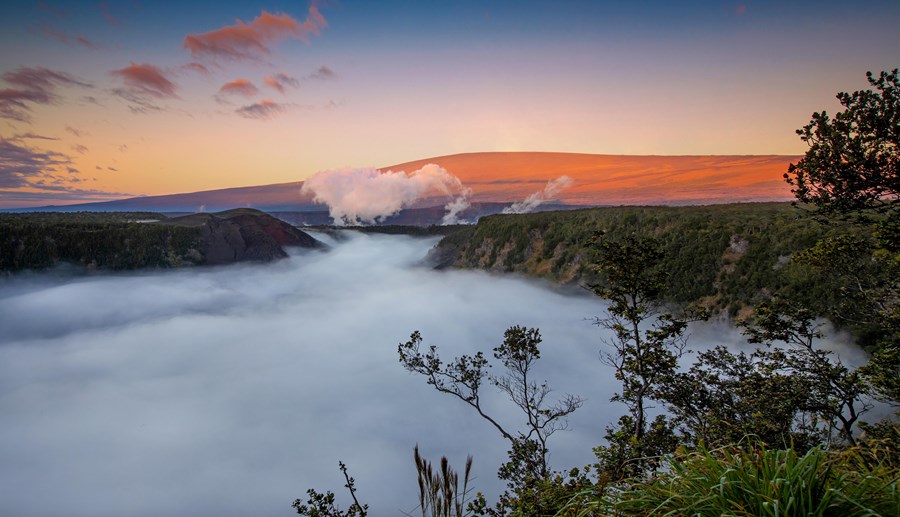
Extending from sea level to 13,680 feet, the park encompasses the summits of two of the world's most active volcanoes - Kīlauea and Mauna Loa - and is a designated International Biosphere Reserve and UNESCO World Heritage Site.
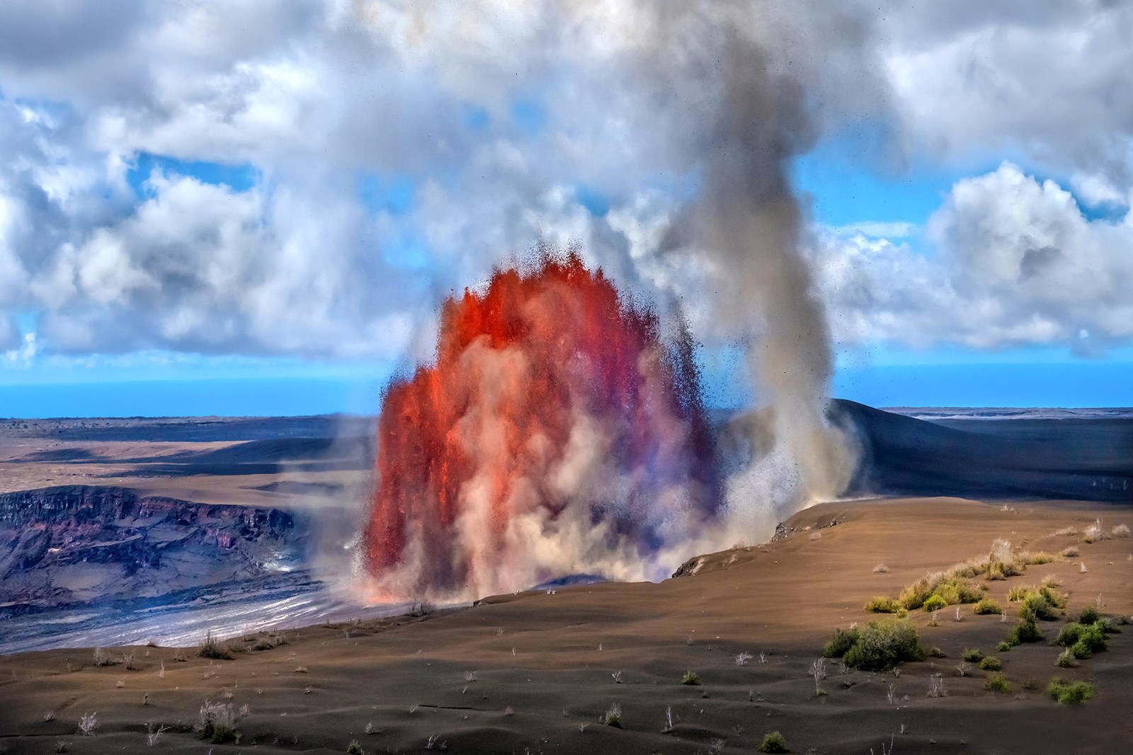 Photo: NPS Photo
Hawaiʻi Volcanoes National Park
Hawai‘i Volcanoes National Park protects some of the most unique geological, biological, and cherished cultural landscapes in the world.
- LocationHawaii National Park, HI
- Entrance $30 private vehicle
- HoursOpen 24 hours, daily
-
 Weather now64°F Fog
- Alerts 8 active alerts
Overview
Topics
- Animals
- Archeology
- Arts
- Birds
- Endangered
- Oceans
- Rare
- Rock Landscapes and Features
4 more topics
- Scenic Views
- Trails
- Unique Species
- Wilderness
Alerts (8)
Park ClosureKeanakākoʻi Side of Kīlauea Volcano Closed Due to Volcanic Unrest Due to increased earthquakes below the summit of Kīlauea and volcanic unrest, the Keanakākoʻi area is temporarily closed… Read more
Due to increased earthquakes below the summit of Kīlauea and volcanic unrest, the Keanakākoʻi area is temporarily closed for safety. This includes old Crater Rim Drive, the overlooks near Keanakākoʻi crater and Crater Rim Trail to Keanakākoʻi crater. Devastation parking lot remains open.
Park ClosureMauna Loa Road Closed Past Second Cattle Guard for Tree Removal Mauna Loa Road will be closed to all use from the second cattle guard (about two miles past Kīpukapuaulu) to Mauna Loa L… Read more
Mauna Loa Road will be closed to all use from the second cattle guard (about two miles past Kīpukapuaulu) to Mauna Loa Lookout for tree removal starting September 23 through October 29, 2026. The tree work will prepare the area for the Mauna Loa Road Rehabilitation Project. Vehicles, bicyclists and pedestrians will not be allowed during the closure.
Park ClosureHilina Pali Road Shoulder Work Scheduled 9/14/26 to 11/19/26 Hilina Pali Road beyond the Maunaiki Trailhead will be closed to motorized vehicles on September 14, 2026 from 6 a.m. to… Read more
Hilina Pali Road beyond the Maunaiki Trailhead will be closed to motorized vehicles on September 14, 2026 from 6 a.m. to 4:30 p.m. Monday through Thursday for shoulder work. Hikers, bicyclists and backcountry permit holders will be given access but should expect delays while heavy machinery works on the road. The entire road will be open to all use outside of those hours including weekends and holidays. The work is expected to be complete by November 19, 2026.
Park ClosureKīpukapuaulu Trail Closed Due to Hazardous Trees and Hanging Limbs Kīpukapuaulu Trail remains closed due to numerous hazardous trees and hanging limbs resulting from several recent storms… Read more
Kīpukapuaulu Trail remains closed due to numerous hazardous trees and hanging limbs resulting from several recent storms. Managers are developing a plan and will reopen the trail when it is safe.
CautionProtect Yourself from Volcanic Tephra Volcanic ash, rock and glassy strands (tephra) is present at Kīlauea summit and can irritate your skin, eyes and respira… Read more
Volcanic ash, rock and glassy strands (tephra) is present at Kīlauea summit and can irritate your skin, eyes and respiratory system. For your safety, do not handle it. Eye protection, long sleeves, long pants, a hat, closed-toe shoes and a dust mask are recommended.
InformationSulphur Banks Bridge Closed; Boardwalk is Open The Sulphur Banks Bridge is damaged and closed until further notice. The Haʻakulamanu area, boardwalk and Sulphur Banks… Read more
The Sulphur Banks Bridge is damaged and closed until further notice. The Haʻakulamanu area, boardwalk and Sulphur Banks Trail are open and accessible from the west side near Steam Vents.
InformationKīlauea eruption Volcanic eruptions can be hazardous. Stay out of closed areas and monitor air quality. Eruptions can last a few hours an… Read more
Volcanic eruptions can be hazardous. Stay out of closed areas and monitor air quality. Eruptions can last a few hours and are often separated by pauses lasting several weeks.
InformationUpper Kahuku Road Closed Beyond Boot Decontamination Station Upper Kahuku Road remains closed beyond the boot decontamination station due to storm damage. The Visitor Contact Statio… Read more
Upper Kahuku Road remains closed beyond the boot decontamination station due to storm damage. The Visitor Contact Station and most trails in the Kahuku Unit are now open following Hurricane Lala. Kahuku Road above the Lower Palm Trailhead is deeply rutted by the recent heavy rains. A 4WD is recommended to access areas above the Lower Palm Trailhead.
Things to Do
17 activities. Pick one to find other parks that offer it.
- Hiking
- Camping
- Wildlife Watching
- Biking
- Guided Tours
- Birdwatching
- Junior Ranger Program
- Museum Exhibits
- Arts and Culture
- Backcountry Camping
- Backcountry Hiking
- Bookstore and Park Store
Show 5 more activities
Facilities & Services
Find permits, visitor centers and other services available in the park. Check current hours and availability before you go.
Permits & Passes
Visitor Centers
-
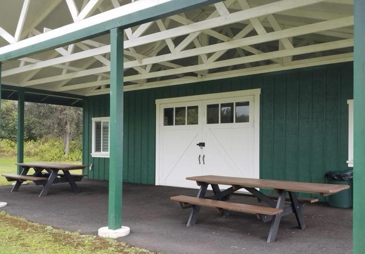
Kahuku Visitor Contact Station
Visitor Center
Located at the Kahuku Unit of the park in the district of Ka'ū, the Kahuku Visitor Contact Station provides park information, assistance, and books and gifts available…
92-7400 Mamalahoa Highway, Ocean View, HI Directions
Details
Located at the Kahuku Unit of the park in the district of Ka'ū, the Kahuku Visitor Contact Station provides park information, assistance, and books and gifts available through Hawaiʻi Pacific Parks Association. -
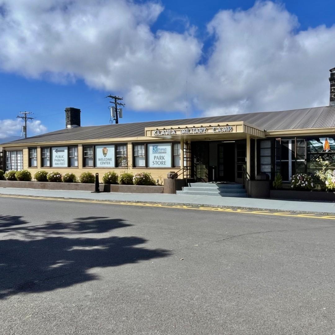
Welcome Center
Visitor Center
The Welcome Center is a great first stop when entering the park. Rangers and volunteers are on duty daily to provide visitors with the latest information on the current…
99-252 Crater Rim Drive, Volcano, HI (808) 985-6011 Directions
Details
The Welcome Center is a great first stop when entering the park. Rangers and volunteers are on duty daily to provide visitors with the latest information on the current conditions, hiking information, things to do and the daily schedule of ranger-led activities. The Hawai'i Pacific Parks Association operates a park store in the Welcome Center that sells books, posters, and other educational materials. Proceeds benefit park programs.
Other Visitor Services
-

Kulanaokuaiki
Facility
Kulanaokuaiki is located off Hilina Pali Road at 3,200 feet (975 m), there are nine walk-in campsites with picnic tables. There is an accessible vault toilet; however…
1 Crater Rim Drive, Hawaii National Park, HI (808) 985-6000 Directions
Details
Kulanaokuaiki is located off Hilina Pali Road at 3,200 feet (975 m), there are nine walk-in campsites with picnic tables. There is an accessible vault toilet; however, no water is available and campfires are not permitted. Use fueled camping stoves only. This campground is subject to closure when the area is dry and during times of high fire risk. No dogs or pets are allowed at this campground to protect endangered nene. -
Nāmakanipaio
Facility
Nāmakanipaio Campground is located 31.5 miles south of Hilo on Highway-11 at 4,000' elevation. It is a large, open grassy area with tall eucalyptus and 'ōhi'a trees…
1 Crater Rim Drive, Hawaii National Park, HI (866) 536-7972 Directions
Details
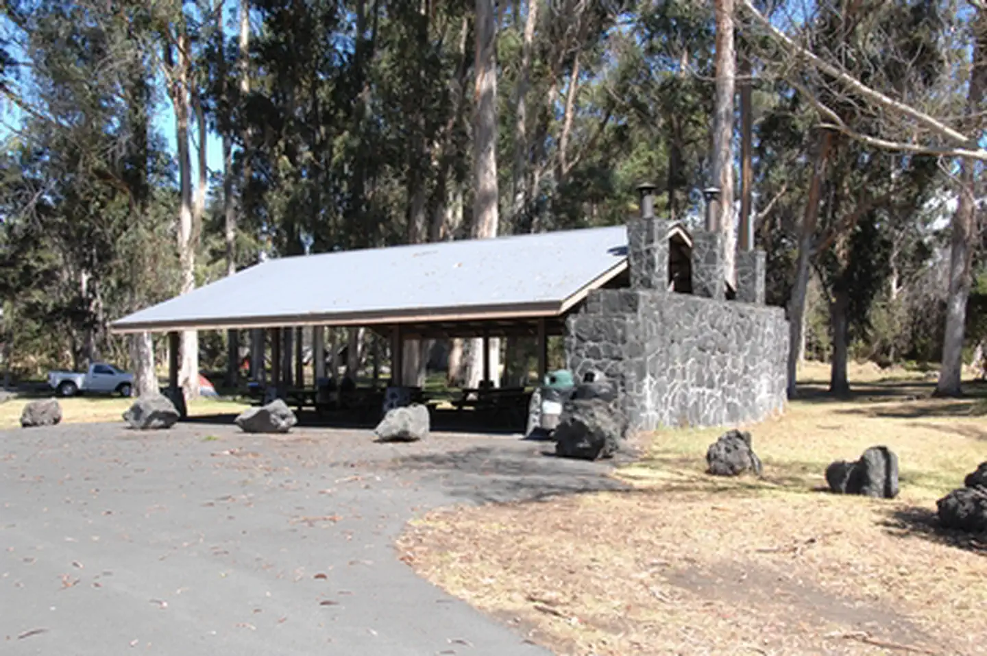
Nāmakanipaio Campground is located 31.5 miles south of Hilo on Highway-11 at 4,000' elevation. It is a large, open grassy area with tall eucalyptus and 'ōhi'a trees. This campground has restrooms, water, picnic tables and barbecue pits. Campfires are permitted in the barbeque pits only. If there are more than 2 people in your party, you can expand to 4 people per site with another tent. Maximum stay is 7 days.
Plan Your Visit
Hours
Open 24 hours, daily · Hawai‘i Volcanoes National Park
Hours by area (2)
-
Hawai‘i Volcanoes National ParkOpen 24 hours, daily
Hawai‘i Volcanoes National Park is open 7 days a week, 24 hours a day including holidays.
-
Kahuku UnitToday: 8:00AM - 4:00PM
The Kahuku Unit is open on Thursdays, Fridays, Saturdays and Sundays from 8 a.m. to 4 p.m. and is closed on Mondays, Tuesdays, and Wednesdays.
Monday Closed Tuesday Closed Wednesday Closed Thursday 8:00AM - 4:00PM Friday 8:00AM - 4:00PM Saturday 8:00AM - 4:00PM Sunday 8:00AM - 4:00PM
Entrance fees
- $30Private Vehicle
- $25Motorcycle
- $15Per Person
All 6 fees & details
-
Private Vehicle$30
Private Vehicle Pass - The private vehicle pass admits the passholder and up to 14 passengers of a single, private (non-commercial) vehicle.
-
Motorcycle$25
Valid for 7 days. Admits up to 2 private, non-commercial motorcycles with up to 4 total passengers.
-
Per Person$15
Pedestrian/Cyclist Pass - Admits one individual bicyclist, hiker, or pedestrian visiting without a private vehicle. An individual pass is not required for visitors aged 15 and under.
-
Commercial Entrance - Mini-bus$100
The commercial entrance fee for a Road Based Guided Tour is based on vehicle seating capacity. For a 16-25 passenger vehicle the user fee is $100.
-
Commercial Entrance - Motor Coach$200
The commercial entrance fee for a Road Based Guided Tour is based on vehicle seating capacity. For a 26+ passenger vehicle the user fee is $200. Large vehicles, defined as more than 26 feet in length and/or more than eight feet wide, are only allowed to operate on Crater Rim Drive to Kilauea Visitor Center, Kūkamāhuākea (Steam Vents), and Uēkahuna. Mauna Loa Road to the Kīpukapuaulu turnabout.
-
Commercial Entrance - Per Person$15
$15 per person for Commercial Non-Road Based Guided Tours. This includes hiking more than one mile on one trail, bird watching on foot for more than one hour at one location, and/or or bicycling tours.
Weather
64°F
Fog · feels like 66°
-
Today
65° 62°
Fog82% rain
-
Tomorrow
 65° 59°
Mist77% rain
65° 59°
Mist77% rain -
Saturday
 66° 58°
Patchy rain nearby51% rain
66° 58°
Patchy rain nearby51% rain
Updated 3 hr ago
What to expect by season
The weather the summit of Kīlauea (~4000' elevation) varies daily and may be rainy and chilly any time of the year. Temperature varies by elevation. At the summit of the volcano, temperatures may be 12 to 15 degrees cooler than at sea level. The coastal plain at the end of Chain of Craters Road is often hot, dry, and windy with the possibility of passing showers.
Contact the park
Upcoming Events
10 coming up-
Explore the Summit
About
Join a park ranger for engaging programs that explore the geology, Native Hawaiian history, and unique native plants and animals. Programs are offered daily at 10:30 a.m. and 12:30 p.m. Programs last approximately 30-45 minutes. Program starts at the U.S. Flagpole located at the Kilauea Military Camp.
Please note: Programs may be canceled due to hazardous weather or volcanic conditions. Stop by the Welcome Center for the latest updates, locations, and details. -
Life on the Edge
About
Discover how people have understood and recorded volcanism for generations—through Native Hawaiian moʻolelo (stories), chants, and historical accounts.. This engaging ranger program blends geology with Native Hawaiian knowledge, offering a powerful look at how eruptions have shaped both the landscape and Hawaiian history.
Programs are offered daily at 10 a.m., 11 a.m., 1 p.m., and 2 p.m. Ranger talk is approximately 20 minutes. Meet the ranger at Uēkahuna parking area.
Please note: programs may be canceled due to hazardous weather or volcanic conditions. Stop by the Welcome Center for the latest updates, locations, and details. -
Stewardship at the Summit Rainforest Restoration
About
Volunteer to help remove invasive, non-native plant species that prevent native plants from growing in Hawai‘i Volcanoes National Park. Wear sturdy hiking shoes and long pants. Bring a hat, rain gear, day pack, snacks and water. Gloves and tools are provided. Under 18? Parental or guardian accompaniment with written consent is required. Visit the park website for details.
When: August 1, 15, 22 and 29. Meet at 8:45 a.m.
Where: Meet project leaders Paul and Jane Field at Kīlauea Visitor Center parking lot on the dates above. (The meeting place is open during the visitor center renovation.) -
Artist in Residence Dawn Waters Baker Returns!
Event page for Artist in Residence Dawn Waters Baker Returns! (opens in a new tab)About
Artist in Residence Dawn Waters Baker Returns! Painter Dawn Waters Baker returns to Hawaiʻi Volcanoes National Park as the National Parks Arts Foundation October Artist in Residence. Learn how she creates her luminous landscape oil paintings through slow, layered glazes and time in the field. Her practice of wonder, walking, observing and journaling results in paintings that are felt as much as they are seen. Co-sponsored by the Friends of Hawaiʻi Volcanoes National Park.
When: Saturday, October 17 at 9:30 a.m. to 11 a.m.
Where: Kahuku Unit Visitor Contact Station. Turn into Kahuku near the 70.5-mile marker on Hwy 11 in Kaʻū.
Show 6 more events
-
Precious Garlands Performances.
About
Precious Garlands Performances. Two one-act plays in Kahuku share Hawaiian history. The Vespers at Hānaiakamālama is a moving visit with Queen Emma (wife of Kamehameha IV), a remarkable woman worked fervently to better the lives of the Hawaiian people. Then, Hoʻokiaʻi Liliʻuoklani is filled with the sounds and cries of mourning. It takes place at the funeral of Queen Liliʻuokalani – the last queen of Hawaiʻi. The queen is present and notes those who come to pay their respects at her casket. The funeral is filled with the music that brought joy to her life, even while she was under house arrest in ʻIolani Palace following the overthrow of the Hawaiian Kingdom.
When: Saturday, October 17 at 11 a.m. to 12:30 p.m.
Where: Kahuku Unit Visitor Contact Station. Turn into Kahuku near the 70.5-mile marker on Hwy 11 in Kaʻū. -
Stewardship at the Summit Rainforest Restoration
About
Volunteer to help remove invasive, non-native plant species that prevent native plants from growing in Hawai‘i Volcanoes National Park. Wear sturdy hiking shoes and long pants. Bring a hat, rain gear, day pack, snacks and water. Gloves and tools are provided. Under 18? Parental or guardian accompaniment with written consent is required. Visit the park website for details.
When: August 1, 15, 22 and 29. Meet at 8:45 a.m.
Where: Meet project leaders Paul and Jane Field at Kīlauea Visitor Center parking lot on the dates above. (The meeting place is open during the visitor center renovation.) -
Koʻi: Hawaiian Adze Demonstration and Talk Story
About
Join us in Kahuku to learn from Volcano woodworker and artist Tom Pico about different types of koʻi and the methods of making and assembling these very important Hawaiian tools.
The koʻi is a basalt woodworking tool traditionally used by Kānaka Maoli, and kākoʻi (adze-making) was one of the essential Hawaiian cultural practices. Large koʻi were used for cutting trees and shaping canoes while smaller ones were used to carve things such as bowls, weapons, kiʻi and small tools.
When: Saturday, September 26 at 9:30 a.m.
Where: Kahuku Unit Visitor Contact Station -
Stewardship at the Summit Rainforest Restoration
About
Volunteer to help remove invasive, non-native plant species that prevent native plants from growing in Hawai‘i Volcanoes National Park. Wear sturdy hiking shoes and long pants. Bring a hat, rain gear, day pack, snacks and water. Gloves and tools are provided. Under 18? Parental or guardian accompaniment with written consent is required. Visit the park website for details.
When: August 1, 15, 22 and 29. Meet at 8:45 a.m.
Where: Meet project leaders Paul and Jane Field at Kīlauea Visitor Center parking lot on the dates above. (The meeting place is open during the visitor center renovation.) -
Fee-free Day for Theodore Roosevelt's Birthday
About
President. Colonel. Rough Rider. Father. Naturalist. Rancher. The National Park Service celebrates the legacy of Theodore Roosevelt with a fee-free day. During his presidency from 1901 to 1909, Teddy Roosevelt doubled the number of national parks from five to 10, created 150 national forests and many more bird and game reserves and national monuments.
When: Tuesday, October 27
Where: All fee-charging national parks in the US. -
Annual Halloween Bingo Scavenger Hunt at Kahuku.
About
Families are invited to the Visitor Contact Station (VCS) to get their free bingo cards. Head out into extraordinary Kahuku landscape and find the items pictured on the card. When five in a row are achieved, return to the VCS to collect a goodie bag provided by the Hawaiʻi Pacific Parks Association. Costumes encouraged!
When: Saturday, October 31 from 9 a.m. to 3 p.m.
Where: Kahuku Unit Visitor Contact Station. Turn into Kahuku near the 70.5-mile marker on Hwy 11 in Kaʻū.
Photos
-
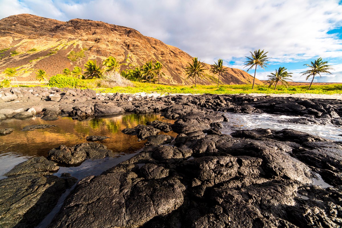
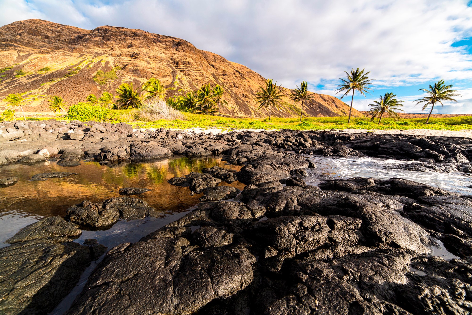
Coastline of Hawaiʻi Volcanoes National Park — Courtesy of J. Frank -
-
-
-
2 more photos
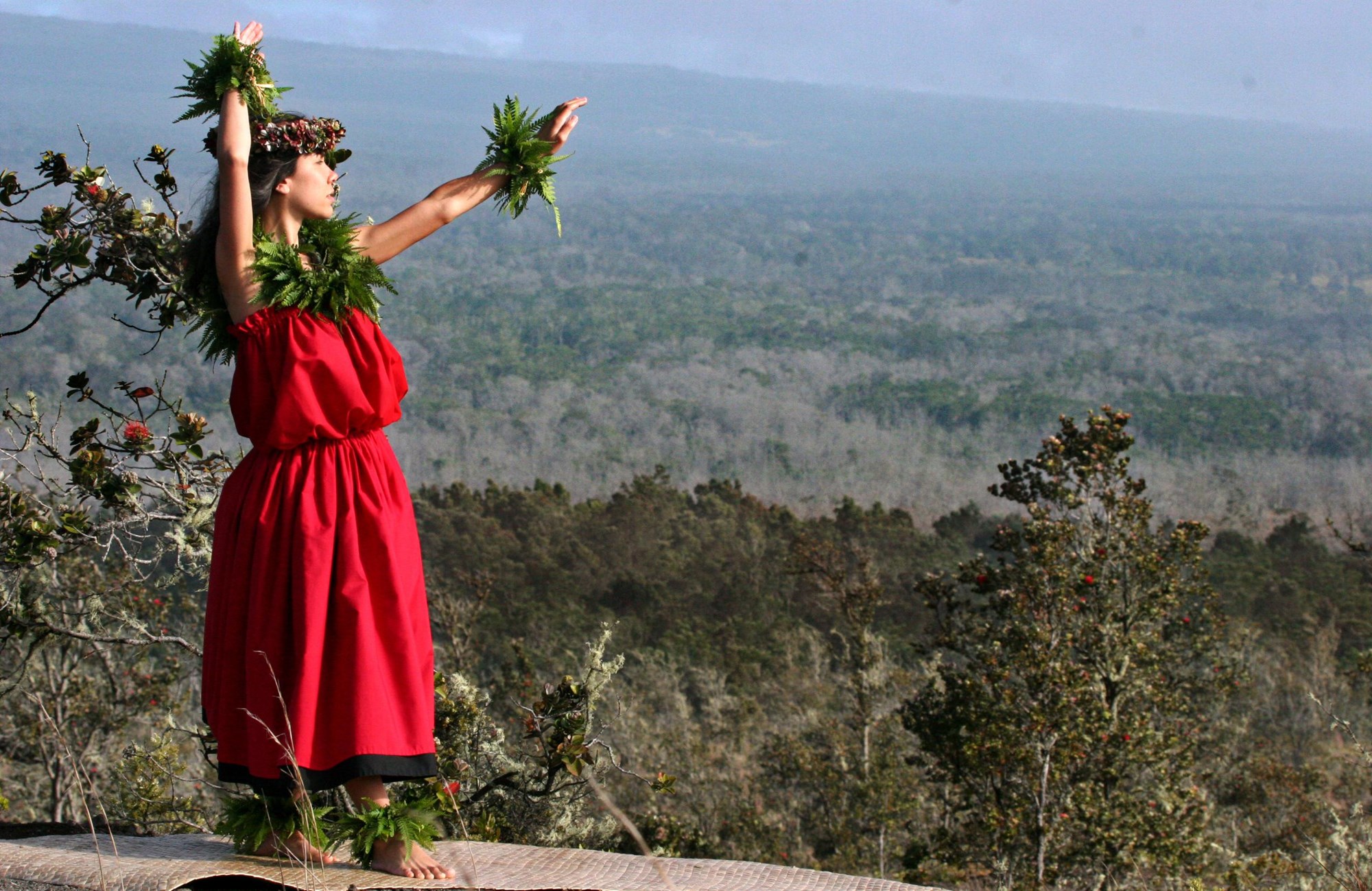
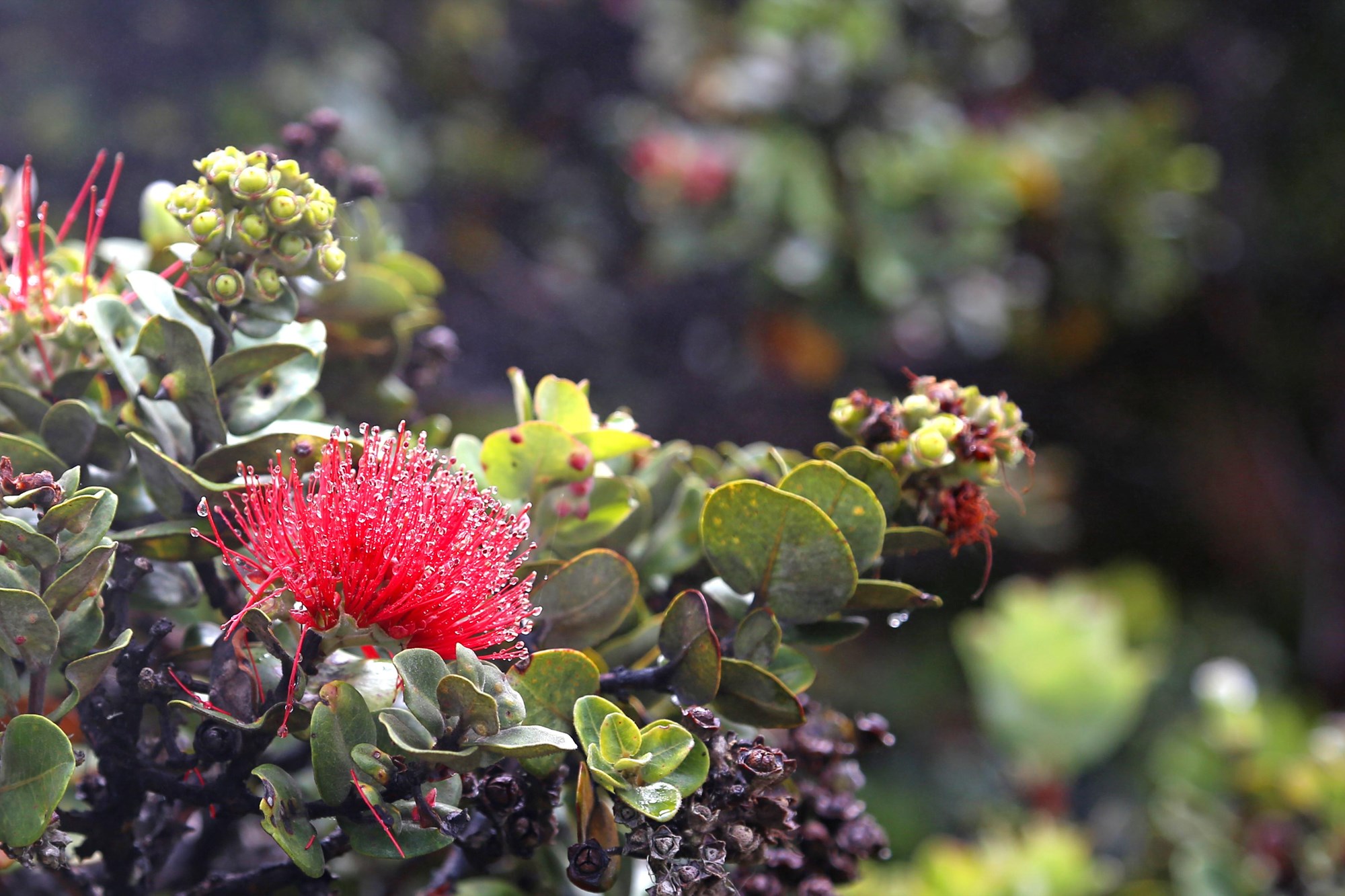
Getting There
Hawaii National Park, HI 96718
Hawai‘i Volcanoes National Park is located on the Island of Hawai‘i. From Hilo: 30 miles southwest on Highway 11 (45 minute drive); from Kailua-Kona: 96 miles southeast on Highway 11 (2 to 2.5 hour drive), or 125 miles through Waimea and Hilo via Highways 19 and 11 (2.5 to 3 hours).
Mailing address: P.O. Box 52, Hawaii National Park, HI 96718
Map loads when you scroll here