Hopewell Culture National Historical Park
Designation: National Historical Park
Location: Ohio
📘 Park Overview
Nearly 2000 years ago, Native Americans built dozens of monumental mounds and earthen enclosures in southern Ohio. These earthwork complexes were ceremonial landscapes used for feasts, funerals, rituals, and rites of passage associated with a Native American religious movement that swept over half the continent for almost 400 years. Come walk among the earthworks and experience the past.
🌤 Weather Information
The park lies in a humid continental zone with a generally temperate climate. Winters are mildly cold with average temperatures around 30 degrees (F). Summers are hot and humid with an average temperature around 75 degrees (F). Average annual total rainfall is just under 38". Snowfall in the winter is generally light with an average total snowfall of less than 24".
🚗 Directions
Take U.S. 23. Exit U.S. 23 at State Route 207 and turn right. Continue on S.R. 207 for 2 miles until it merges with S.R. 104 (Make no turns, continue straight on road as it turns into S.R. 104). Follow S.R. 104, turn left into park (approximately 1.8 miles past the S.R. 104 & S.R. 207 intersection), follow entrance road to visitor center.
Images
Dawn at the Mound City Group as the sun casts long shadows over the grass.
Credit: NPS / Tom Engberg
The Mound City Group visitor center main entrance with Mound City Group in the background view
Credit: NPS / Tom Engberg
The overlook area of Hopeton Earthworks allowing visitors to view the interpretive mowing of the geometric shapes
Credit: NPS / Tom Engberg
The main overlook area of Hopewell Mound Group showing the enormity of the site.
Credit: NPS / Tom Engberg

A cut grass trail leading to the large Seip Mound at Seip Earthworks.
Credit: NPS / Tom Engberg
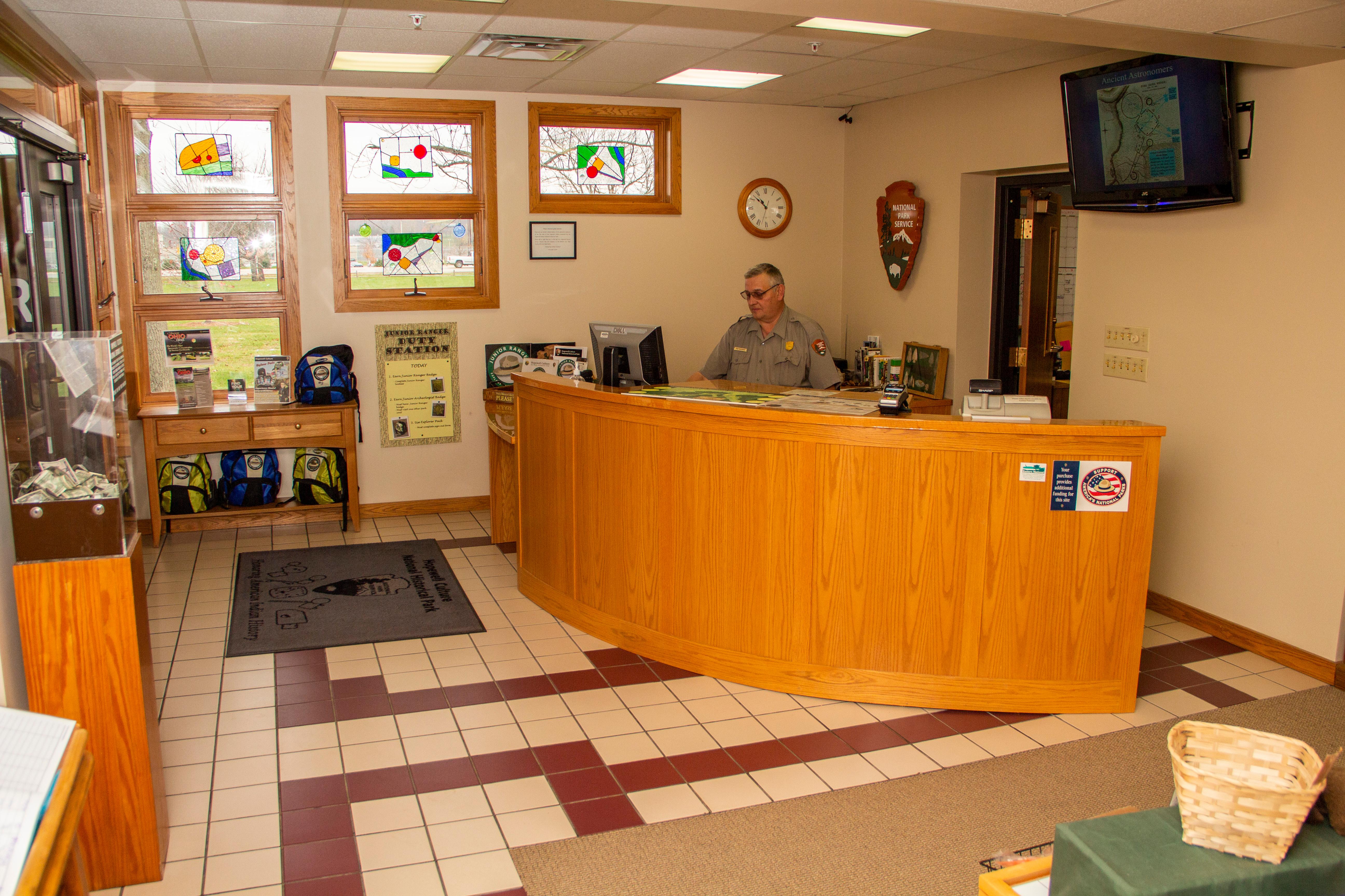
The information desk inside of the Mound City Group visitor center.
Credit: NPS / Tom Engberg
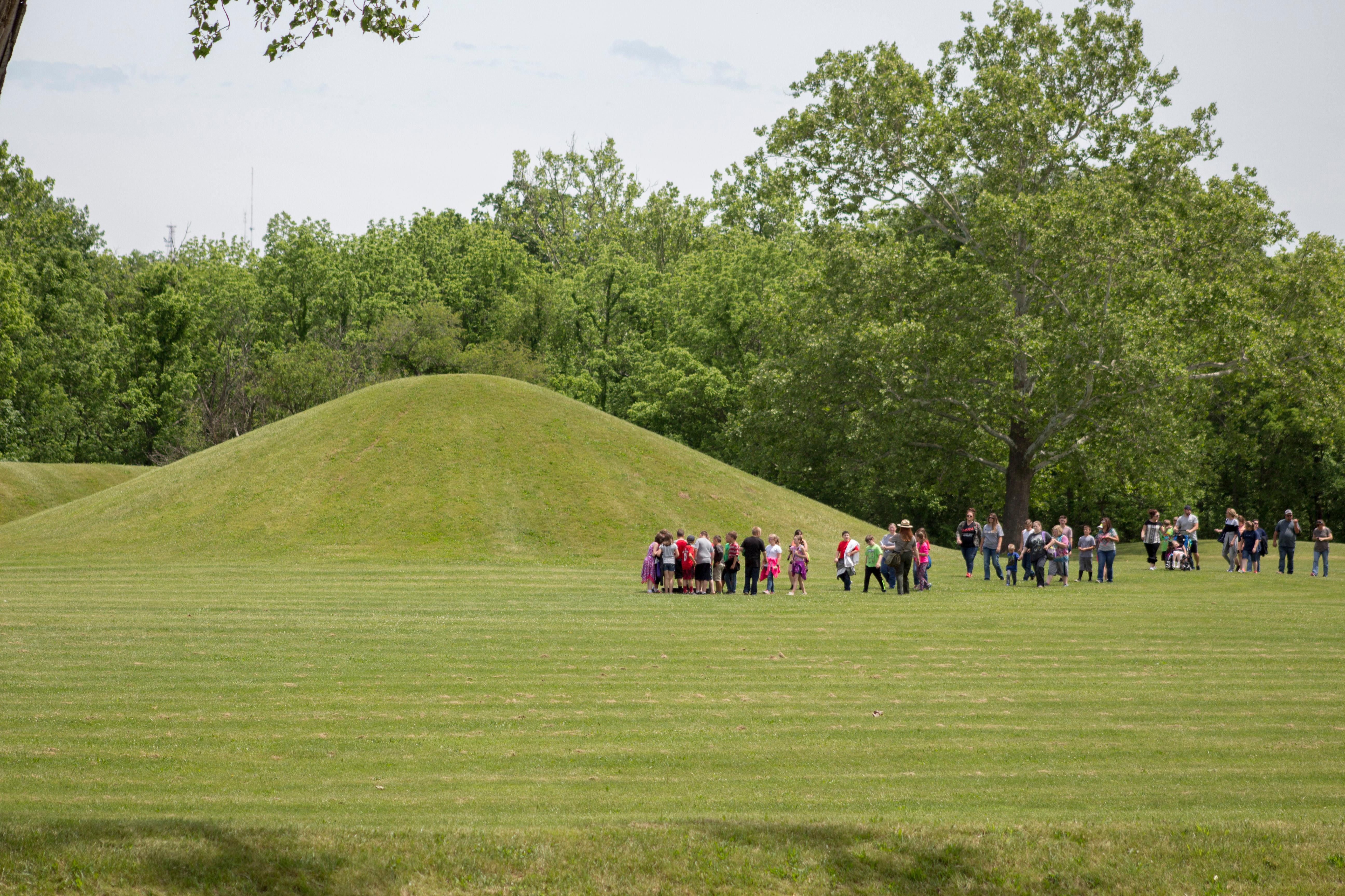
A school field trip visiting the Mound City Group as a ranger leads them on a tour.
Credit: NPS / Tom Engberg
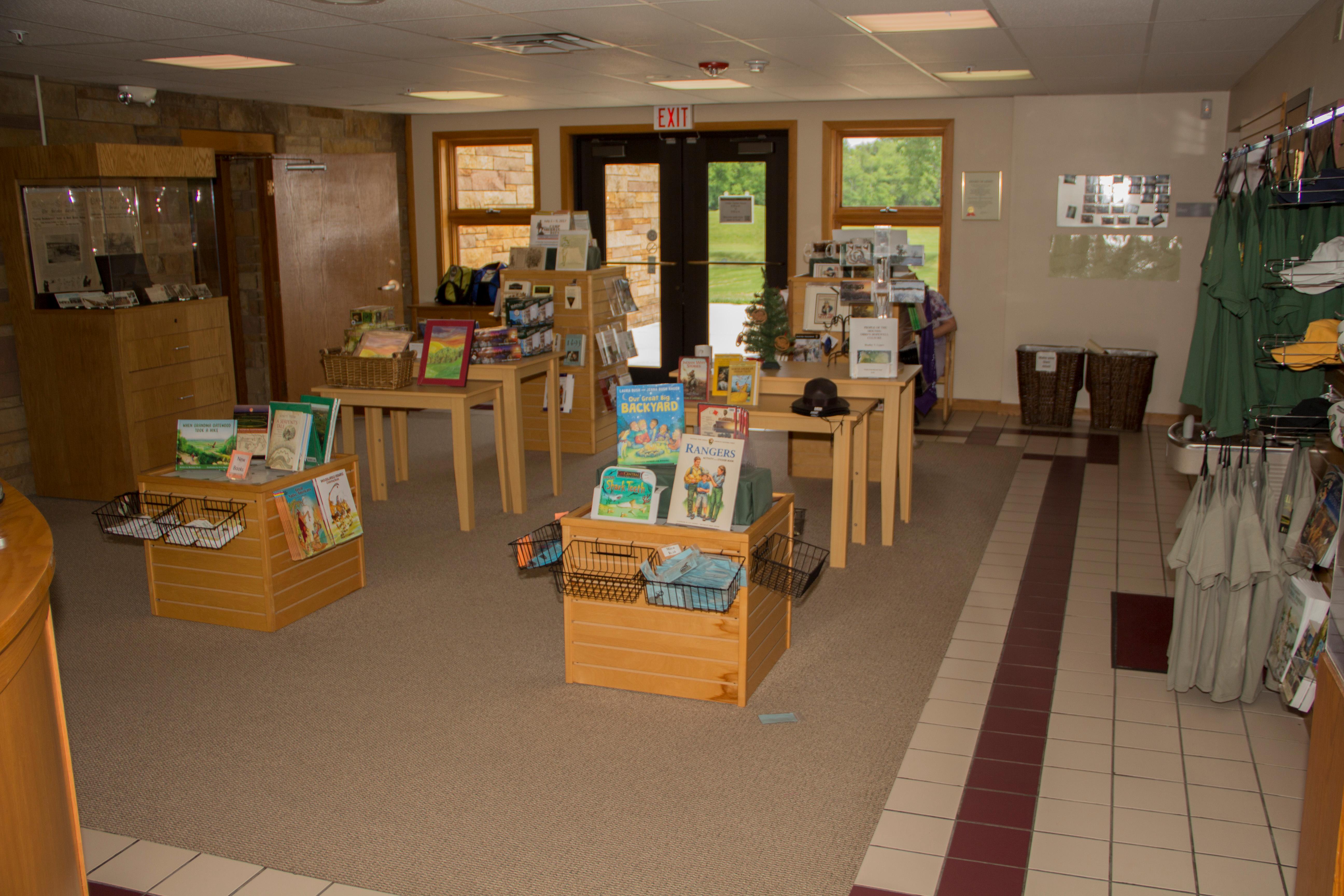
The bookstore inside of the Mound City Group visitor center.
Credit: NPS / Tom Engberg

The paved river walk trail at the Mound City Group.
Credit: NPS / Tom Engberg
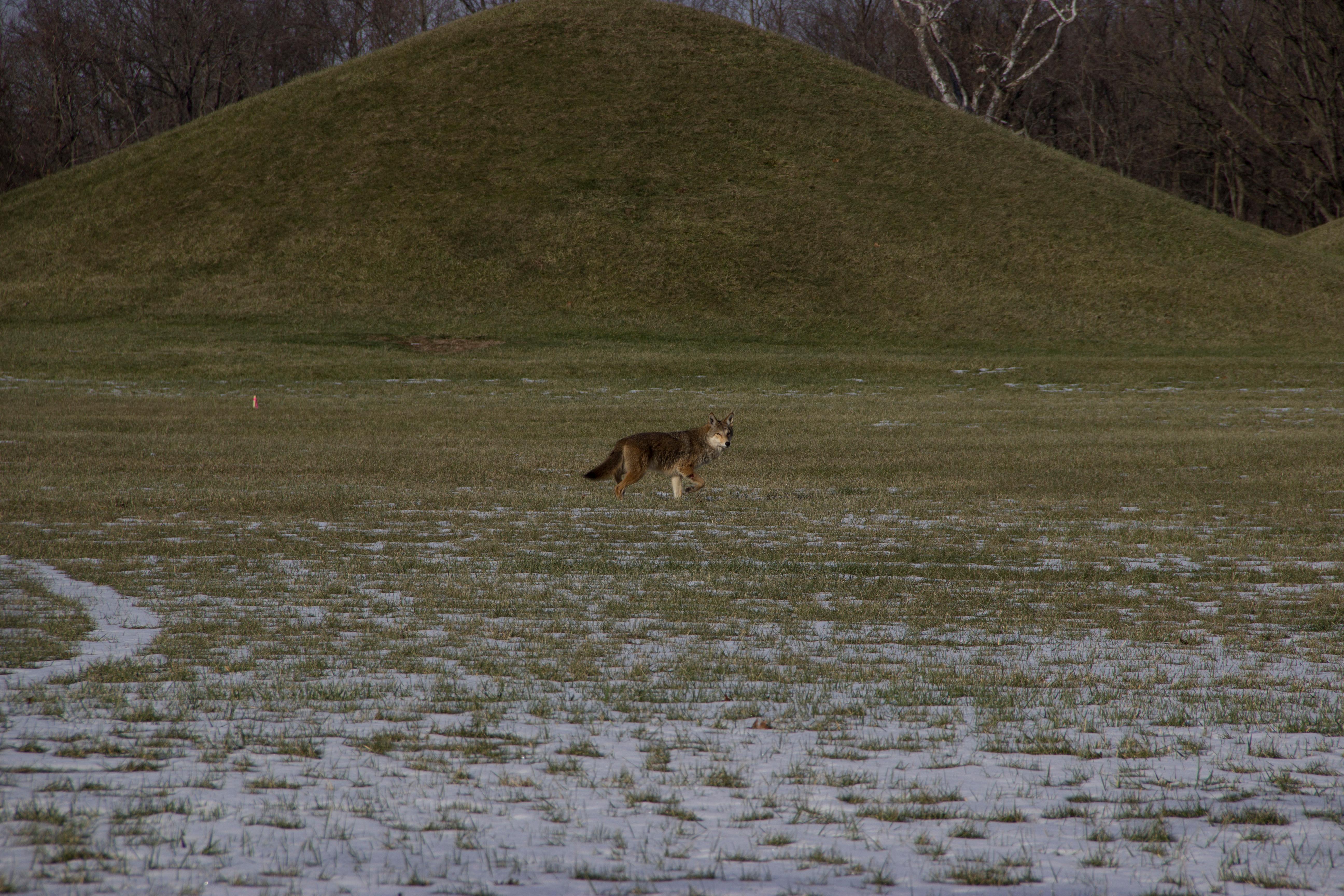
A lone coyote stares at the photographer while walking in front of a mound at Mound City Group.
Credit: NPS / Tom Engberg
Activities
Topics
Operating Hours
Entrance Fees
No entrance fees listed.
Entrance Passes
No entrance passes listed.
3-Day Weather Forecast
Sunday, Jul 26

Sunny
High: 82.6°F | Low: 66.6°F
Humidity: 76%
Wind: 8.9 mph
Rain Chance: 12%
UV Index: 7.5
Sunrise: 06:27 AM
Sunset: 08:50 PM
Moon: Waxing Gibbous (95%)
Visibility: 5 mi
Dew Point: 69.6°F
Cloud Cover: 12%
Pressure: N/A mb
Air Quality (PM2.5): N/A
Ozone: N/A
EPA Index: N/A
Monday, Jul 27
Sunny
High: 89.5°F | Low: 65°F
Humidity: 73%
Wind: 5.6 mph
Rain Chance: 7%
UV Index: 4.1
Sunrise: 06:27 AM
Sunset: 08:49 PM
Moon: Full Moon (99%)
Visibility: 5 mi
Dew Point: 71.2°F
Cloud Cover: 7%
Pressure: N/A mb
Air Quality (PM2.5): N/A
Ozone: N/A
EPA Index: N/A
Tuesday, Jul 28
Sunny
High: 83.4°F | Low: 67.8°F
Humidity: 86%
Wind: 12.3 mph
Rain Chance: 85%
UV Index: 8.7
Sunrise: 06:28 AM
Sunset: 08:48 PM
Moon: Full Moon (100%)
Visibility: 5 mi
Dew Point: 70.8°F
Cloud Cover: 85%
Pressure: N/A mb
Air Quality (PM2.5): N/A
Ozone: N/A
EPA Index: N/A
Park Alerts
Park Events
Garlic Mustard Removal Training
Step 1: Choose one training date
Saturday, March 29
9 am, 11 am, or 1 pm
Call 740-774-1126 to sign up for one 30-minute training session to become a Garlic Mustard Volunteer!
OR
Training Tuesdays in April at 9 am
Simply show up for these training sessions to become a Garlic Mustard Volunteer!
Step 2: Stop by and help!
Once trained, Volunteers can stop by any day in April and volunteer any amount of time from 9 am to 3 pm, to help with garlic mustard removal.
Bags, gloves, insect repellant, and sunscreen will be provided.
Mound City Group is located at 16062 State Route 104, Chillicothe, OH 45601. The Mound City Group Visitor Center is open 7-days a week from 9:00am - 4:00pm. Parking lots and trails are open daylight hours.
Location: Mound City Group Visitor Center, 16062 State Route 104, Chillicothe, OH 45601.
Date: Mar 14, 2026 12:00am to Mar 14, 2026 12:00am
Paid Event
World Heritage Week Tour of Seip Earthworks
World Heritage Week Tour of Seip Earthworks
Location: 7078 US Route 50, Bainbridge, OH 45612
10 a.m: Free ranger-guided tour
Two thousand years ago, the region between Seip Earthworks and Chillicothe was one of the most important cultural centers in eastern North America, for hundreds of years. Join a ranger-led tour of this site to learn more!
Free and open to the public, no registration needed
Tour will last approximately 2 hours and will cover 2-3 miles of unpaved, uneven terrain
Come prepared with snacks and water
There is little to no shade on these tours
Bring a hat, bug spray, sunscreen
Wear sensible hiking shoes. No flip flops or open toed shoes
Ages 12 and up will be best suited for these tours
There are no restrooms at the Seip Earthworks
For more information about this and other park events, call the park at 740-774-1126.
Location: Seip Earthworks is located at 7058 US Route 50, Bainbridge, OH 45612
Date: Apr 16, 2026 12:00am to Apr 16, 2026 12:00am
Paid Event
World Hertitage Week Tour of Mound City Group
World Heritage Week Tour of Mound City Group
10 a.m: Free ranger-guided tour
Location: 16062 State Route 104, Chillicothe, OH 45601
This site is the only fully recreated Hopewell earthwork complex of the five managed by the National Park Service. Mound City Group is a uniquely sacred space, even among Hopewell earthworks. Walking among these burial mounds can give the sense of what it must have been like to attend a ceremonial gathering here nearly two thousand years ago.
Reminders:Free and open to the public, no registration needed
Tour will last approximately 1 hour and will cover approximately 1 mile of grassy uneven terrain.
Come prepared with snacks and water
There is little to no shade on these tours
Bring a hat, bug spray, sunscreen
Wear sensible hiking shoes. No flip flops or open toed shoes
Ages 12 and up will be best suited for these tours
For more information about this and other park events, call the park at 740-774-1126.
Location: Mound City Group is located at 16062 State Route 104, Chillicothe, OH 45601. This is the site of the only visitor center for Hopewell Culture National Historical Park
Date: Apr 17, 2026 12:00am to Apr 17, 2026 12:00am
Paid Event
High Bank Works Discovery Event
Saturday, April 18
10:00 am - 1:00pm
Experience a rare opportunity to visit High Bank Works, open to the public only for special events. Park staff will share the site's remarkable lunar and solar alignments, which connect High Bank Works to the Octagon Earthworks, over 60 miles distant!
This event is free but does require pre-registration. To register, call Hopewell Culture National Historical Park at 740-774-1126 and sign-up. Parking is very limited. There are no restrooms. Walking will take place on gravel roads, and in farm fields with uneven terrain. Ages 12 and up are best suited for this event.
Date: Apr 18, 2026 12:00am to Apr 18, 2026 12:00am
Paid Event
Ranger Guided Tours of Mound City Group
Mound City Group is the location of the park's only visitor center and is typically the first stop for visitors. A sacred site built by Native Americans, Mound City is the only Hopewell earthwork to have been restored. Walking among these burial mounds can give the sense of what it must have been like to attend a ceremonial gathering here nearly 2,000 years ago.
What you can expect on a tour at Mound City Group:
Tours begin at the Mound City Group Visitor Center. Rangers will guide visitors into the Mound City Group earthwork. The tour will last approximately one hour and will be mostly in the sun. Visitors should wear comfortable walking/hiking shoes, bring sun protection and bug spray. Mound City Group is a flat, grassy lawn and considered an "easy" hike/walk. Learn about what to expect when hiking at Mound City Group.
Location: Mound City Group, 16062 State Route 104, Chillicothe, OH 45601
Date: May 30, 2026 12:00am to Jul 31, 2026 12:00am
Paid Event
Ranger - led Tour at Hopewell Mound Group
Date: June 8, 2026
Time: 10:00am
Location: 4731 Sulphur Lick Road, Chillicothe, OH 45601
Hopewell Mound Group is the largest of our earthwork sites. 2.4 miles of trail will wind you through 130 acres of astounding architecture. Join our rangers and step back in time!
- Tour is free, open to the public and does not require registration
- Tour will last approximately 2 hours and will cover 2-3 miles of unpaved, uneven terrain
- Come prepared with snacks and water
- There is little to no shade on this tour
- Bring a hat, bug spray, sunscreen
- Wear sensible hiking shoes. No flip flops or open toed shoes.
- Ages 12 and up are best suited for this tour
For more information call the park at 740-774-1126
Location: Hopewell Mound Group, 4731 Sulphur Lick Road, Chillicothe, OH 45601
Date: Jun 8, 2026 12:00am to Jun 8, 2026 12:00am
Paid Event
Hopewell Mound Group Highlights
Explore the enormous Hopewell Mound Group, at your own pace!
With over 2 miles of trail, Hopewell Mound Group is the largest site of Hopewell Culture National Historical Park. Hopewell Mound Group Highlights is an opportunity for visitors to pick their path and engage with park rangers at several key locations within the earthwork. Park Rangers will have several stations to help visitors take a deeper dive into the lessons of this amazing site. Enjoy time outdoors with your friends and family, meeting up at a location that was the center of community and gathering 2,000 years ago.
This event begins at the picnic shelter located near the parking lot at Hopewell Mound Group, 4731 Sulphur Lick Rd, Chillicothe, OH 45601. Visitors will park and walk to the stations located throughout the earthwork. This event is free and registration is not required.
Call the park at 740-774-1126 for more information.
Location: Hopewell Mound Group is located at 4731 Sulphur Lick Road, Chillicothe, OH 45601.
Date: Jun 22, 2026 12:00am to Jun 22, 2026 12:00am
Paid Event
Ranger-led Tour at Seip Earthworks
Date: July 6, 2026
Time: 10:00am
Location: 7058 US HWY 50, Bainbridge, OH 45612
Two thousand years ago, the region between Seip Earthworks and Chillicothe was one of the most important cultural centers in eastern North America, for hundreds of years. On high terraces along the Paint Creek and Scioto River valleys, almost two dozen giant geometric earthwork complexes were constructed by Native Americans. One of the most magnificent engineering feats of them all was Seip Earthworks. Join a ranger-led tour of this site to learn more!
- Tour is free, open to the public and does not require registration
- Tour will last approximately 2 hours and will cover 2 miles of unpaved, uneven terrain
- Come prepared with snacks and water
- There is little to no shade on this tour
- Bring a hat, bug spray, sunscreen
- Wear sensible hiking shoes. No flip flops or open toed shoes.
- Ages 12 and up are best suited for this tour
For more information call the park at 740-774-1126
Location: Seip Earthworks, 7058 US HWY 50, Bainbridge, OH 45612
Date: Jul 6, 2026 12:00am to Jul 6, 2026 12:00am
Paid Event
Seip Earthworks Highlights
Explore Seip Earthworks, at your own pace!
Set amongst the gorgeous Paint Valley region, Seip Earthworks is one of the most magnificent engineering feats. Seip Earthworks Highlights is an opportunity for visitors to pick their path and engage with park rangers at several key locations within the earthwork. Park Rangers will have several stations to help visitors take a deeper dive into the lessons of this amazing site. Enjoy time outdoors with your friends and family, meeting up at a location that was the center of community and gathering 2,000 years ago.
This event takes place at Seip Earthworks, located at 7058 US Highway 50, Bainbridge, OH 45612. Visitors will park and walk to the stations located throughout the earthwork. This event is free and registration is not required.
Call the park at 740-774-1126 for more information.
Location: Seip Earthworks is located at 7058 US Highway 50, Bainbridge, OH 45612
Date: Jul 20, 2026 12:00am to Jul 20, 2026 12:00am
Paid Event
Ranger Guided Tours of Mound City Group
Mound City Group is the location of the park's only visitor center and is typically the first stop for visitors. A sacred site built by Native Americans, Mound City is the only Hopewell earthwork to have been restored. Walking among these burial mounds can give the sense of what it must have been like to attend a ceremonial gathering here nearly 2,000 years ago.
What you can expect on a tour at Mound City Group:
Tours begin at the Mound City Group Visitor Center. Rangers will guide visitors into the Mound City Group earthwork. The tour will last approximately one hour and will be mostly in the sun. Visitors should wear comfortable walking/hiking shoes, bring sun protection and bug spray. Mound City Group is a flat, grassy lawn and considered an "easy" hike/walk. Learn about what to expect when hiking at Mound City Group.
Location: Mound City Group, 16062 State Route 104, Chillicothe, OH 45601
Date: Aug 1, 2026 12:00am to Sep 6, 2026 12:00am
Paid Event
Visitor Center & Contacts
📍 Physical Address:
16062 State Route 104
Chillicothe, OH 45601
🏤 Mailing Address:
16062 State Route 104
Chillicothe, OH 45601
📞 Voice Phone: 7407741125
📞 Fax Phone: 7407741140
✉️ Email: hocu_info@nps.gov