Johnstown Flood National Memorial
Designation: National Memorial
Location: Pennsylvania
📘 Park Overview
The South Fork Dam failed on Friday, May 31, 1889, and unleashed 20,000,000 tons of water that devastated Johnstown, PA. The flood killed 2,209 people but it brought the nation and the world together to aid the "Johnstown sufferers." The story of the Johnstown Flood reminds us all, "...that we must leave nothing undone for the preservation and protection of our brother men."
🌤 Weather Information
Winters can be cold and severe. Spring can be seasonable and wet. Summer can be hot with potentials for thunderstorms. Fall can be seasonal, with cold temperatures into October and November.
🚗 Directions
Take US Route 219 to the St Michael/Sidman exit. At the end of the exit ramp head East on PA 869 (there is a park sign at the end of the exit ramp). Travel approximately 1.5 miles on PA 869 watching for a left turn onto Lake Road at the sign for Johnstown Flood National Memorial. Follow Lake Road 1.5 miles until the visitor center appears on your right. Please park safely in the designated parking lot and not block any emergency access roads.
Images

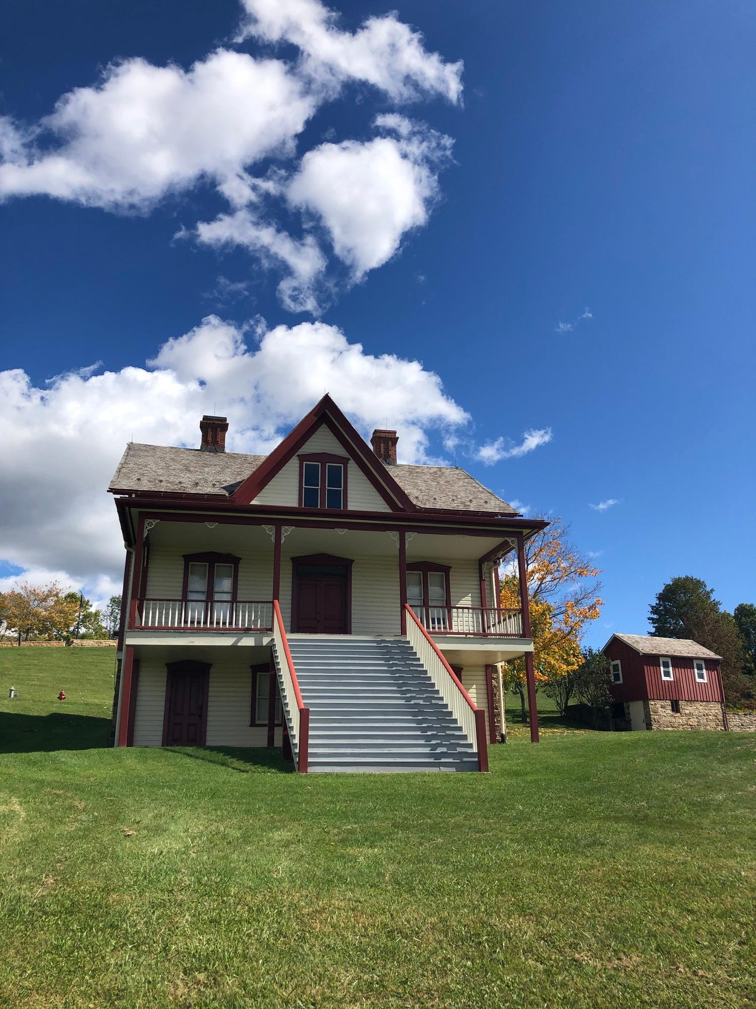
The Lake View Farm
Credit: NPS
Lake View House
Credit: NPS
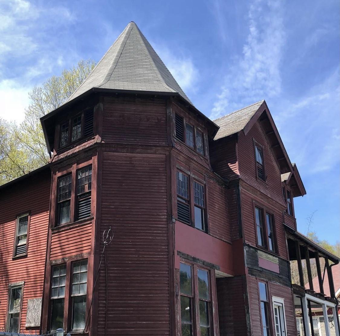
The Double Cottage once served as a structure for the South Fork Fishing and Hunting Club
Credit: NPS
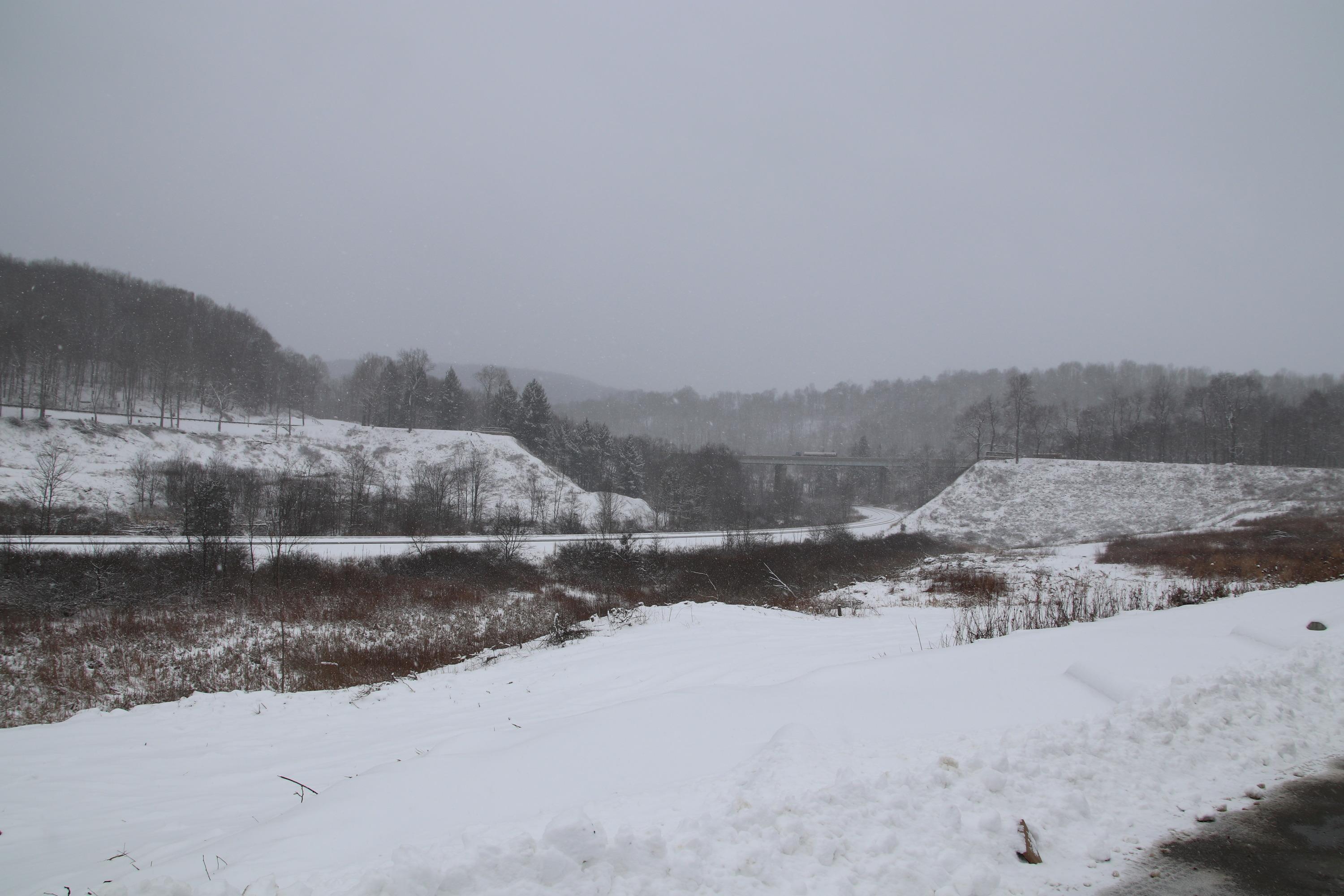
Remains of the South Fork Dam with snow
Credit: NPS
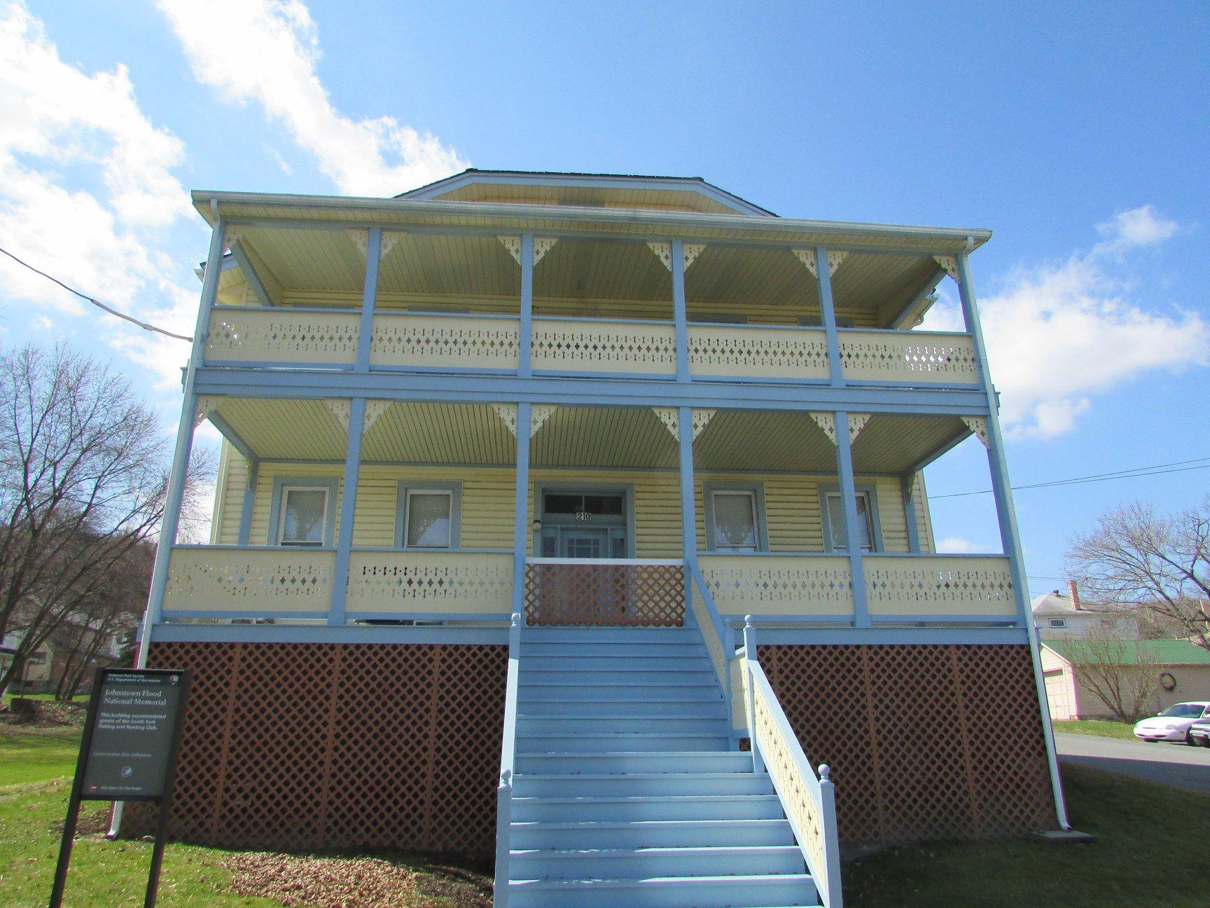
The Lippincott Cottage once served as a structure for the South Fork Fishing and Hunting Club
Credit: NPS
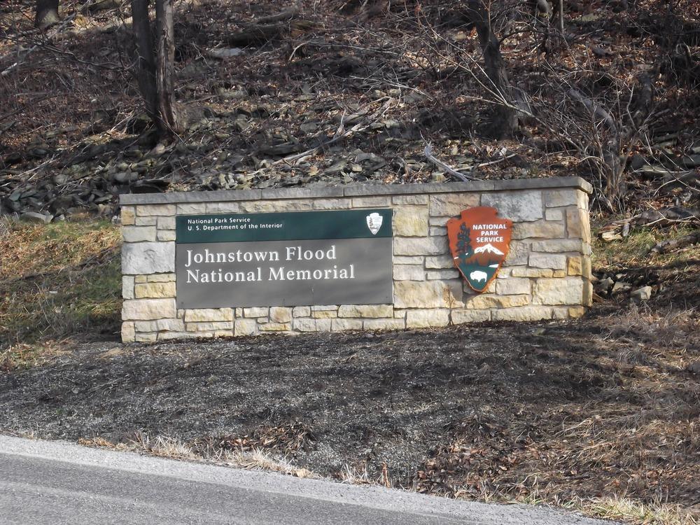
Park entrance sign
Credit: NPS
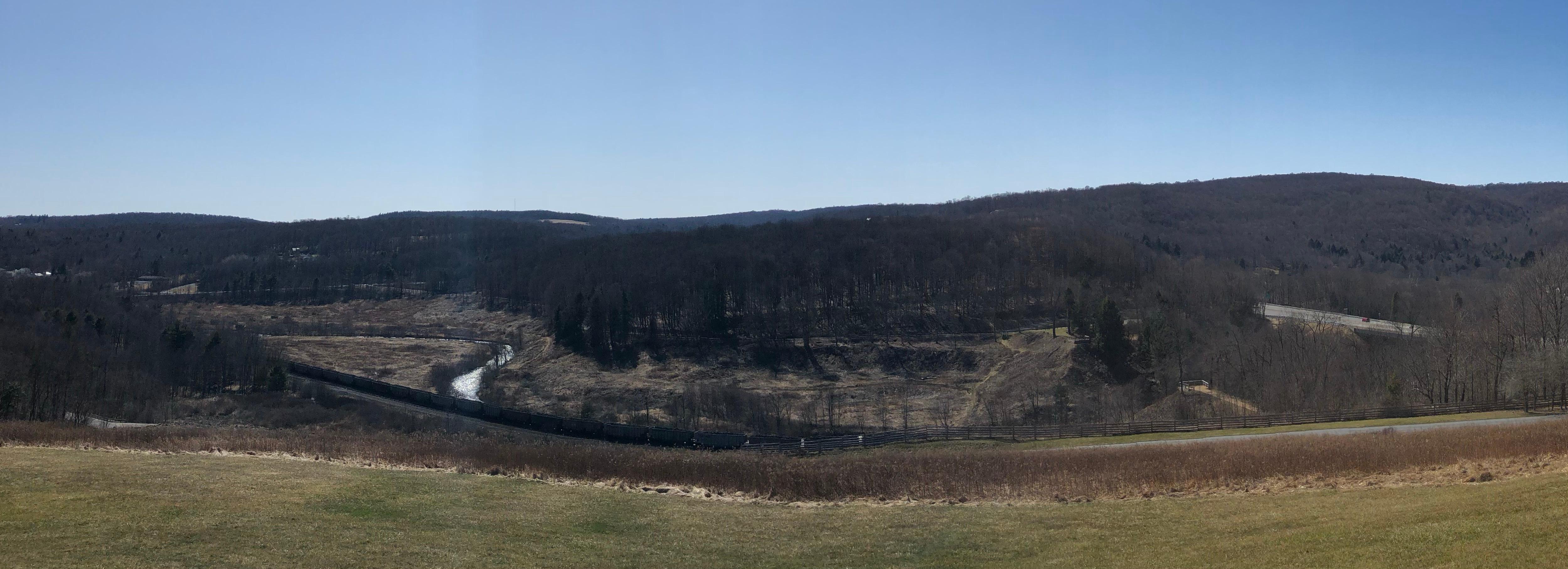
The remains of the South Fork Dam
Credit: NPS
The remains of the South Fork Dam
Credit: NPS
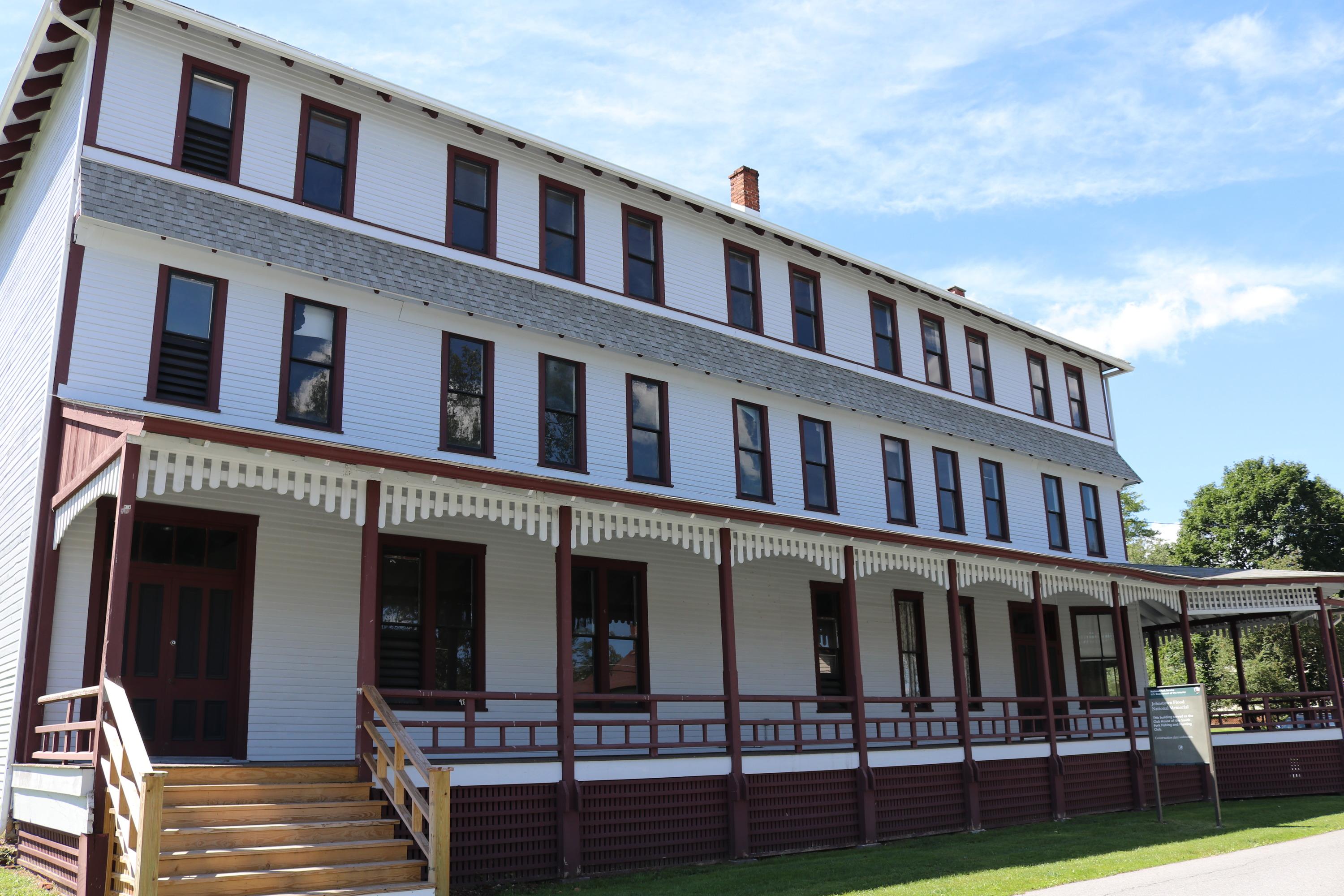
South Fork Fishing and Hunting Club Club House
Credit: NPS
The remains of the South Fork Dam
Credit: NPS
Activities
Topics
Operating Hours
Entrance Fees
No entrance fees listed.
Entrance Passes
No entrance passes listed.
3-Day Weather Forecast
Monday, Jun 1

Sunny
High: 69.8°F | Low: 48°F
Humidity: 49%
Wind: 6.5 mph
Rain Chance: 1%
UV Index: 8.6
Sunrise: 05:47 AM
Sunset: 08:38 PM
Moon: Waning Gibbous (96%)
Visibility: 6 mi
Dew Point: 49.3°F
Cloud Cover: 1%
Pressure: N/A mb
Air Quality (PM2.5): N/A
Ozone: N/A
EPA Index: N/A
Tuesday, Jun 2

Patchy rain nearby
High: 66.9°F | Low: 48.1°F
Humidity: 64%
Wind: 6.3 mph
Rain Chance: 73%
UV Index: 7.5
Sunrise: 05:46 AM
Sunset: 08:39 PM
Moon: Waning Gibbous (90%)
Visibility: 6 mi
Dew Point: 49.8°F
Cloud Cover: 73%
Pressure: N/A mb
Air Quality (PM2.5): N/A
Ozone: N/A
EPA Index: N/A
Wednesday, Jun 3
Sunny
High: 72°F | Low: 46.7°F
Humidity: 61%
Wind: 7.8 mph
Rain Chance: 1%
UV Index: 8.6
Sunrise: 05:46 AM
Sunset: 08:40 PM
Moon: Waning Gibbous (83%)
Visibility: 6 mi
Dew Point: 51.4°F
Cloud Cover: 1%
Pressure: N/A mb
Air Quality (PM2.5): N/A
Ozone: N/A
EPA Index: N/A
Park Alerts
Park Events
Club House and Cottage Row Walking Tours
Please note that the 2026 tours are full!
Club House and Cottage Row Walking Tours take place on May 16, 2026, and are part of our programming for the anniversary of the 1889 Johnstown Flood. Tours start at the Club House building located at 186 Main Street in St. Michael and last approximately one hour. Reservations for both tours are required! Please call the Visitor Center at 814-886-6171 to reserve a spot on these free tours!
Club House Tours
The Club House was the center of activity for the members of the South Fork Fishing and Hunting Club and their guests. The club owned the South Fork Dam, also known as Lake Conemaugh on May 31, 1889.
Tours include a walk through all three floors of the building. Participants will learn about the different uses of the building through the years, both during the days of the South Fork Fishing and Hunting Club and after.
May 16 tour times: 10:00 a.m., 10:30 a.m., 11:00 a.m. and 11:30 a.m.
Cottage Row Walking Tours
Members of the South Fork Fishing and Hunting Club built 16 cottages along Lake Conemaugh.
Cottage Row Walking Tours are led by park rangers and provide information on the 16 cottages built along the lake and the members of the South Fork Fishing and Hunting Club that owned them. As many of these structures are currently occupied, the tours do not go into any buildings. (es)
May 16 tour times: 1:00 p.m., 1:30 p.m., 2:30 p.m. and 3:00 p.m.
Date: May 16, 2026 12:00am to May 16, 2026 12:00am
Paid Event
Evening on the Lake: Alleviating Human Suffering in the Face of Emergencies: The American Red Cross’ Response to the Johnstown Flood and the September 11 Attacks.
Alleviating Human Suffering in the Face of Emergencies: The American Red Cross’ Response to the Johnstown Flood and the September 11 Attacks.
Join park rangers as they discuss how the American Red Cross grew as an organization, but its mission remained the same from the 1889 Johnstown Flood to the September 11th attacks of 2001.
This program is presented by park rangers Elizabeth Shope and Sam Govan.
The program begins at 7:00 p.m. in the Club House building located at 186 Main Street in St. Michael. No reservations are required for these free programs. Our Evening on the Lake series is sponsored by Friends of Johnstown Flood National Memorial.
Date: May 26, 2026 12:00am to May 26, 2026 12:00am
Paid Event
May 31 Anniversary
Sunday, May 31, 2026 is the 137th anniversary of the Great Johnstown Flood of May 31, 1889.
The Visitor Center will be open from 9:00 a.m. until 10:00 p.m. and is free of charge. The park film, Black Friday will play at quarter after each hour from 9:15 a.m. until 9:15 p.m.
At 4:07 p.m. park rangers will lay commemorative wreaths on the remains of the dam at the time the floodwaters reached Johnstown. The wreath laying will be broadcast live on our Facebook page.
Beginning at 7:00 p.m., 2,209 luminaries, will be lit to honor the victims of the flood. They line the remains of the South Fork Dam and around the Visitor Center. Each luminary will have the name of a flood victim written on it and will remain lit until 10:00 p.m. Park grounds remain open until the conclusion of the luminaries.
Parking is available at the Visitor Center and South Abutment. A shuttle runs between the Visitor Center and the North Abutment through the duration of the luminaries. Luminaries will also be visible from the Visitor Center area.
No reservations are required for any events on May 31. It is free and open to the public.
Date: May 31, 2026 12:00am to May 31, 2026 12:00am
Paid Event
Tales of the Great Flood
2026 program dates:
June 5 to August 30- Fridays through Tuesdays
September- Saturdays and Sundays
Tales of the Great Flood ranger talks take place daily in the Visitor Center theater between showings of the park film, “Black Friday.”
Talks are approximately 15-minutes in length and cover a variety of topics relating to the Johnstown Flood and time period.
Program times:
9:55 a.m., 10:55 a.m., 11:55 a.m., 1:55 p.m., 2:55 p.m. and 3:55 p.m.
Please note that the talks are staff dependent.
Date: Jun 5, 2026 12:00am to Aug 30, 2026 12:00am
Paid Event
Walk Through the Ruins
2026 program dates:
June 5 to August 30- Fridays, Saturdays and Sundays.
September- Saturdays and Sundays.
This ranger guided walk takes participants through the ruins of the South Fork Dam.
The program is approximately 45 minutes in length and will take participants to the bottom of the dam, through the breach and back up out of the dam on the other side. Participants will learn about May 31, 1889, the hillside across from the dam, and much more! Please note that the last portion of the walk contains a steep section. The walk is approximately 1/3 mile.
Participants are encouraged to wear proper shoes and bring water. The meeting location is on the South Abutment.
The walk is weather and staff dependent. Please call the Visitor Center at 814-886-6171 on the day of your visit to see if the program is being offered. No reservations are required! This walk can also be done self-guided. Park grounds are open daily from sunrise to sunset.
Date: Jun 5, 2026 12:00am to Aug 30, 2026 12:00am
Paid Event
Path of the Flood Van Tour
Ranger-guided Path of the Flood van tours are a great way to learn about the destructive force of the Johnstown Flood of May 31, 1889.
This free tour begins at 1:00 p.m. at the Johnstown Flood National Memorial Visitor Center on select Saturdays in the summer. The tour is four hours in length. Space is limited to 12 people and reservations are required.
The tour goes around the site of the South Fork Dam. Participants will learn about the history of the dam, plus the timeline that explains how and why the dam failed. During this time, there is also a fully-guided tour of the South Fork Fishing and Hunting Club Club House.
After leaving the park grounds, the tour then winds through the flood ravaged communities of South Fork, Mineral Point, East Conemaugh, Woodvale, and ultimately Johnstown. While driving through these communities, the Park Ranger explains the key events that happened in each town and even shares some photos of flood damage and/or significant people from the flood. The narrative portion of the tour concludes at Grandview Cemetery. At the cemetery, the van will stop at the "Monument of Tranquility," the monument that was dedicated to flood victims on May 31, 1892. Participants will then be shuttled back to the park Visitor Center.
Accommodations for children under the age of eight cannot be made due to Pennsylvania law. The child safety law states that children eight years of age and under must be in an appropriate booster seat. Please be advised that because we cannot ensure that car seats are properly and safely installed on the vans and/or the bus, we cannot accommodate them on van tours. If a child arrived at the park in a car seat, they must always be in a car seat, while in a motorized vehicle. No allowances will be made for "holding" children while on a van tour. Thank you for your understanding!
Date: Jun 13, 2026 12:00am to Jun 13, 2026 12:00am
Paid Event
Evening on the Lake: We've Come a Long Way: Allegheny Portage Railroad National Historic Site and Johnstown Flood National Memorial Through the Years.
We've Come a Long Way: Allegheny Portage Railroad National Historic Site and Johnstown Flood National Memorial Through the Years.
We've come a long way in 62 years! Participants will view the photographic history of both Allegheny Portage Railroad National Historic Site and Johnstown Flood National Memorial. This photographic timeline will take visitors from the humble beginnings of these two parks to what exists today.
This program is presented by park ranger Doug Bosley.
The program begins at 7:00 p.m. in the Club House building located at 186 Main Street in St. Michael. No reservations are required for these free programs. Our Evening on the Lake series is sponsored by Friends of Johnstown Flood National Memorial.
Date: Jun 30, 2026 12:00am to Jun 30, 2026 12:00am
Paid Event
Path of the Flood Van Tour
Ranger-guided Path of the Flood van tours are a great way to learn about the destructive force of the Johnstown Flood of May 31, 1889.
This free tour begins at 1:00 p.m. at the Johnstown Flood National Memorial Visitor Center on select Saturdays in the summer. The tour is four hours in length. Space is limited to 12 people and reservations are required.
The tour goes around the site of the South Fork Dam. Participants will learn about the history of the dam, plus the timeline that explains how and why the dam failed. During this time, there is also a fully-guided tour of the South Fork Fishing and Hunting Club Club House.
After leaving the park grounds, the tour then winds through the flood ravaged communities of South Fork, Mineral Point, East Conemaugh, Woodvale, and ultimately Johnstown. While driving through these communities, the Park Ranger explains the key events that happened in each town and even shares some photos of flood damage and/or significant people from the flood. The narrative portion of the tour concludes at Grandview Cemetery. At the cemetery, the van will stop at the "Monument of Tranquility," the monument that was dedicated to flood victims on May 31, 1892. Participants will then be shuttled back to the park Visitor Center.
Accommodations for children under the age of eight cannot be made due to Pennsylvania law. The child safety law states that children eight years of age and under must be in an appropriate booster seat. Please be advised that because we cannot ensure that car seats are properly and safely installed on the vans and/or the bus, we cannot accommodate them on van tours. If a child arrived at the park in a car seat, they must always be in a car seat, while in a motorized vehicle. No allowances will be made for "holding" children while on a van tour. Thank you for your understanding!
Date: Jul 25, 2026 12:00am to Jul 25, 2026 12:00am
Paid Event
Evening on the Lake: Clara Barton
Clara Barton
We know her from the Red Cross, Johnstown Flood and Civil War. There is much more to this courageous and compassionate woman. Come to really know the person who is looked upon worldwide as the embodiment of the American Red Cross.
This program is presented by park volunteer Jim Effinger.
The program begins at 7:00 p.m. in the Club House building located at 186 Main Street in St. Michael. No reservations are required for these free programs. Our Evening on the Lake series is sponsored by Friends of Johnstown Flood National Memorial.
Date: Jul 28, 2026 12:00am to Jul 28, 2026 12:00am
Paid Event
Evening on the Lake: Insect Invaders: A Battle for our Park’s Native Forests.
Insect Invaders: A Battle for our Park’s Native Forests.
Invasive insects are changing the face of forests in the National Parks of the Northeast United States. These destructive insects are non-native species that have escaped into areas where they do not occur naturally and have no natural enemies, so their populations can explode causing devastation to our forests. Infestations have caused the elimination of large canopy trees such as our native ash, oak, maples, and hemlock species. This presentation dives into how these bugs are affecting our parklands and how the National Parks of Western Pa are fighting back against one of these species, the emerald ash borer.
This program is presented by park ranger Margaret Speicher.
The program begins at 7:00 p.m. in the Club House building located at 186 Main Street in St. Michael. No reservations are required for these free programs. Our Evening on the Lake series is sponsored by Friends of Johnstown Flood National Memorial.
Date: Aug 25, 2026 12:00am to Aug 25, 2026 12:00am
Paid Event
Visitor Center & Contacts
📍 Physical Address:
733 Lake Road
South Fork, PA 15956
🏤 Mailing Address:
733 Lake Road
South Fork, PA 15956
📞 Voice Phone: 8148866171
✉️ Email: jofl_interpretation@nps.gov