Lower Delaware National Wild and Scenic River
Designation: National Wild and Scenic River
Location: Pennsylvania, New Jersey
📘 Park Overview
The Delaware River, the largest free-flowing river in the eastern United States, runs past forests, farmlands and villages. It also links some of the most densely populated regions in America. In 2000, the National Wild and Scenic River System incorporated key segments of the lower Delaware River to form this unit of the National Park System.
🌤 Weather Information
Spring: Temperatures usually range from lows of 26 F to highs of 80 F with average rainfall of 5 inches. Summer: Temperatures usually range from lows of 55 F to highs of 85 F with average rainfall of 4 inches. Fall: Temperatures usually range from lows of 30 F to highs of 83F. Fall foliage is at its peak sometime in October as daily mountain temperatures vary frequently and influence the change. Winter: Temperatures usually range from lows of 15 F to highs of 49 F.
🚗 Directions
The Lower Delaware National Wild and Scenic River is located between Interstate 80 (at Portland, Pennsylvania and Columbia, New Jersey) and Interstate 95 (at exit 51 in Washington Crossing, Pennsylvania and exit 1 in Washington Crossing, New Jersey). In Pennsylvania, follow PA-611 and PA-32 to drive along the river. In New Jersey, follow NJ-29 south of Frenchtown for a drive along the river.
Images
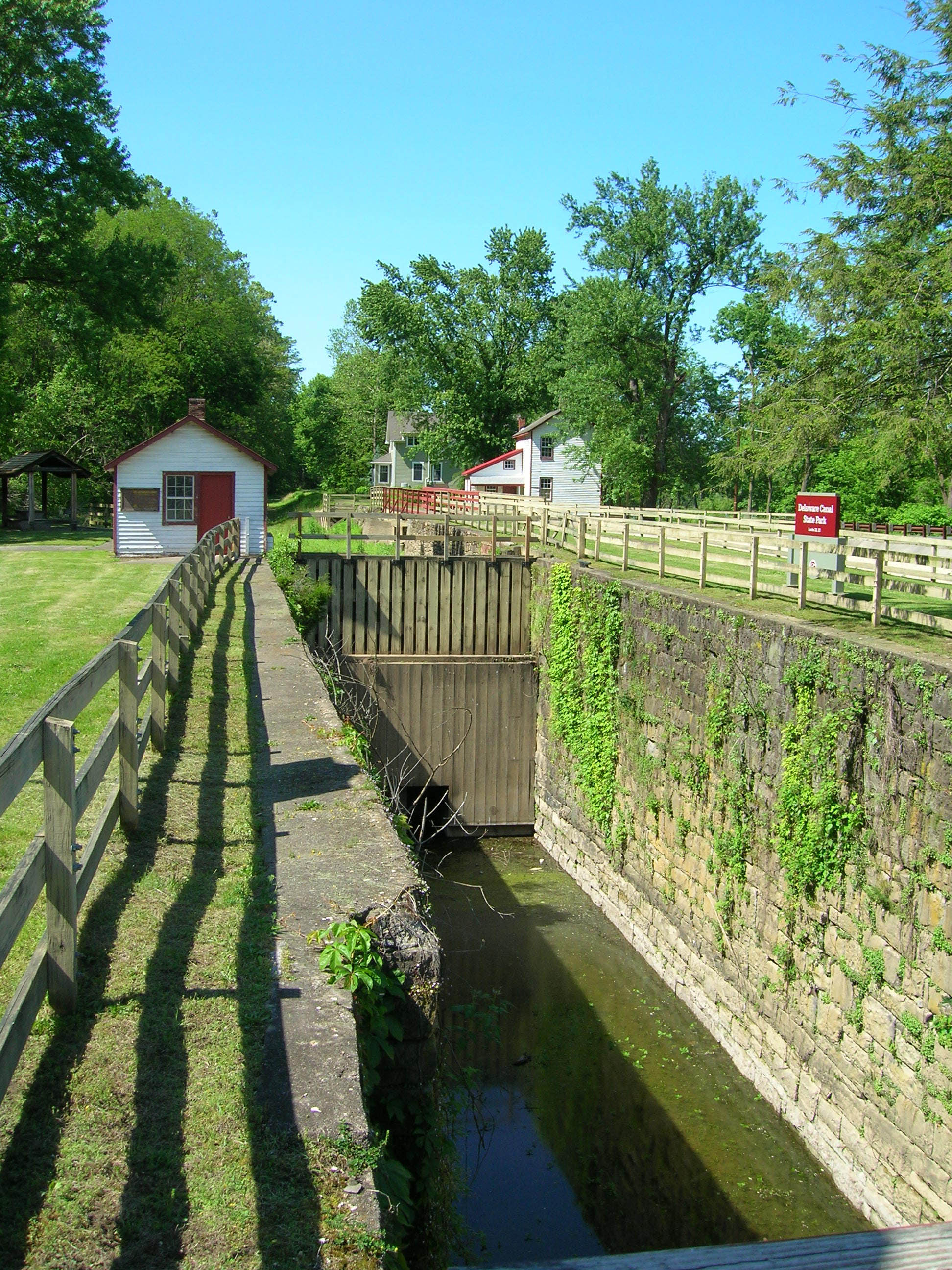
Locks were used to move boats overland via canals
Credit: NPS Photo/Julia Bell
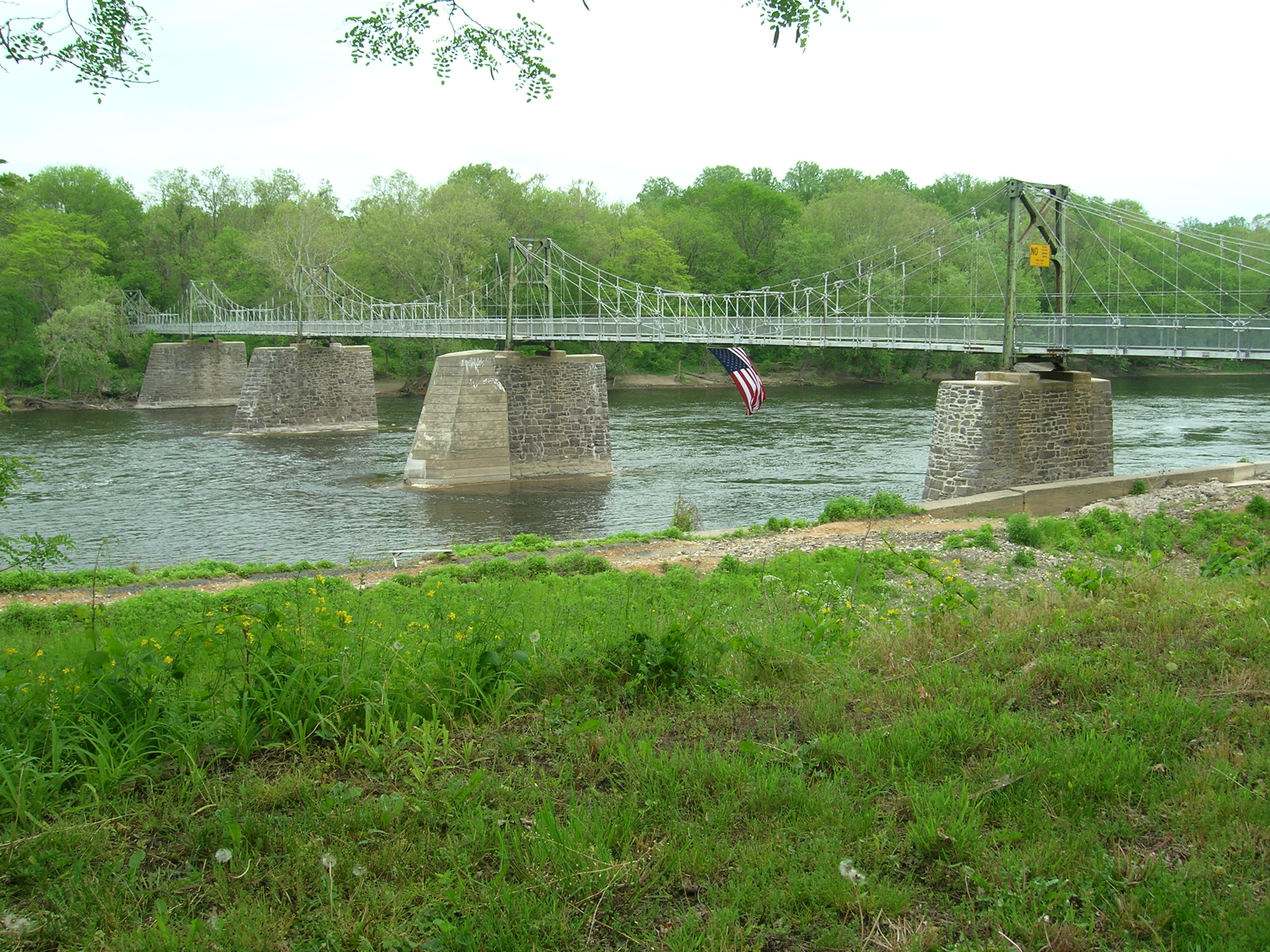
The Bridge from Lumberville, PA to Bulls Island Recreation Area, NJ
Credit: NPS Photo/Julia Bell
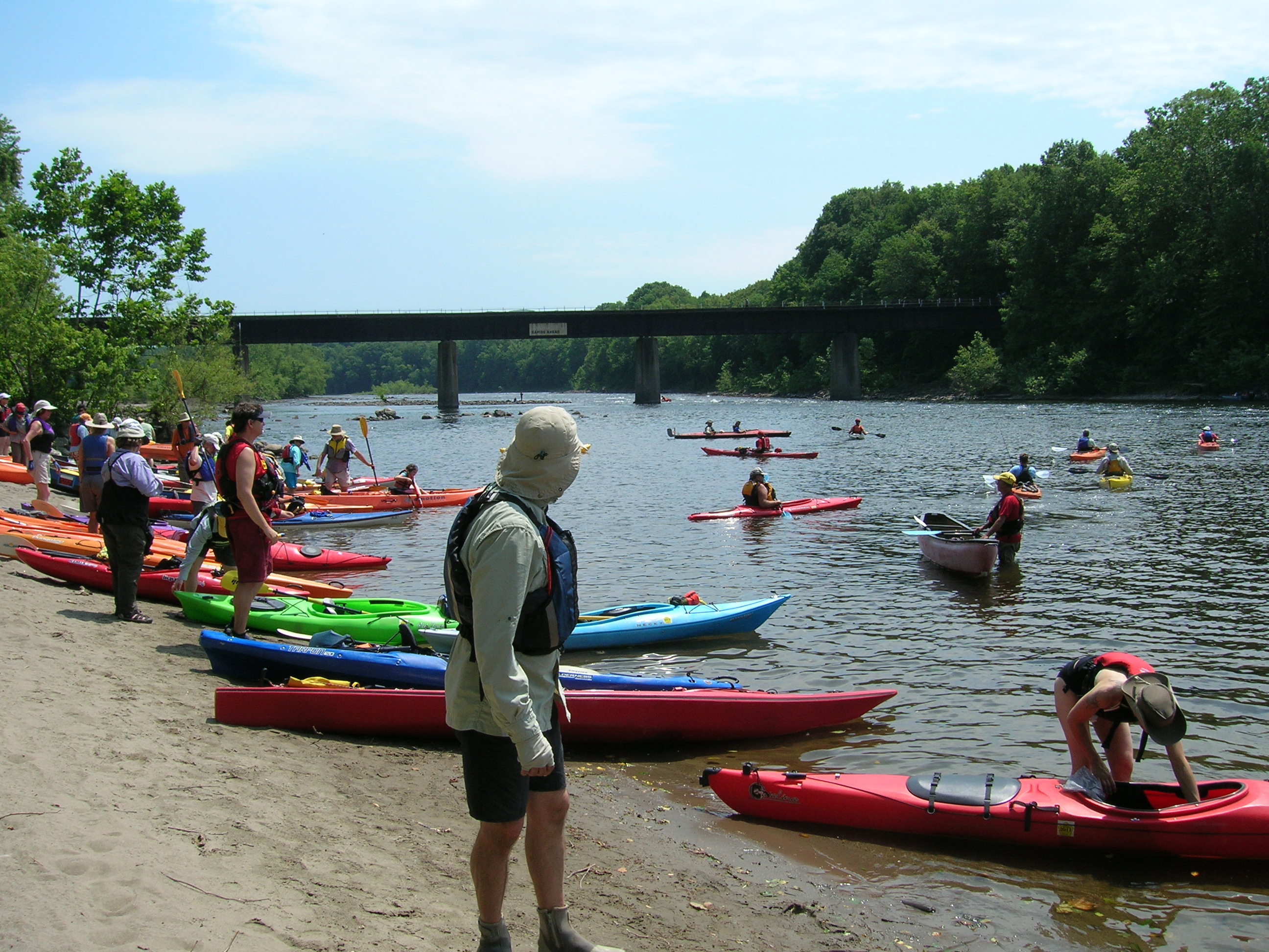
Sojourners enter the river at Martins Creek, PA
Credit: NPS Photo/Julia Bell
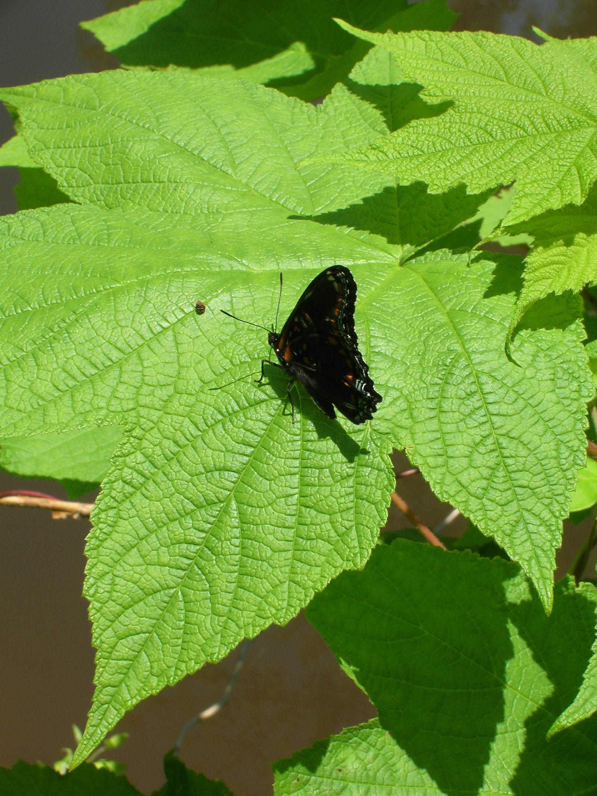
Butterfly at Delaware Canal State Park near Upper Black Eddy, PA
Credit: NPS Photo/Julia Bell
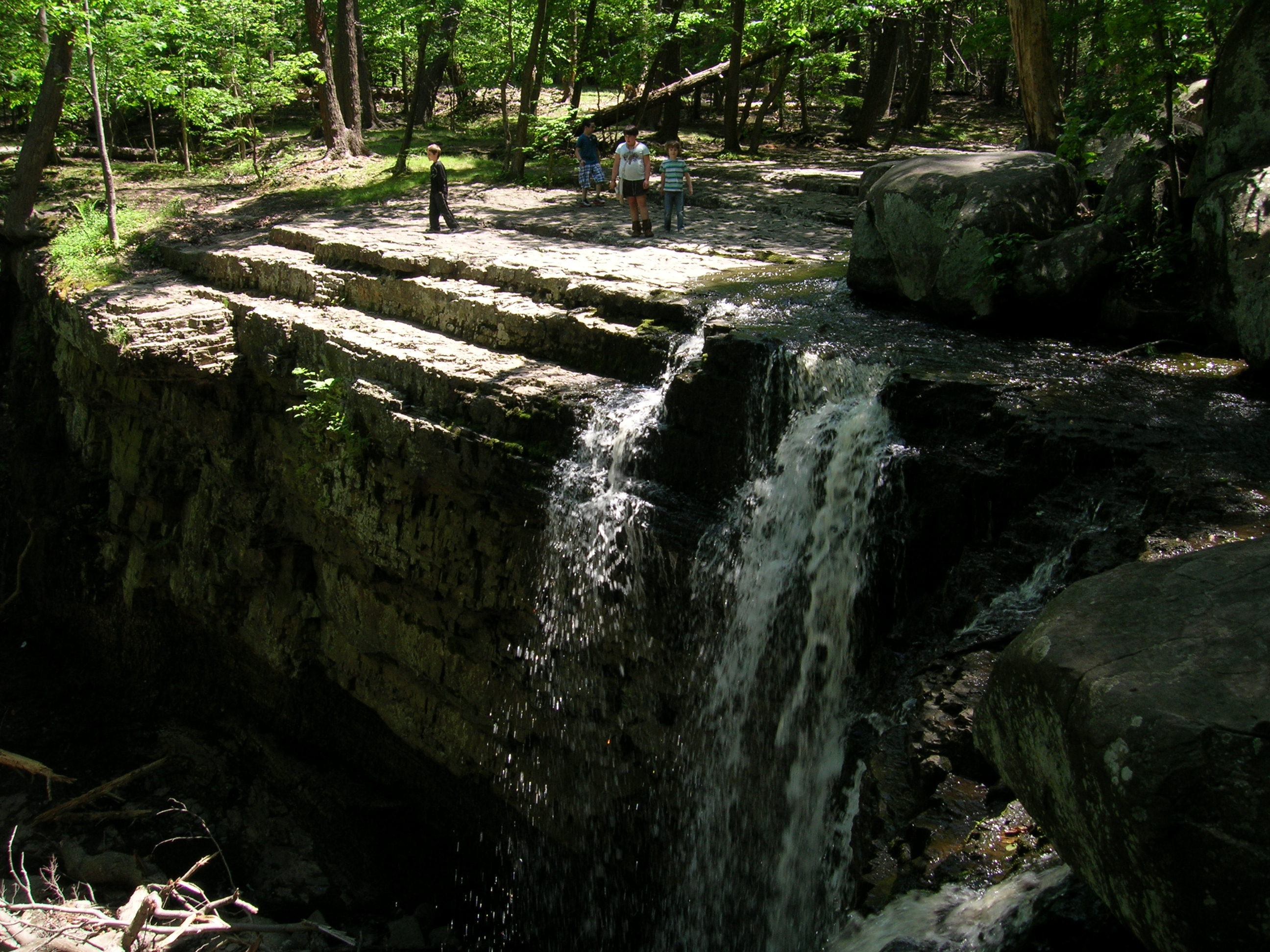
Visitors overlook the waterfall
Credit: NPS Photo/Julia Bell
Locks were used to move boats overland via canals
Credit: NPS Photo/Julia Bell
The Bridge from Lumberville, PA to Bulls Island Recreation Area, NJ
Credit: NPS Photo/Julia Bell
Sojourners enter the river at Martins Creek, PA
Credit: NPS Photo/Julia Bell
Butterfly at Delaware Canal State Park near Upper Black Eddy, PA
Credit: NPS Photo/Julia Bell
Visitors overlook the waterfall
Credit: NPS Photo/Julia Bell
Activities
Topics
Operating Hours
Entrance Fees
No entrance fees listed.
Entrance Passes
No entrance passes listed.
3-Day Weather Forecast
Tuesday, May 5

Sunny
High: 88.5°F | Low: 55.8°F
Humidity: 48%
Wind: 15.9 mph
Rain Chance: 0%
UV Index: 6.9
Sunrise: 05:54 AM
Sunset: 07:59 PM
Moon: Waning Gibbous (90%)
Visibility: 6 mi
Dew Point: 60°F
Cloud Cover: 0%
Pressure: N/A mb
Air Quality (PM2.5): N/A
Ozone: N/A
EPA Index: N/A
Wednesday, May 6

Moderate rain
High: 64.9°F | Low: 59.7°F
Humidity: 83%
Wind: 14.3 mph
Rain Chance: 87%
UV Index: 1
Sunrise: 05:53 AM
Sunset: 08:00 PM
Moon: Waning Gibbous (84%)
Visibility: 5 mi
Dew Point: 58.5°F
Cloud Cover: 87%
Pressure: N/A mb
Air Quality (PM2.5): N/A
Ozone: N/A
EPA Index: N/A
Thursday, May 7
Moderate rain
High: 53.7°F | Low: 47.9°F
Humidity: 94%
Wind: 14.1 mph
Rain Chance: 89%
UV Index: 1.7
Sunrise: 05:52 AM
Sunset: 08:01 PM
Moon: Waning Gibbous (77%)
Visibility: 3 mi
Dew Point: 51.6°F
Cloud Cover: 89%
Pressure: N/A mb
Air Quality (PM2.5): N/A
Ozone: N/A
EPA Index: N/A
Visitor Center & Contacts
📍 Physical Address:
NPS Wild & Scenic Rivers
1234 Market Street
Philadelphia, PA 19107
🏤 Mailing Address:
NPS Wild & Scenic Rivers
1234 Market Street
Philadelphia, PA 19107
📞 Voice Phone: 617-981-0466
✉️ Email: sarah_bursky@nps.gov