Mill Springs Battlefield National Monument
Designation: National Monument
Location: Kentucky
📘 Park Overview
The US won a significant victory early in the Civil War at the Battle of Mill Springs. Explore the rolling fields of Kentucky where the battle took place and learn about that state's strategic importance to both sides of the fight.
🌤 Weather Information
Nancy, Kentucky, on average, gets 50 inches of rain per year and 11 inches of snow. July is usually the warmest month with temperatures around 86 F. January can reach a low of 25 F.
🚗 Directions
The address of the Visitor Center and Museum is 9020 West Highway 80, Nancy, Kentucky 42544. The Visitor Center and Museum is located approximately eight miles west of Somerset, Kentucky along KY-80. Next door is the Mill Springs National Cemetery. Zollicoffer Park (Core Battlefield) is one mile due south of the Visitor Center along KY-235. From the Visitor Center, turn right onto KY-80 W head 0.3 of a mile. Turn left onto State Hwy 235 go 1 mile, Zollicoffer Park will be on your left.
Images
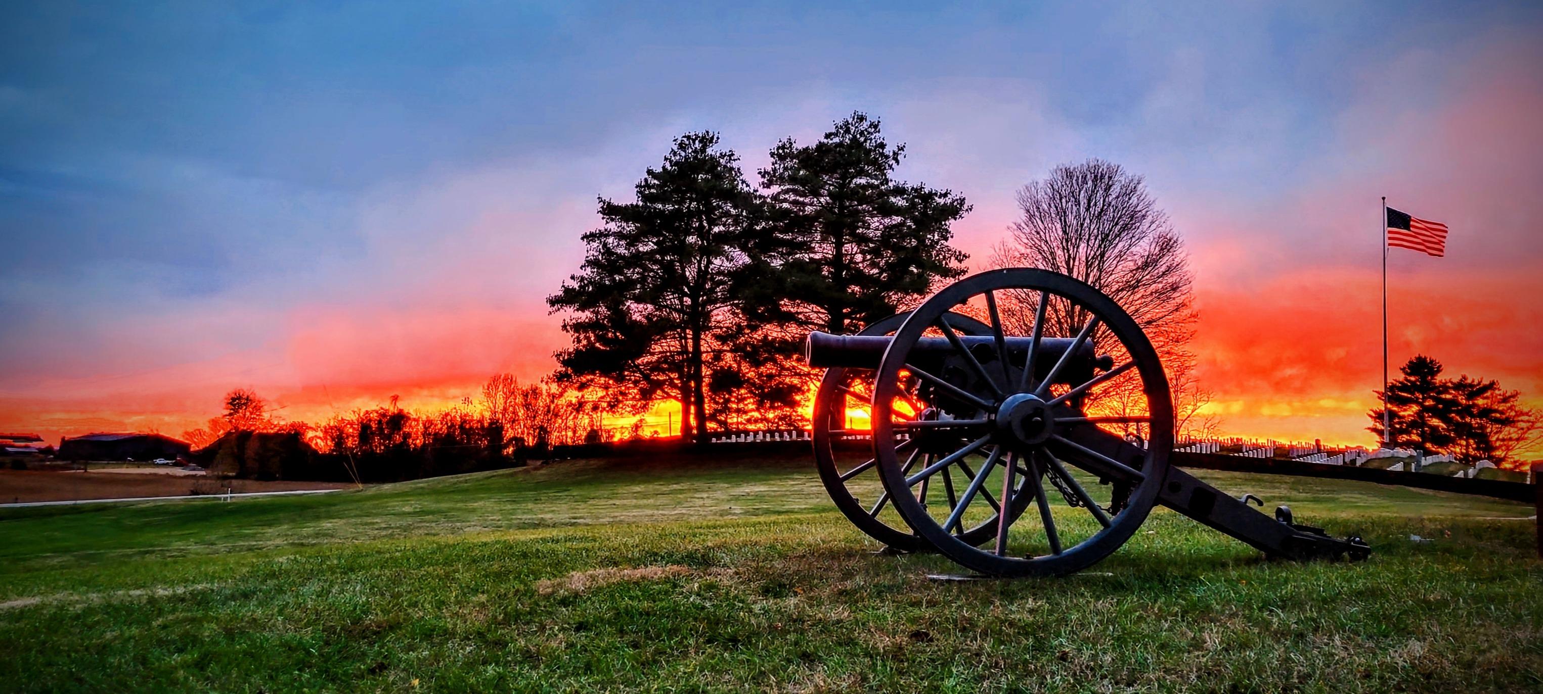
A glorious orange sunset back drops the Mill Springs National Cemetery.
Credit: NPS
Activities
Topics
Operating Hours
Entrance Fees
No entrance fees listed.
Entrance Passes
No entrance passes listed.
3-Day Weather Forecast
Sunday, Mar 29

Sunny
High: 73.9°F | Low: 37°F
Humidity: 42%
Wind: 11.9 mph
Rain Chance: 0%
UV Index: 1.7
Sunrise: 07:29 AM
Sunset: 07:58 PM
Moon: Waxing Gibbous (83%)
Visibility: 6 mi
Dew Point: 40.2°F
Cloud Cover: 0%
Pressure: N/A mb
Air Quality (PM2.5): N/A
Ozone: N/A
EPA Index: N/A
Monday, Mar 30

Overcast
High: 66°F | Low: 49.6°F
Humidity: 77%
Wind: 15 mph
Rain Chance: 0%
UV Index: 1
Sunrise: 07:27 AM
Sunset: 07:59 PM
Moon: Waxing Gibbous (90%)
Visibility: 6 mi
Dew Point: 52.4°F
Cloud Cover: 0%
Pressure: N/A mb
Air Quality (PM2.5): N/A
Ozone: N/A
EPA Index: N/A
Tuesday, Mar 31
Overcast
High: 76.1°F | Low: 56.7°F
Humidity: 77%
Wind: 16.3 mph
Rain Chance: 0%
UV Index: 1.4
Sunrise: 07:26 AM
Sunset: 08:00 PM
Moon: Waxing Gibbous (95%)
Visibility: 6 mi
Dew Point: 60.7°F
Cloud Cover: 0%
Pressure: N/A mb
Air Quality (PM2.5): N/A
Ozone: N/A
EPA Index: N/A
Weather Alerts (5)
Frost Advisory issued March 28 at 3:53PM EDT until March 29 at 10:00AM EDT by NWS Jackson KY
Effective: Mar 28, 2026 3:53pm
Expires: Mar 29, 2026 6:00am
* WHAT...Sub-freezing temperatures around 30 in the valleys and low
lying areas and in the mid 30s on the ridges are expected tonight
into early Sunday morning.
* WHERE...Pulaski and Wayne Counties.
* WHEN...From midnight tonight to 10 AM EDT Sunday.
* IMPACTS...Frost could harm sensitive outdoor vegetation. Sensitive
outdoor plants may be killed if left uncovered.
Special Weather Statement issued March 28 at 9:03PM EDT by NWS Jackson KY
Effective: Mar 28, 2026 9:03pm
Expires: Mar 29, 2026 6:00am
Low humidity, gusty winds, and very dry fuels will combine to
result in High Fire Danger between 10 AM and around sunset Sunday.
A burn ban in currently in place for McCreary County. Check for
any other county burn bans or restrictions that may be in place.
Remember, Kentucky regulations make it illegal to burn between
the hours of 6 AM and 6 PM within 150 feet of any woodlands or
brushlands during the Spring Forest Fire Season that runs until
April 30th.
Frost Advisory issued March 28 at 1:52PM EDT until March 29 at 10:00AM EDT by NWS Louisville KY
Effective: Mar 28, 2026 1:52pm
Expires: Mar 29, 2026 4:00am
* WHAT...Temperatures in the lower 30s will result in frost
formation.
* WHERE...Portions of south central Indiana and east central, north
central, and south central Kentucky.
* WHEN...From midnight EDT /11 PM CDT/ tonight to 10 AM EDT /9 AM
CDT/ Sunday.
* IMPACTS...Frost could harm sensitive outdoor vegetation. Sensitive
outdoor plants may be killed if left uncovered.
Freeze Warning issued March 28 at 3:53PM EDT until March 29 at 10:00AM EDT by NWS Jackson KY
Effective: Mar 28, 2026 3:53pm
Expires: Mar 29, 2026 6:00am
* WHAT....Sub-freezing temperatures as low as the mid to upper 20s
in the more eastern and southern valleys to around 30 in more
western valley locations. Ridgetop and more open terrain locations
will experiences lows in the mid 30s tonight into early Sunday
morning.
* WHERE...Portions of east central, northeast, south central, and
southeast Kentucky.
* WHEN...From midnight tonight to 10 AM EDT Sunday.
* IMPACTS...Frost and freeze conditions could kill crops, other
sensitive vegetation and possibly damage unprotected outdoor
plumbing.
Special Weather Statement issued March 28 at 8:52PM EDT by NWS Morristown TN
Effective: Mar 28, 2026 8:52pm
Expires: Mar 29, 2026 8:00pm
Fire weather concerns exist again for midday Sunday into the
evening due to a very dry airmass and breezy south to southwest
winds. Relative humidity values are expected to drop into the
teens and lower 20s across the whole region. Winds will gust up to
25 mph.
Residents and visitors are urged to properly dispose of cigarette
butts, matches, and any other flammable items in appropriate
containers. Additionally, exercise caution if operating any
equipment that could create sparks and keep vehicles off of dry
grass. Most dry grasses, dead leaves, and other tree litter could
easily ignite and spread fire quickly.
Lastly, remember to obey local burn bans.
Park Alerts
Visitor Center & Contacts
📍 Physical Address:
Mill Springs Battlefield National Monument
9020 West Highway 80
Nancy, KY 42544
🏤 Mailing Address:
Mill Springs Battlefield National Monument
9020 West Highway 80
Nancy, KY 42544
📞 Voice Phone: 606-636-4045
✉️ Email: misp_information@nps.gov