New River Gorge National Park & Preserve
Designation: National Park & Preserve
Location: West Virginia
📘 Park Overview
A rugged, whitewater river flowing northward through deep canyons, the New River is among the oldest rivers on the continent. The park encompasses over 70,000 acres of land along the New River, is rich in cultural and natural history, and offers an abundance of scenic and recreational opportunities.
🌤 Weather Information
Weather in the Appalachian Mountains can be unpredictable and can change quickly. Always be prepared for the possibility of sudden storms. Weather in the mountains is often cooler and wetter than the surrounding area. On average, the warmest month is July. The maximum average precipitation also occurs in July.
🚗 Directions
To reach Park Headquarters take Route 19 North from Beckley to the Glen Jean exit. Upon exiting Rt 19, make an immediate left turn. At the next intersection, turn right. Park Headquarters will be straight ahead on the right. GPS Coordinates for Headquarters: 81.15587W, 37.92775N PLEASE NOTE: Third party search and map apps may direct you to an potentially inaccessible area of the park with no amenities or rangers stations. Please refer to the Visitor Center or Park Headquarters addresses for directions.
Images
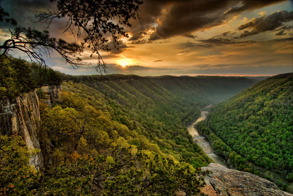
Sun rising over the New River Gorge from Diamond Point on the Endless Wall Trail.
Credit: Gary Hartley
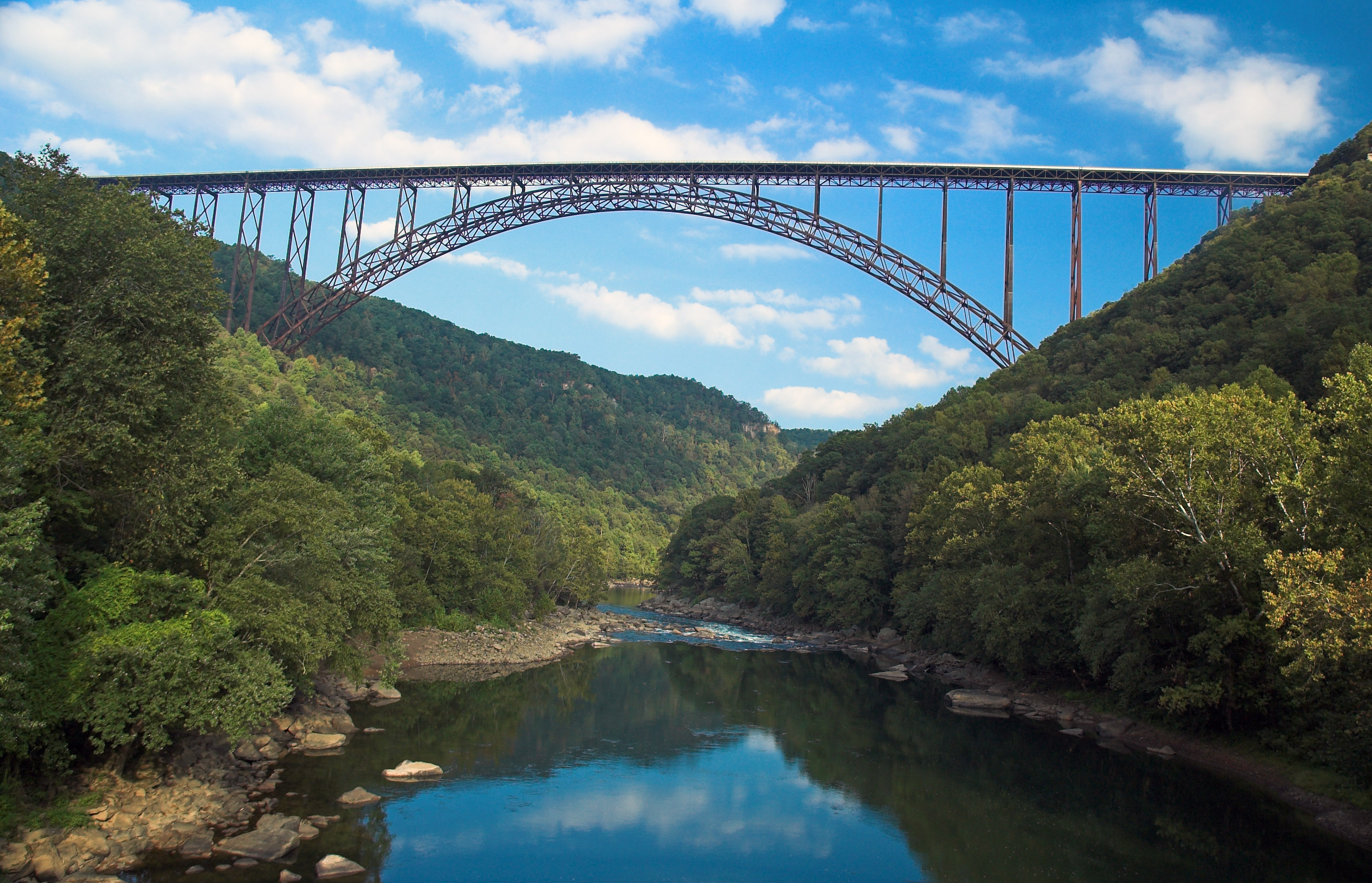
The New River Gorge Bridge spans across the New River.
Credit: Gary Hartley
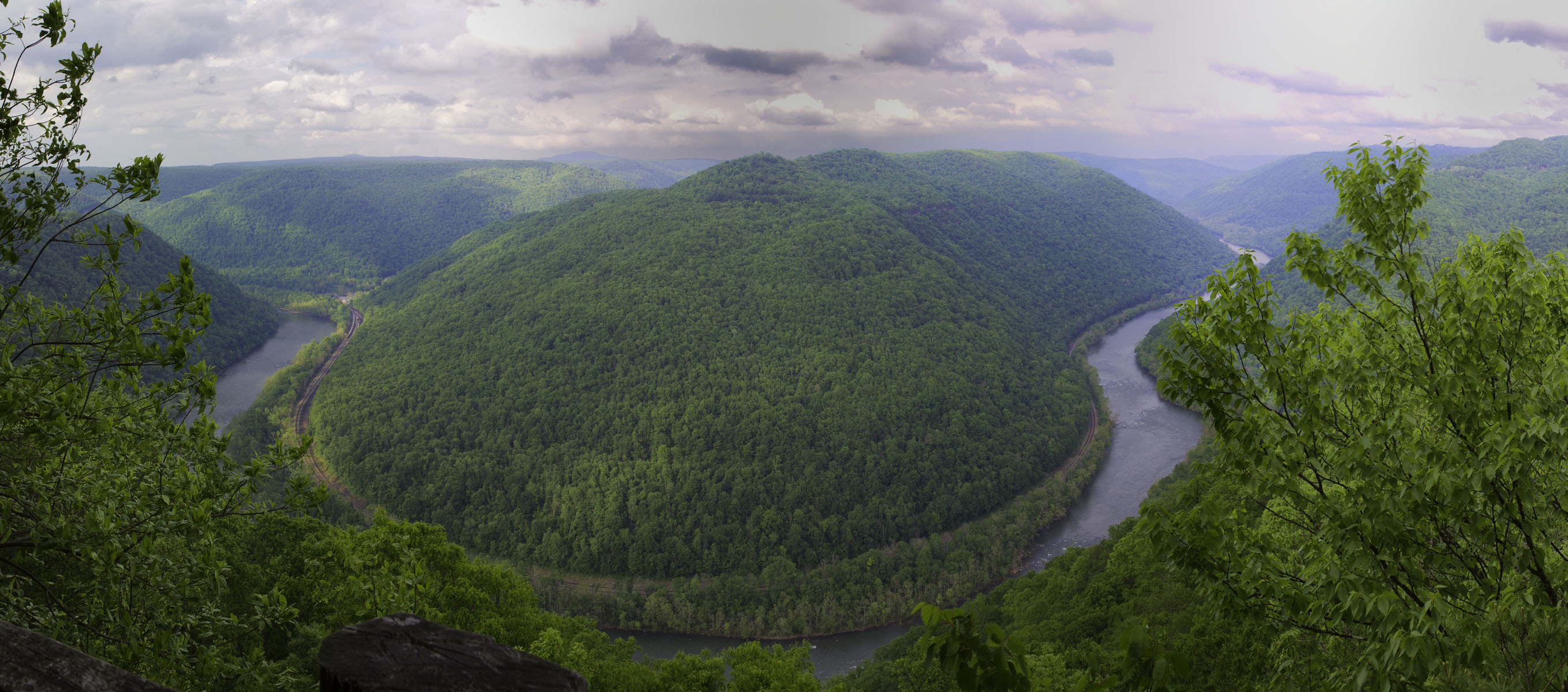
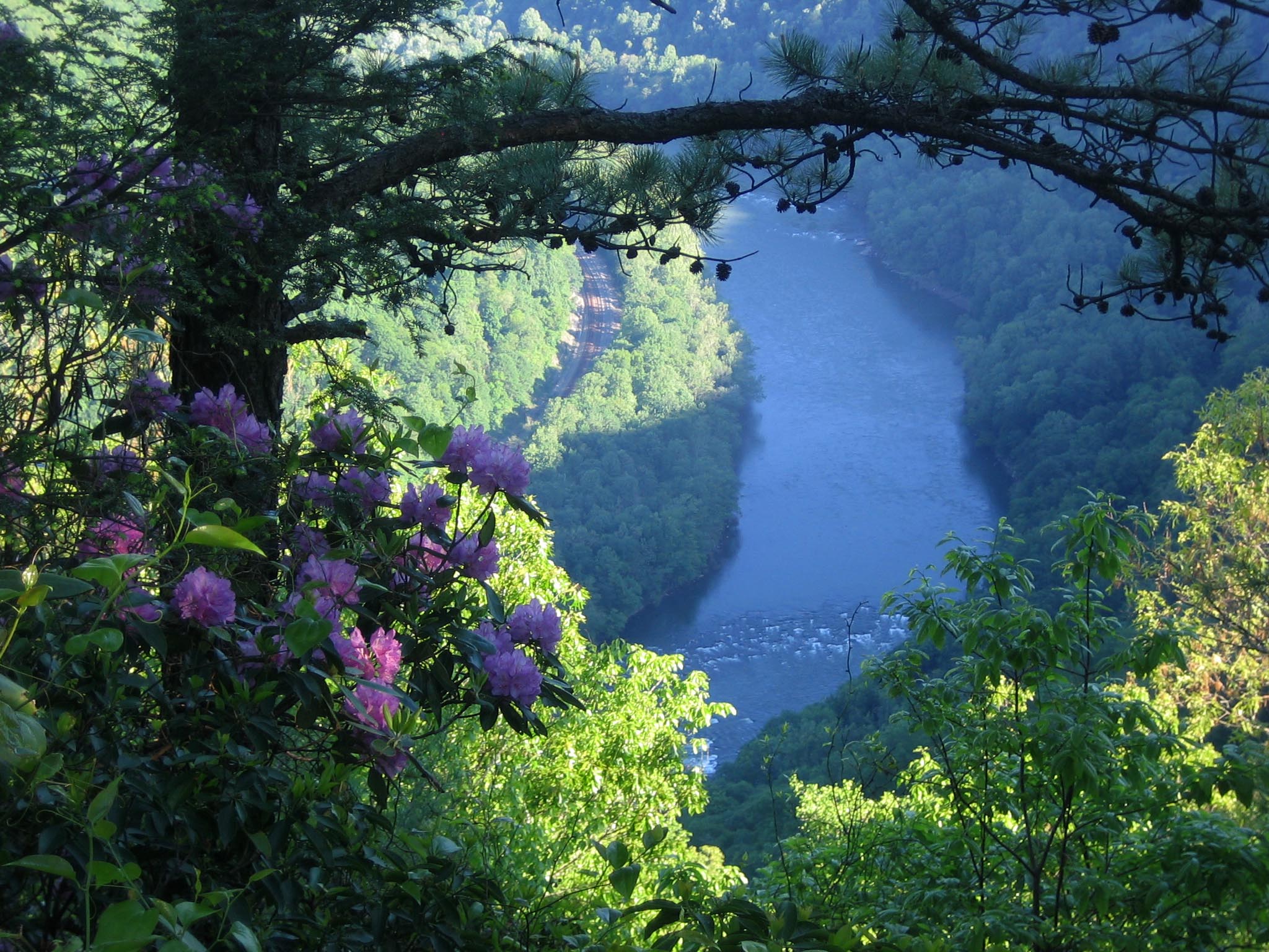
The Horseshoe Bend in the New River from Grandview
Credit: NPS photo/Louise McLaughlin
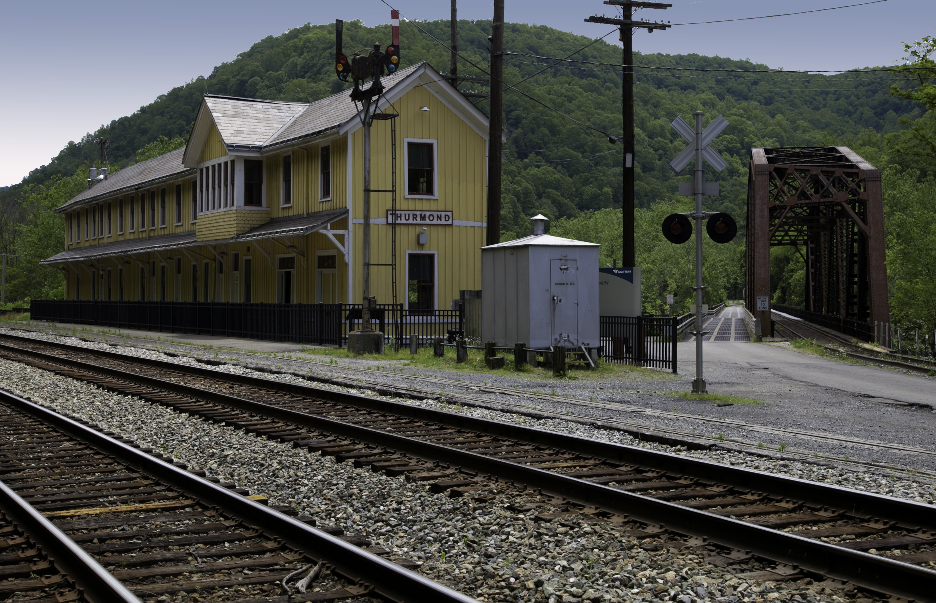
Thurmond Depot
Credit: NPS photo/Louise McLaughlin
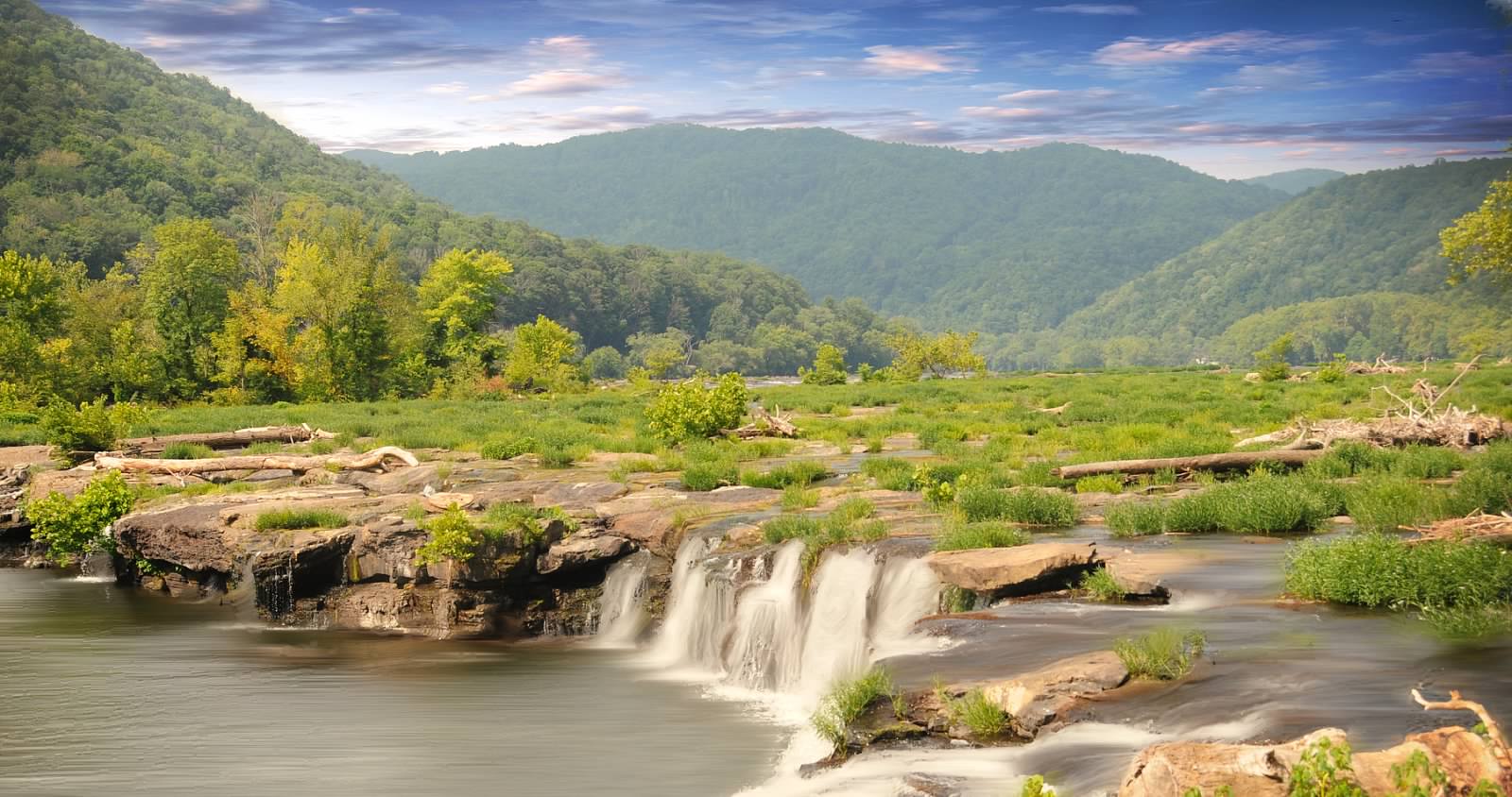
Sandstone Falls spans the New River
Credit: NPS photo/Carey Woods
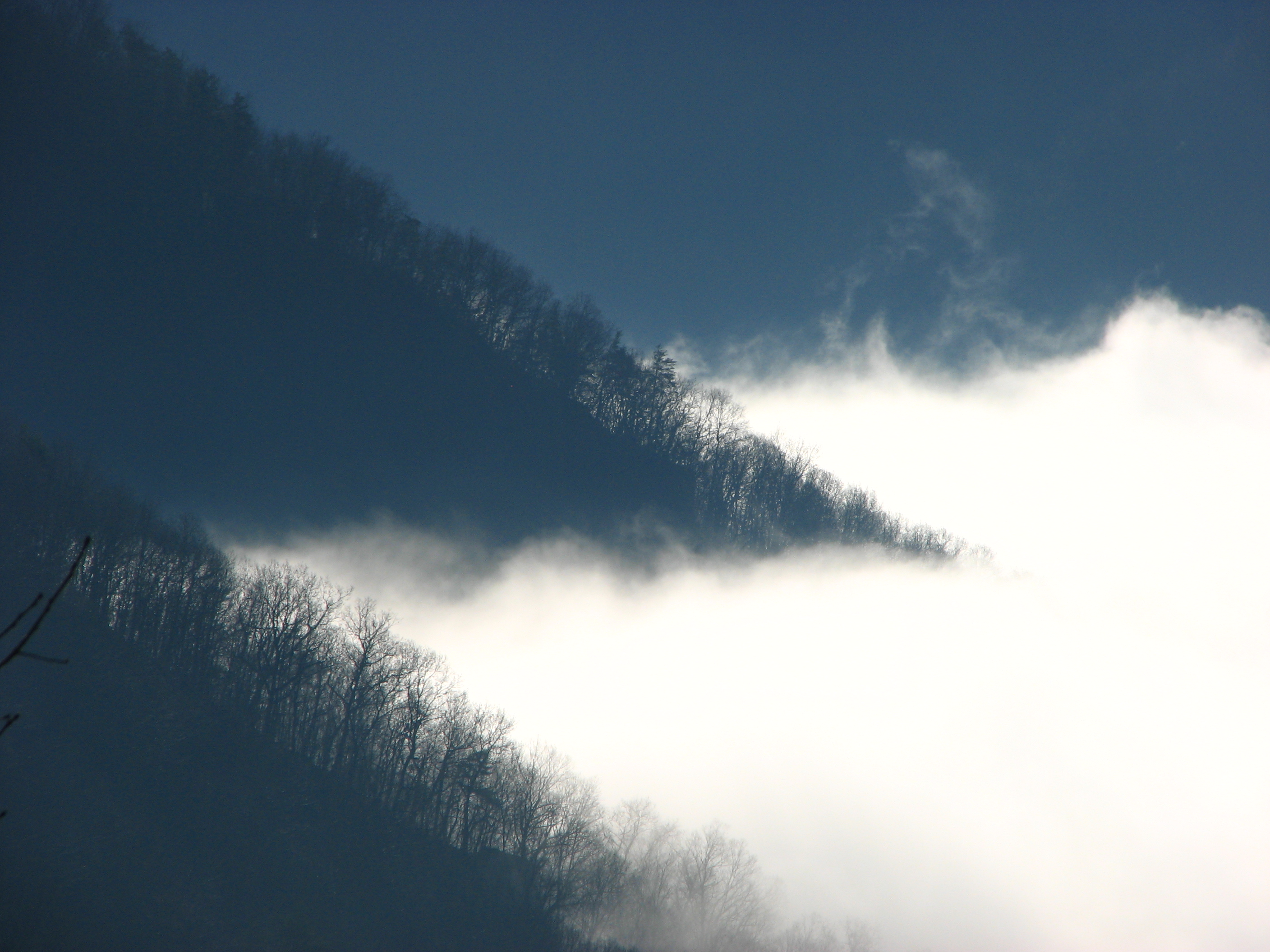
Fog settles in the gorge
Credit: NPS photo/Leah Perkowski-Sisk
View from Turkey Spur at Grandview
Credit: NPS photo/Dave Bieri
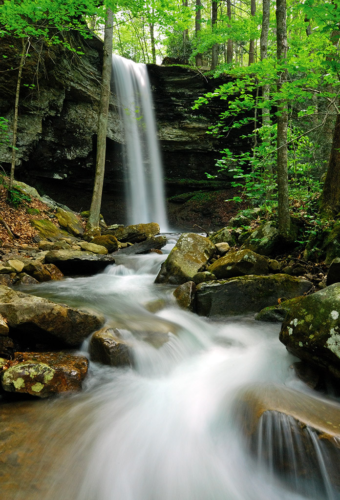
Waterfall on Dowdy Creek
Credit: Gary Hartley
Activities
Topics
Operating Hours
Entrance Fees
No entrance fees listed.
Entrance Passes
No entrance passes listed.
3-Day Weather Forecast
Sunday, May 10

Patchy rain nearby
High: 71.6°F | Low: 48.4°F
Humidity: 64%
Wind: 10.7 mph
Rain Chance: 89%
UV Index: 8.6
Sunrise: 06:18 AM
Sunset: 08:22 PM
Moon: Waning Crescent (49%)
Visibility: 5 mi
Dew Point: 51.7°F
Cloud Cover: 89%
Pressure: N/A mb
Air Quality (PM2.5): N/A
Ozone: N/A
EPA Index: N/A
Monday, May 11

Moderate rain
High: 57.6°F | Low: 43.4°F
Humidity: 82%
Wind: 10.5 mph
Rain Chance: 89%
UV Index: 7.4
Sunrise: 06:17 AM
Sunset: 08:23 PM
Moon: Waning Crescent (39%)
Visibility: 4 mi
Dew Point: 47.2°F
Cloud Cover: 89%
Pressure: N/A mb
Air Quality (PM2.5): N/A
Ozone: N/A
EPA Index: N/A
Tuesday, May 12

Sunny
High: 65°F | Low: 35°F
Humidity: 62%
Wind: 4 mph
Rain Chance: 0%
UV Index: 0.6
Sunrise: 06:16 AM
Sunset: 08:24 PM
Moon: Waning Crescent (29%)
Visibility: 5 mi
Dew Point: 42.4°F
Cloud Cover: 0%
Pressure: N/A mb
Air Quality (PM2.5): N/A
Ozone: N/A
EPA Index: N/A
Park Alerts
Park Events
Amazing Aprons: Women of the New River Gorge
Join us during Women's History Month and America's 250th with a program celebrating the women who have called the New River Gorge home. This one hour program will cover how the nurses, homemakers, farmers, and other women have influenced life in this region.
Program will take place in the theater at Canyon Rim Visitor Center.
Location: Canyon Rim Visitor Center
Date: Mar 14, 2026 12:00am to Mar 14, 2026 12:00am
Paid Event
Amazing Aprons: Women of the New River Gorge
Join us during Women's History Month and America's 250th with a program celebrating the women who have called the New River Gorge home. This one hour program will cover how the nurses, homemakers, farmers, and other women have influenced life in this region.
Program will take place in the theater at Canyon Rim Visitor Center.
Location: Canyon Rim Visitor Center
Date: Mar 21, 2026 12:00am to Mar 21, 2026 12:00am
Paid Event
Springing Up Wildflowers and Their Tales
See what’s blooming in the New River Gorge, plus hear the stories behind these Appalachian beauties, their folklore of uses and stories
Meet in theater inside Canyon Rim Visitor Center
Date: Apr 17, 2026 12:00am to Apr 17, 2026 12:00am
Paid Event
Get Active in the Park: Southside Wildflower Hike
Meet at the Brooklyn trailhead for a wildflower hike on the Southside Trail; This is a partner program with Active Southern West Virginia. approximately 3 miles
Date: Apr 17, 2026 12:00am to Apr 17, 2026 12:00am
Paid Event
Hike into Spring
2.5 miles.
The big bloom hike is back! Join rangers and naturalists on a leisurely hike from Grandview top down to the New River, finding wildflowers and other natural wonders along the way. Over 60 blooming wildflower species are usually seen on this hike. Be prepared for some steep terrain as we travel down an old dirt road, the Little Laurel Trail. A free return shuttle will be provided back to the top of the gorge. Wear hiking boots. Bring water, snack, and favorite nature ID tools.
Meet at Grandview picnic shelter #4
RESERVATIONS requested for shuttle bus by April 10; email dave_bieri@nps.gov with name, number in your party, and phone number.
Date: Apr 18, 2026 12:00am to Apr 18, 2026 12:00am
Paid Event
Historic Hamlet Hike
1.5-mile easy to moderate off trail hike.
Walk near the New River to explore the old logging town site of Hamlet, once a booming town of the New River Gorge. See evidence of this once-thriving industrial town. Wear pants and sturdy hiking shoes; bring water and a snack.
Meet at Glade Creek Trailhead. 6 miles from Prince near the Glade Creek Campground
Date: Apr 19, 2026 12:00am to Apr 19, 2026 12:00am
Paid Event
Bluebells and Blooms: Arts in Nature
1 mile walk
Take a different sensory look at nature, letting it inspire your creativity through the sights and sounds found around Glade Creek at the peak of the spring season. Peace can be found where nature abounds, so join Poet Paula Lepp and Volunteer Jodi French-Burr to guide us closer to such serenity. We’ll explore the area on a level but off-trail walk in search of true community connections and inspiration at Hamlet’s large bluebell patch and along the babbling waters of Glade Creek. Hear poems and learn how writing poetry and nature journaling can help us explore our connections to such places. After the walk, there will be a short poetry/journaling mini workshop with opportunities to further your own creativity by writing/journaling, or if you wish, to simply be nourished by the time shared with others in nature. Wear hiking boots and bring water. Bring journaling and writing tools or some will be available.
Glade Creek Trailhead at the end of Glade Creek Road near Glade Creek Campground, 6 miles from Prince
Date: Apr 19, 2026 12:00am to Apr 19, 2026 12:00am
Paid Event
Patio Talk at Canyon Rim Visitor Center
Join a ranger at 10:00 for programs about various topics. Topics vary daily. Check the "whats happening today" board at Canyon Rim Visitor Center or ask a ranger for the topic of the day and the program starting location.
Location: Canyon Rim Visitor Center in Lansing WV
Date: May 23, 2026 12:00am to Oct 31, 2026 12:00am
Paid Event
Thurmond Walk
Unlike many turn of the century towns in New River Gorge, Thurmond was a railroad town instead of a coal town. For years, this small town brought in millions of dollars for the C&O Railway with a bustling downtown district and trains rolling through every 15 minutes. Now, over 100 years since the boom time of Thurmond, the town is all but abandoned. Join a ranger as you walk through the remnants of the downtown district while learning more about this unique place and the people who lived there. This outdoors walking tour will cover approximately 0.25 miles one way on mostly flat paved and graveled walkways. Some terrain may become slightly uneven. Good shoes, water, a hat, sunscreen, and insect repellent are recommended. The path through town is located directly next to active CSX railroad mainline; loud freight trains may be encountered during the tour.
Meet at the Thurmond Depot Visitor Center. The road to Thurmond is narrow and winding; RVs and trailers are not recommended on this road. Since parking is limited at the depot, overflow and large vehicle parking is available across the river in the Dunglen area. Visitors in this parking lot can access the town by walking across the road bridge.
Location: Meet at the Thurmond Depot Visitor Center. The road to Thurmond is narrow and winding; RVs and trailers are not recommended on this road. Since parking is limited at the depot, overflow and large vehicle parking is available across the river in the Dunglen area. Visitors in this parking lot can access the town by walking across the road bridge.
Date: May 23, 2026 12:00am to Sep 7, 2026 12:00am
Paid Event
Thurmond Walk
Unlike many turn of the century towns in New River Gorge, Thurmond was a railroad town instead of a coal town. For years, this small town brought in millions of dollars for the C&O Railway with a bustling downtown district and trains rolling through every 15 minutes. Now, over 100 years since the boom time of Thurmond, the town is all but abandoned. Join a ranger as you walk through the remnants of the downtown district while learning more about this unique place and the people who lived there. This outdoors walking tour will cover approximately 0.25 miles one way on mostly flat paved and graveled walkways. Some terrain may become slightly uneven. Good shoes, water, a hat, sunscreen, and insect repellent are recommended. The path through town is located directly next to active CSX railroad mainline; loud freight trains may be encountered during the tour.
Meet at the Thurmond Depot Visitor Center. The road to Thurmond is narrow and winding; RVs and trailers are not recommended on this road. Since parking is limited at the depot, overflow and large vehicle parking is available across the river in the Dunglen area. Visitors in this parking lot can access the town by walking across the road bridge.
Location: Meet at the Thurmond Depot Visitor Center. The road to Thurmond is narrow and winding; RVs and trailers are not recommended on this road. Since parking is limited at the depot, overflow and large vehicle parking is available across the river in the Dunglen area. Visitors in this parking lot can access the town by walking across the road bridge.
Date: Sep 12, 2026 12:00am to Oct 25, 2026 12:00am
Paid Event
Visitor Center & Contacts
📍 Physical Address:
104 Main Street
Glen Jean, WV 25846
🏤 Mailing Address:
P.O. Box 246, 104 Main Street
Glen Jean, WV 25846
📞 Voice Phone: 304-465-0508
✉️ Email: neri_interpretation@nps.gov