Noatak National Preserve
Designation: National Preserve
Location: Alaska
📘 Park Overview
As one of North America's largest mountain-ringed river basins with an intact ecosystem, the Noatak River environs feature some of the Arctic's finest arrays of plants and animals. The river is classified as a National Wild and Scenic River. It offers stunning wilderness float-trip opportunities - from deep in the Brooks Range to the tidewater of the Chukchi Sea.
🌤 Weather Information
Snow, rain, and freezing temperatures can occur any time of the year. Always travel with good quality rain gear and warm layers. Be especially careful to stay dry. Hypothermia can set in on a windy, wet day, even when it doesn't feel that cold.
🚗 Directions
Noatak National Preserve is a very remote area. There are no roads that provide access. Commercial airlines provide service from Anchorage to Kotzebue or Fairbanks to Bettles. Once in Kotzebue or Bettles, you must fly to the preserve with various air taxi operators. There are scheduled flights to villages and chartered flights to remote park areas. Summer access may include motorized/non-motorized watercraft, aircraft, or by foot.
Images
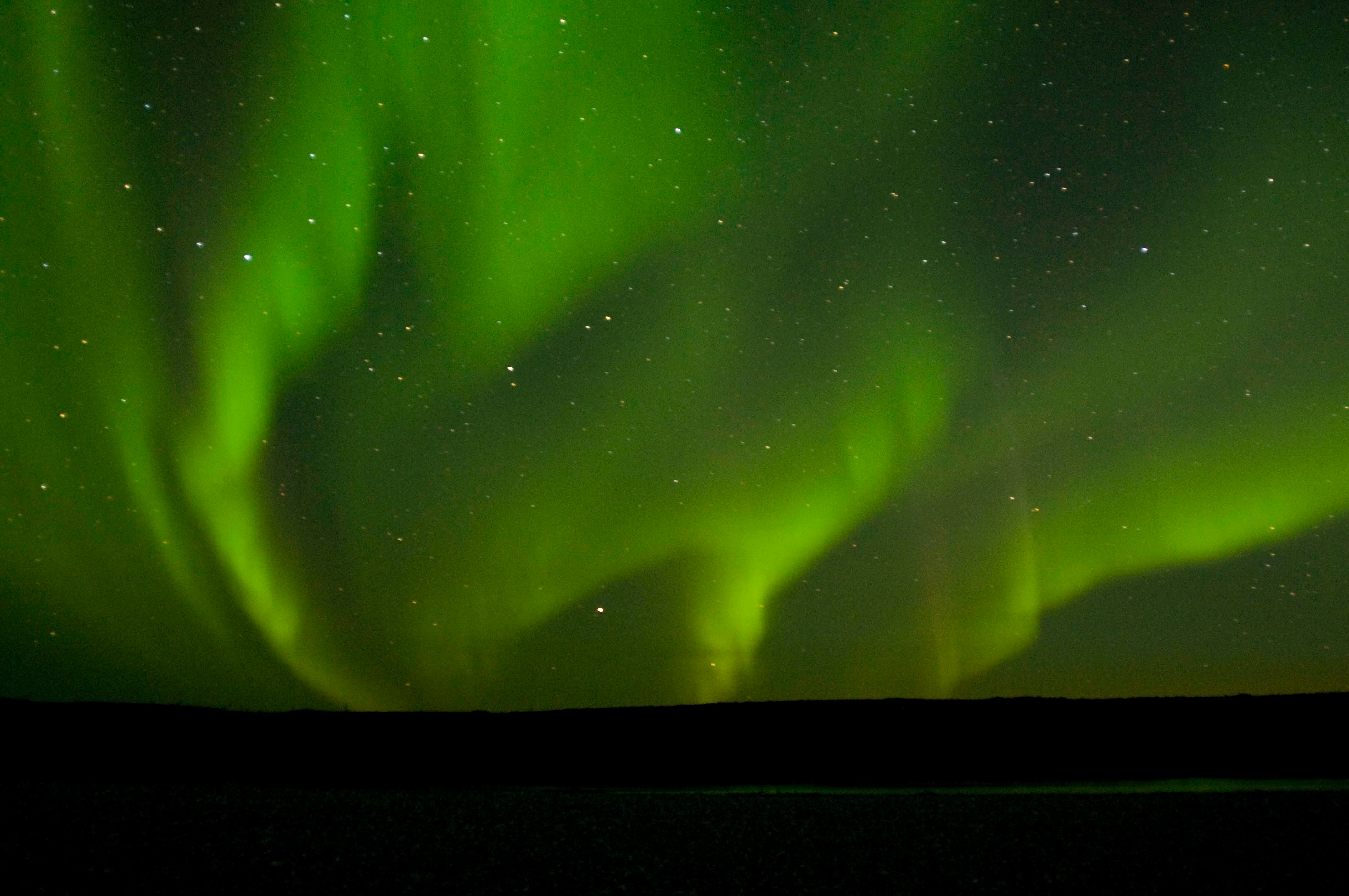
A huge spray of northern lights is reflected in a tiny sliver of water in the Noatak River. This image was captured in early September at 2:30 in the morning.
Credit: NPS Photo
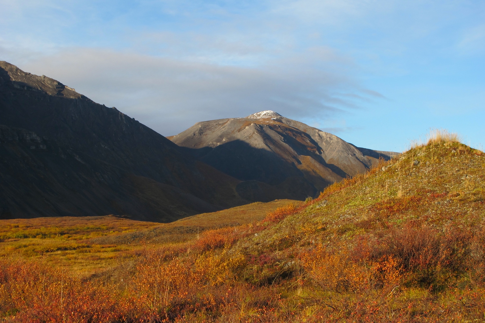
The famous golden hour near sunset on Copter Peak gives depth to the mountains and neon hues to the tundra.
Credit: NPS Photo
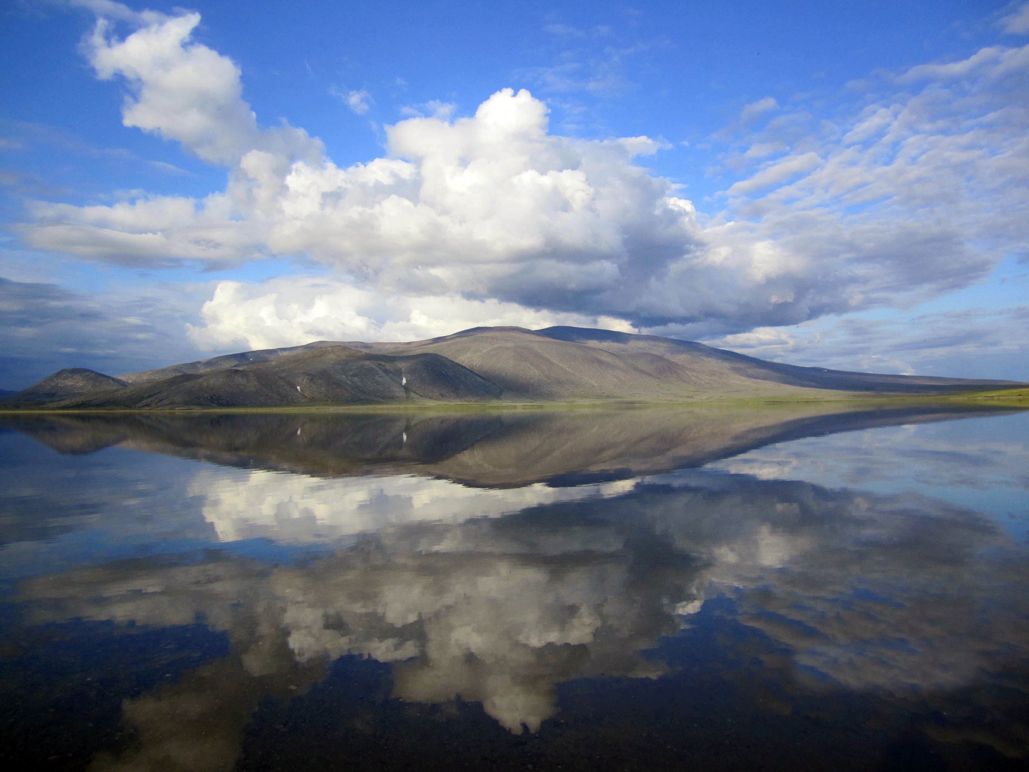
The Delong Mountains are flawlessly reflected in the clear, clean water of Desperation Lake in the northern part of Noatak National Preserve.
Credit: NPS Photo
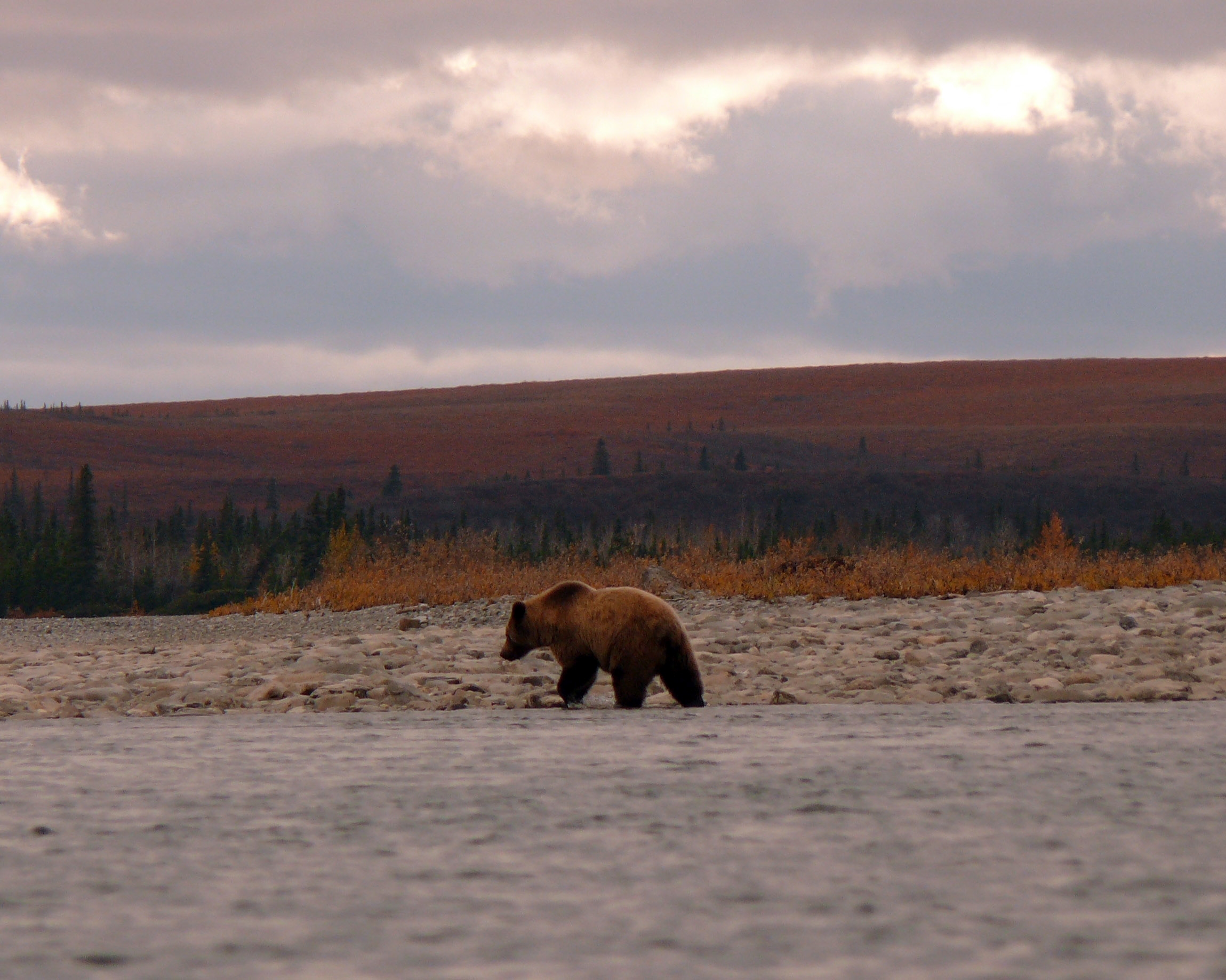
The profile of this grizzly on the Noatak River shows a nice example of the hump of muscle between it's shoulders. That muscle makes grizzlies good diggers.
Credit: NPS Photo
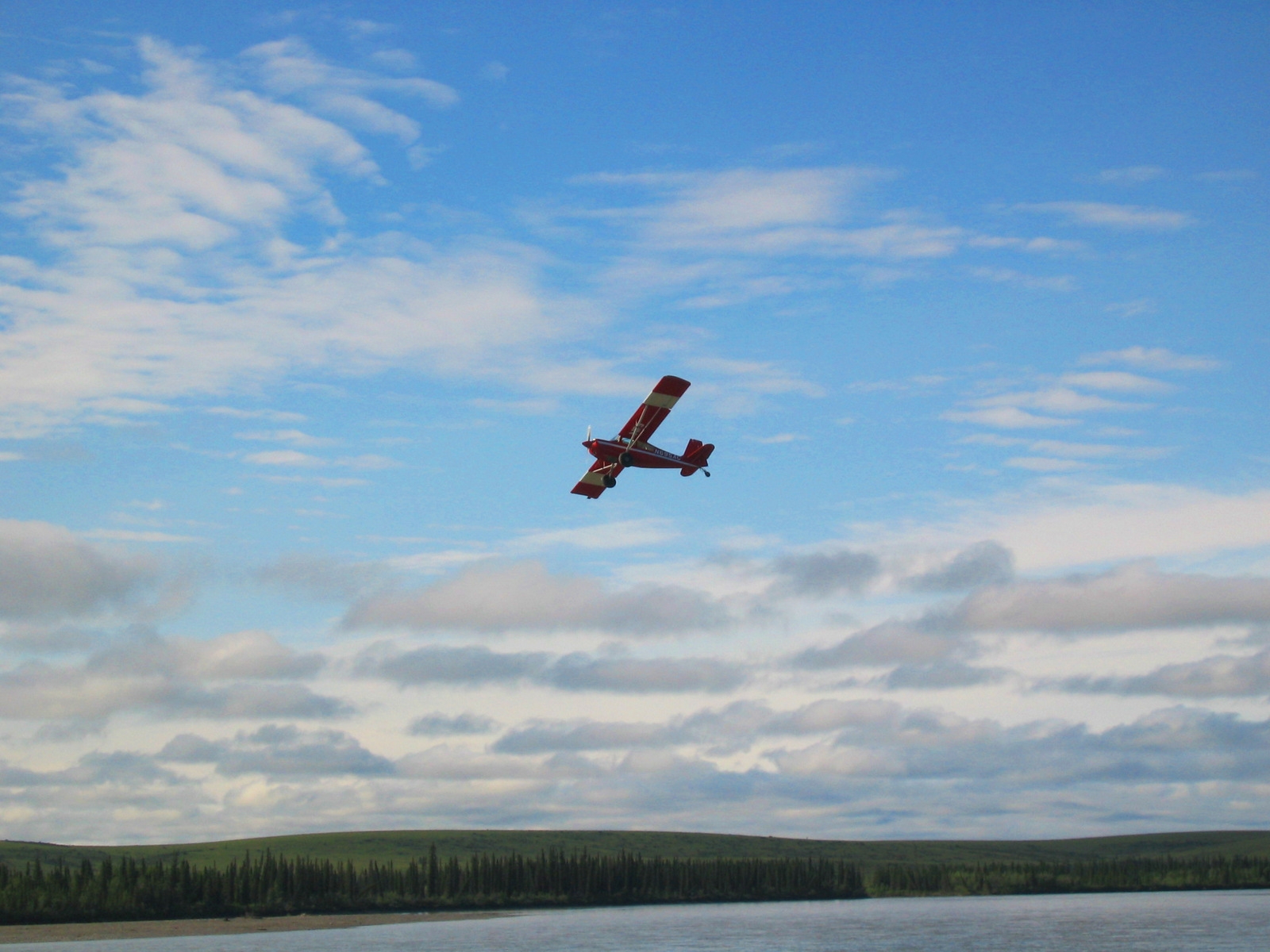
A National Park Service plane takes off from the Kelly Bar landing site at the confluence of the Kelly River and Noatak River
Credit: NPS Photo
Activities
Topics
Operating Hours
Entrance Fees
No entrance fees listed.
Entrance Passes
No entrance passes listed.
3-Day Weather Forecast
Tuesday, Feb 17

Moderate snow
High: -1.7°F | Low: -4.1°F
Humidity: 94%
Wind: 7.2 mph
Rain Chance: 73%
UV Index: 0.1
Sunrise: 09:47 AM
Sunset: 06:05 PM
Moon: New Moon (0%)
Visibility: 3 mi
Dew Point: -3.4°F
Cloud Cover: 73%
Pressure: N/A mb
Air Quality (PM2.5): N/A
Ozone: N/A
EPA Index: N/A
Wednesday, Feb 18
Moderate snow
High: 2.7°F | Low: -8.9°F
Humidity: 98%
Wind: 11.2 mph
Rain Chance: 69%
UV Index: 0.1
Sunrise: 09:42 AM
Sunset: 06:09 PM
Moon: Waxing Crescent (0%)
Visibility: 3 mi
Dew Point: -2.4°F
Cloud Cover: 69%
Pressure: N/A mb
Air Quality (PM2.5): N/A
Ozone: N/A
EPA Index: N/A
Thursday, Feb 19

Freezing fog
High: -12.7°F | Low: -22.9°F
Humidity: 99%
Wind: 6.7 mph
Rain Chance: 82%
UV Index: 0.1
Sunrise: 09:38 AM
Sunset: 06:13 PM
Moon: Waxing Crescent (3%)
Visibility: 2 mi
Dew Point: -14.1°F
Cloud Cover: 82%
Pressure: N/A mb
Air Quality (PM2.5): N/A
Ozone: N/A
EPA Index: N/A
Weather Alerts (4)
Blizzard Warning issued February 16 at 6:30PM AKST until February 19 at 3:00AM AKST by NWS Fairbanks AK
Effective: Feb 16, 2026 10:30pm
Expires: Feb 17, 2026 8:00pm
* WHAT...Blizzard conditions. Total snow accumulations between 4 and
9 inches. Winds gusting as high as 60 mph.
* WHERE...Baldwin Peninsula and Kivalina and Red Dog Dock.
* WHEN...Until 3 AM AKST Thursday.
* IMPACTS...Travel may be impacted. Areas of blowing snow could
significantly reduce visibility.
* ADDITIONAL DETAILS...Heaviest snowfall will be along the Baldwin
Peninsula. Whiteout conditions are expected along the coastline
with the worst conditions arriving Monday evening and continuing
through Tuesday night.
Winter Storm Warning issued February 16 at 6:30PM AKST until February 18 at 3:00PM AKST by NWS Fairbanks AK
Effective: Feb 16, 2026 10:30pm
Expires: Feb 17, 2026 8:00pm
* WHAT...Heavy snow. Total snow accumulations between 7 and 15
inches. Winds gusting as high as 35 mph.
* WHERE...South Slopes of the Western Brooks Range and Upper Kobuk
Valleys.
* WHEN...Until 3 PM AKST Wednesday.
* IMPACTS...Travel could be very difficult. Areas of blowing snow
could significantly reduce visibility.
* ADDITIONAL DETAILS...Blizzard or near blizzard conditions are
possible in Kobuk Valley Monday night through Wednesday afternoon.
Winter Weather Advisory issued February 16 at 6:30PM AKST until February 18 at 3:00PM AKST by NWS Fairbanks AK
Effective: Feb 16, 2026 10:30pm
Expires: Feb 17, 2026 8:00pm
* WHAT...Snow and blowing snow. Winds gusting as high as 45 mph.
Total snow accumulations between 1 and 3 inches.
* WHERE...Northern Seward Peninsula.
* WHEN...Until 3 PM AKST Wednesday.
* IMPACTS...Travel may be impacted.
* ADDITIONAL DETAILS...Blizzard or near blizzard conditions are
possible at times Monday evening through Tuesday night.
Winter Storm Warning issued February 16 at 6:30PM AKST until February 18 at 3:00PM AKST by NWS Fairbanks AK
Effective: Feb 16, 2026 10:30pm
Expires: Feb 17, 2026 8:00pm
* WHAT...Heavy snow. Total snow accumulations between 5 and 8
inches. Winds gusting as high as 50 mph.
* WHERE...Lower Kobuk Valley and Noatak Valley.
* WHEN...Until 3 PM AKST Wednesday.
* IMPACTS...Travel could be difficult. Areas of blowing snow could
significantly reduce visibility.
* ADDITIONAL DETAILS...Blizzard or near blizzard conditions are
possible in Kobuk and Noatak Valleys Monday night through
Wednesday afternoon.
Visitor Center & Contacts
📍 Physical Address:
171 3rd Ave
Kotzebue, AK 99752
🏤 Mailing Address:
PO Box 1029
Kotzebue, AK 99752
📞 Voice Phone: 9074423890
📞 Fax Phone: 9074428316
✉️ Email: wear_webmail@nps.gov