Oregon Caves National Monument & Preserve
Designation: National Monument & Preserve
Location: Oregon
📘 Park Overview
Deep within the Siskiyou Mountains are dark, twisting passages that await your discovery. Eons of acidic water seeping into marble rock created and decorated the wondrous “Marble Halls of Oregon.” Join a tour, get a taste of what caving is all about, and explore a mountain from the inside and out!
🌤 Weather Information
For current weather conditions visit https://forecast.weather.gov/MapClick.php?lat=42.07376224008719&lon=-123.3984375&site=mfr&smap=1&unit=0&lg=en&FcstType=text#.YCGJRWhKjIV
🚗 Directions
Take 199 to Cave Junction, Oregon. Turn onto OR-46 (a Chevron gas station is on the corner). Follow OR-46 for 20 miles to the Monument and Preserve.
Images
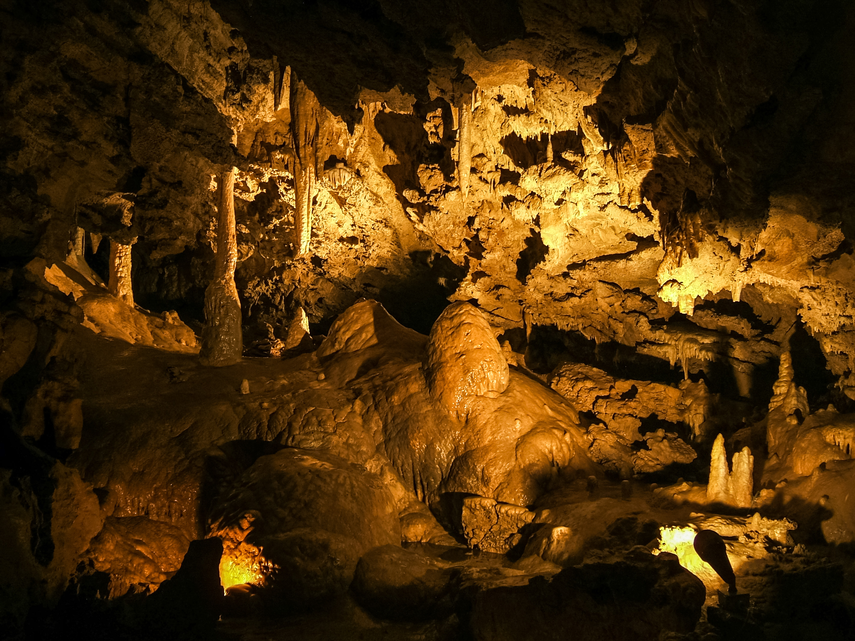
Miller's Chapel at Oregon Caves National Monument and Preserve
Credit: NPS
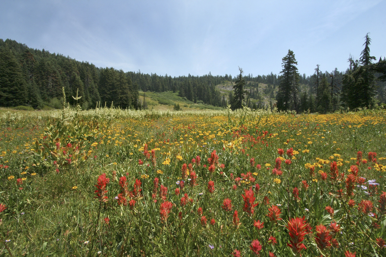
Mountain Meadows at Bigelow Lakes at Oregon Caves National Preserve
Credit: NPS
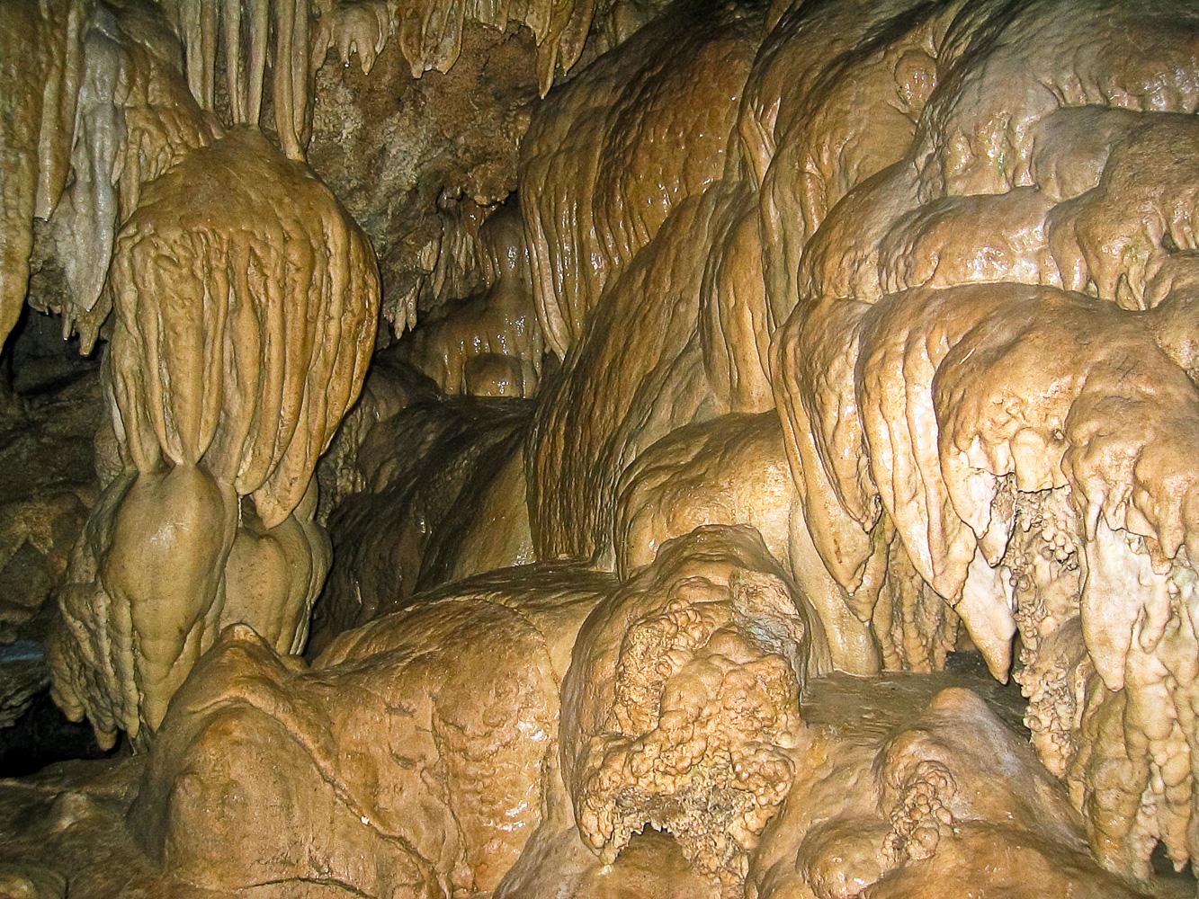
Speliothems in the Banana Grove room, Oregon Caves.
Credit: NPS
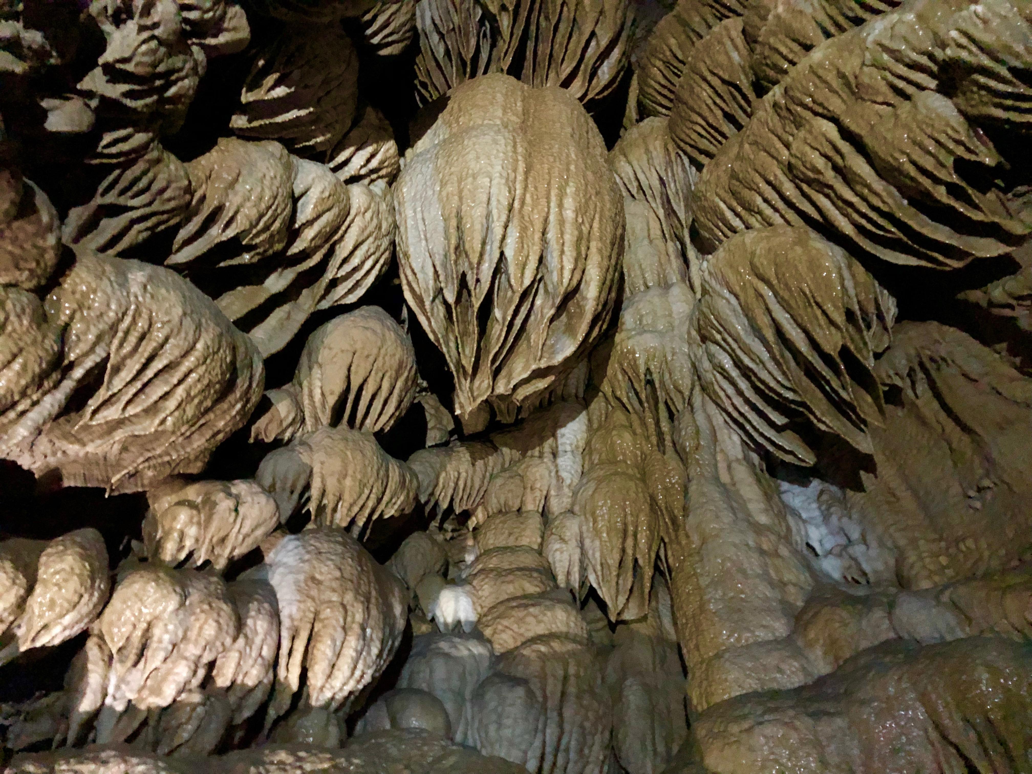
Paradise Lost
Credit: NPS Photo/ Summer Vogel
Activities
Topics
Operating Hours
Entrance Fees
No entrance fees listed.
Entrance Passes
No entrance passes listed.
3-Day Weather Forecast
Saturday, Aug 1

Sunny
High: 90°F | Low: 57°F
Humidity: 44%
Wind: 6.3 mph
Rain Chance: 1%
UV Index: 9.1
Sunrise: 06:07 AM
Sunset: 08:33 PM
Moon: Waning Gibbous (83%)
Visibility: 6 mi
Dew Point: 60.9°F
Cloud Cover: 1%
Pressure: N/A mb
Air Quality (PM2.5): N/A
Ozone: N/A
EPA Index: N/A
Sunday, Aug 2
Sunny
High: 82.3°F | Low: 40.6°F
Humidity: 48%
Wind: 9.6 mph
Rain Chance: 2%
UV Index: 9.6
Sunrise: 06:08 AM
Sunset: 08:32 PM
Moon: Waning Gibbous (75%)
Visibility: 5 mi
Dew Point: 53.3°F
Cloud Cover: 2%
Pressure: N/A mb
Air Quality (PM2.5): N/A
Ozone: N/A
EPA Index: N/A
Monday, Aug 3
Sunny
High: 92.4°F | Low: 41°F
Humidity: 43%
Wind: 9.2 mph
Rain Chance: 1%
UV Index: 9.6
Sunrise: 06:09 AM
Sunset: 08:30 PM
Moon: Last Quarter (65%)
Visibility: 6 mi
Dew Point: 53.5°F
Cloud Cover: 1%
Pressure: N/A mb
Air Quality (PM2.5): N/A
Ozone: N/A
EPA Index: N/A
Park Alerts
Park Events
Pulling with Purpose
We need your help! Join Park Rangers at Oregon Caves to assist with invasive species removal in a sub-alpine meadow. This event involves a moderately strenuous 1-mile hike over uneven terrain. Bring good hiking shoes, sunscreen, water, your lunch and, if you have them, gardening gloves. Oregon Caves will provide all other necessary equipment and training.
Location: Arrive at the Oregon Caves Visitor Center (19000 Caves Highway) before 9am and look for Park Rangers. You will receive safety instructions and then we will head to Bigelow Meadow for Invasive Species Removal.
Date: Aug 8, 2026 12:00am to Aug 8, 2026 12:00am
Paid Event
Visitor Center & Contacts
📍 Physical Address:
21000 Caves Hwy
Cave Junction, OR 97523
🏤 Mailing Address:
19000 Caves Hwy
Cave Junction, OR 97523
📞 Voice Phone: 5415925125
📞 Fax Phone: 5415923981
✉️ Email: orca_information@nps.gov