← Back to Search

Ozark National Scenic Riverways

Designation: National Scenic Riverways

Location: Missouri

Visit Official Park Website

📘 Park Overview

Ozark National Scenic Riverways is the first national park area to protect a river system. The Current and Jacks Fork rivers are two of the finest floating rivers found anywhere. Spring-fed, cold and clear: they are a delight to canoe, swim, boat, or fish. Besides these two famous rivers, the park is home to hundreds of freshwater springs, caves, trails, and historic sites such as Alley Mill.

🌤 Weather Information

Ozark National Scenic Riverways is located in southeastern Missouri. Summer temperatures generally range from 75-100 degrees (°F) with high humidity. Winter temperatures generally range from 0-50 (°F) degrees with periods of intermittent freezing and snow. Periods of excessive heat are typical in summer, while heavy rains or flooding can occur throughout the year. Be sure to plan accordingly when camping, hiking, or floating.

🚗 Directions

Visitor centers can be found at the following locations: Big Spring Entrance Station - 3 miles south of Van Buren on Highway 103 Alley Mill & Store - 12185 Alley Hollow Road Round Spring Ranger Station - 13209 Round Spring Campground Rd Administrative offices for Ozark National Scenic Riverways are located at 404 Watercress Drive, Van Buren, MO 63965. This location does not offer a visitor center - tourists should instead go to the Big Spring Entrance Station.

Images

Sunset picture with high vantage point overlooking river with fall colors and sun setting in distanc

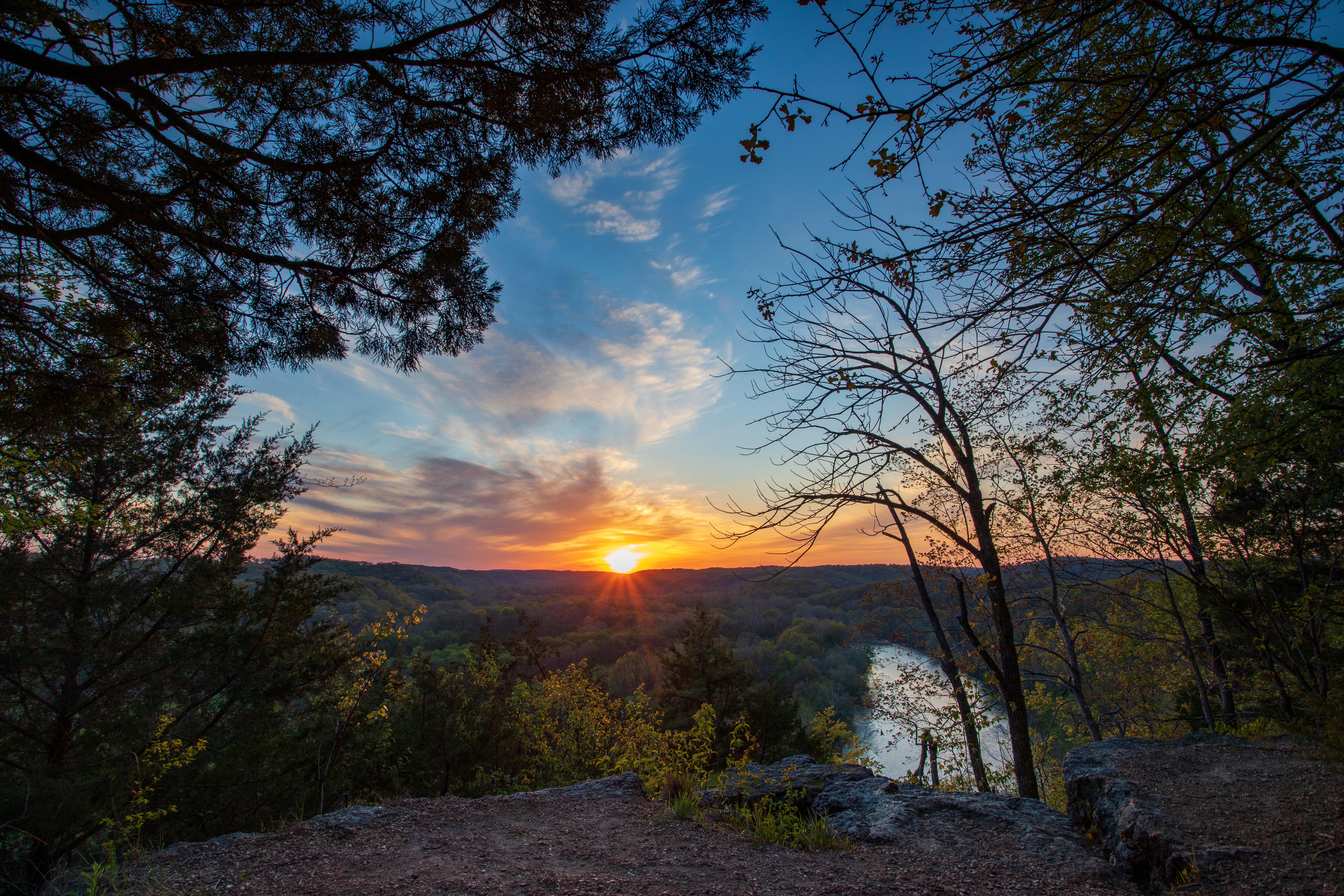
Ozark National Scenic Riverways has some spectacular scenery.

Credit: Brock Davis

A rocky "shut-in" with a modest waterfall.

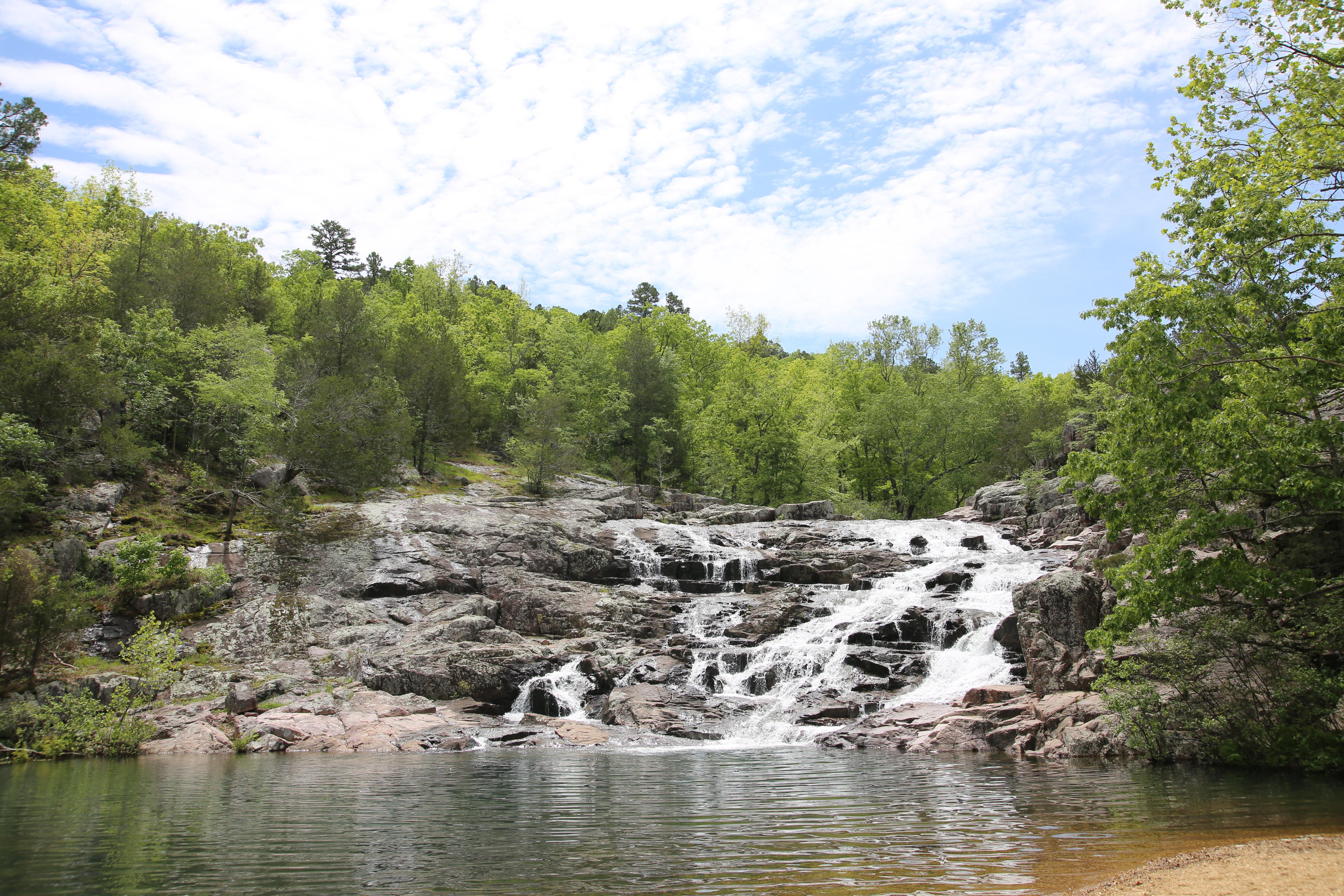
Rocky Falls is a popular picnic area and swimming hole located near the center of Ozark National Scenic Riverways.

Credit: NPS Photo / Wil Marischen

A woman paddles down a river while wearing a personal flotation device.

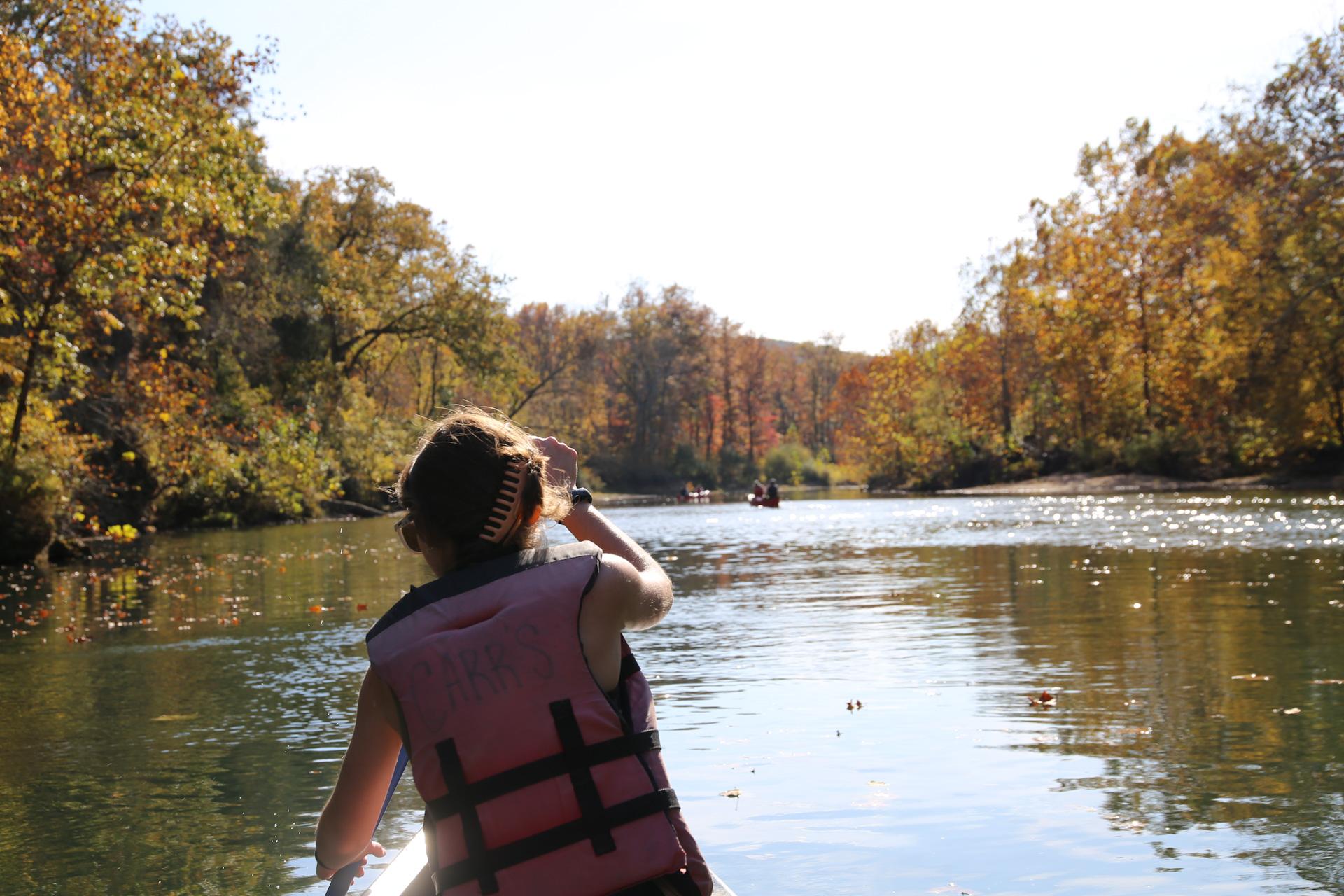
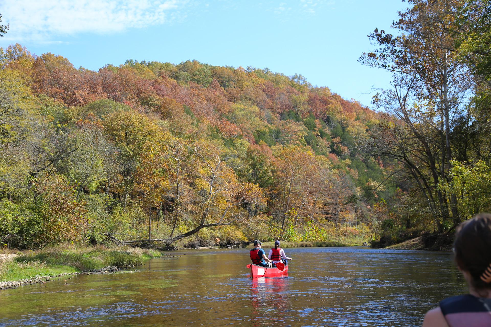
Floating the Current and Jacks Fork Rivers is the perfect way to enjoy the Ozarks, no matter the season.

Credit: Courtesy of Wil Marischen

fall colors on leaves of trees surrounding a creek with an old wooden mill on the right

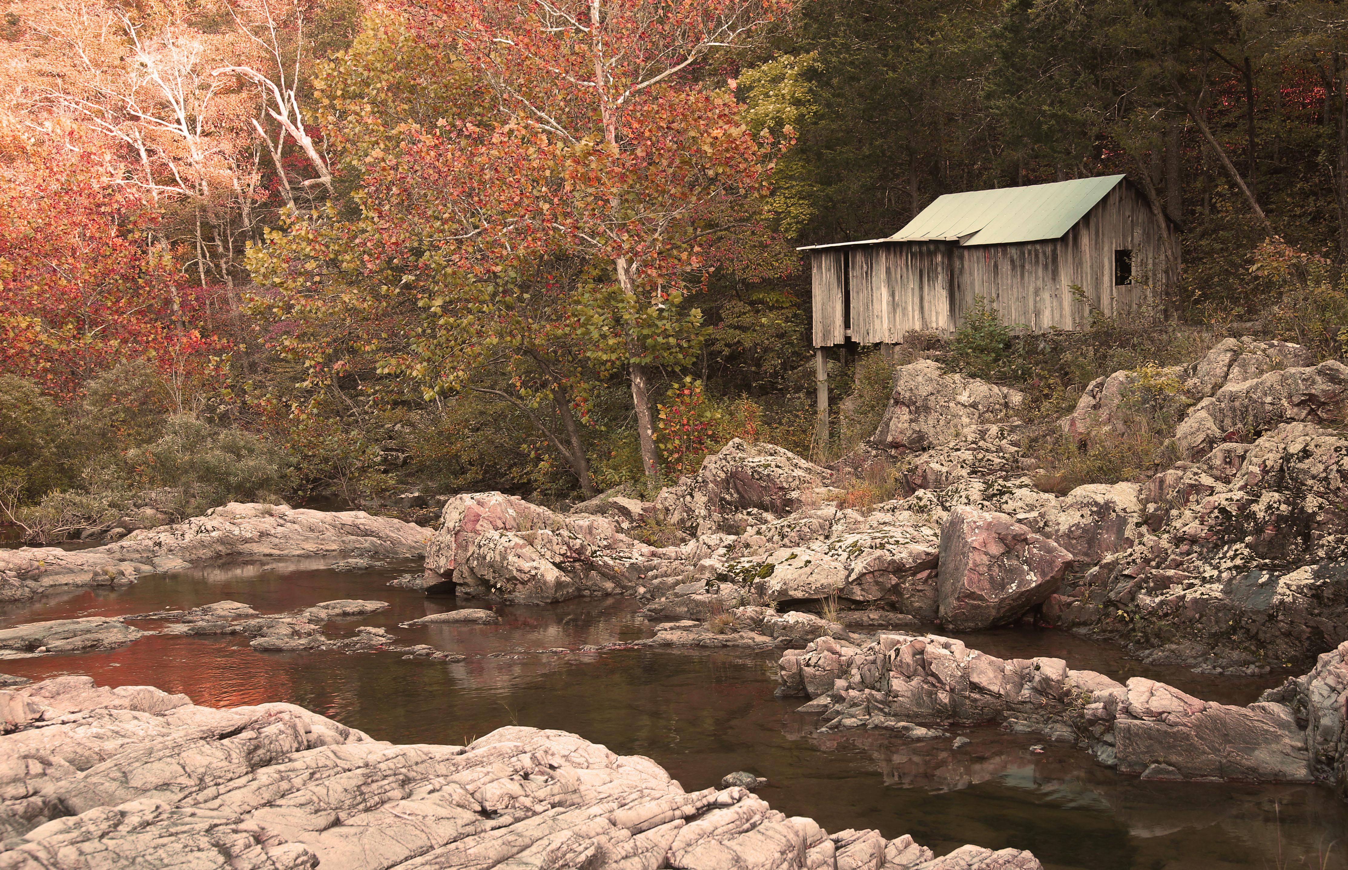
Klepzig Mill is a little off the beaten path but worth the trip.

Credit: NPS Photo

a red mill with snow on roof with a stream emanating from it.

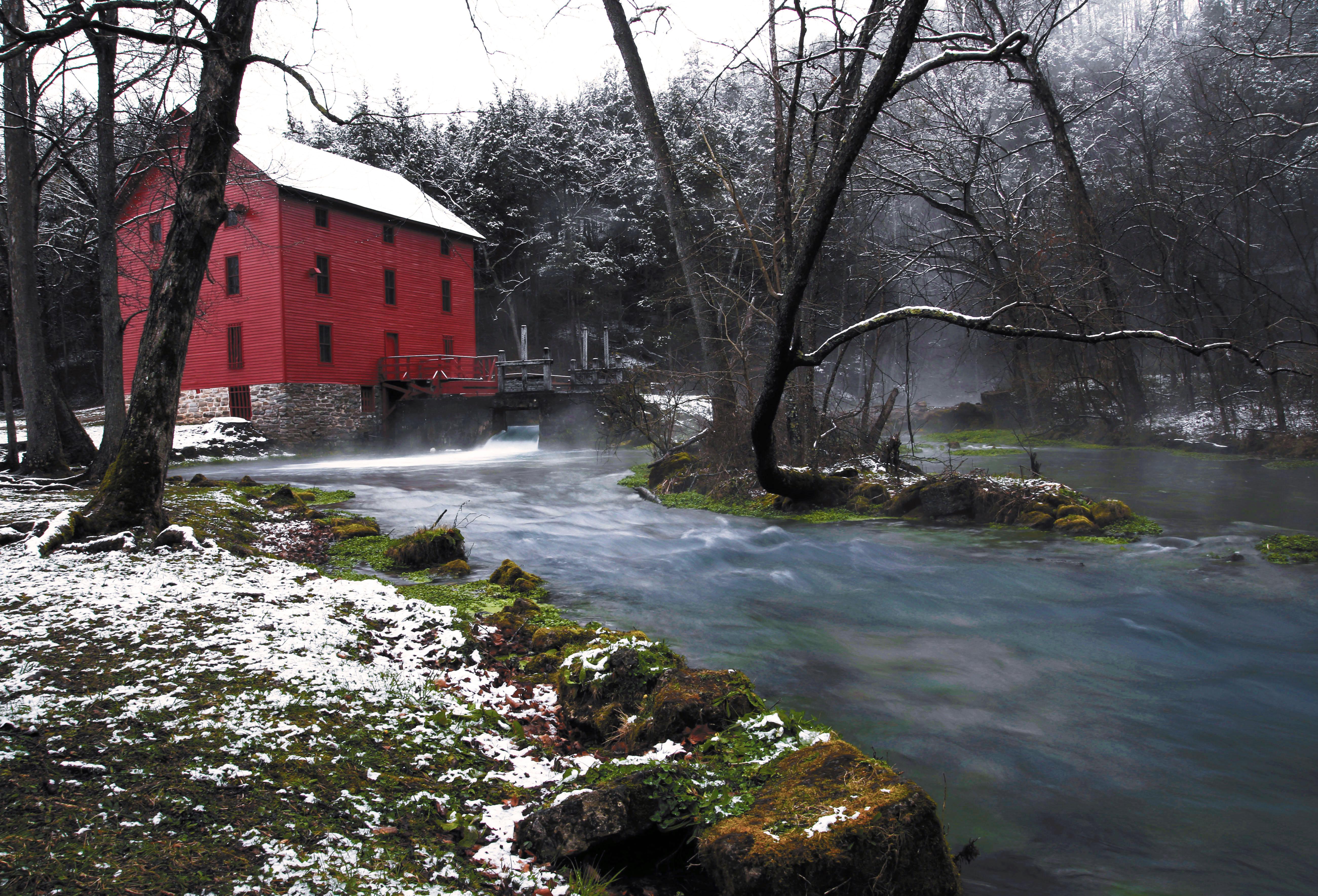
Alley Mill is a popular destination.

Credit: NPS Photo

brown rocks with water flowing over like a waterfall

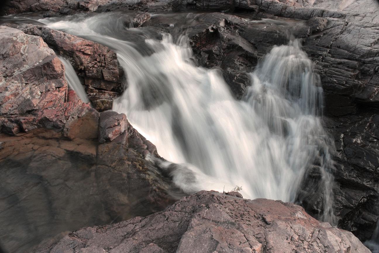
Klepzig Mill has a series of shut-ins along the creek

Credit: NPS Photo

A sunrise photo with blue turbulent water and a algae colored rock with trees overhanging

Big Spring produces more than 250 million gallons of water per day.

Credit: NPS Photo

looking down through large brown/grey/purple boulders with creek in middle and forest in distance

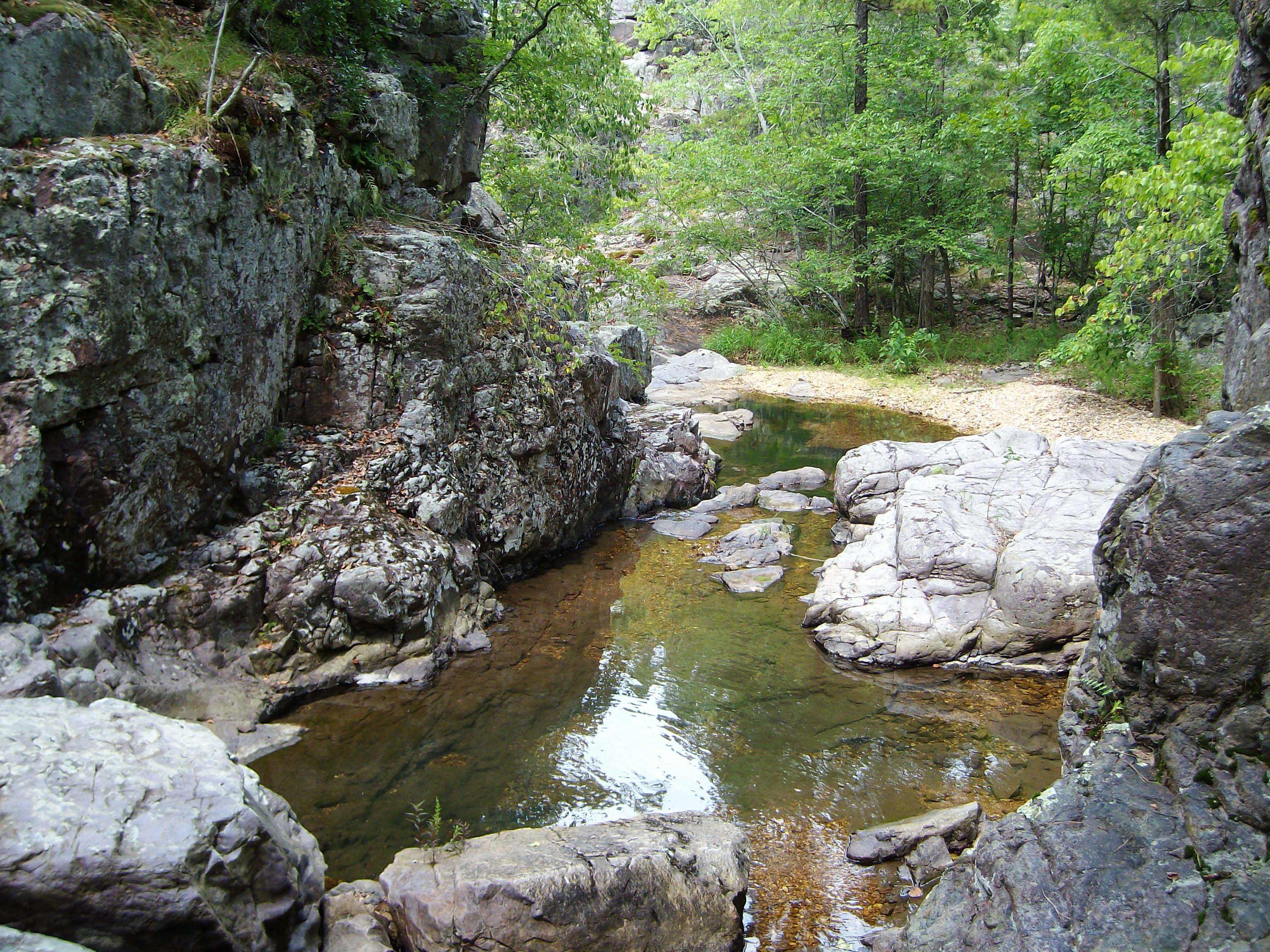
Prairie Hollow Gorge is located near the Two Rivers junction, off State Route V.

Credit: NPS Photo/JoAnn Miller

A canoe floats down a river surrounded in fall color.

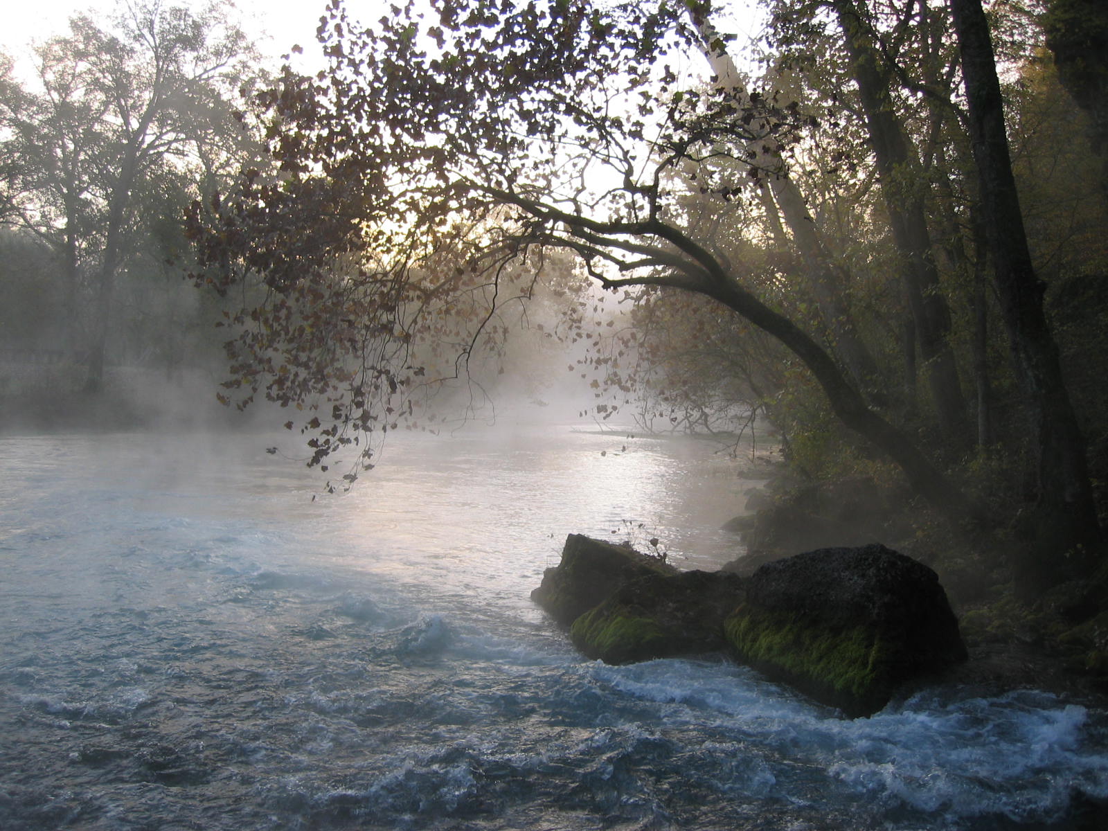
The Current River is one of the finest recreational rivers in the entire country.

Credit: Courtesy of Wil Marischen

A red canoe on gravel bar with clear blue stream behind and green forest

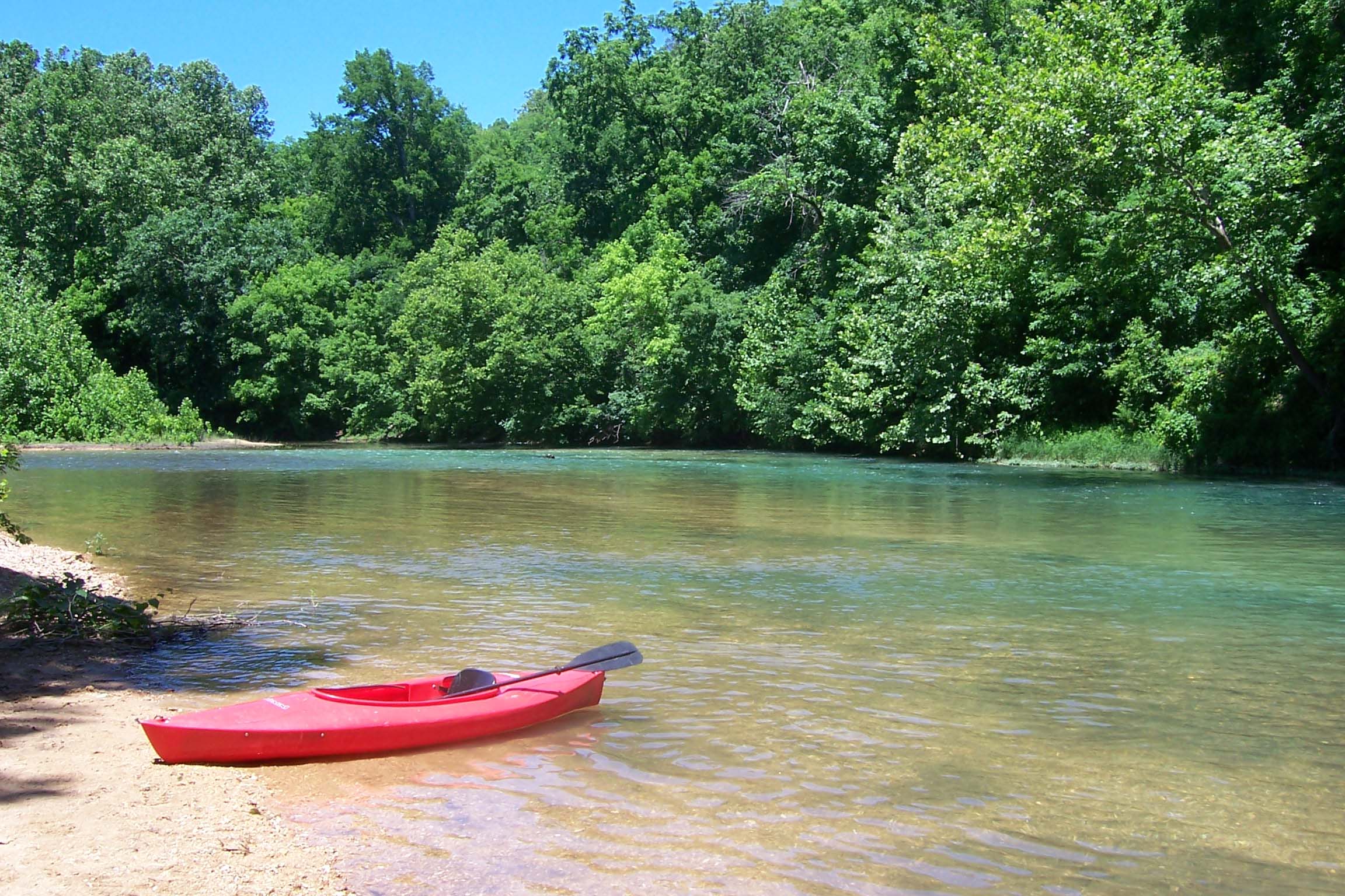
The clear water of the Current River is perfect for floating.

Credit: NPS Photo/JoAnn Miller

Activities

Topics

Operating Hours

Sunday
All Day
Monday
All Day
Tuesday
All Day
Wednesday
All Day
Thursday
All Day
Friday
All Day
Saturday
All Day

Entrance Fees

No entrance fees listed.

Entrance Passes

No entrance passes listed.

3-Day Weather Forecast

Wednesday, Mar 11

Heavy rain

Heavy rain

High: 66.4°F | Low: 41.5°F

Humidity: 87%

Wind: 15.4 mph

Rain Chance: 88%

UV Index: 0.2

Sunrise: 07:22 AM

Sunset: 07:09 PM

Moon: Last Quarter (54%)

Visibility: 5 mi

Dew Point: 54.2°F

Cloud Cover: 88%

Pressure: N/A mb

Air Quality (PM2.5): N/A

Ozone: N/A

EPA Index: N/A

Thursday, Mar 12

Sunny

Sunny

High: 55.4°F | Low: 36.7°F

Humidity: 49%

Wind: 9.2 mph

Rain Chance: 0%

UV Index: 1.3

Sunrise: 07:20 AM

Sunset: 07:10 PM

Moon: Waning Crescent (44%)

Visibility: 6 mi

Dew Point: 35.6°F

Cloud Cover: 0%

Pressure: N/A mb

Air Quality (PM2.5): N/A

Ozone: N/A

EPA Index: N/A

Friday, Mar 13

Sunny

Sunny

High: 65.3°F | Low: 43.2°F

Humidity: 55%

Wind: 12.5 mph

Rain Chance: 0%

UV Index: 0

Sunrise: 07:19 AM

Sunset: 07:11 PM

Moon: Waning Crescent (35%)

Visibility: 6 mi

Dew Point: 43.9°F

Cloud Cover: 0%

Pressure: N/A mb

Air Quality (PM2.5): N/A

Ozone: N/A

EPA Index: N/A

Park Alerts

Reservations Required for Developed Campgrounds Information
As of January 1, 2025, ALL developed campsites will be available through reservation ONLY. These include Pulltite, Round Spring, Alley Spring, Big Spring, Two Rivers, and Akers. Reservations must be made through recreation.gov (online or by calling).

More Info

Campground Closures Park Closure
The following campgrounds are closed pending repairs: Pulltite (sites 1-13) and Dee Murray. Day use areas remain open for visitors.
All hiking trails, day-use areas, and campgrounds south of Big Spring will be closed January 16/17 Park Closure
MDC and USDA are conducting feral hog culling operation in the ONSR Jan 16/17. All hiking trails, day-use areas, and campgrounds from mouth of Big Spring to Gooseneck, on both sides of the Current River, will be closed for health and public safety.

More Info

Campground Closures Park Closure
The following campgrounds are closed pending repairs: Pulltite (sites 1-13) and Dee Murray. Day use areas remain open for visitors.
Pulltite Campground Partial Closure Park Closure
Sites 1-13 remain closed. All other sites are open. Sites are available by reservation only - book online at https://www.recreation.gov/camping/campgrounds/234357

More Info

Peavine Road Closed Park Closure
Peavine Road near Big Spring will be closed for paving beginning 7/28 at noon and will remain closed for several weeks. Please use Highway 103 to reach all destinations in the Big Spring area.
Peavine Road Closed Park Closure
Peavine Road near Big Spring will be closed for paving beginning 7/28 at noon and will remain closed for several weeks. Please use Highway 103 to reach all destinations in the Big Spring area.
Round Spring - September Paving Work Park Closure
Paving work will be done in the Round Spring area throughout the month of September. Currently, the parking area at the pavilion is closed. Closure of the electric sites (E1-E6) in the campground will begin Monday, 9/8.

More Info

Log Yard: Water off at spigot until Memorial Day 2025 Caution
Log Yard: Water off at spigot until Memorial Day 2025
Peavine Road Closed Starting July 9 for Paving Park Closure
Peavine Road will be closed to thru traffic starting July 9 while the road is being paved. Big Spring Campground, the boat ramp, picnic pavilions, and Big Spring itself will remain accessible via Hwy 103. Thank you for your patience.
Pulltite Campground Partial Closure Park Closure
Sites 1-13 remain closed. All other sites are open. Sites are available by reservation only - book online at https://www.recreation.gov/camping/campgrounds/234357

More Info

Big Spring Ridge Prescribed Burn 3-8-17 Information
This prescribed burn encompasses 630 acres and is located south of Van Buren off State Highway 103 in Carter County. The hiking trails around Big Spring and along the Spring Branch could be subject to closure during periods of the prescribed burn.
River Ferry at Akers (on State Highway K) CLOSED until further notice Caution
The Akers Ferry on State Highway K will not be in service until further notice.
Portions of Big Spring Area Temporarily Closed December 5 -7, 2025 Park Closure
Managed deer hunt being conducted: These closures help ensure public safety during these activities. Big Spring Campground, all trails in the Big Spring area and areas around Peavine Road- CLOSED during this managed hunt. Big Spring and the boat ramp will remain open.
Information About River Closures
For the most up-to-date information about river closures during flood conditions, please visit our Facebook page! Click the Facebook link at the bottom of the home page. No Facebook? Contact park headquarters at 573-323-4236 or dispatch at 1-844-460-3604.
Scan & Pay Required for Backcountry Campgrounds Information
Starting April 15, 2025, "backcountry" campgrounds will only accept payment through Scan & Pay, on the recreation.gov mobile app. While the app works offline, visitors should download the app and set up their account beforehand. Cell service is limited.

More Info

River Ferry at Akers (on State Highway K) CLOSED until further notice Caution
The Akers Ferry on State Highway K will not be in service until further notice.
Scan & Pay Required for Backcountry Campgrounds Information
Starting April 15, 2025, "backcountry" campgrounds will only accept payment through Scan & Pay, on the recreation.gov mobile app. While the app works offline, visitors should download the app and set up their account beforehand. Cell service is limited.

More Info

Round Spring - September Paving Work Park Closure
Paving work will be done in the Round Spring area throughout the month of September. Expect closures in various locations throughout the month. Check this alert or the park Facebook page for updates.

More Info

Reservations Required for All Campgrounds Information
As of January 1, 2025, ALL developed campsites will be available through reservation ONLY. These include Pulltite, Round Spring, Alley Spring, Big Spring, Two Rivers, and Akers. Reservations must be made through recreation.gov (online or by calling).

More Info

Campbell Point/Beaver Pond Prescribed Burn 3-9-17 Information
ONSR is conducting the Campbell Point/Beaver Pond Prescribed Burn. Prescribed burn encompasses 540 acres and is located on the east side of the Current River, across from Big Spring in Carter County. NPS Road 123 (aka Brown’s Road) may be closed.

Visitor Center & Contacts

📍 Physical Address:
Multiple locations - Alley Spring Visitor Center: 12185 Alley Hollow Road, Eminence, MO 65466
Big Spring Entrance Station: Hwy 103, Van Buren, MO 63965
Van Buren, MO 63965

🏤 Mailing Address:
P.O. Box 490
Van Buren, MO 63965

📞 Voice Phone: (573) 323-4236

📞 Fax Phone: (573) 323-8010

✉️ Email: ozar_interpretation@nps.gov

Park Location


👏 Fun Fact
Loading fun fact...