Pictured Rocks National Lakeshore
Designation: National Lakeshore
Location: Michigan
📘 Park Overview
Sandstone cliffs, beaches, waterfalls, sand dunes, inland lakes, deep forest, and wild shoreline beckon you to visit Pictured Rocks National Lakeshore. The power of Lake Superior shapes the park's coastal features and affects every ecosystem, creating a unique landscape to explore. Hiking, camping, sightseeing, and four-season outdoor opportunities abound.
🌤 Weather Information
Summers are pleasant with the average highs in June, July, and August in the 70s°F, and lows in the low 50s°F. The coldest months are December through March with average highs of 25°F to 32°F, and average lows in the teens. Annual precipitation averages 31 inches; average annual snowfall is about 140 inches, although winters with more than 200 inches are not uncommon. Snow generally covers the ground from late November through late April.
🚗 Directions
Pictured Rocks NL is located on the south shore of Lake Superior in Michigan's Upper Peninsula, between the towns of Munising (west) and Grand Marais (east). Access the west side of the park via Michigan highways M-28 and M-94 to Munising. State highway M-77 leads to Grand Marais on the east side. Alger County Road H-58 runs parallel and through the park, providing access to spur roads that lead to scenic overlooks, trailheads, campgrounds, beaches, etc. Most park roads are closed in winter due to snow.
Images
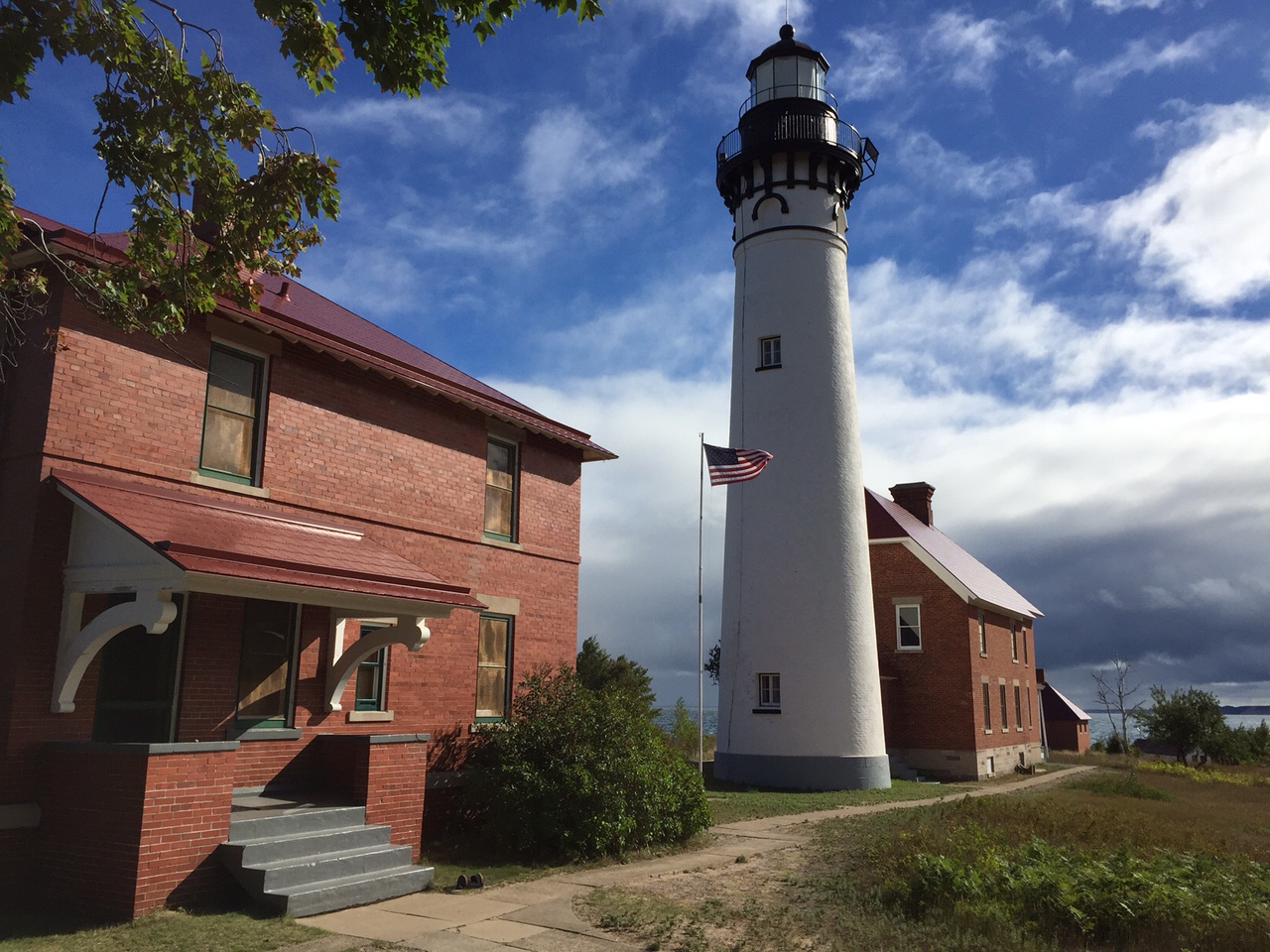
Au Sable Lighthouse and light keeper's quarters
Credit: NPS Photo
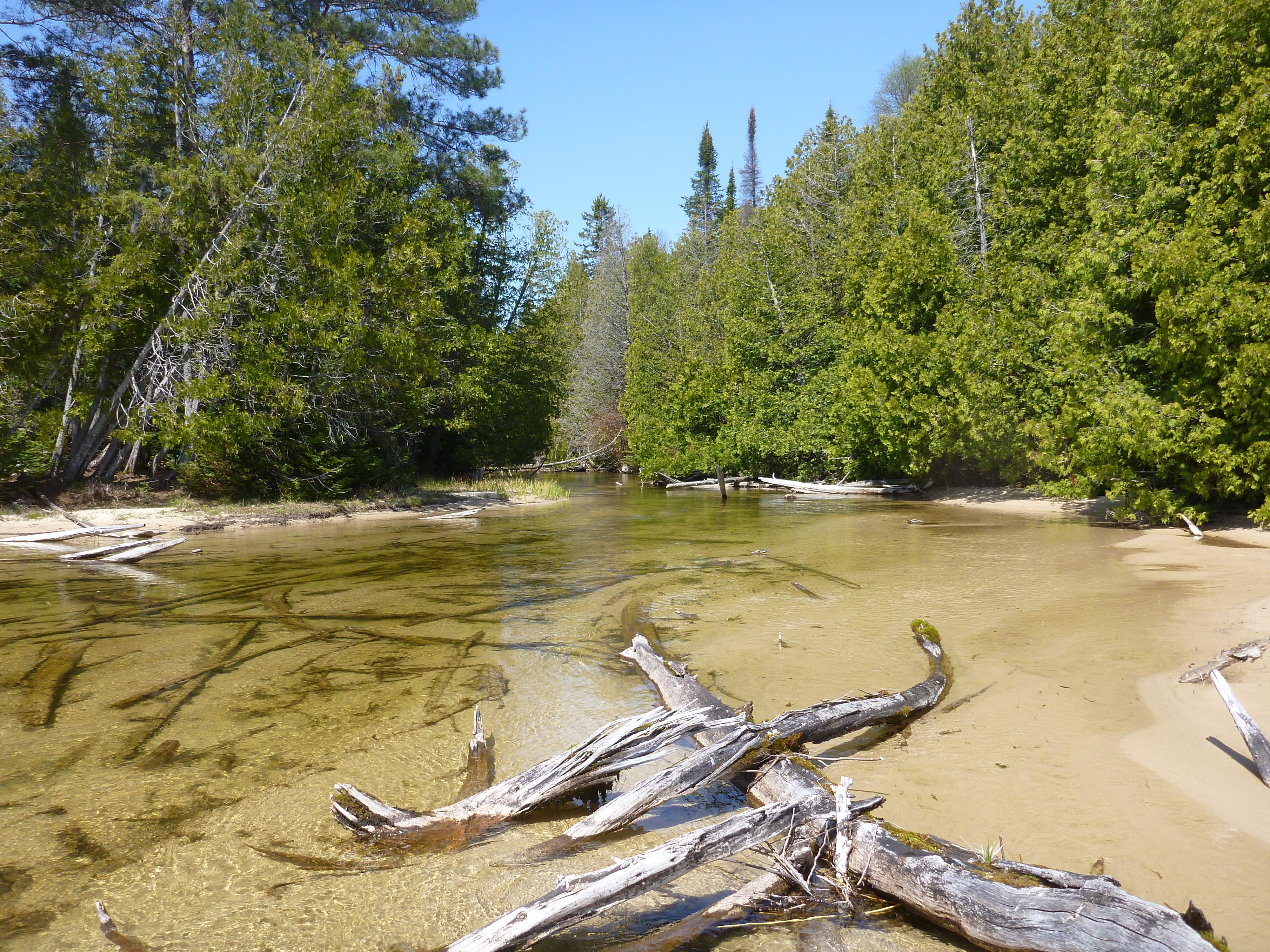
Shallow creek in the Beaver Basin Wilderness
Credit: NPS Photo
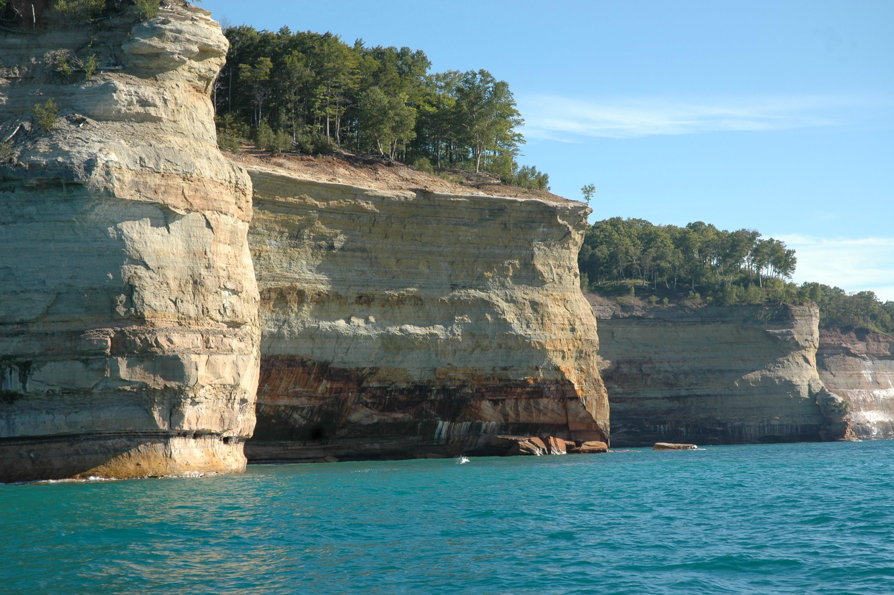
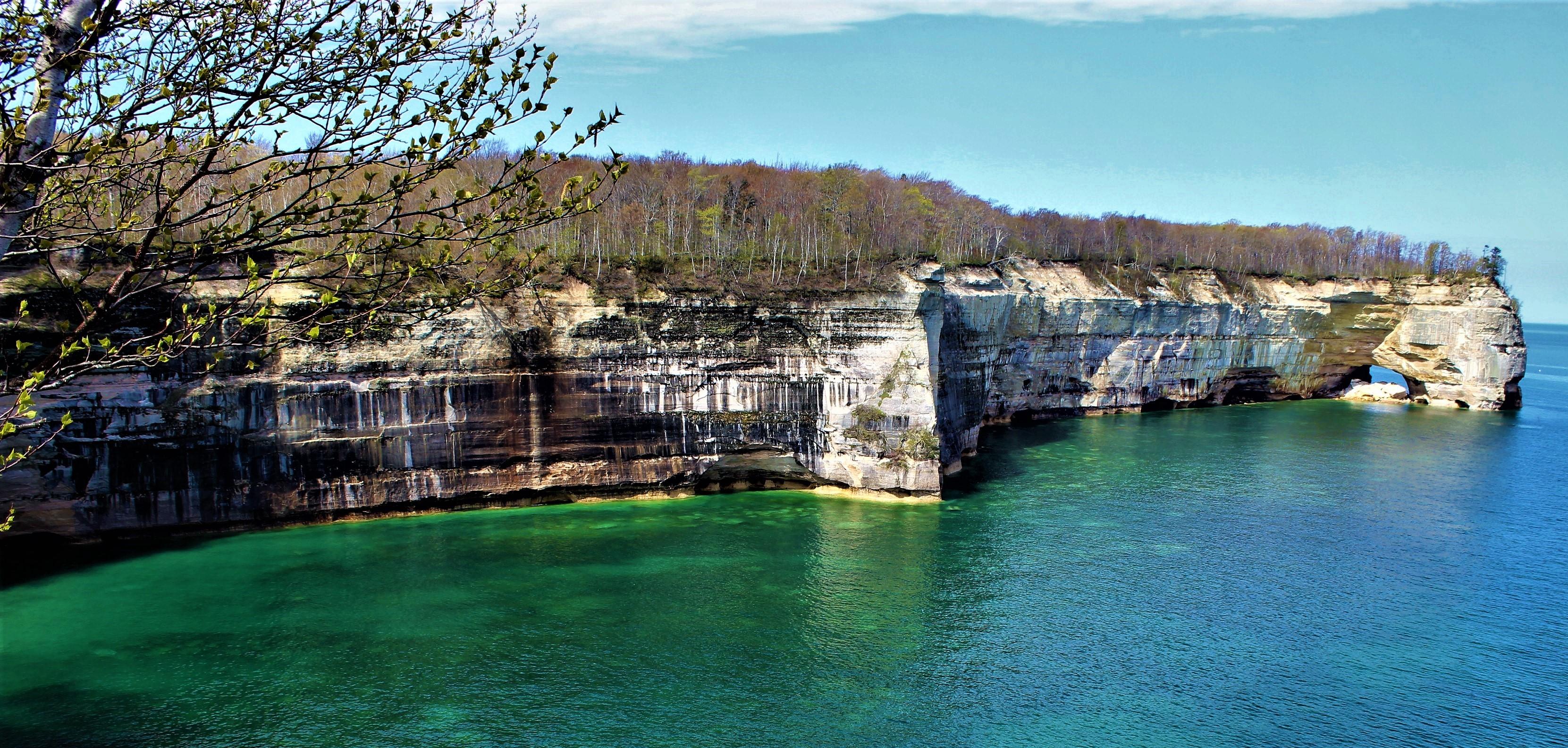
15 miles of carved and colorful cliffs along the Lake Superior shoreine.
Credit: NPS Photos
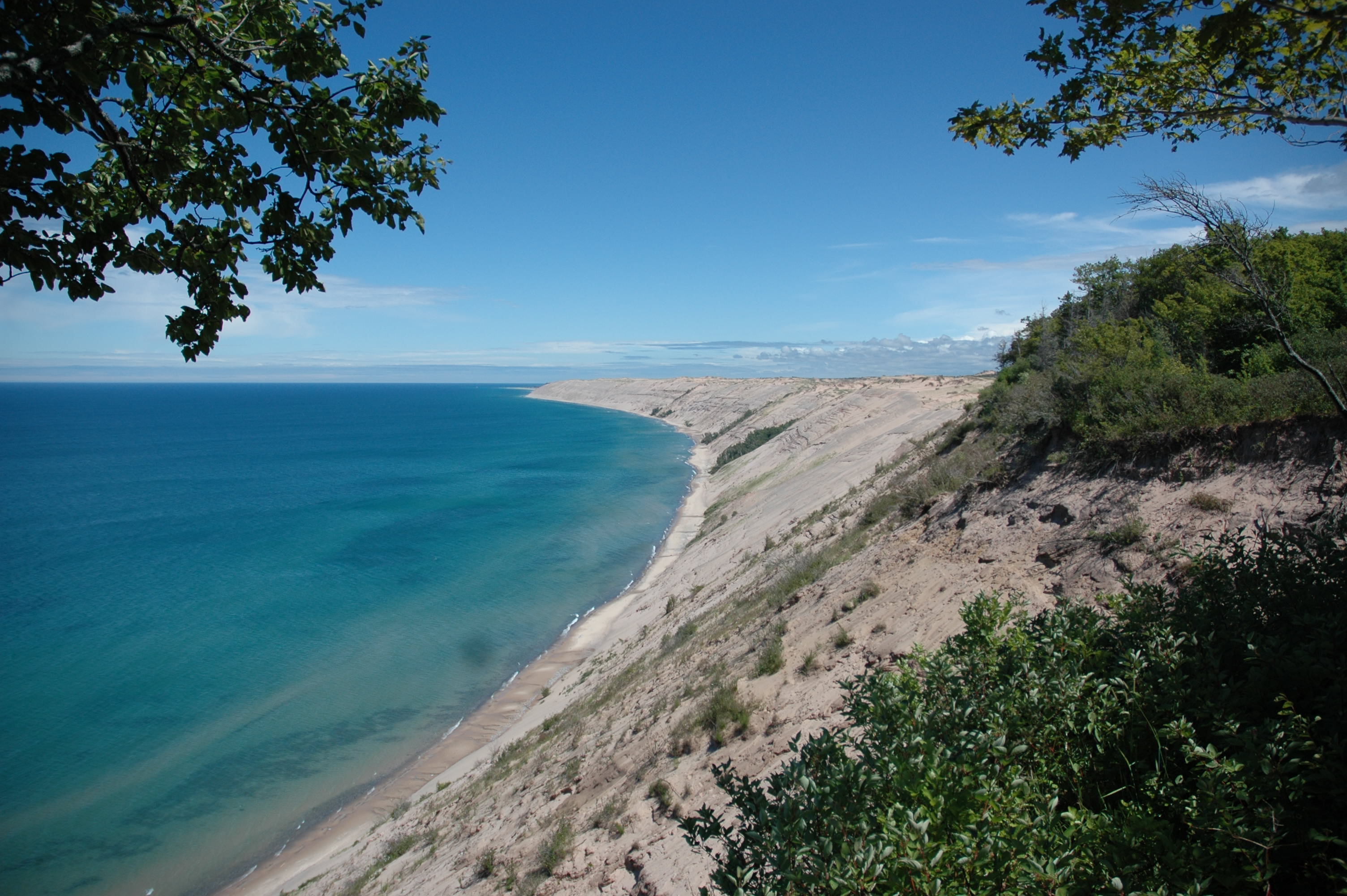
The Grand Sable Dunes rise up 300 feet from Lake Superior.
Credit: NPS Photo
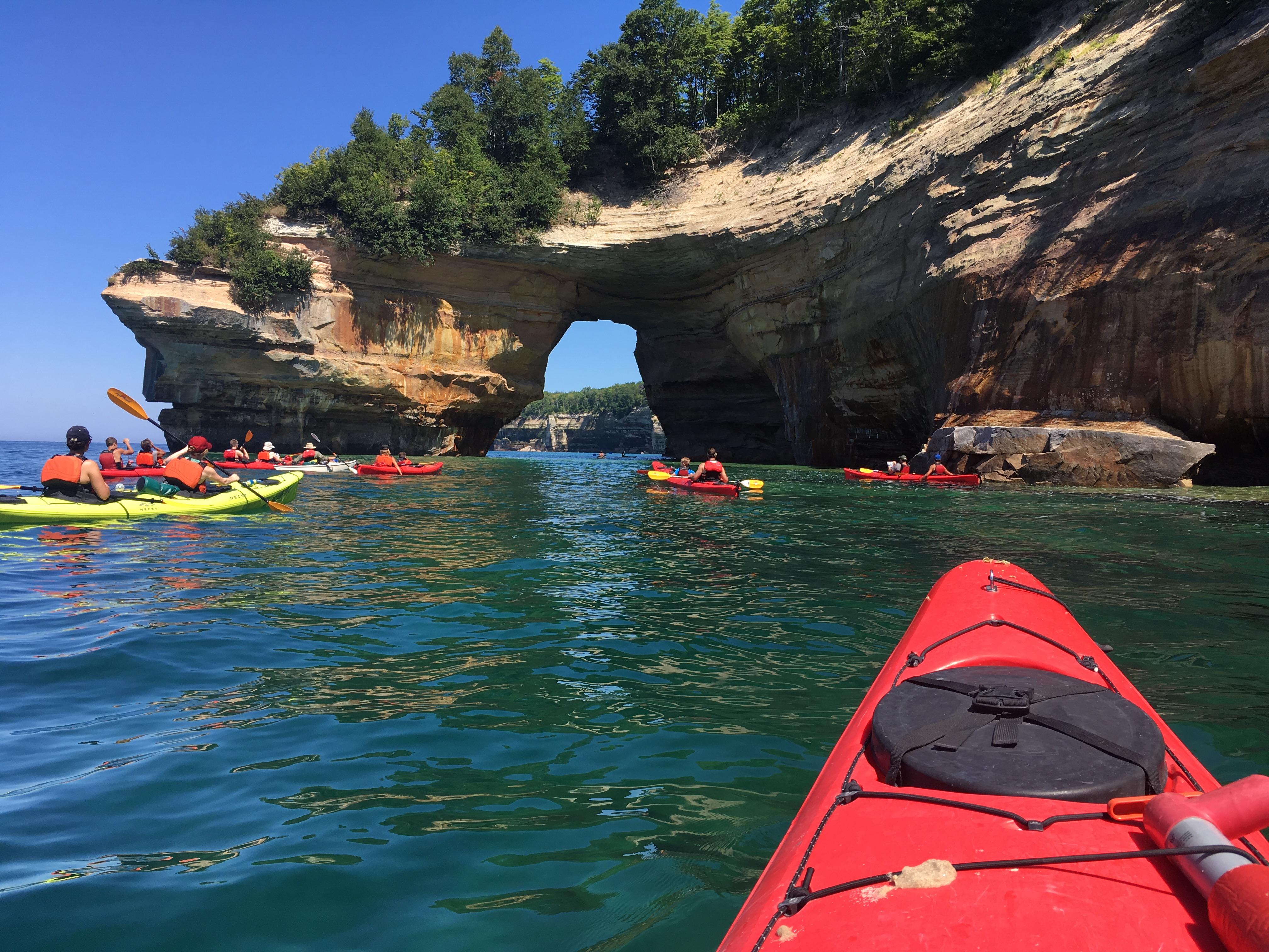
Kayakers near Lovers Leap
Credit: NPS Photos
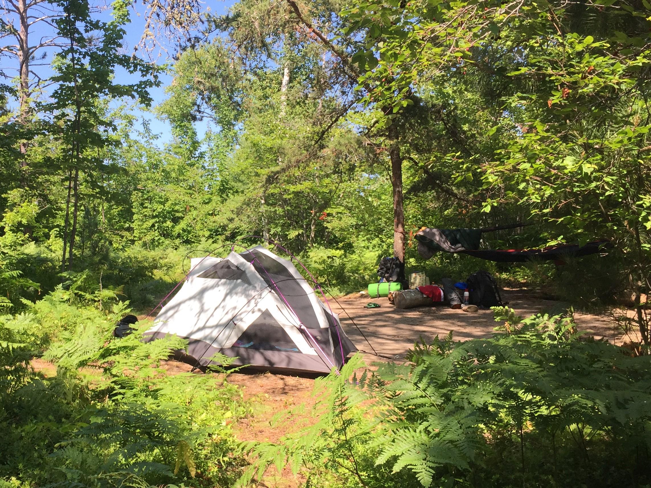
Backpacking and camping are a popular activities.
Credit: NPS Photos
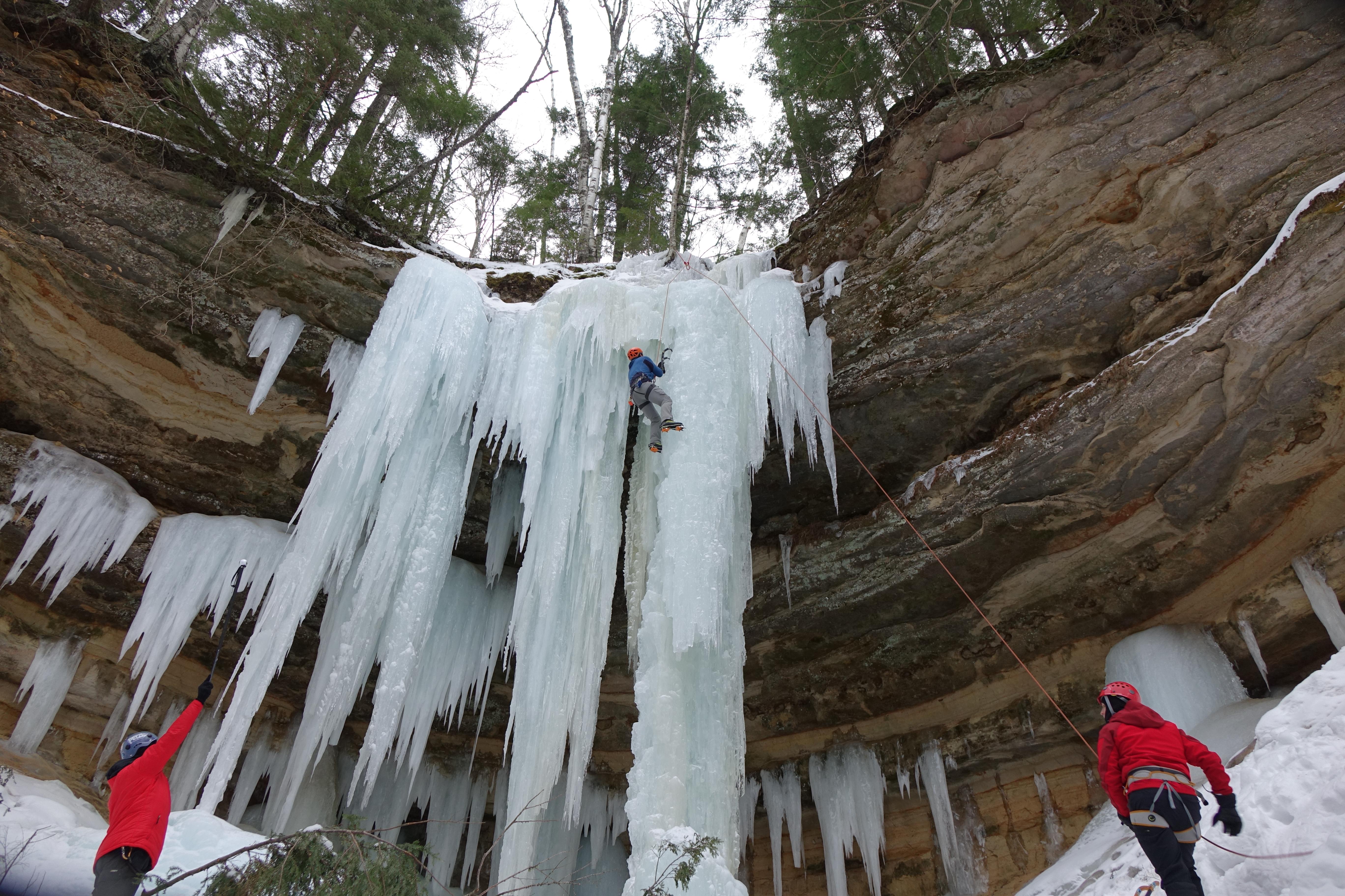
Ice climbing is a popular winter activity.
Credit: NPS Photo
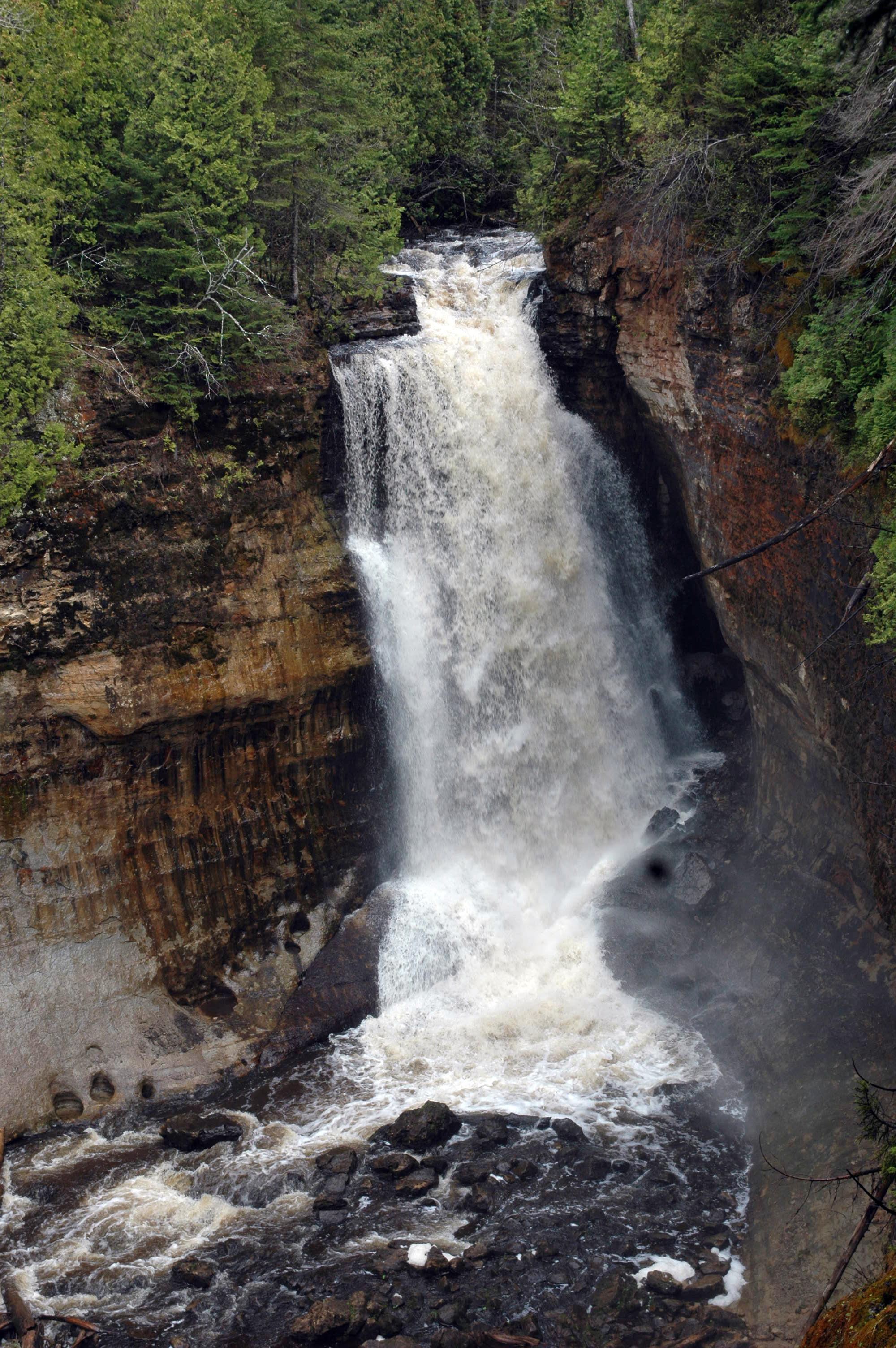
Water flowing over Miners Falls
Credit: NPS Photo
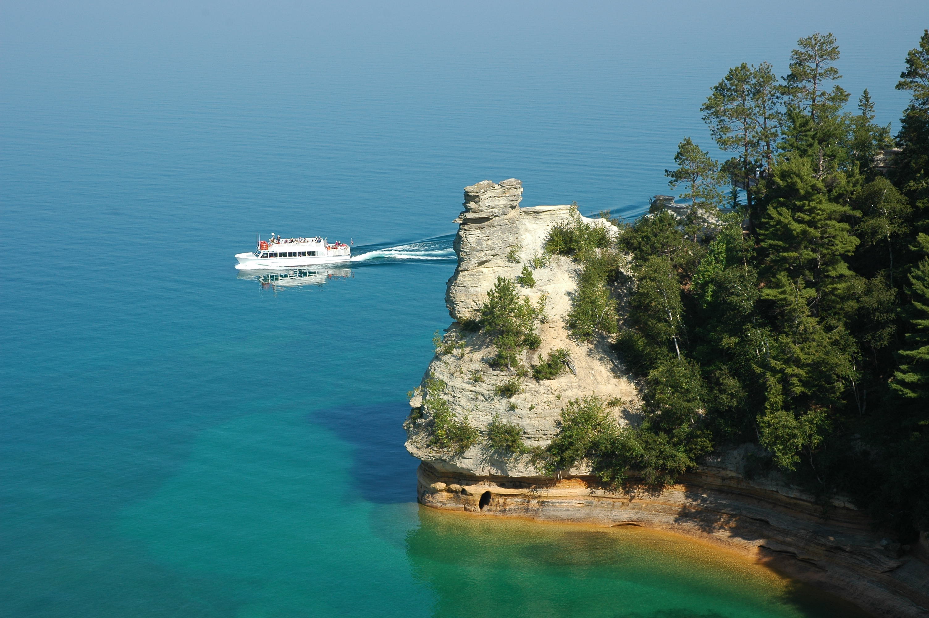
View the Miner's Castle rock formation from the adjacent cliffs or from a boat.
Credit: NPS Photo
Springtime along the Chapel / Mosquito hiking loop
Credit: NPS Photos
Activities
Topics
Operating Hours
Entrance Fees
Entrance Passes
3-Day Weather Forecast
Tuesday, Apr 28

Patchy rain nearby
High: 52°F | Low: 38.6°F
Humidity: 86%
Wind: 19.7 mph
Rain Chance: 85%
UV Index: 2.7
Sunrise: 06:34 AM
Sunset: 08:50 PM
Moon: Waxing Gibbous (87%)
Visibility: 4 mi
Dew Point: 42.7°F
Cloud Cover: 85%
Pressure: N/A mb
Air Quality (PM2.5): N/A
Ozone: N/A
EPA Index: N/A
Wednesday, Apr 29

Partly Cloudy
High: 40.9°F | Low: 33.6°F
Humidity: 76%
Wind: 10.5 mph
Rain Chance: 0%
UV Index: 5.9
Sunrise: 06:32 AM
Sunset: 08:51 PM
Moon: Waxing Gibbous (93%)
Visibility: 6 mi
Dew Point: 32.9°F
Cloud Cover: 0%
Pressure: N/A mb
Air Quality (PM2.5): N/A
Ozone: N/A
EPA Index: N/A
Thursday, Apr 30
Partly Cloudy
High: 39.2°F | Low: 31.8°F
Humidity: 77%
Wind: 12.1 mph
Rain Chance: 0%
UV Index: 5.5
Sunrise: 06:31 AM
Sunset: 08:53 PM
Moon: Waxing Gibbous (97%)
Visibility: 6 mi
Dew Point: 30.6°F
Cloud Cover: 0%
Pressure: N/A mb
Air Quality (PM2.5): N/A
Ozone: N/A
EPA Index: N/A
Weather Alerts (1)
Flood Advisory issued April 27 at 9:07PM EDT by NWS Marquette MI
Effective: Apr 27, 2026 9:07pm
Expires: Apr 28, 2026 4:00pm
...The Flood Advisory continues for the following rivers in
Michigan...
Tahquamenon River near Paradise affecting Luce County.
.Snowmelt and recent rainfall are resulting in rivers reaching
elevated levels.
* WHAT...Elevated river levels caused by rain and snowmelt continue.
* WHERE...Tahquamenon River near Paradise.
* WHEN...Until further notice.
* IMPACTS...At 9.5 feet, The river exceeds bankfull stage
* ADDITIONAL DETAILS...
- At 8:45 PM EDT Monday the stage was 9.9 feet.
- Bankfull stage is 9.5 feet.
- Forecast...No forecast is available for this location.
- Action stage is 9.5 feet.
- Flood stage is 10.0 feet.
- www.weather.gov/safety/flood
Park Alerts
Park Events
Touch A Truck
Date: Apr 25, 2026 12:00am to Apr 25, 2026 12:00am
Paid Event
Au Sable Lighthouse Climbs
Learn about the history of the Au Sable Light Station and climb the 98 stairs of the lighthouse to enjoy the views of the Grand Sable Dunes and Lake Superior. Climbs are free and are first-come, first-served.
Climbers are required to wear secured, heel strapped shoes (no flip-flops).
Location: Meet at the Au Sable Lighthouse. Park at the Hurricane River Day Use area and walk 1.5 miles east on the lighthouse trail.
Date: Jun 7, 2026 12:00am to Oct 15, 2026 12:00am
Paid Event
Geology Walking Tour
Travel back into the geologic past of Pictured Rocks! Join a ranger to learn about the rocks that give the park its name. Program will travel half-mile roundtrip from the upper viewing platform to the lower viewing area of Miners Castle. Terrain includes stairs and climbing up and down a steep paved path. Meet at Miners Castle on the wooden pavilion.
Date: Jun 9, 2026 12:00am to Oct 17, 2026 12:00am
Paid Event
Marsh Trail Walk
Join rangers for a guided walk through the Sand Point Marsh and discover what makes this ecosystem special. Program travels on a half-mile wheelchair accessible boardwalk. Meet at the Sand Point Marsh Trailhead along Sand Point Rd
Location: Meet at the entrance to the Sand Point Marsh Trail.
Date: Jun 10, 2026 12:00am to Oct 14, 2026 12:00am
Paid Event
Wilderness Canoe Expedition
Join rangers for a guided paddle and hike to one of the park's least-traveled beaches. Paddle is 3.5 miles long and includes a one-mile hike with some steep portions. All equipment is provided and tour is free. Meet at the Beaver Campground boat launch. Reservations required, please call (906) 202-5958.
Location: Meet at the Little Beaver Campground Boat Launch.
Date: Jun 14, 2026 12:00am to Oct 3, 2026 12:00am
Paid Event
Fish with a Ranger
Ever wanted to try your hand at fishing? Join us for a hands-on experience where youth will learn how to “think like a fish” and develop basic fishing skills. All equipment is provided and lesson is free. Participants will even receive their own fishing rod to take home! Meet at Grand Sable Lake Accessible Fishing Dock. Reservations are required, please call 906-202-5958 to make a reservation.
Location: Meet at the Grand Sable Lake Accessible Fishing Dock
Date: Jun 26, 2026 12:00am to Sep 4, 2026 12:00am
Paid Event
Visitor Center & Contacts
📍 Physical Address:
1505 Sand Point Road
Munising, MI 49862
🏤 Mailing Address:
P.O. Box 40
Munising, MI 49862
📞 Voice Phone: 906-387-3700
✉️ Email: piro_information@nps.gov