Tallgrass Prairie National Preserve
Designation: National Preserve
Location: Kansas
📘 Park Overview
Tallgrass prairie once covered 170 million acres of North America, but within a generation most of it had been transformed into farms, cities, and towns. Today less than 4% remains intact, mostly in the Kansas Flint Hills. Established on November 12, 1996, the preserve protects a nationally significant remnant of the once vast tallgrass prairie ecosystem. Here the tallgrass makes its last stand.
🌤 Weather Information
Typical weather for the preserve ranges from lows of 0 degrees in the winter and highs of 90 + degrees in the summer. Prevailing prairie winds attribute to winter blizzards and occasional summer storms. Thunderstorms that form on the Great Plains have a rare chance of producing tornadoes. Lightning poses a danger when hiking into the prairie. Please check current weather conditions at NOAA before hiking into the preserve.
🚗 Directions
The preserve is located in northern Chase County, Kansas 2 miles north of intersection U.S. Hwy 50 and Flint Hills National Scenic Byway 177 (K-177) west of Strong City. Watch for brown attraction signs. **2 miles north of Strong City, KS on K-177** **16 miles west of Emporia, KS on U.S. Hwy 50 and 2 miles north on K-177** **17 miles south of Council Grove, KS on K-177** **85 miles northeast of Wichita on I-35, U.S. Hwy 50, and K-177** **60 miles southwest of Topeka on I-335 (Kansas Turnpike) to Emporia**
Images
Fall is the season for another assortment of color on the prairie
Credit: NPS
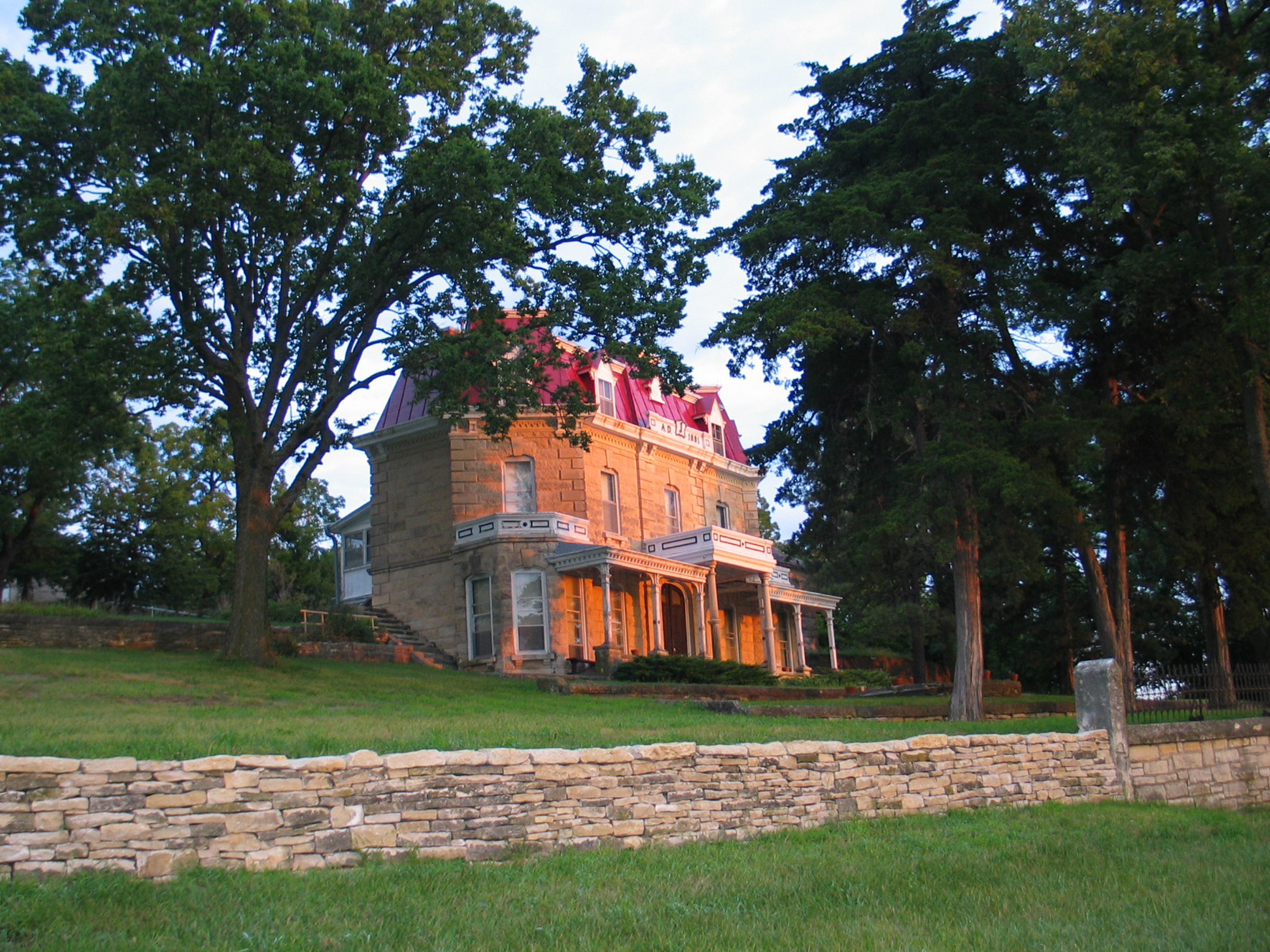
Historic 1881 Spring Hill Ranch house
Credit: NPS
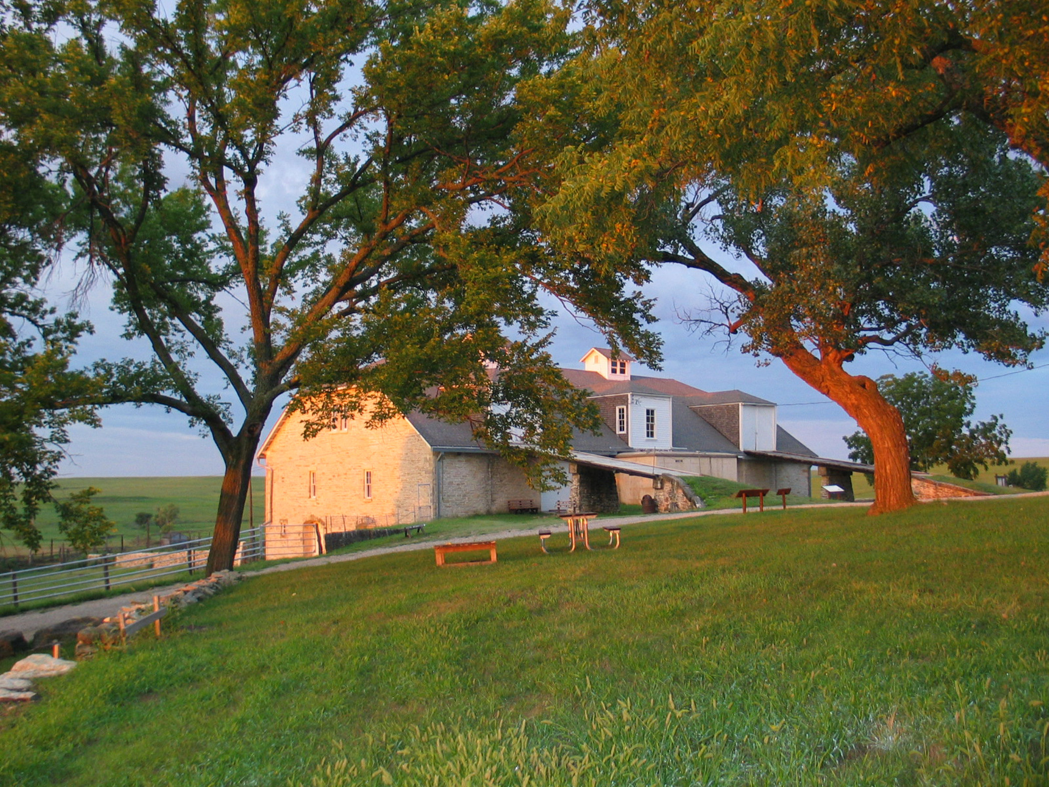
Historic 1882 Spring Hill Ranch barn
Credit: NPS
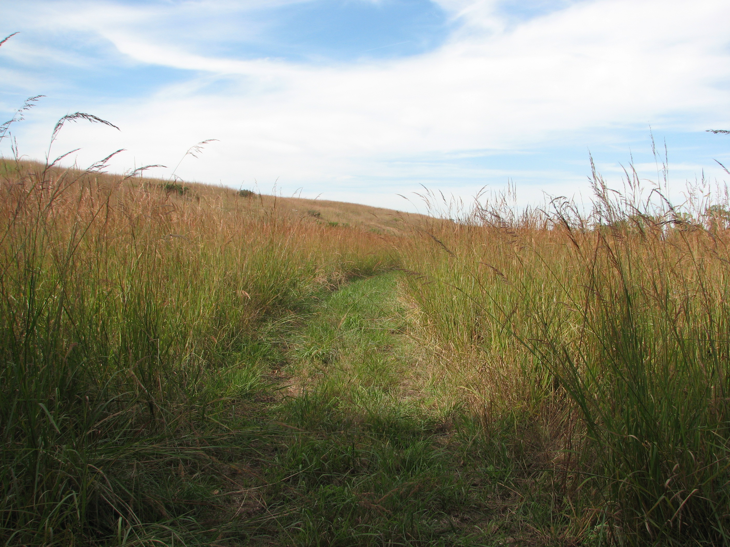
Hike among the tall tallgrass species in the fall
Credit: NPS
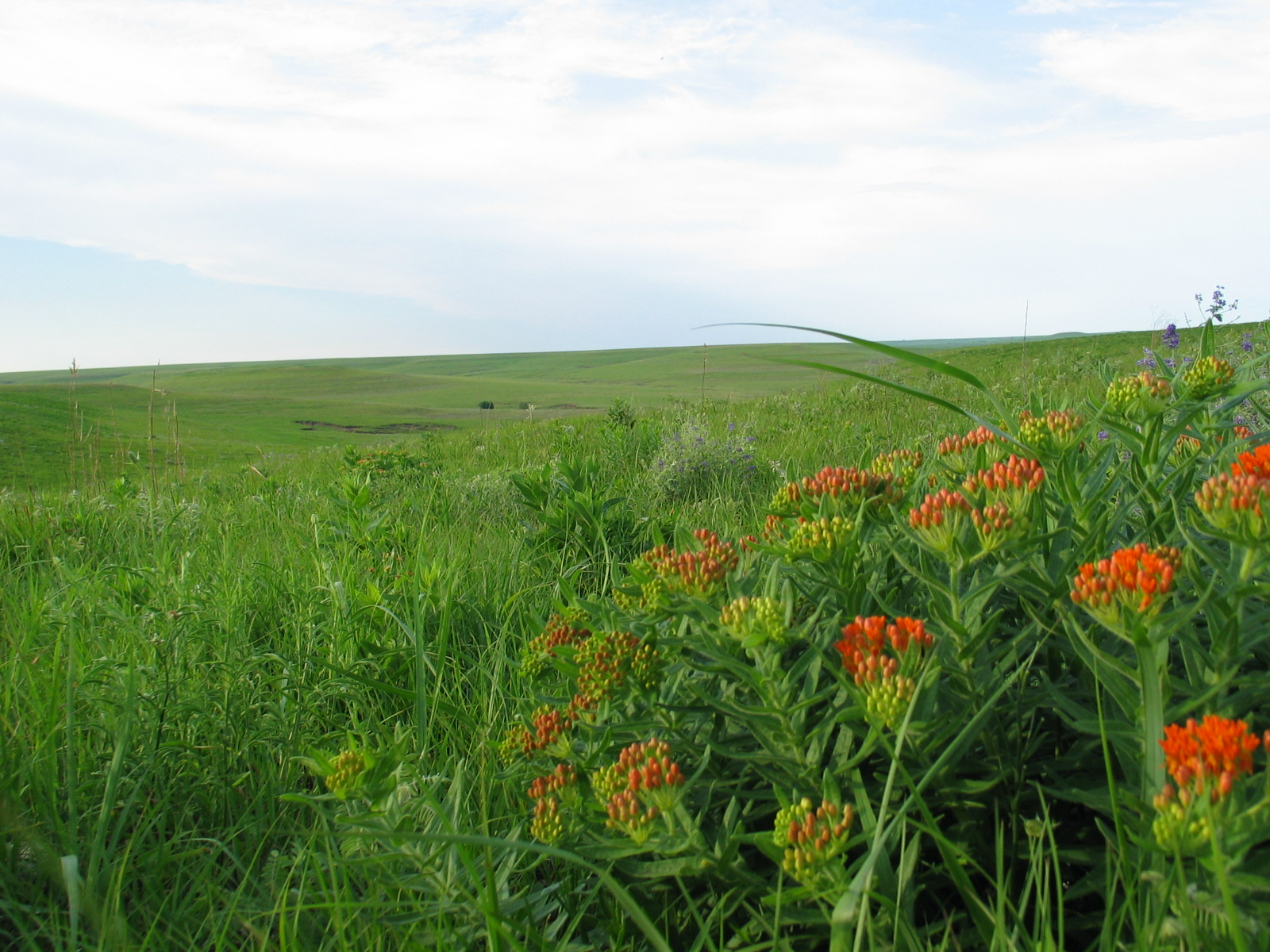
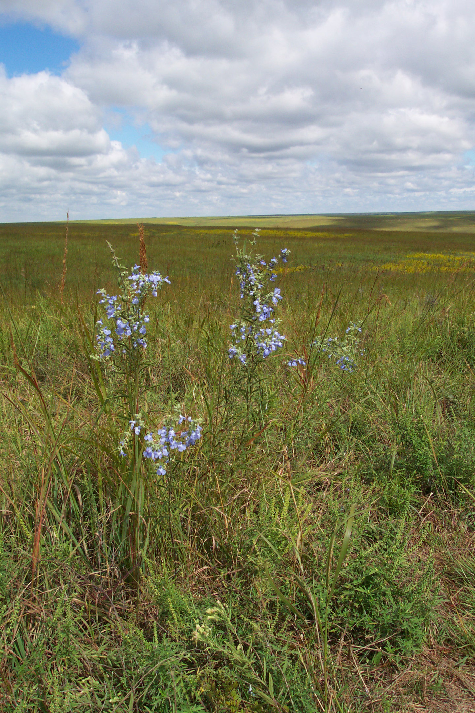
View a collage of summer flowers among a carpet of green in the spring and early summer
Credit: NPS
Activities
Topics
Operating Hours
Entrance Fees
No entrance fees listed.
Entrance Passes
No entrance passes listed.
3-Day Weather Forecast
Sunday, Feb 15

Overcast
High: 55.9°F | Low: 44.4°F
Humidity: 92%
Wind: 15.2 mph
Rain Chance: 0%
UV Index: 0.8
Sunrise: 07:17 AM
Sunset: 06:05 PM
Moon: Waning Crescent (7%)
Visibility: 6 mi
Dew Point: 47.5°F
Cloud Cover: 0%
Pressure: N/A mb
Air Quality (PM2.5): N/A
Ozone: N/A
EPA Index: N/A
Monday, Feb 16

Sunny
High: 65.7°F | Low: 41.9°F
Humidity: 80%
Wind: 20.6 mph
Rain Chance: 0%
UV Index: 0.8
Sunrise: 07:15 AM
Sunset: 06:06 PM
Moon: Waning Crescent (2%)
Visibility: 6 mi
Dew Point: 48.2°F
Cloud Cover: 0%
Pressure: N/A mb
Air Quality (PM2.5): N/A
Ozone: N/A
EPA Index: N/A
Tuesday, Feb 17
Overcast
High: 61.5°F | Low: 51.8°F
Humidity: 84%
Wind: 26.2 mph
Rain Chance: 0%
UV Index: 0.7
Sunrise: 07:14 AM
Sunset: 06:07 PM
Moon: New Moon (0%)
Visibility: 6 mi
Dew Point: 52.6°F
Cloud Cover: 0%
Pressure: N/A mb
Air Quality (PM2.5): N/A
Ozone: N/A
EPA Index: N/A
Weather Alerts (4)
Flood Warning issued February 15 at 5:44AM CST until February 16 at 4:48AM CST by NWS Topeka KS
Effective: Feb 15, 2026 6:44am
Expires: Feb 15, 2026 9:45pm
...The National Weather Service in Topeka KS has issued a Flood
Warning for the following rivers in Kansas...
Cottonwood River near Emporia affecting Lyon County.
* WHAT...Minor flooding is occurring and minor flooding is forecast.
* WHERE...Cottonwood River near Emporia.
* WHEN...From early this morning to late tonight.
* IMPACTS...At 20.0 feet, South bank of the Cottonwood River 1 mile
south of Emporia floods.
* ADDITIONAL DETAILS...
- At 5:30 AM CST Sunday the stage was 20.1 feet.
- Forecast...The river is expected to rise to a crest of 20.4
feet this morning. It will then fall below flood stage late
this morning.
- Flood stage is 20.0 feet.
Flood Warning issued February 15 at 1:05AM CST until February 16 at 4:26PM CST by NWS Topeka KS
Effective: Feb 15, 2026 2:05am
Expires: Feb 15, 2026 5:15pm
...The Flood Warning is extended for the following rivers in
Kansas...
Neosho River Near Neosho Rapids affecting Lyon County.
* WHAT...Moderate flooding is forecast.
* WHERE...Neosho River near Neosho Rapids.
* WHEN...Until tomorrow afternoon.
* IMPACTS...At 22.0 feet, Low lying areas along the river flood.
At 23.0 feet, Water overtops Road 145 on the west side of the
bridge over the Neosho River.
At 26.0 feet, Water covers large areas over both banks.
* ADDITIONAL DETAILS...
- At 12:30 AM CST Sunday the stage was 20.7 feet.
- Forecast...The river is expected to rise above flood stage
this morning to a crest of 25.7 feet this evening. It will
then fall below flood stage late this evening.
- Flood stage is 22.0 feet.
Flood Warning issued February 15 at 7:39AM CST until February 16 at 12:40PM CST by NWS Topeka KS
Effective: Feb 15, 2026 8:39am
Expires: Feb 16, 2026 12:30am
...The Flood Warning is extended for the following rivers in
Kansas...
Cottonwood River near Emporia affecting Lyon County.
...The Flood Warning continues for the following rivers in Kansas...
Pottawatomie Creek near Garnett affecting Anderson County.
Neosho River Near Neosho Rapids affecting Lyon County.
* WHAT...Minor flooding is occurring and minor flooding is forecast.
* WHERE...Cottonwood River near Emporia.
* WHEN...Until early tomorrow afternoon.
* IMPACTS...At 20.0 feet, South bank of the Cottonwood River 1 mile
south of Emporia floods.
* ADDITIONAL DETAILS...
- At 7:30 AM CST Sunday the stage was 20.5 feet.
- Forecast...The river is expected to rise to a crest of 20.6
feet this afternoon. It will then fall below flood stage this
evening.
- Flood stage is 20.0 feet.
Flood Warning issued February 15 at 7:39AM CST until February 16 at 2:24PM CST by NWS Topeka KS
Effective: Feb 15, 2026 8:39am
Expires: Feb 16, 2026 12:30am
...The Flood Warning is extended for the following rivers in
Kansas...
Cottonwood River near Emporia affecting Lyon County.
...The Flood Warning continues for the following rivers in Kansas...
Pottawatomie Creek near Garnett affecting Anderson County.
Neosho River Near Neosho Rapids affecting Lyon County.
* WHAT...Moderate flooding is forecast.
* WHERE...Neosho River near Neosho Rapids.
* WHEN...Until early tomorrow afternoon.
* IMPACTS...At 22.0 feet, Low lying areas along the river flood.
At 23.0 feet, Water overtops Road 145 on the west side of the
bridge over the Neosho River.
* ADDITIONAL DETAILS...
- At 6:30 AM CST Sunday the stage was 21.9 feet.
- Forecast...The river is expected to rise to a crest of 23.1
feet this afternoon. It will then fall below flood stage this
evening.
- Flood stage is 22.0 feet.
Park Alerts
Visitor Center & Contacts
📍 Physical Address:
2480B KS Hwy 177
Strong City, KS 66869
🏤 Mailing Address:
2480B KS Hwy 177
Strong City, KS 66869
📞 Voice Phone: 6202738494
📞 Fax Phone: 6202738660
✉️ Email: tapr_interpretation@nps.gov