📘 Park Overview
In the 1930s, landscape architects transformed Mason’s Island from neglected, overgrown farmland into Theodore Roosevelt Island, a memorial to America’s 26th president. They conceived a “real forest” designed to mimic the natural forest that once covered the island. Today miles of trails through wooded uplands and swampy bottomlands honor the legacy of a great outdoorsman and conservationist.
🌤 Weather Information
Outdoor trails and memorial plaza subject to weather for Washington, D.C. and Arlington, VA.
🚗 Directions
By Car: accessible from the northbound lanes of the George Washington Memorial Parkway, after Roosevelt Bridge, exit sign, turn right into the parking lot. Please note: park in a designated parking space, US Park Police regularly tickets drivers who park on the grass. By Metro: exit Rosslyn Metro station, walk toward Key Bridge, take short connecting trail downhill from the downstream side of the bridge, across the parkway, and into the parking lot for the island. By Bike: Mount Vernon Trail north end
Images
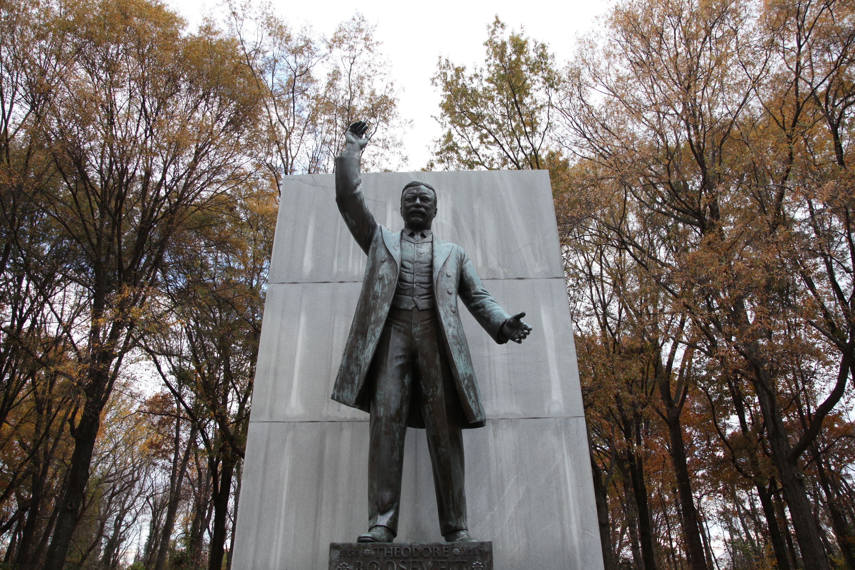
Theodore Roosevelt memorial plaza on Theodore Roosevelt Island.
Credit: NPS
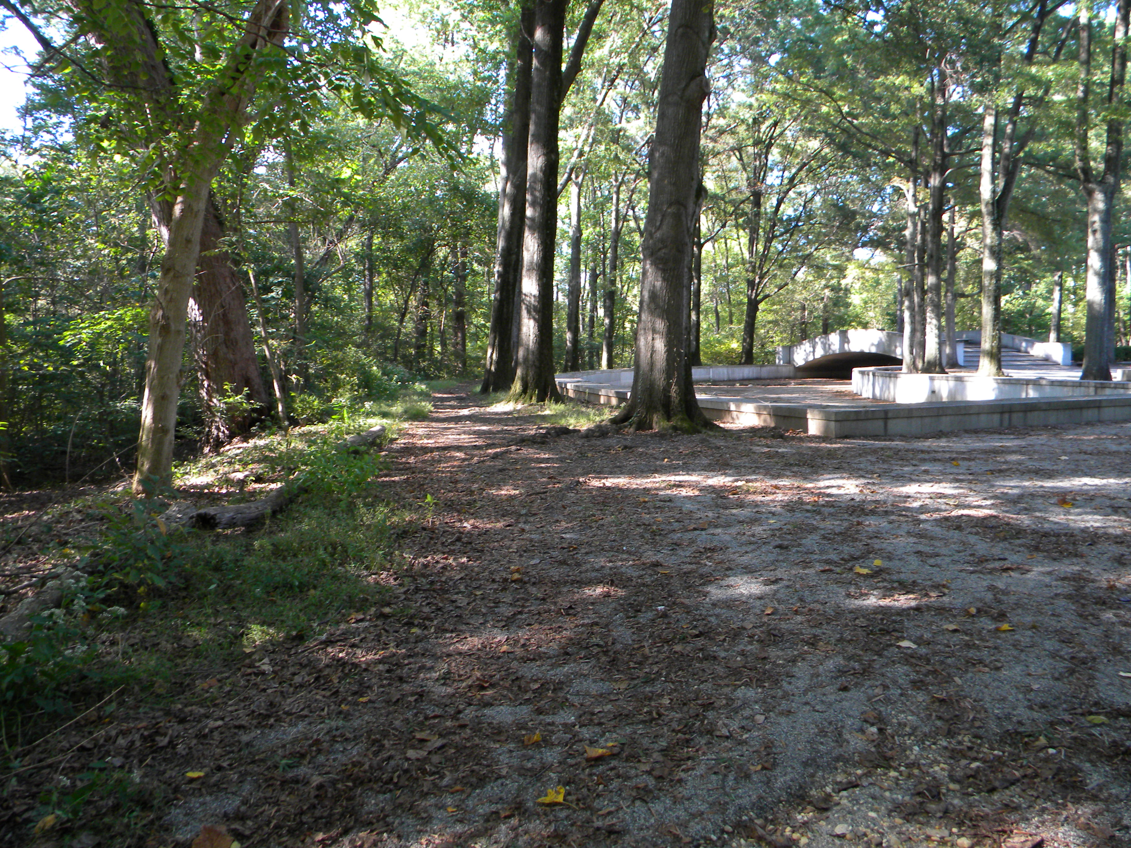
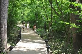
Hike the trails around the island
Credit: NPS Photo
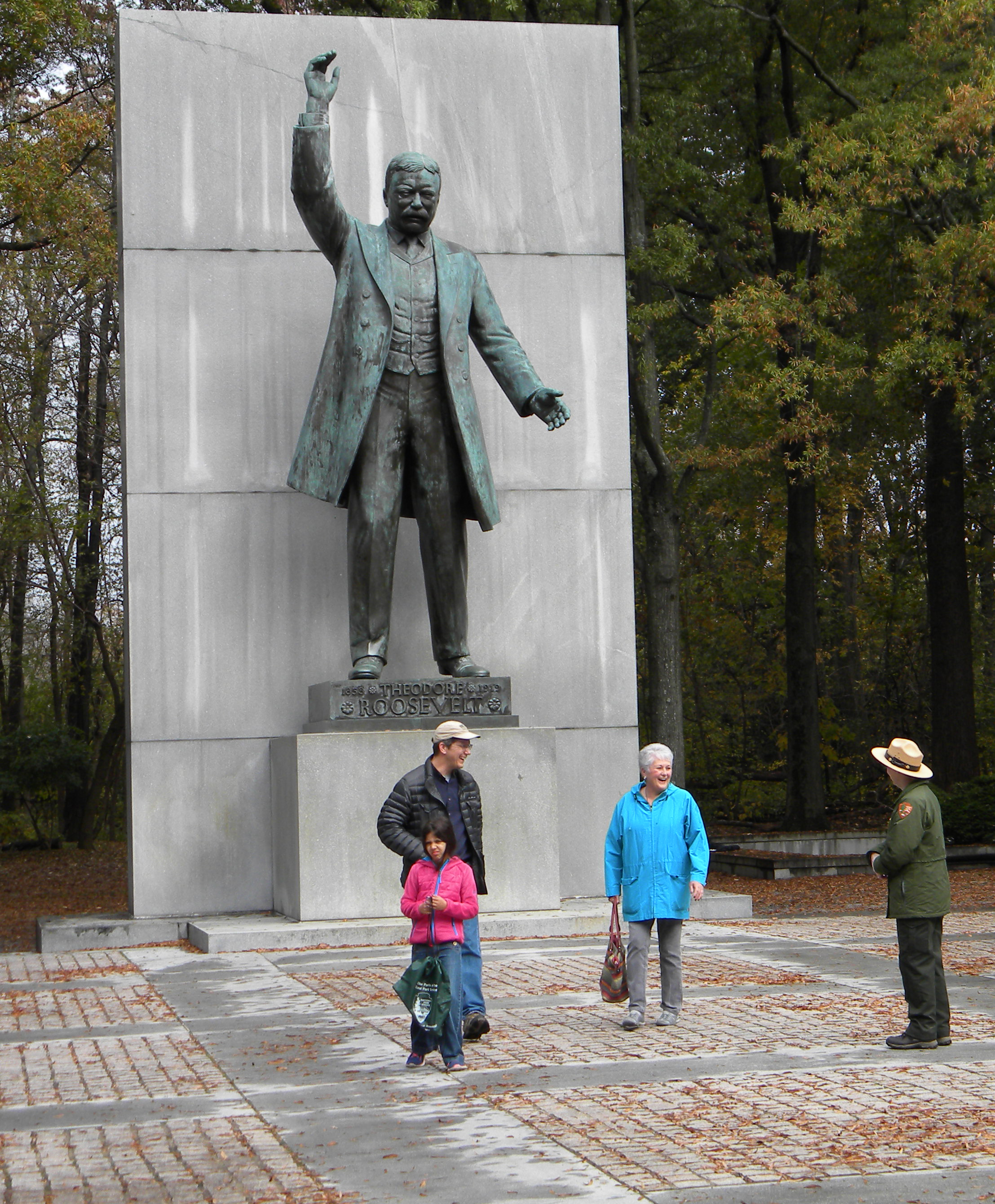
National Park Service Ranger discussing Theodore Roosevelt with visitors at his memorial.
Credit: NPS Photo
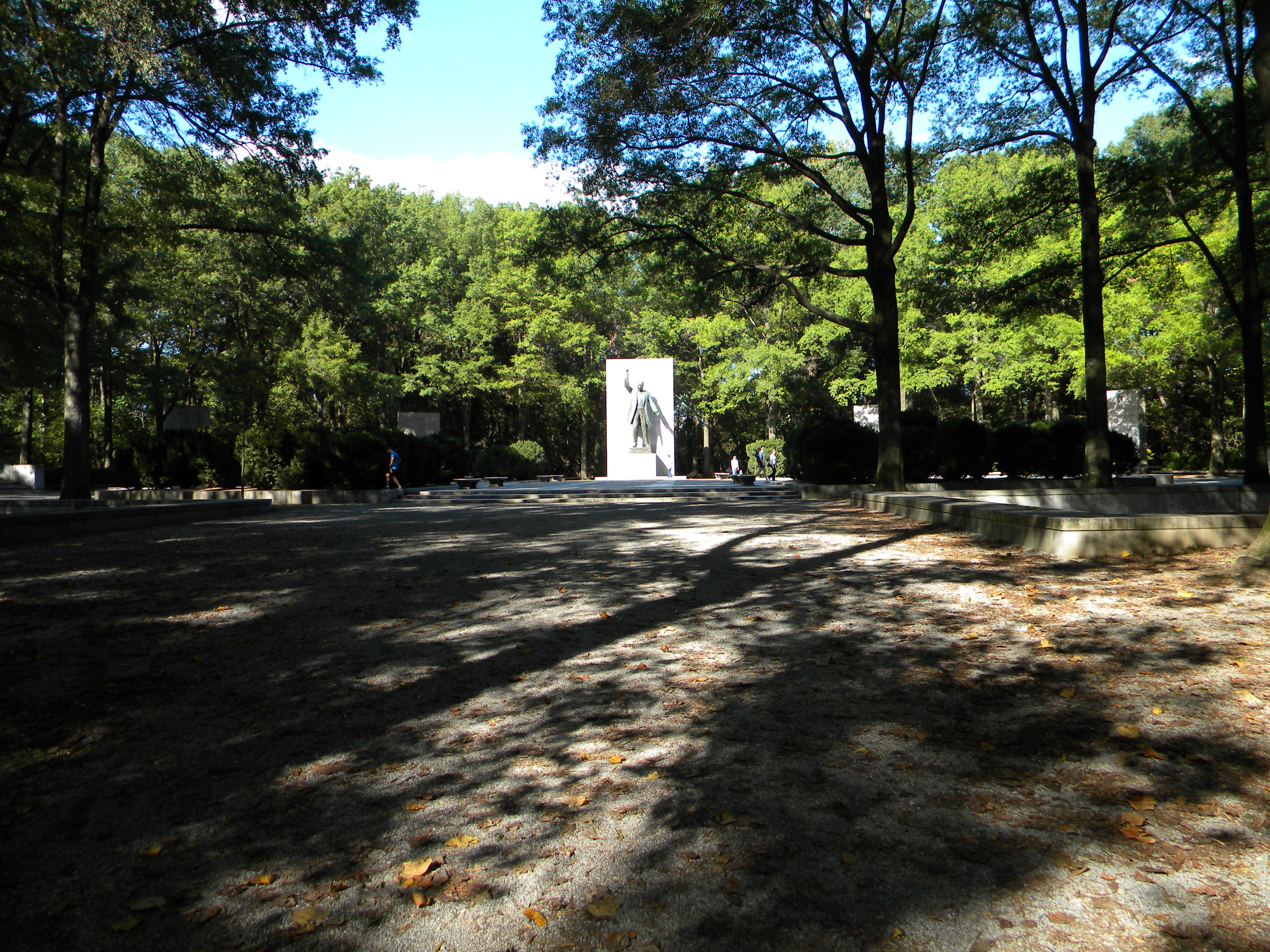
Enjoy a hidden gem, an island oasis, in the busy Washington, D.C region.
Credit: NPS Photo
Hike the trails throughout Theodore Roosevelt Island for a grand adventure.
Credit: NPS Photo
Activities
Topics
Operating Hours
Entrance Fees
No entrance fees listed.
Entrance Passes
No entrance passes listed.
3-Day Weather Forecast
Tuesday, Apr 7

Sunny
High: 61.7°F | Low: 41.9°F
Humidity: 38%
Wind: 14.8 mph
Rain Chance: 0%
UV Index: 1.5
Sunrise: 06:44 AM
Sunset: 07:38 PM
Moon: Waning Gibbous (79%)
Visibility: 6 mi
Dew Point: 39.6°F
Cloud Cover: 0%
Pressure: N/A mb
Air Quality (PM2.5): N/A
Ozone: N/A
EPA Index: N/A
Wednesday, Apr 8
Sunny
High: 53.6°F | Low: 31.8°F
Humidity: 45%
Wind: 7.8 mph
Rain Chance: 0%
UV Index: 1.5
Sunrise: 06:42 AM
Sunset: 07:39 PM
Moon: Waning Gibbous (70%)
Visibility: 6 mi
Dew Point: 31.7°F
Cloud Cover: 0%
Pressure: N/A mb
Air Quality (PM2.5): N/A
Ozone: N/A
EPA Index: N/A
Thursday, Apr 9

Overcast
High: 49.1°F | Low: 34.7°F
Humidity: 85%
Wind: 6.7 mph
Rain Chance: 0%
UV Index: 1.4
Sunrise: 06:40 AM
Sunset: 07:40 PM
Moon: Waning Gibbous (61%)
Visibility: 6 mi
Dew Point: 37.7°F
Cloud Cover: 0%
Pressure: N/A mb
Air Quality (PM2.5): N/A
Ozone: N/A
EPA Index: N/A
Weather Alerts (5)
Freeze Warning issued April 7 at 10:14AM EDT until April 8 at 9:00AM EDT by NWS Baltimore MD/Washington DC
Effective: Apr 7, 2026 10:14am
Expires: Apr 7, 2026 6:15pm
* WHAT...Sub-freezing temperatures as low as 30 expected.
* WHERE...In DC, District of Columbia. In Maryland, Anne Arundel,
Central and Southeast Howard, Central and Southeast Montgomery,
Prince Georges, Southern Baltimore, and Charles Counties. In
Virginia, King George and Fairfax Counties, and Arlington/Falls
Church/Alexandria.
* WHEN...From midnight tonight to 9 AM EDT Wednesday.
* IMPACTS...Frost and freeze conditions could kill crops, other
sensitive vegetation and possibly damage unprotected outdoor
plumbing.
Special Weather Statement issued April 7 at 8:37AM EDT by NWS Baltimore MD/Washington DC
Effective: Apr 7, 2026 8:37am
Expires: Apr 7, 2026 7:00pm
The combination of drying 10 hour fuels, minimum relative
humidity around 15 to 30 percent, and northwesterly wind gusts
around 20 to 35 mph will lead to an increased risk for the rapid
spread of wildfires today, especially in the afternoon to early
evening.
Residents and visitors are urged to properly dispose of cigarette
butts, matches, and any other flammable items in appropriate
containers. Additionally, exercise caution if operating any
equipment that could create sparks and keep vehicles off of dry
grass. Most dry grasses, dead leaves, and other tree litter could
easily ignite and spread fire quickly.
Lastly, remember to obey local burn bans. For more information about
wildfire danger, burn restrictions, and wildfire prevention and
education, please visit your state forestry or environmental
protection website.
For West Virginia, visit www.wvforestry.com...
For Maryland, visit dnr.maryland.gov...
For Virginia, visit dof.virginia.gov...
Effective: Apr 7, 2026 2:28pm
Expires: Apr 7, 2026 2:38pm
Monitoring message only. Please disregard.
Freeze Warning issued April 7 at 10:14AM EDT until April 8 at 9:00AM EDT by NWS Baltimore MD/Washington DC
Effective: Apr 7, 2026 10:14am
Expires: Apr 7, 2026 6:15pm
* WHAT...For the Freeze Warning, sub-freezing temperatures as low as
27 expected. For the Freeze Watch, sub-freezing temperatures as
low as 30 possible.
* WHERE...Portions of central, north central, northeast, and
northern Maryland, central, northern, northwest, and western
Virginia, and panhandle West Virginia.
* WHEN...For the Freeze Warning, from midnight tonight to 9 AM EDT
Wednesday. For the Freeze Watch, from late Wednesday night through
Thursday morning.
* IMPACTS...Frost and freeze conditions could kill crops, other
sensitive vegetation and possibly damage unprotected outdoor
plumbing.
Freeze Watch issued April 7 at 10:14AM EDT until April 9 at 9:00AM EDT by NWS Baltimore MD/Washington DC
Effective: Apr 7, 2026 10:14am
Expires: Apr 7, 2026 6:15pm
* WHAT...For the Freeze Warning, sub-freezing temperatures as low as
27 expected. For the Freeze Watch, sub-freezing temperatures as
low as 30 possible.
* WHERE...Portions of central, north central, northeast, and
northern Maryland, central, northern, northwest, and western
Virginia, and panhandle West Virginia.
* WHEN...For the Freeze Warning, from midnight tonight to 9 AM EDT
Wednesday. For the Freeze Watch, from late Wednesday night through
Thursday morning.
* IMPACTS...Frost and freeze conditions could kill crops, other
sensitive vegetation and possibly damage unprotected outdoor
plumbing.
Park Alerts
Visitor Center & Contacts
📍 Physical Address:
George Washington Memorial Parkway
northbound lanes between Roosevelt Bridge and Key Bridge
Arlington, VA 22209
🏤 Mailing Address:
700 George Washington Memorial Parkway
McLean, VA 22101
📞 Voice Phone: 7032892500
✉️ Email: gwmp_superintendent@nps.gov