Virgin Islands Coral Reef National Monument
Designation: National Monument
Location: U.S. Virgin Islands
📘 Park Overview
Virgin Islands Coral Reef National Monument includes federal submerged lands within the 3-mile belt off the island of St. John. These waters support a diverse and complex system of coral reefs and other ecosystems such as shoreline mangrove forests and seagrass beds.
🌤 Weather Information
Mostly Perfect. The Tradewinds (the Easterlies) dominate the weather in the Virgin Islands, blowing east to west across the tropical Atlantic. The winter tends to bring stronger winds and less rain, and the summer tends to bring more rain and lighter winds.
🚗 Directions
Once on St. John, the only part of Virgin Islands Coral Reef National Monument accessible by land is in Hurricane Hole. To get to Hurricane Hole, follow route 10 from Cruz Bay to Estate Hermitage. The Monument extends eastward from Borck Creek to Haulover Bay along the southern shoreline of the Island. Just a sliver of the Monument touches the north shore. To the west of the Monument line is National Park waters, and to the east is territorial waters.
Images
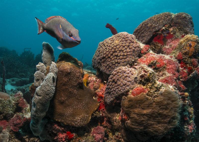
Parrot Fish posing for the camera over several corals
Credit: Susanna Pershern
Activities
Topics
Operating Hours
Entrance Fees
No entrance fees listed.
Entrance Passes
No entrance passes listed.
3-Day Weather Forecast
Friday, Apr 17

Patchy rain nearby
High: 80.2°F | Low: 78.1°F
Humidity: 82%
Wind: 19.7 mph
Rain Chance: 87%
UV Index: 2.5
Sunrise: 06:01 AM
Sunset: 06:36 PM
Moon: New Moon (0%)
Visibility: 6 mi
Dew Point: 75.3°F
Cloud Cover: 87%
Pressure: N/A mb
Air Quality (PM2.5): N/A
Ozone: N/A
EPA Index: N/A
Saturday, Apr 18
Patchy rain nearby
High: 82.9°F | Low: 78.1°F
Humidity: 81%
Wind: 19.5 mph
Rain Chance: 83%
UV Index: 2.9
Sunrise: 06:00 AM
Sunset: 06:37 PM
Moon: Waxing Crescent (1%)
Visibility: 6 mi
Dew Point: 75.7°F
Cloud Cover: 83%
Pressure: N/A mb
Air Quality (PM2.5): N/A
Ozone: N/A
EPA Index: N/A
Sunday, Apr 19
Patchy rain nearby
High: 83.1°F | Low: 77.5°F
Humidity: 81%
Wind: 19.5 mph
Rain Chance: 71%
UV Index: 2.7
Sunrise: 06:00 AM
Sunset: 06:37 PM
Moon: Waxing Crescent (3%)
Visibility: 6 mi
Dew Point: 75.2°F
Cloud Cover: 71%
Pressure: N/A mb
Air Quality (PM2.5): N/A
Ozone: N/A
EPA Index: N/A
Visitor Center & Contacts
📍 Physical Address:
Hurrican Hole
St. John, VI 00830
🏤 Mailing Address:
1300 Cruz Bay Creek
St. John, VI 00830
📞 Voice Phone: 3407766201
✉️ Email: viis_interpretation@nps.gov